Trail details

How long does the Tour du Mont Blanc hike take?

How long does the Tour du Mont Blanc hike take?

Most people take between 6 and 12 days to hike the Tour du Mont Blanc. Anything quicker requires Olympic speed walking or part trail running; anything longer would allow for frequent breaks and a relaxed trekking pace.

Since 2018, we’ve produced 100’s of personalised hiking itineraries that have helped 1000’s of hikers confidently plan their Tour du Mont Blanc. It all starts with guiding hikers through the following 4 steps to determine how long it will take them to hike the Tour du Mont Blanc.

The Pennine Alps

The Pennine Alps are a towering mountain range marking the border between the canton of Valais in Switzerland and the Italian provinces of Piedmont and the Aosta Valley. They are located in the western part of the Alps, with the Mont Blanc massif flanking them to the West and Lepontine Alps to the East. With over thirty 4,000m / 13,000ft + peaks including the famous  Matterhorn and Monte Rosa, a trail through the Pennine Alps features on the bucket list of most hikers.

Pennine Alps: Shaded in blue

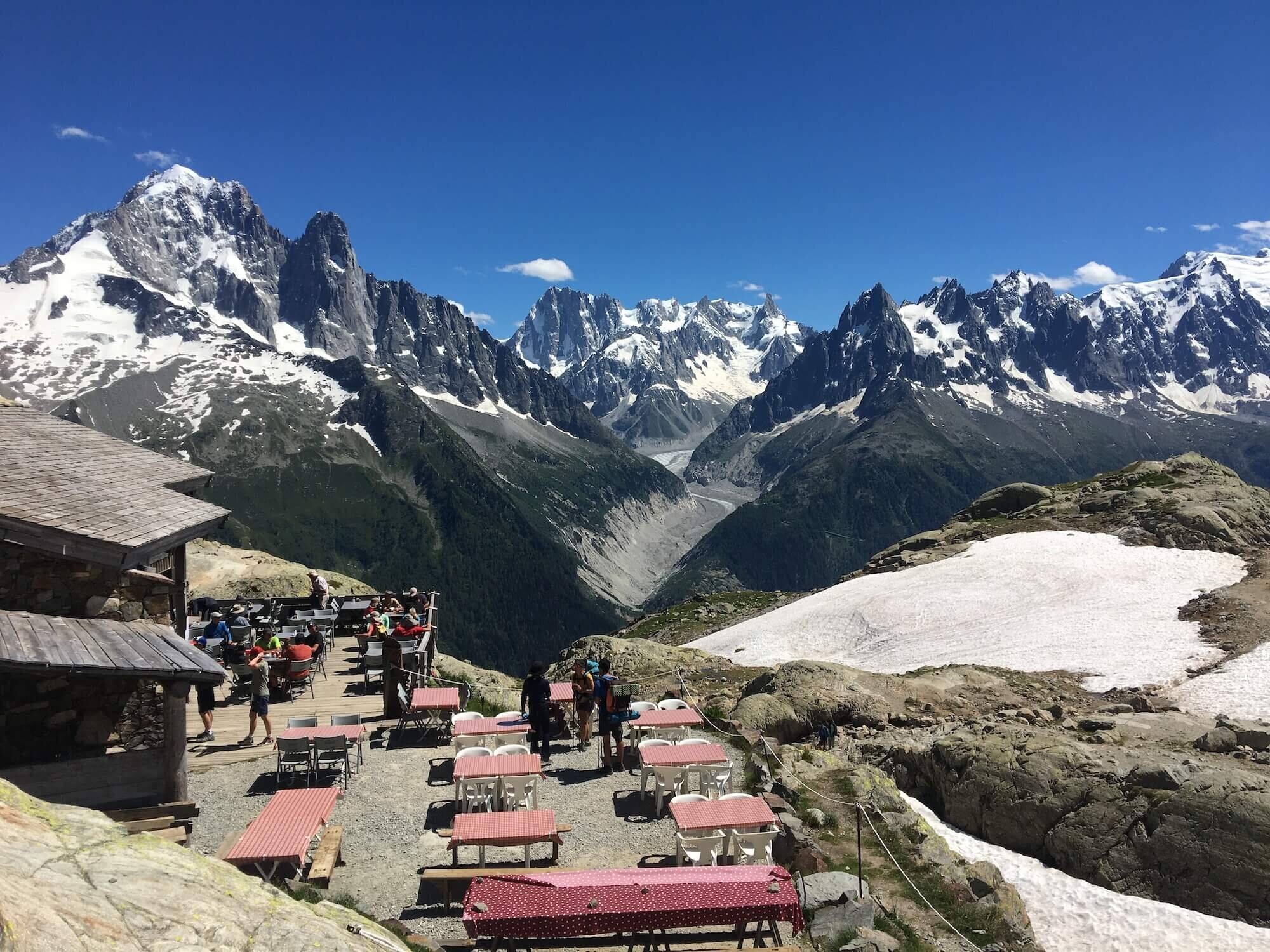
The availability of mountain accommodation and transportation has created many incredible day and overnight hiking experiences in the Pennine Alps. The top 5 multi-day experiences in this area are:

  • Walker’s Haute Route (~ 213km / 132mi): along the North side 

  • Alta Via 1 - Aosta Valley (~ 190km / 118mi) : along the South side

  • Tour of Monte Rosa (164km / 102mi): around the East end

  • Tour des Combins (100km / 62mi): around the West end

  • Tour of the Matterhorn (107km / 66mi): around the middle section

Experienced mountaineers also have the original ‘Haute Route’ which follows the Pennine Alps mountain chain, spending much of its time on glaciated terrain. This route was first forged by the English Alpine Club in the mid-19th century and has become a popular ski route in the Spring months too.

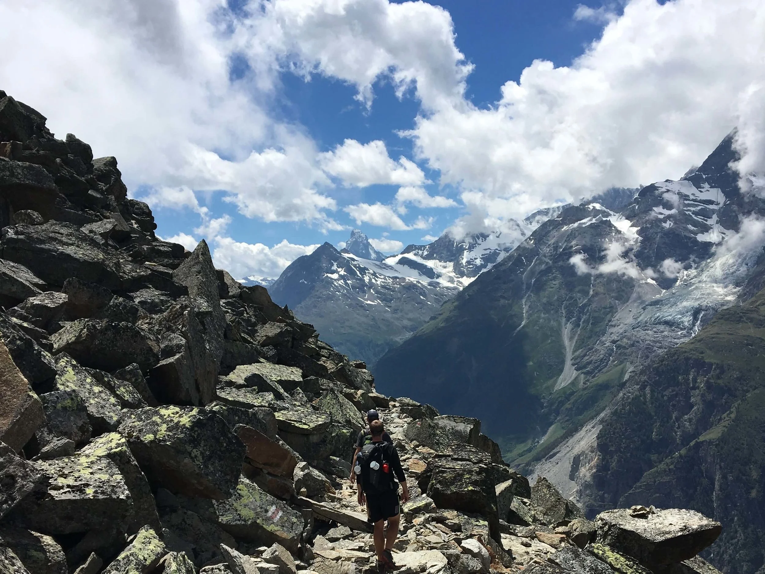
The rugged high mountain terrain of the Pennine Alps offers few opportunities for easy passage between Switzerland and Italy.  For hikers, only four trails become snow-free in the summer and a further two remain glaciated year-round (but can be crossed with a guide). Col du Grand Saint Bernard on the West end and Simplon pass on the East offer the easiest places to cross the Pennine Alps and have been used by travelers as far back as the Bronze Age — about 800 B.C.  Nowadays, roads have been built over these two passes and you’ll often hear the roar of sports cars enjoying the high mountain switchbacks.

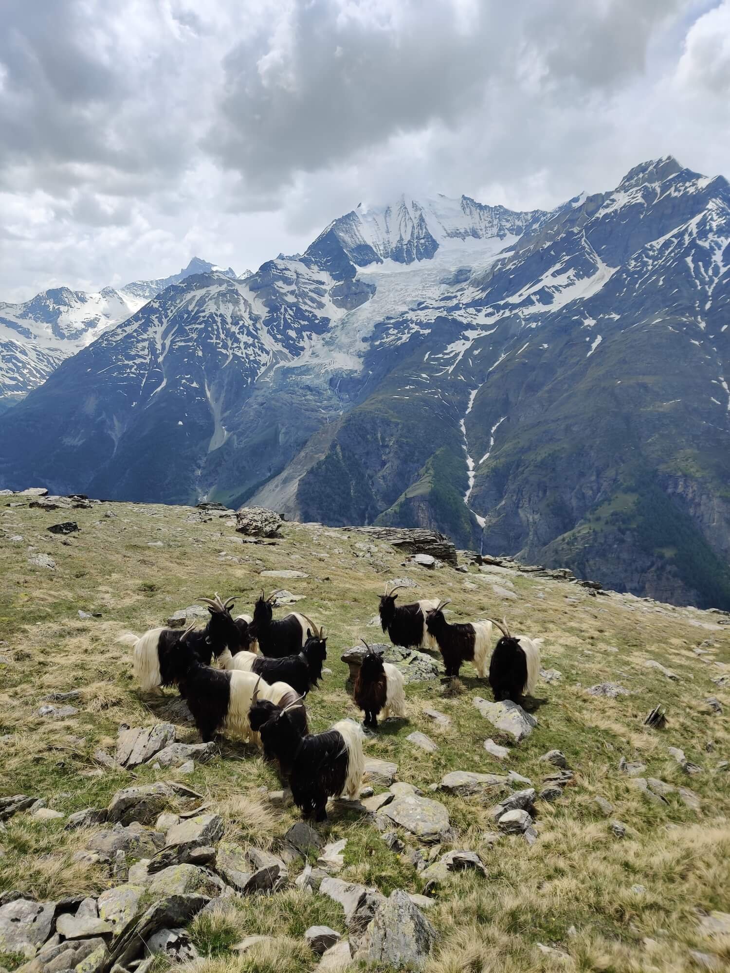
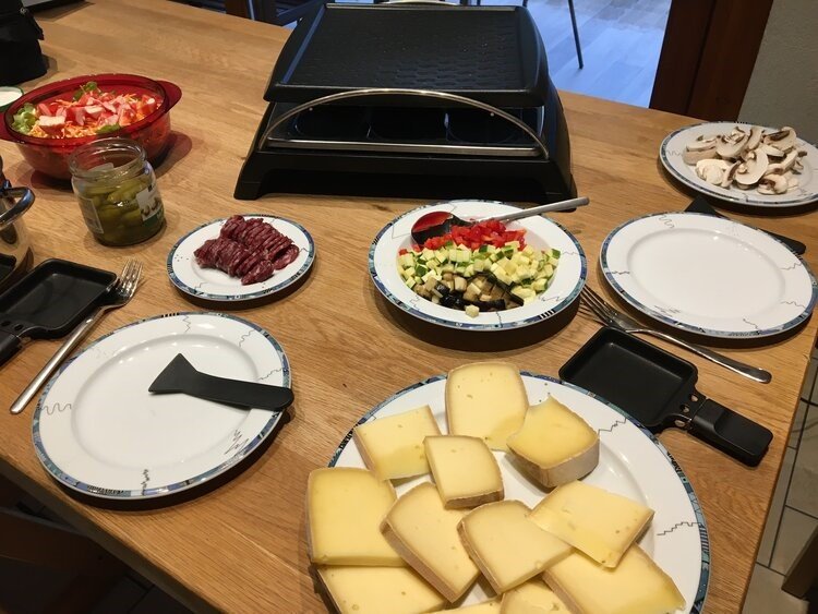
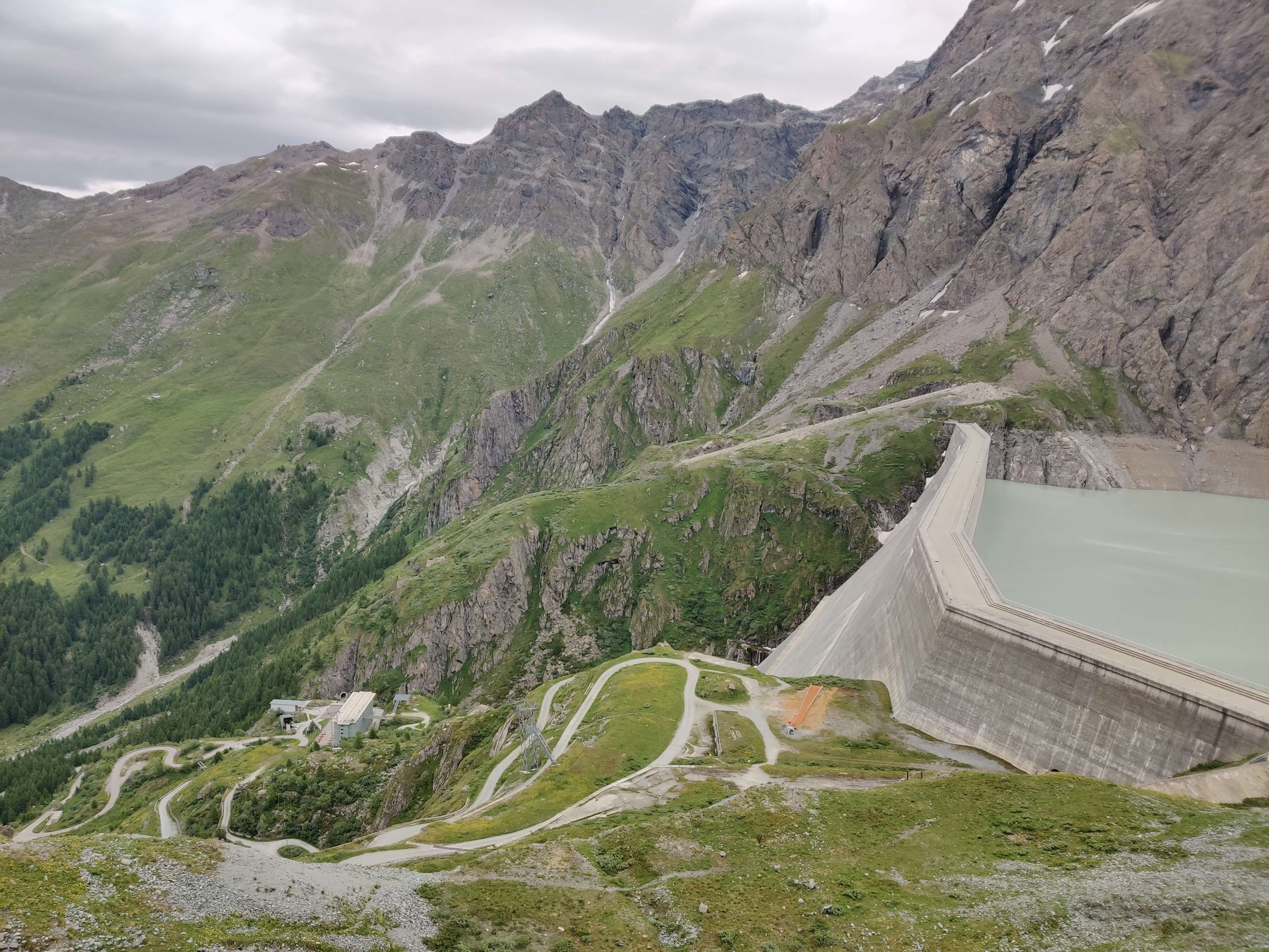
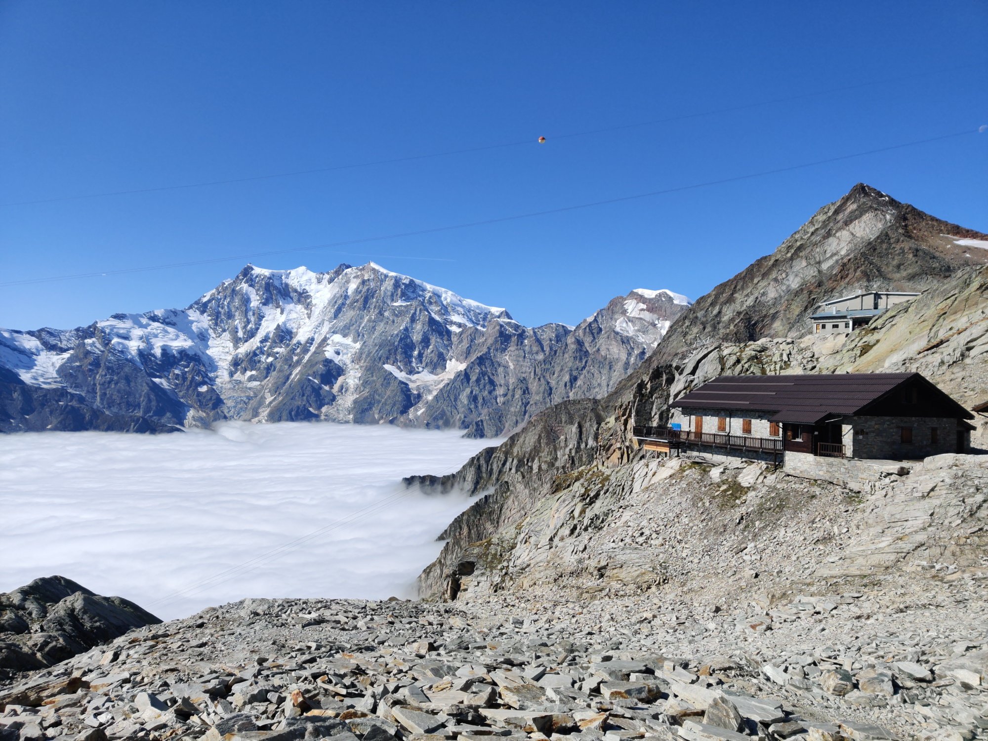
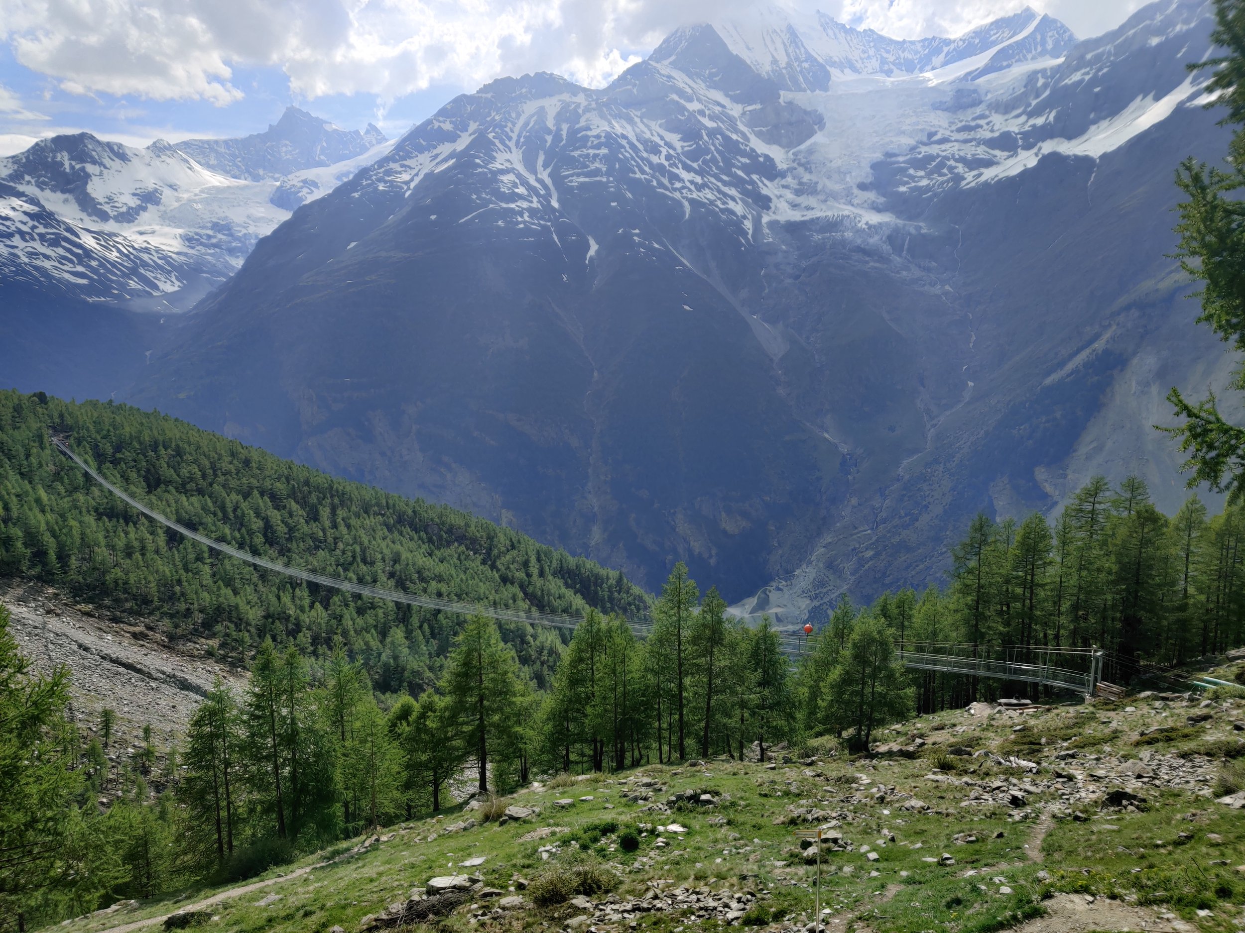
Aside from the big mountain vistas, some of the unique highlights in the area include seeing the Valais Blackneck goat, the origin of raclette and fontina cheeses (which are a culinary highlight in their own right!); the tallest gravity dam in the world (Grande Dixence); the highest peak in Switzerland (Monte Rosa); and longest pedestrian suspension bridge in the alps (Charles Kuonen suspension bridge).


Col du Grand Saint Bernard holds particular historical significance as Napoleon crossed here with his army to surprise Austrian forces in Genoa. A famous painting (considered a propaganda masterpiece) was produced to mark the occasion and ultimate triumph of the campaign. In the painting, Napoleon is wearing a magnificent cloak on a rearing charger, when in actual fact, he crossed the pass riding a donkey, wearing a simple grey greatcoat. Hannibal is also etched into the foreground of the painting which aims to draw a comparison with other great generals and has fueled the debate as to whether Col du Grand Saint Bernard was where he crossed the Alps with his African war elephants to strike at Rome.

Napoleon crossing the Alps: Jacques-Louis David, Public domain, via Wikimedia Commons


The Pennine Alps is also home to The Great St Bernard Hospice was originally a monastic shelter founded in the Middle Ages, led by Augustinian monks. The hospitality of the monks is legendary and continues on as a hospice welcoming pilgrims and hikers, and a museum, today. Founded in 1049, the hospice became famous for its breeding and use of St Bernard dogs in rescue operations.

The Saint Bernard dog: Large size, and gentle temperament originally bred for rescue work by the hospice of the Great St Bernard Pass.

Hiking in this inspiring part of the world was where the idea for The Hiking Club was born and therefore thought there was no better location to kick off our ‘Trails of the world spotlight’. Many of you have experience hiking in the Pennine Alps so we’d invite you to share any highlights or interesting history from the area that you discovered.


Author: Brendan Jones, The Hiking Club
A pizza-making, craft beer-loving, peanut butter connoisseur that has been exploring the great outdoors since completing the Duke of Edinburgh Award in high school. He started The Hiking Club to democratise hiking and the benefits that come from spending time in nature. You can read more about Brendan and the team here.


WHO ARE WE?

The Hiking Club empowers anyone to walk the way they want in the wild with personalised self-guided hiking experiences that are easy to find, quick to plan and simple to navigate.

We believe hiking experiences have the power to transform lives. With a growing range of personalised hikes that take into account your preferences, fitness and interests, we give you everything you need to explore the legendary trails of the world!

Tour du Mont Blanc: The Main Trail

Tour du Mont Blanc: The Main Trail

The “main” Tour du Mont Blanc trail is 166 km / 103 mi and travels around Mont Blanc, Europe’s highest mountain at 4,810m (15,781 ft). The trail crosses 10 mountain passes with a total elevation gain of just under 10,000m (32,700ft). Hikers will see alpine lakes, magnificent glaciers and lush meadows. The Tour du Mont Blanc is one of the legendary multi-day hikes in the Alps. Read our detailed blog post which takes a “walk” through all the different sections of the main Tour du Mont Blanc trail, including images, descriptions and trail stats.

Tour du Mont Blanc: The Alternate Routes

Tour du Mont Blanc: The Alternate Routes

The standard Tour du Mont Blanc trail is 166 km / 103 mi. But did you realise that there are lots of exciting alternate routes you can incorporate into your hike to make it even more epic? Or alternate routes that allow you to skip some of the more difficult and challenging sections. Take a read through our list of top alternate routes for the Tour du Mont Blanc to make sure you are choosing the best routes to suit your ideal hike!

Mobile phone coverage on the Walker’s Haute Route

Mobile phone coverage on the Walker’s Haute Route

While going completely off the grid during the Walker’s Haute Route is appealing, it’s best to be making that choice by switching your mobile to flight mode rather than not having a way to find a signal at all. In this blog post, I’m going to share with you which mobile network has most verified coverage along the Walker’s Haute Route and how you can access it for your hike.

The Complete Guide to Camping on the Walker's Haute Route

The Complete Guide to Camping on the Walker's Haute Route

So you’re interested in hiking the Haute Route from Chamonix to Zermatt but want to camp, instead of staying huts, hotels or B&Bs each night? Great choice! Although the idea of spending each night under the stars is an idyllic option, you need to be aware of where you can actually camp along the Haute Route, as there are very strict rules put in place by the National Parks and local governments.

Over the past few years, we’ve gathered the latest information on where you can wild camp, campgrounds with facilities and mountain huts that allow you to camp nearby. About 20% of our customers use our platform to plan and navigate their camping adventure along the Haute Route. Read on to learn about the various camping options, the cost estimates for camping and other useful tips to help you prepare for camping the Walker’s Haute Route.

Walker's Haute Route: The Alternate Routes

Walker's Haute Route: The Alternate Routes

The standard Walker’s Haute Route trail is 213km / 132mi. But did you realise that there are lots of exciting alternate routes you can incorporate into your hike to make it even more epic? Or alternate routes that allow you to skip some of the more difficult and challenging sections. Take a read through our list of top alternate routes for the Walker’s Haute Route to make sure you are choosing the best routes to suit your ideal hike!

Walker's Haute Route: The Main Trail

Walker's Haute Route: The Main Trail

The “main” Walker’s Haute Route trail is 123 km / 132 mi and travels from Chamonix, France to Zermatt, Switzerland. The trail crosses 11 mountain passes with a total elevation gain of 14,000 m / 46,000 ft. Hikers will see alpine lakes, magnificent glaciers and desolate, rugged landscapes. The Walker’s Haute Route is one of the legendary multi-day hikes in the Alps. Read our detailed blog post which takes a “walk” through all the different sections of the main Walker’s Haute Route trail, including images, descriptions and trail stats.

The Complete Guide to Camping on the Tour of Monte Rosa

So you’re interested in hiking the Tour of Monte Rosa but want to camp, instead of staying huts, hotels or B&Bs each night? Great choice! Although the idea of spending each night under the stars is an idyllic option, you need to be aware of where you can actually camp along the Tour of Monte Rosa, as there are rules put in place by Swiss and Italian local governments and National Parks.

How much does the Tour of Monte Rosa cost to hike?

How much does the Tour of Monte Rosa cost to hike?

How much it costs to hike the Tour of Monte Rosa is one of the most common questions we’re asked about the trail. I’ve dug deep into the numbers to compare the cost for campers, self-guided hikers and tour group costs, including transportation, food and accommodation. This will give you firm guidance on what it costs to hike the Tour of Monte Rosa.