
Walker’s Haute Route: Main Trail
The Walker’s Haute Route is a world-renowned multi-day hiking journey starting in Chamonix, France near the Mont Blanc Massif and finishing in Zermatt, Switzerland where the Matterhorn towers above. It is regarded by many as the most magnificent hut-to-hut hiking trail that the Alps has to offer.
As with all multi-day legendary trails in the Alps there is a “main / classic” route and then many variations, shortcuts and detours for hikers to choose from. The main route is:
Distance: 213km / 132mi
Elevation gain: 14,000 m / 46,000 ft
Highest point: 2,987 m / 9,800 ft
Number of mountain passes: 11
Number of days: 13 (at steady pace)
By including alternative routes, it’s possible to shorten the trail by up to 40 km / 24 mi and reduce your elevation gain by 3,000 m / 9,850 ft (2 mountain passes), or, increase it by a further 15km / 9 mi. These differences combined with the different speed and experience of hikers means that it can take anywhere from 6 to 15 days to complete the journey from Chamonix to Zermatt.
JOIN ONE OF OUR LIVE ONLINE EVENTS


Below we take a “walk” through all the different sections of the main Walker’s Haute Route trail, including images, descriptions and trail stats. If you’d like to skip to a specific section of the trail, click on the below link:
Alternate Routes
For those that haven’t hiked in the Alps before, it is important to understand that the Alps offer a network of trails. There are in fact no Walker’s Haute Route trail markers at all. There are countless trail junctions that offer different - or alternate - routes throughout the area.
Many Haute Route hikers choose to take one or more alternate routes along their journey to include a specific highlight (such as Glacier du Tour), avoid difficult terrain (such as Mattertal Valley Trail instead of Europaweg) or stay at a prominent accommodation option (such as Hotel Weisshorn).
For more details of the top alternate routes of the Walker’s Haute Route, read our detailed blog post.
OUR SELF-GUIDED HIKING PACKAGES
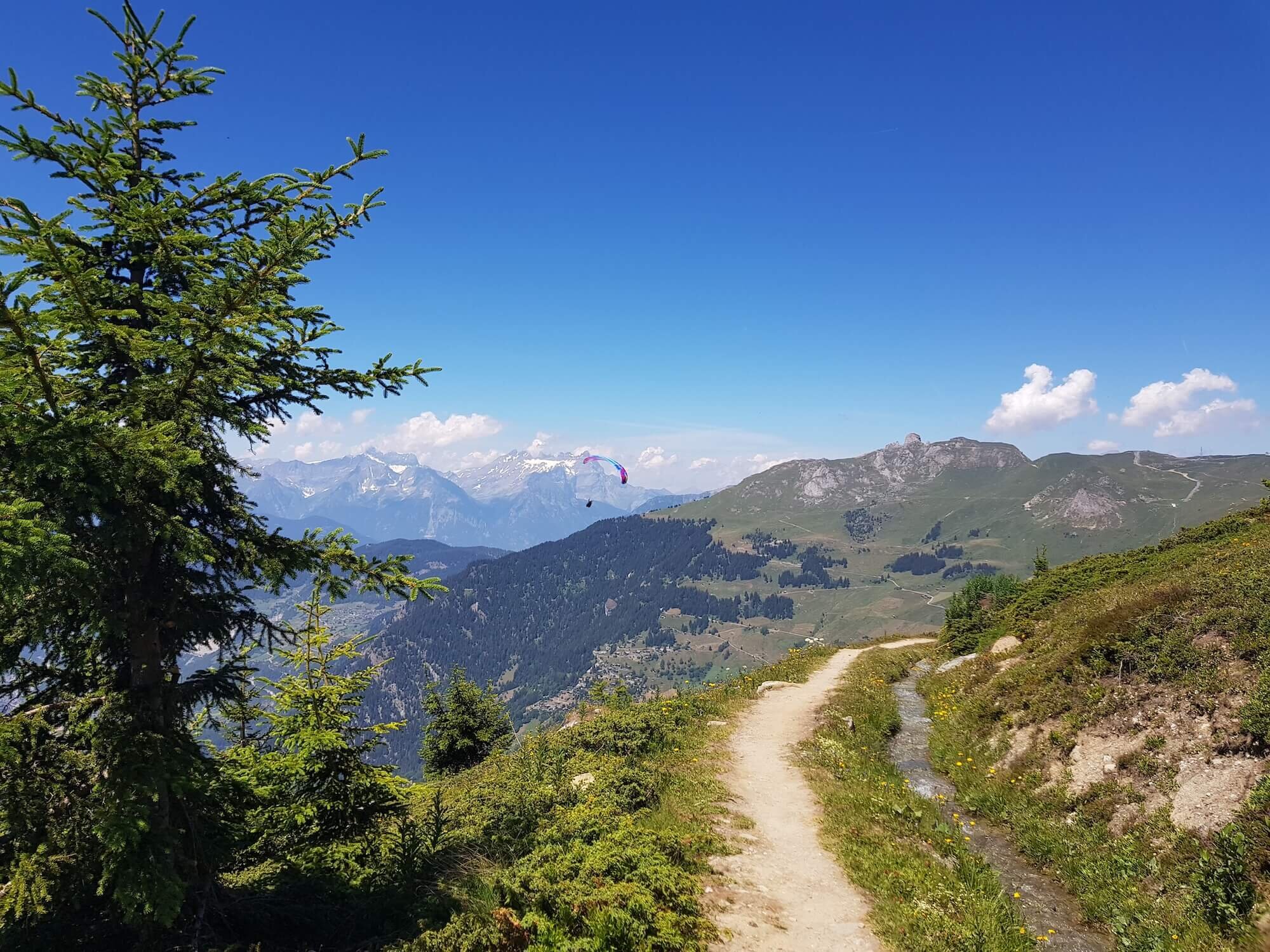
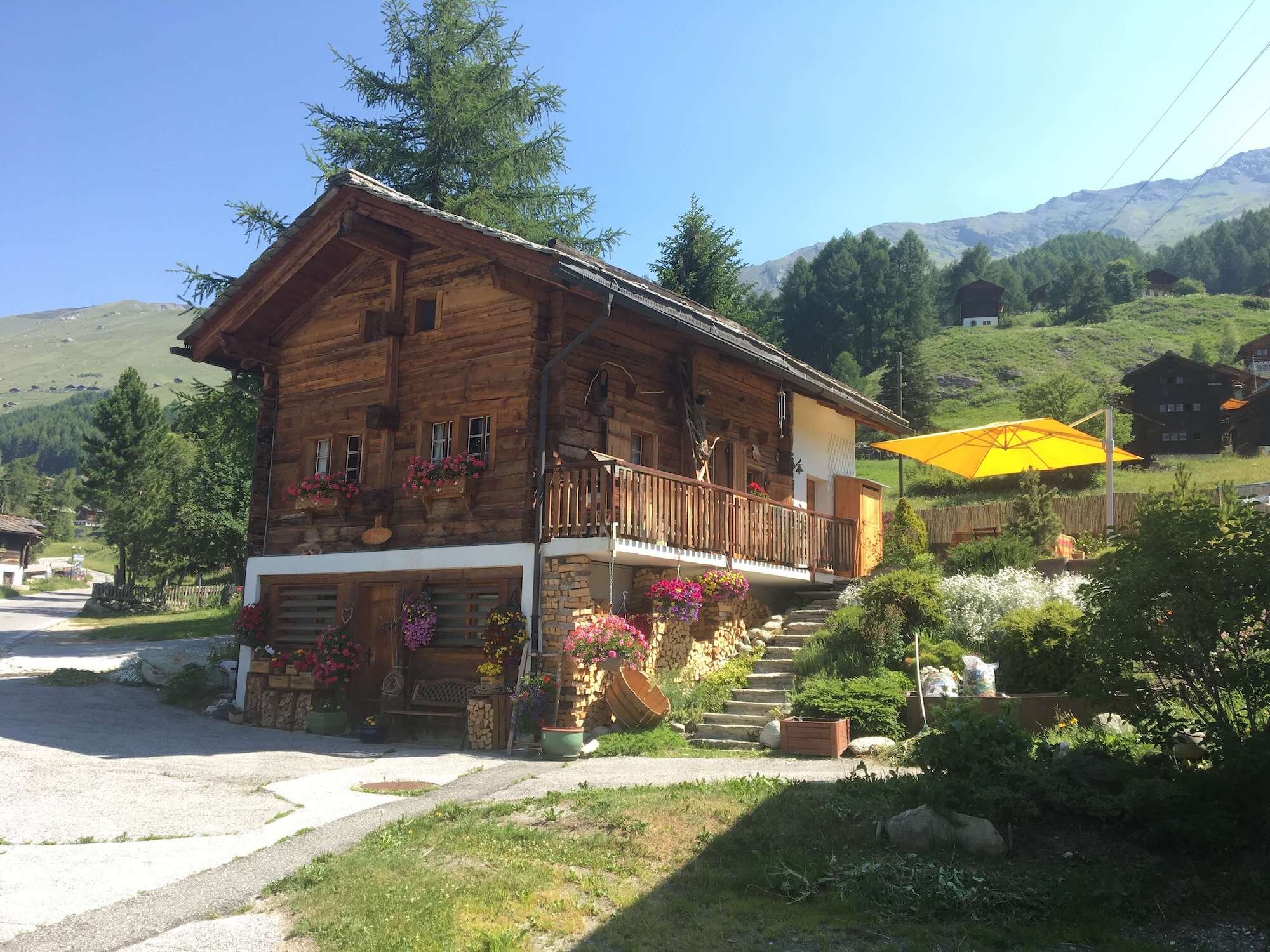
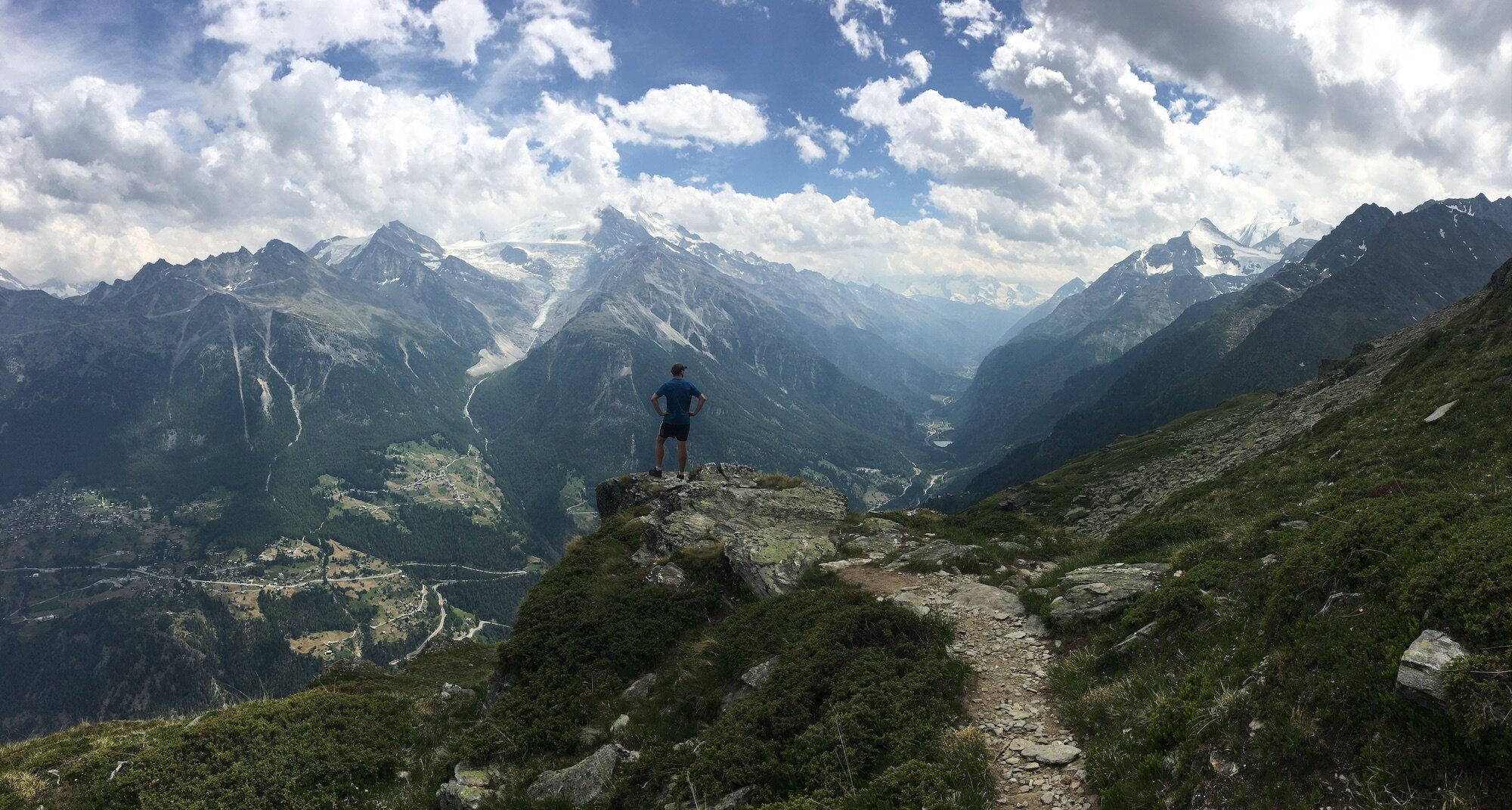
Chamonix Valley Trail
From Chamonix to Col de Balme
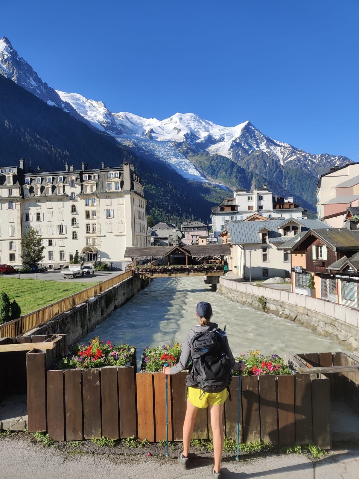
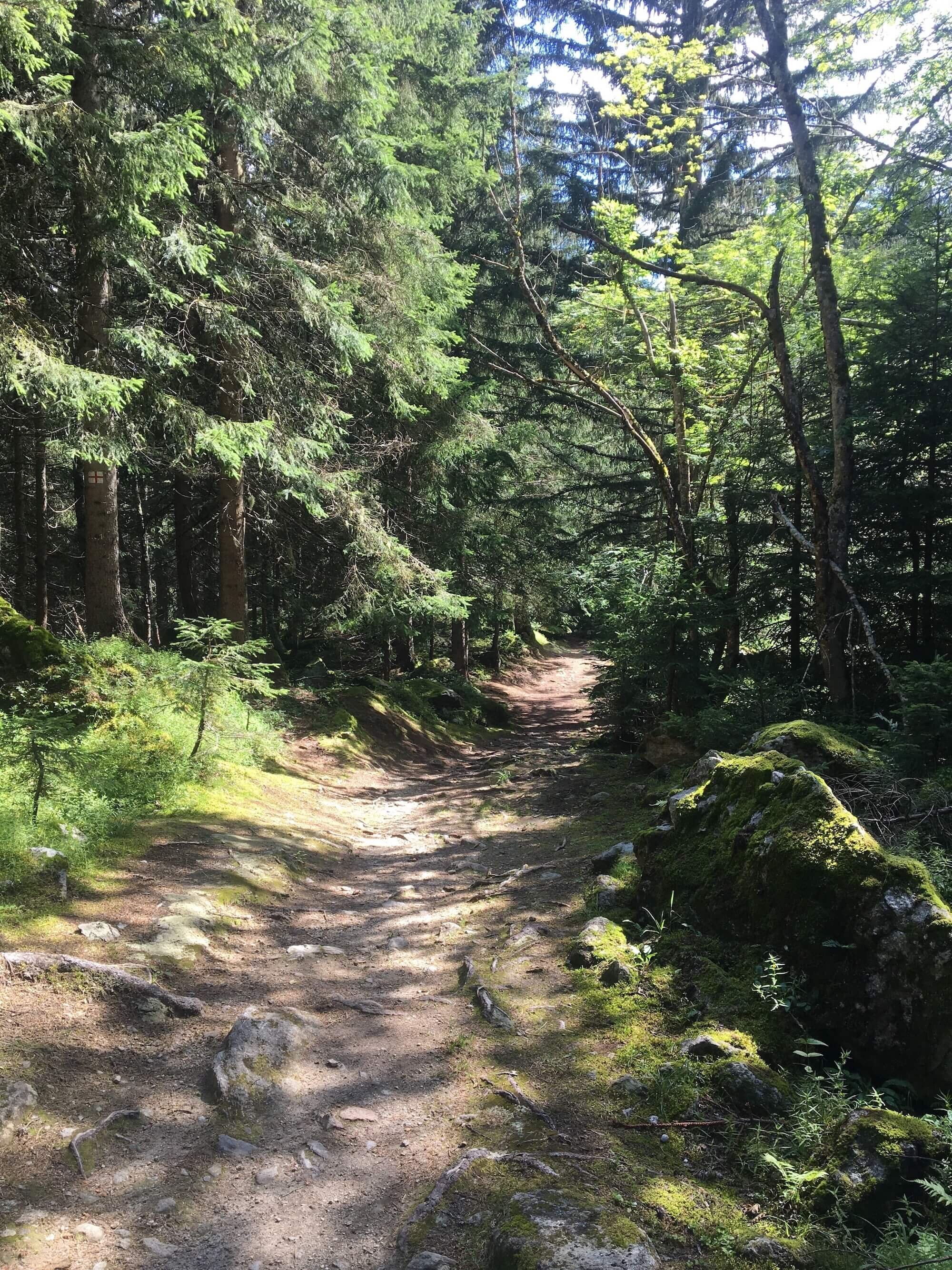
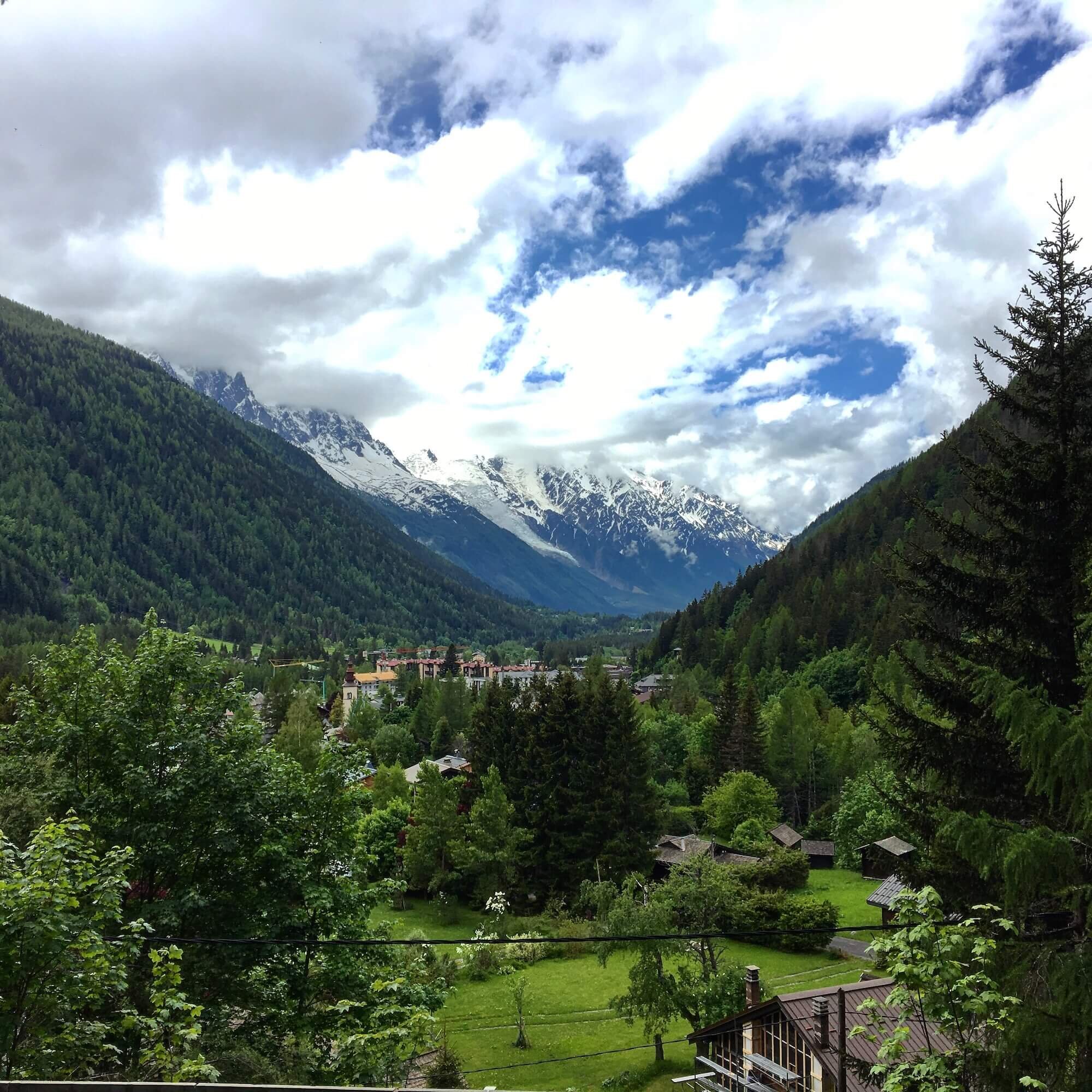
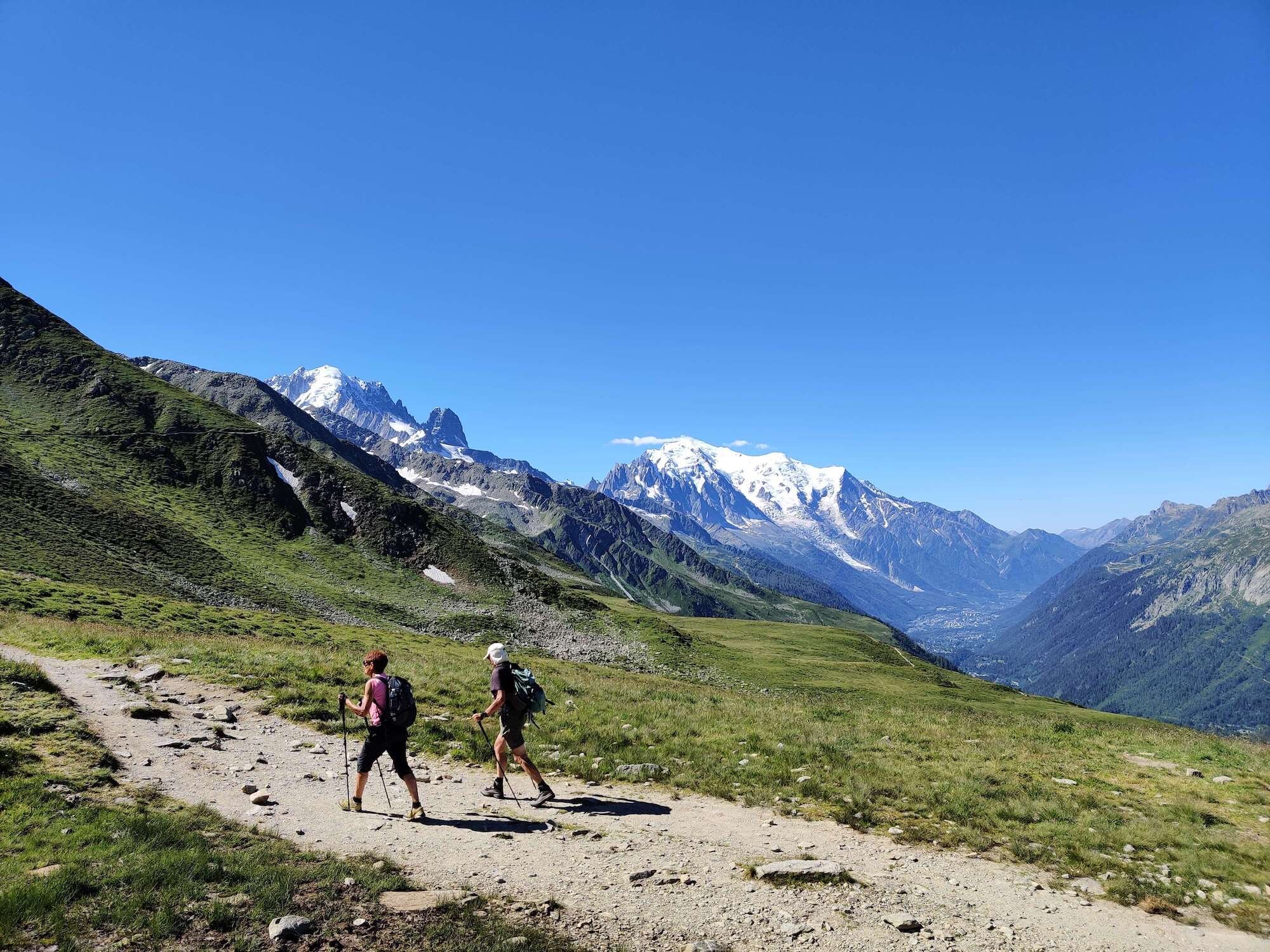
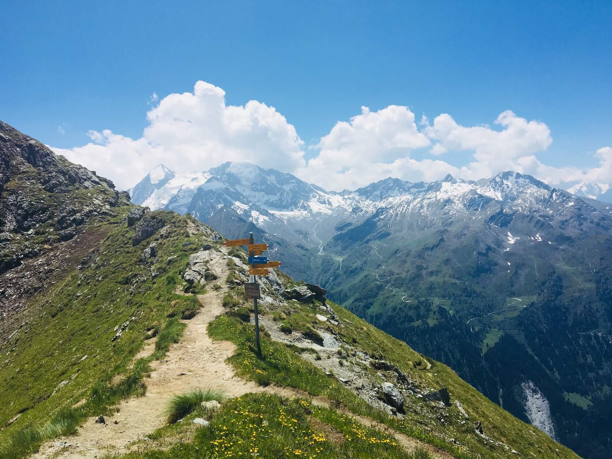
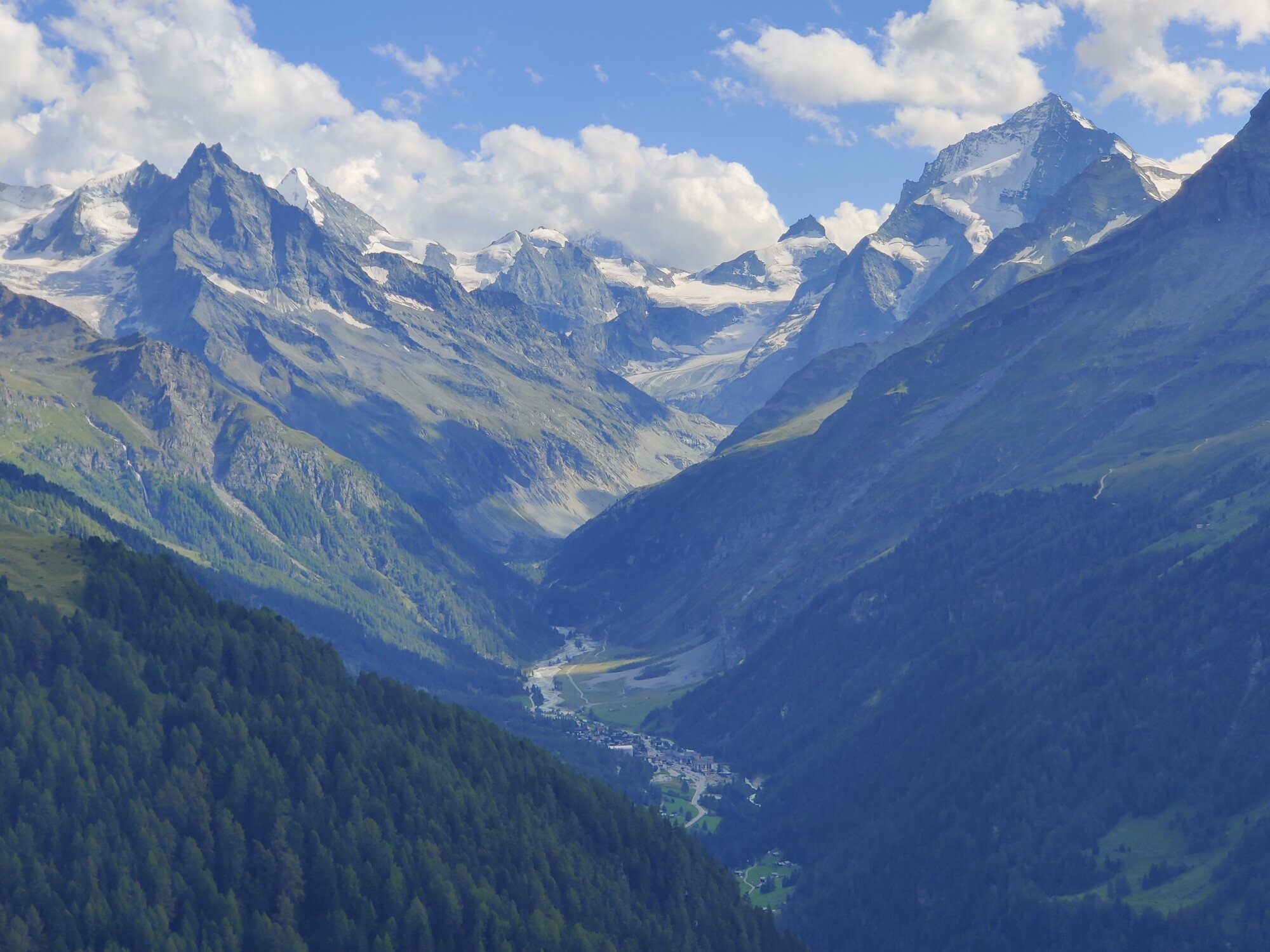
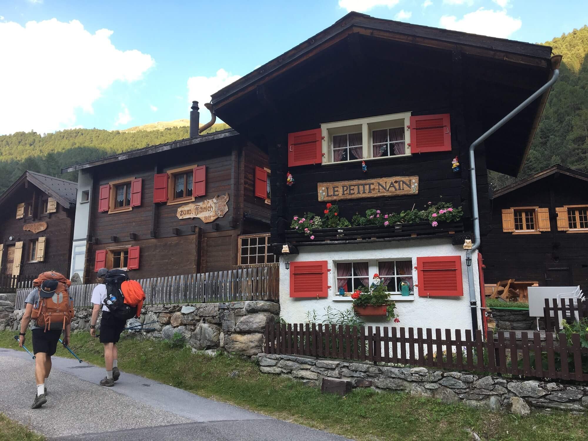
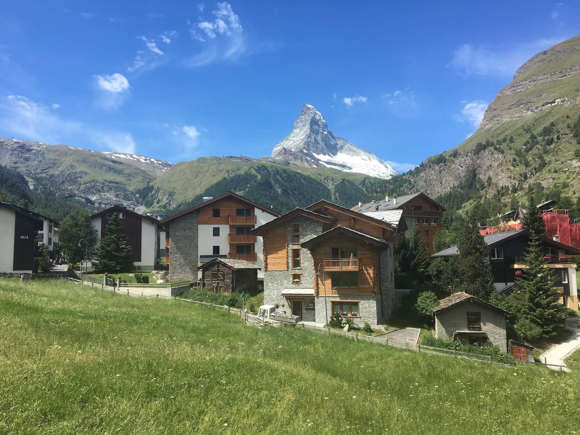
Trail Description: From Chamonix, the main route follows the Arve river through the greater Chamonix village. Passing through the golf course at Les Praz, the trail gently rises through the forrest on the north side of the valley floor until it reaches the village of Argentiere. The route then crosses the valley to the south side where it joins the Petit Balcon Nord trail and continues ascending through the trees to Le Tour. From here, the path climbs up through the open ski area to arrive at Col de Balme, the border between France and Switzerland. Col de Balme is the first mountain pass that hikers need to cross. Although it is the lowest of the 11 on the Walker’s Haute Route at just over 2,200m (7,200ft), most will find it challenging as their legs get used to hiking with a backpack again.
Difficulty: Combination of hiking and mountain trails.
Is there an alternate route? Yes, there are two; (1) Posettes Trail diverts at Argentiere and rejoins near Col de Balme, and (2) Glacier du Tour Trail diverts at Charamillion and rejoins at Col de Balme.
Transport Shortcuts:
Bus between Chamonix and Le Tour
Gondola between Le Tour and Charamillion
Chairlift between Charamillion and Autannes Chair Top
Via Chieuset and the Fenetre D'Arpette Trail
From Col de Balme to Champex-Lac
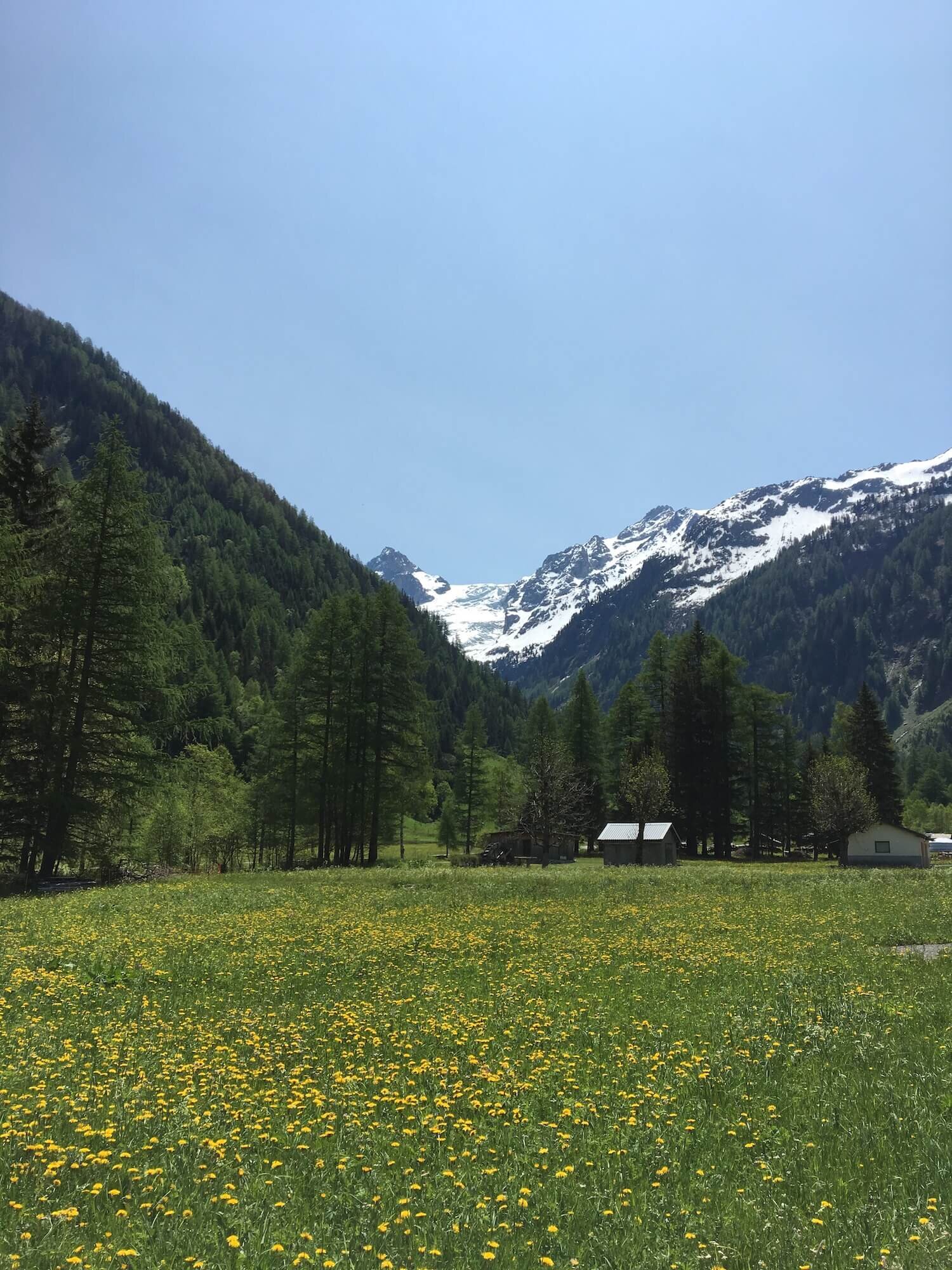
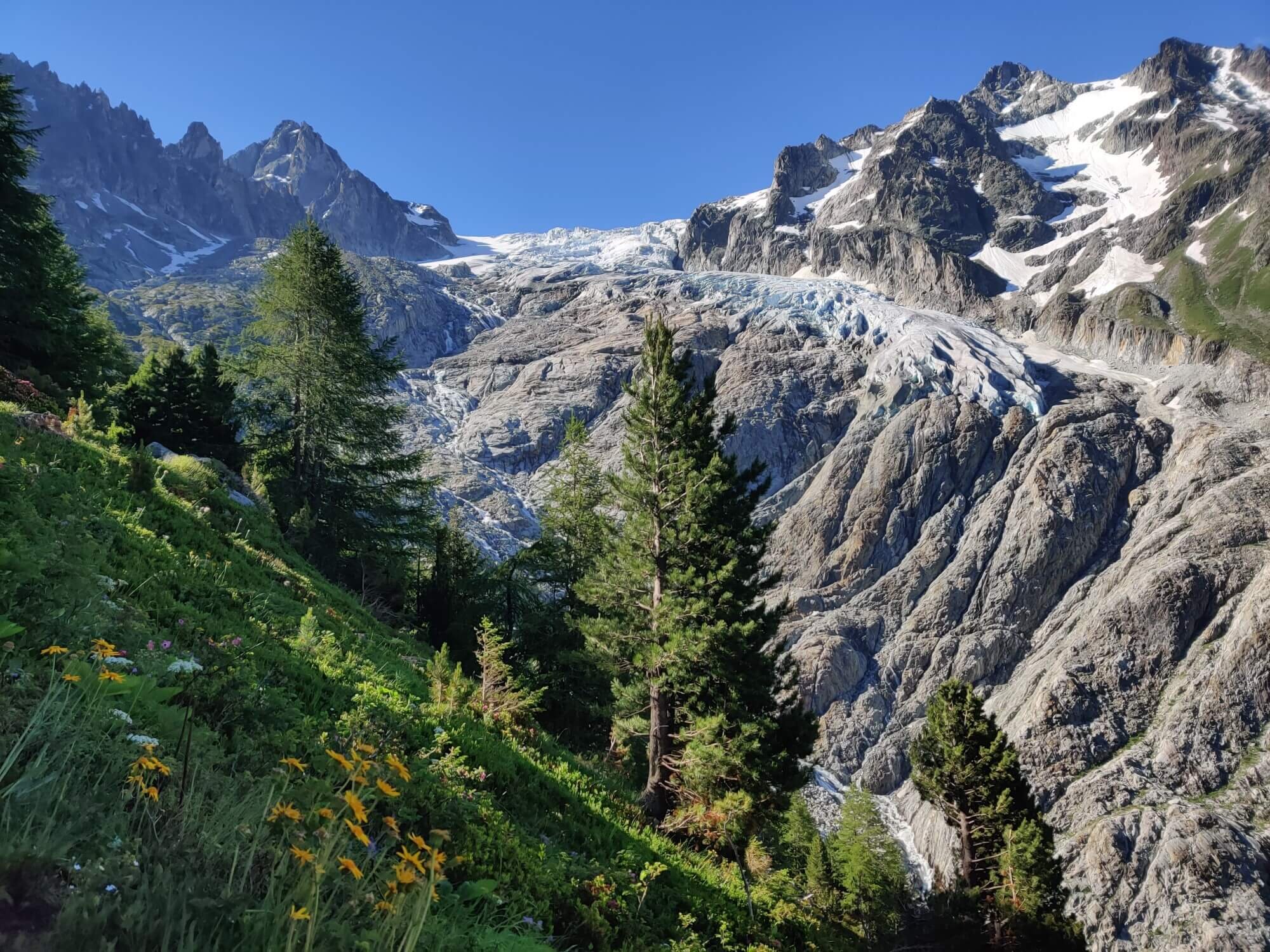
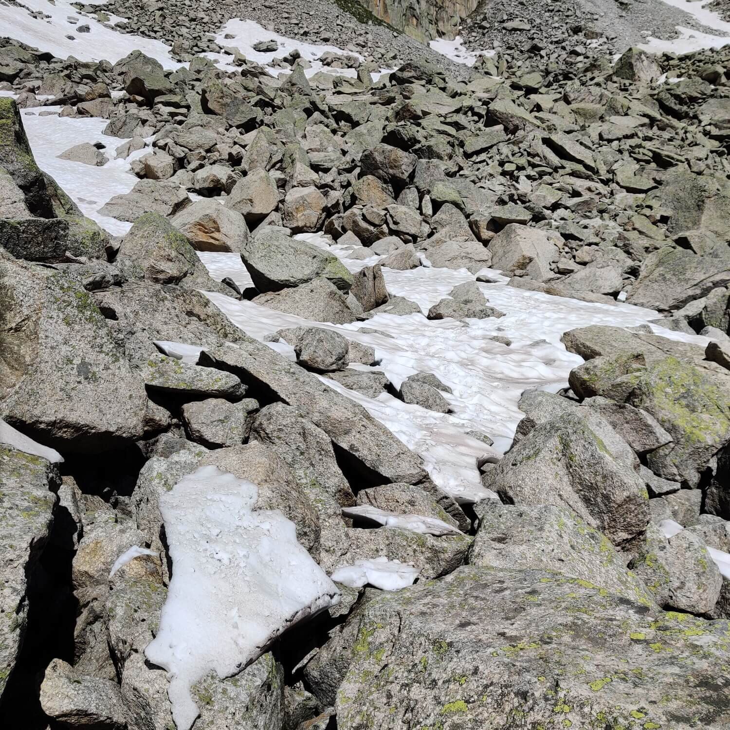
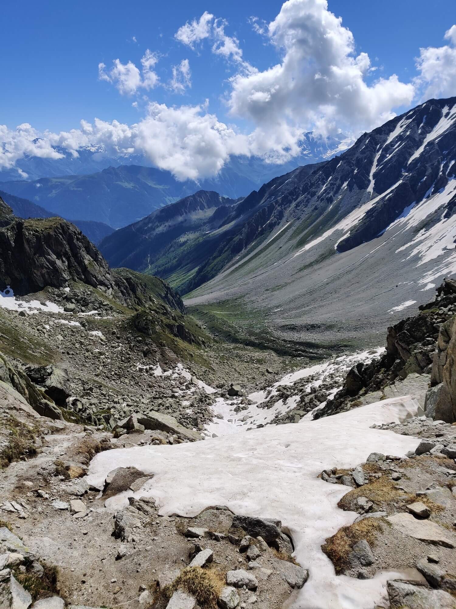
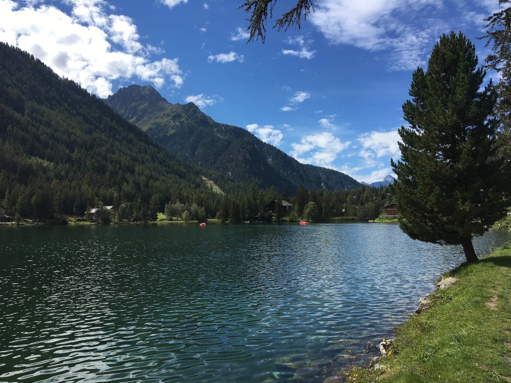
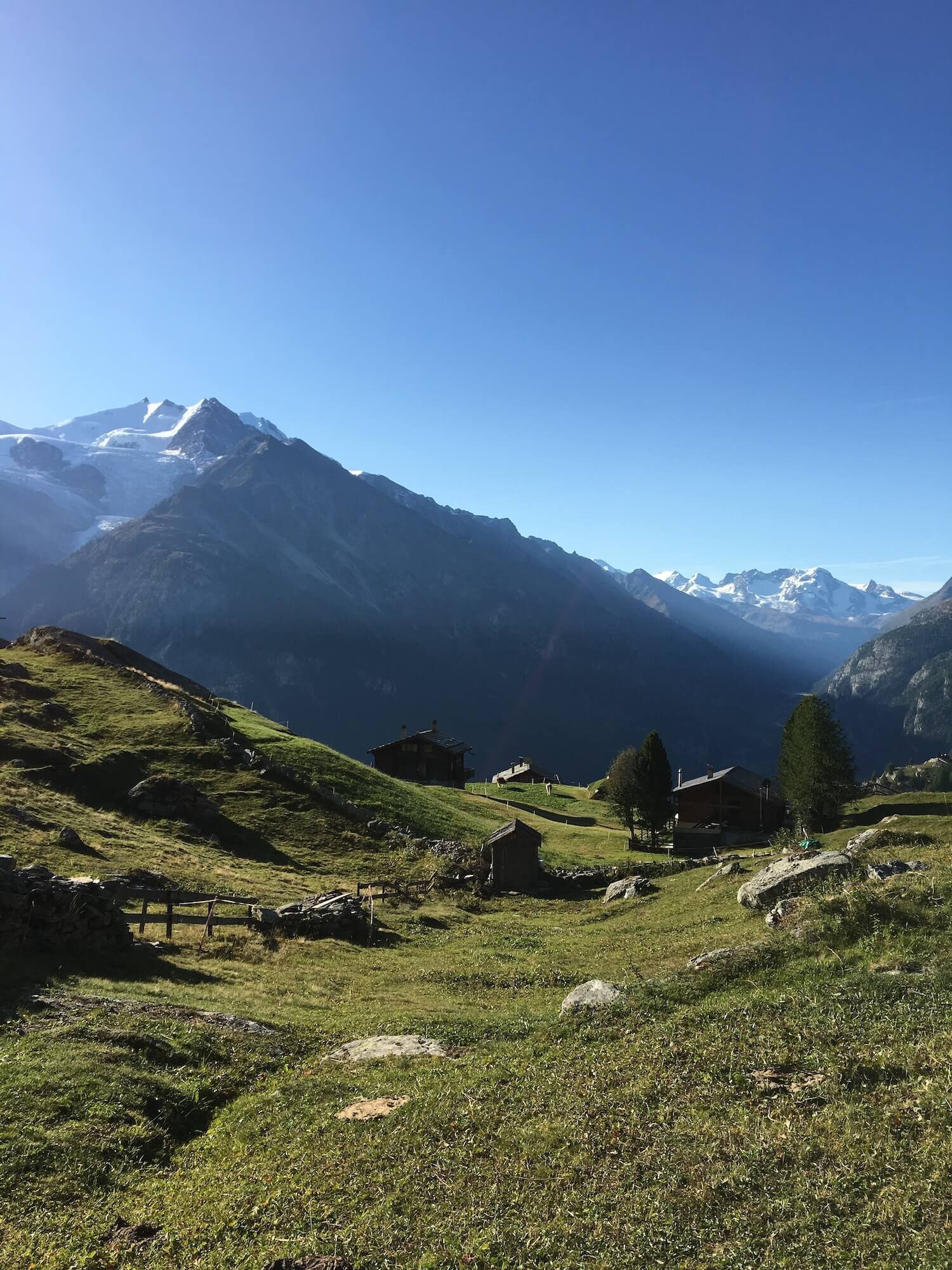
Trail Description: From Col de Balme, the main trail immediately starts descending toward Chieuset in the Trient valley. As the path dips below the treeline, a series of long switchbacks help to quickly lose elevation. The trail leaves the forest as it reaches the valley floor where the small village of Le Peuty welcomes hikers with a gite and campground. The trail re-enters the forest on the east side of the valley and climbs up to Chalet du Glacier, a small, basic cafe located next to the Trient glacier run-off. From here the trail starts to climb up out of the trees so that a view of the Trient glacier becomes visible. The trail up to the Fenetre D’Arpette pass is steep and rocky at the top. Once at the pass, views into Val D’Arpette reward hikers. The immediate descent is very steep and loose stones are easily dislodged so vigilence is required. A large boulder field then needs to be crossed which needs all fours at times to safely do so. Once clear, the trail wanders lower into the valley through an alpine meadow, past Relais d Arpette (a cute cafe and hotel) and follows a network of streaming alongside the trail. Hikers will shortly arrive at Champex-Lac which is a town situated on a beautiful alpine lake. This marks the point where the Walker’s Haute Route branches away from the Tour du Mont Blanc trail.
Difficulty: Mostly mountain trail with some short hiking trail sections.
Are there alternate routes? Yes.
Les Grands Trail diverts at Col de Balme and rejoins at Chalet du Glacier.
Alpe Bovine Trail diverts at Col de la Forclaz and rejoins near Champex-Lac.
Transport Shortcuts: Bus between Trient and Col de la Forclaz.
Considerations:
Fenetre D’Arpette pass is steep at the top and dangerous when still covered with winter snow. In 2018 there was still a heavy covering of snow well into June which resulted in a number of accidents (including a fatality) due to ill-prepared hikers attempting to pass. The local huts on either side receive daily reports from hikers checking and crossing these passes so ask them what the conditions are like when you are there. If there is still a snow cover at the pass, only take this route if you have the skills, experience and equipment to cross a steep mountain pass in these conditions. If there is no snow at the pass there may still be some in then boulder field on then Arpette side which creates a postholing risk. Leave plenty of time to turnaround and take the Alpe Bovine route if needed.
Val de Bagnes Trail
From Champex-Lac to Cabane du Mont Fort
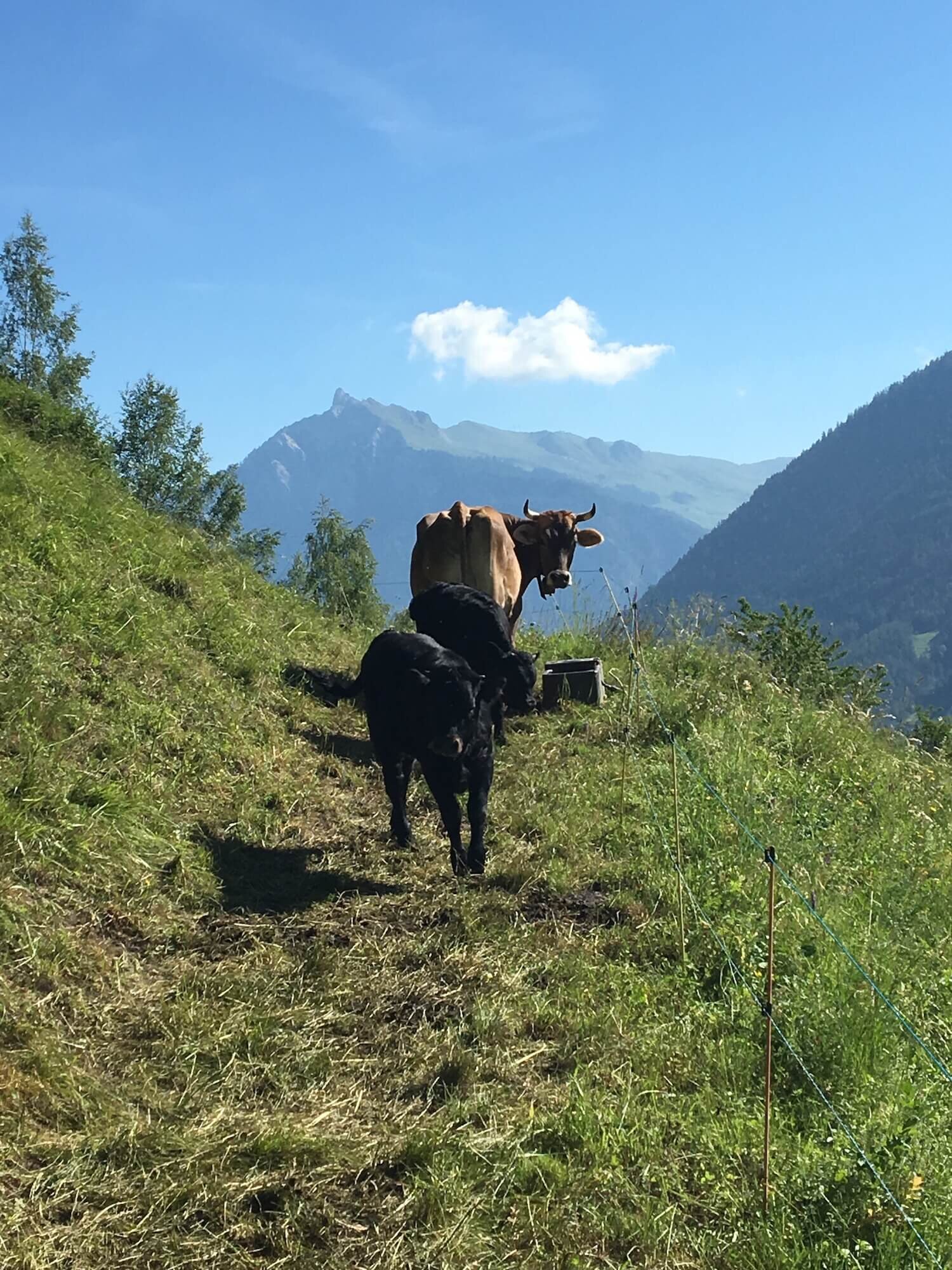
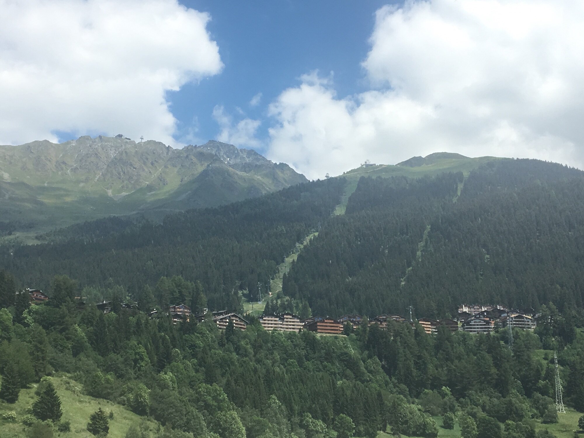
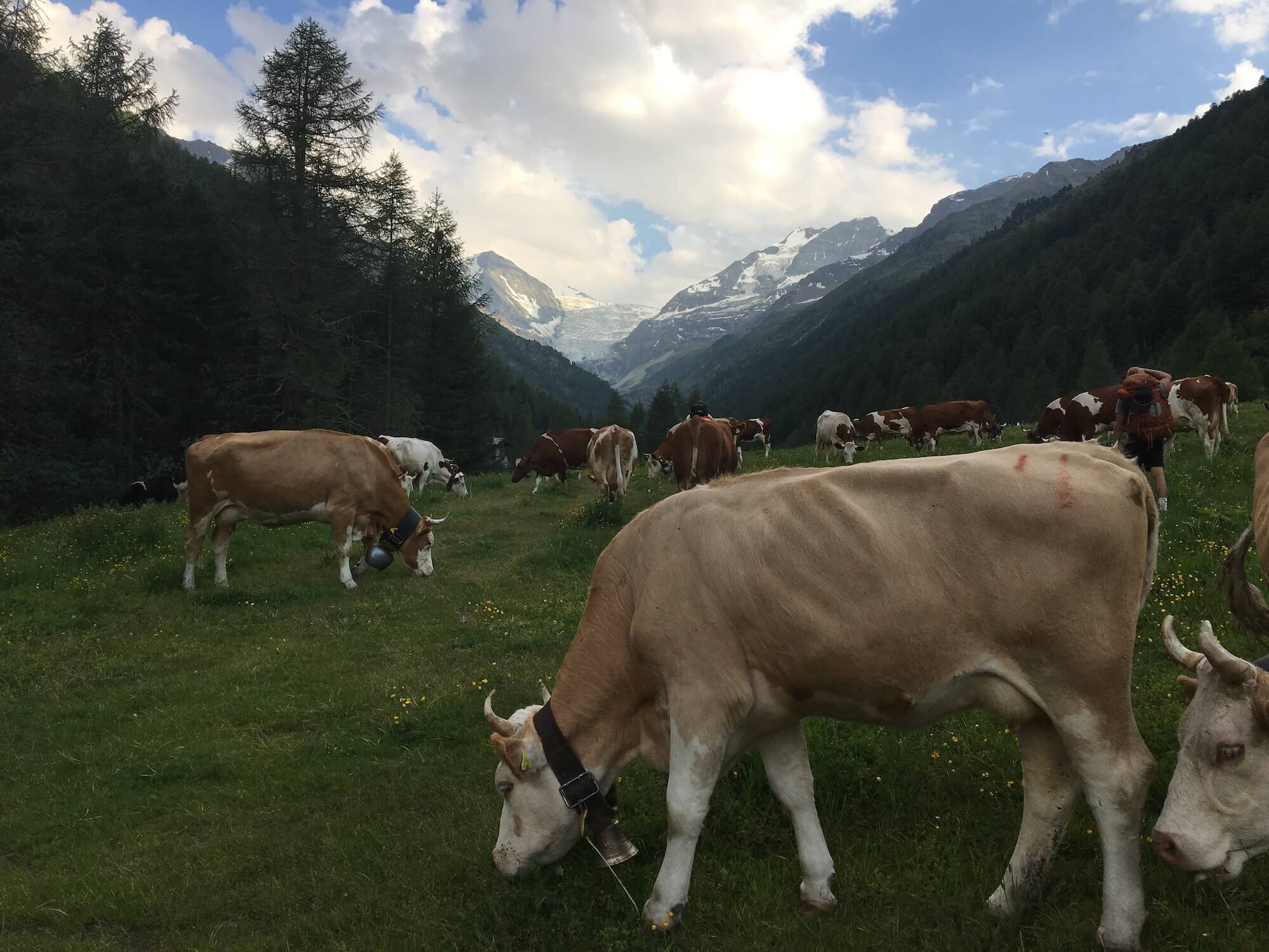
Trail Description: The trail continues past the end of the lake descending through farmland on the way to Sembracher. The route follows a combination of flat bitumen and dirt roads before reaching Le Chable and starting the climb up to Verbier through winding, steep trail that pass through small hamlets. Stock up in Verbier on any supplies you might need before heading out of town and up through the Four Valleys (or 4 Vallées) ski resort on a steep track that ascends past the hamlet of Clambin to the Les Ruinettes lift station. From here the trail flattens out and follows a wide track along the Bagnes Valley before one last climb to Cabane du Mont Fort, located within the ski area.
Difficulty: Hiking Trail only.
Are there alternate routes? No.
Transport Shortcuts:
Train between Sembrancher and Le Chable.
Gondola between Le Chable and Verbier.
Gondola between Verbier and Les Ruinettes.
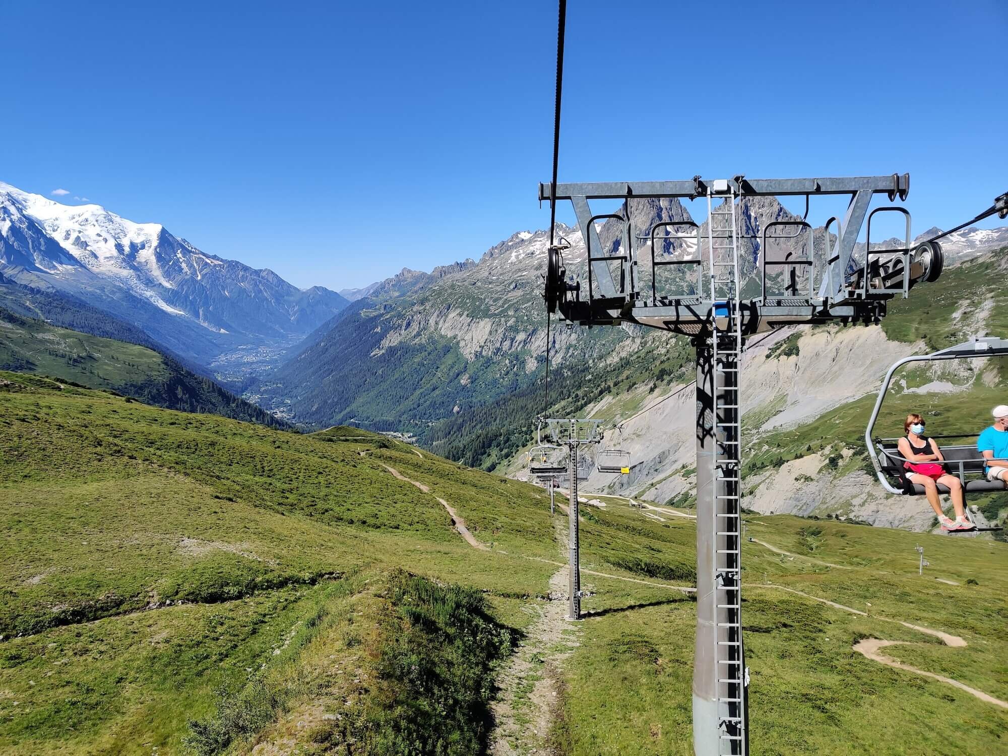
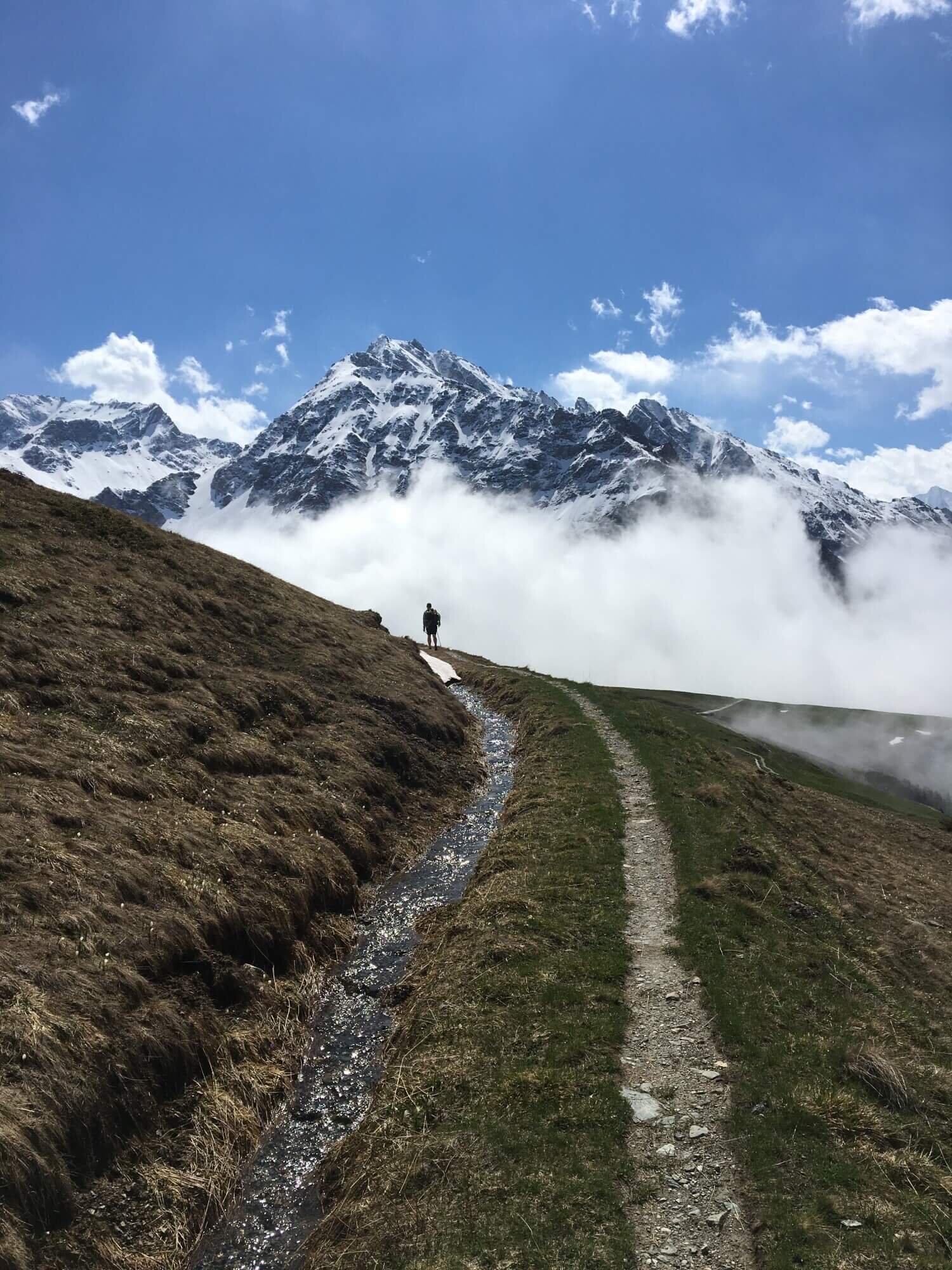
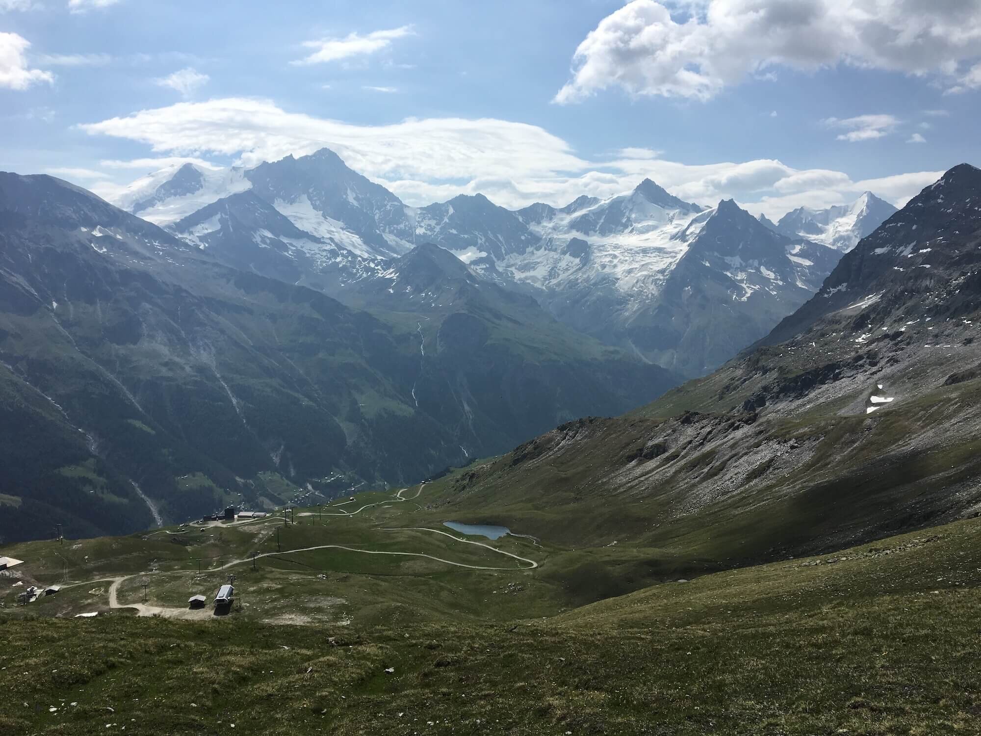
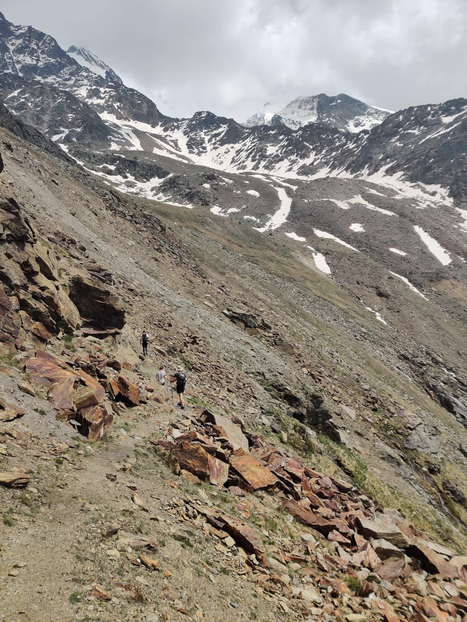
Sentier des Chamois and the Grand Desert Trail
From Cabane du Mont Fort to Cabane de Prafleuri
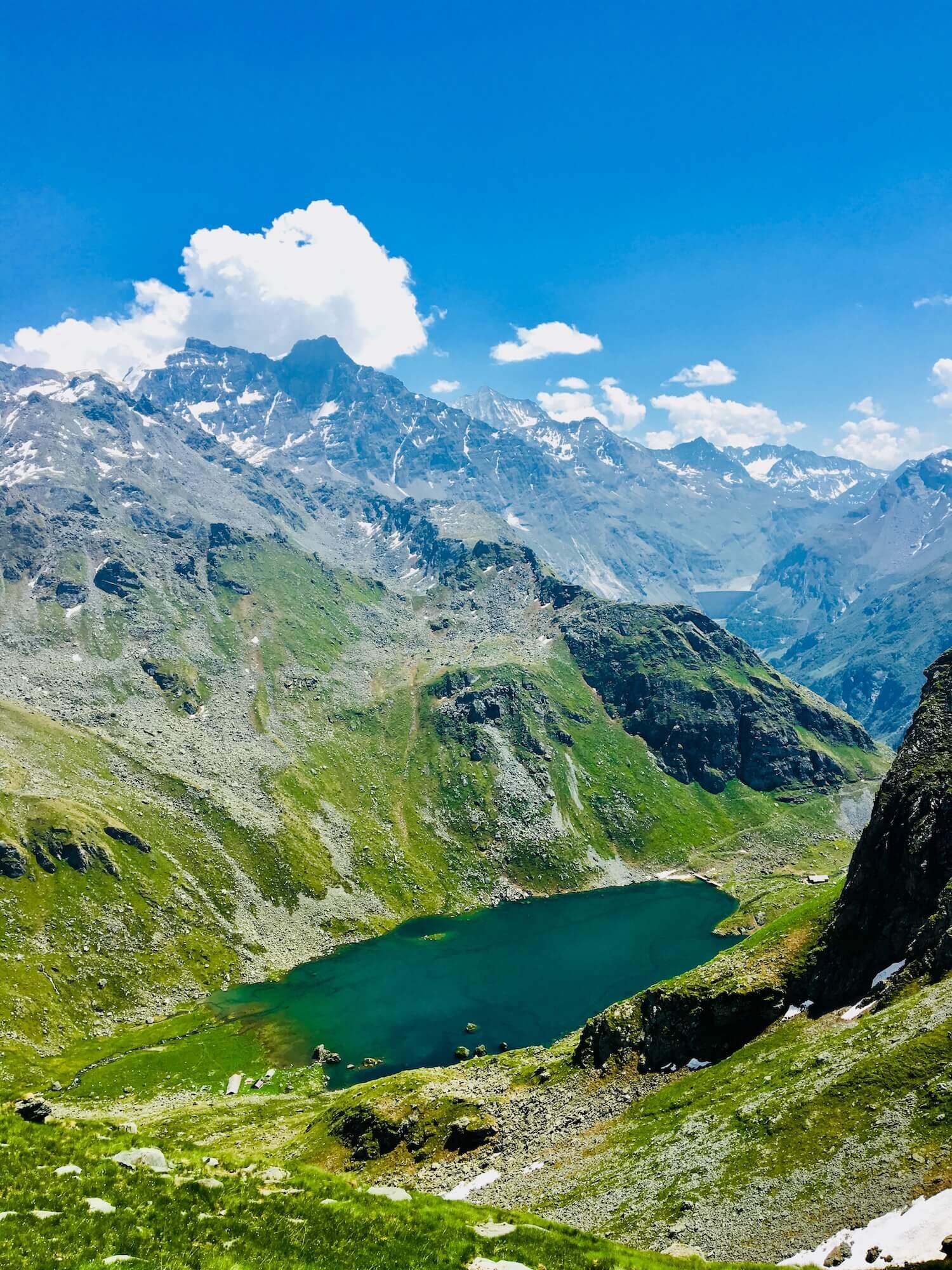
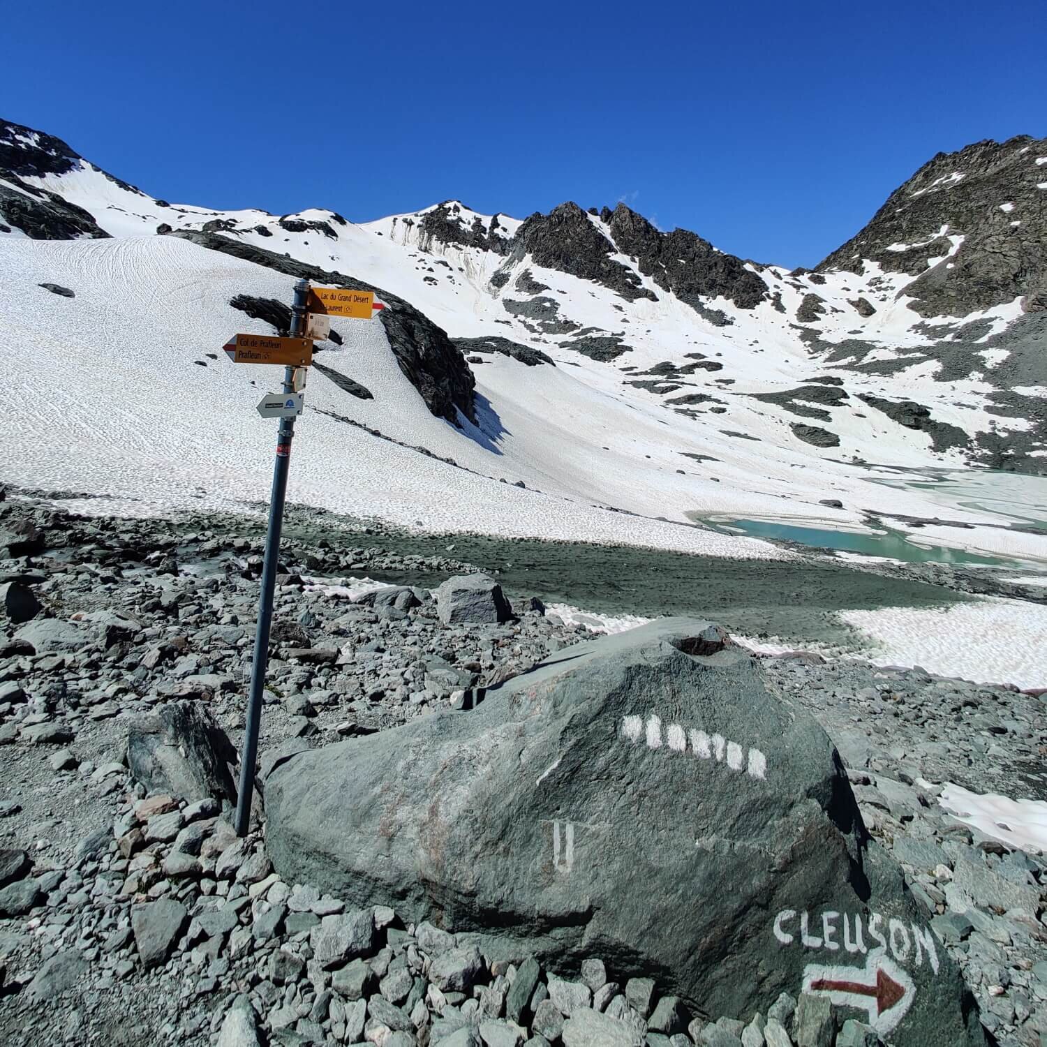
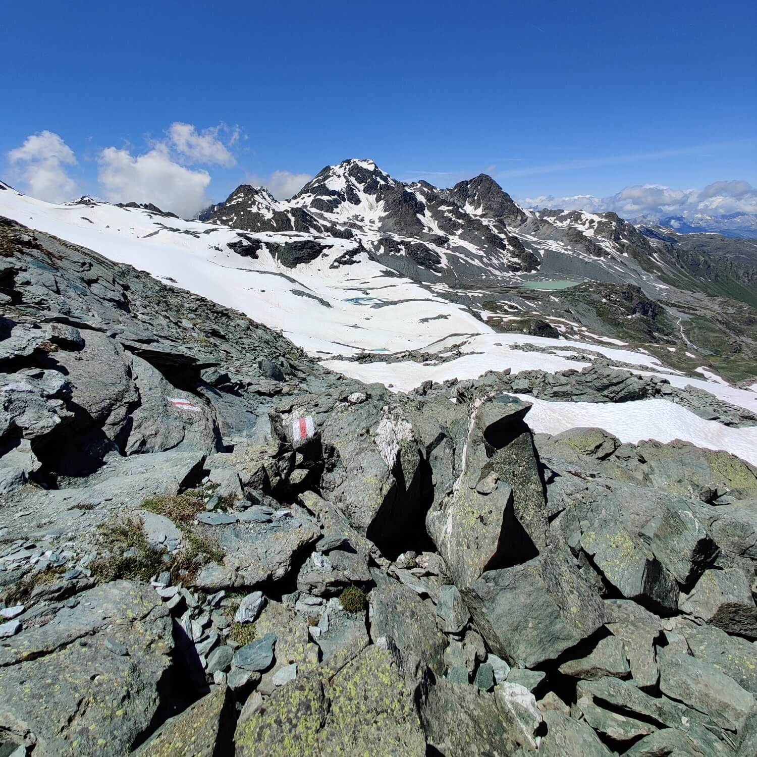
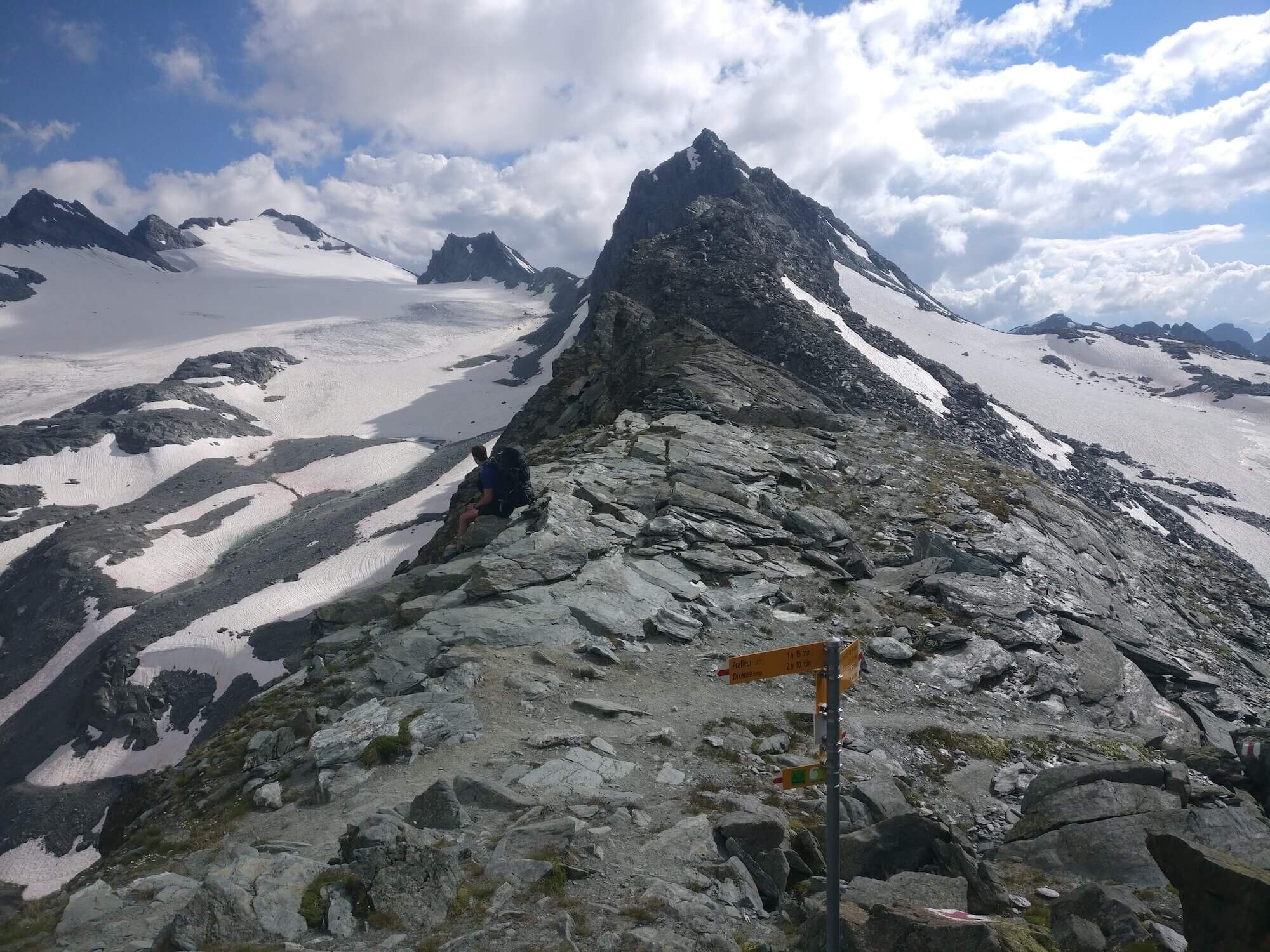
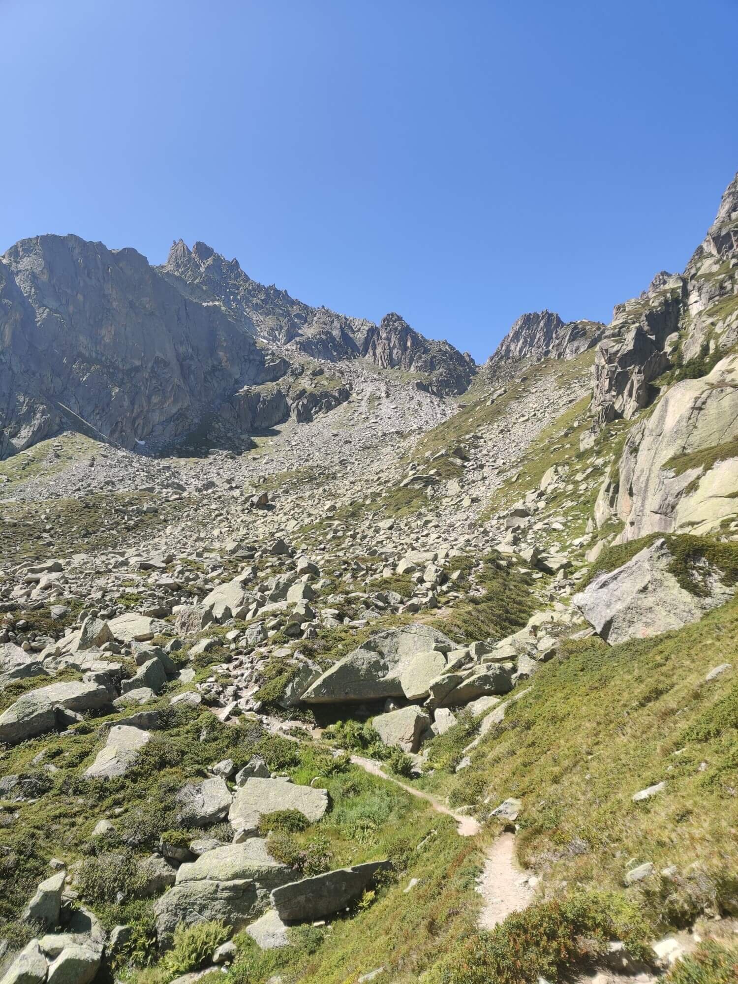
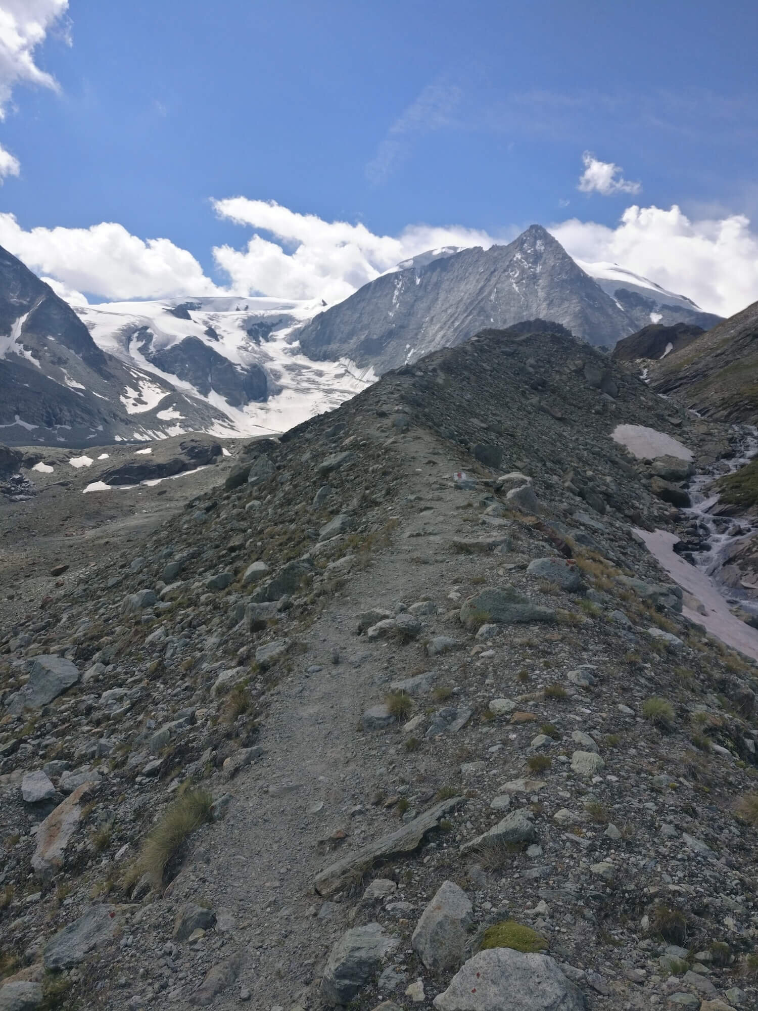
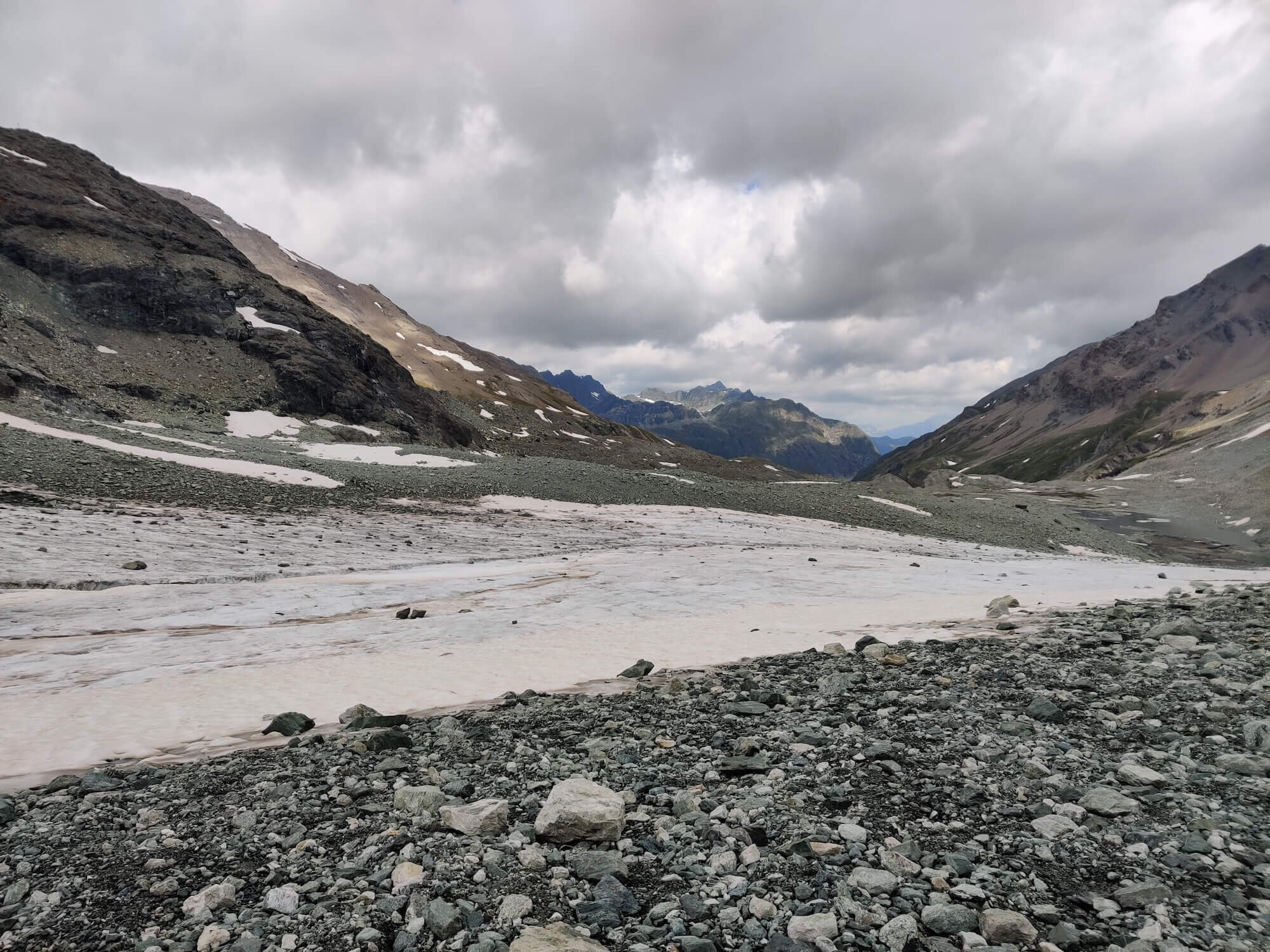
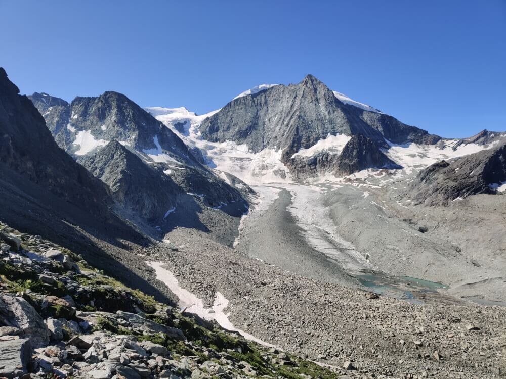
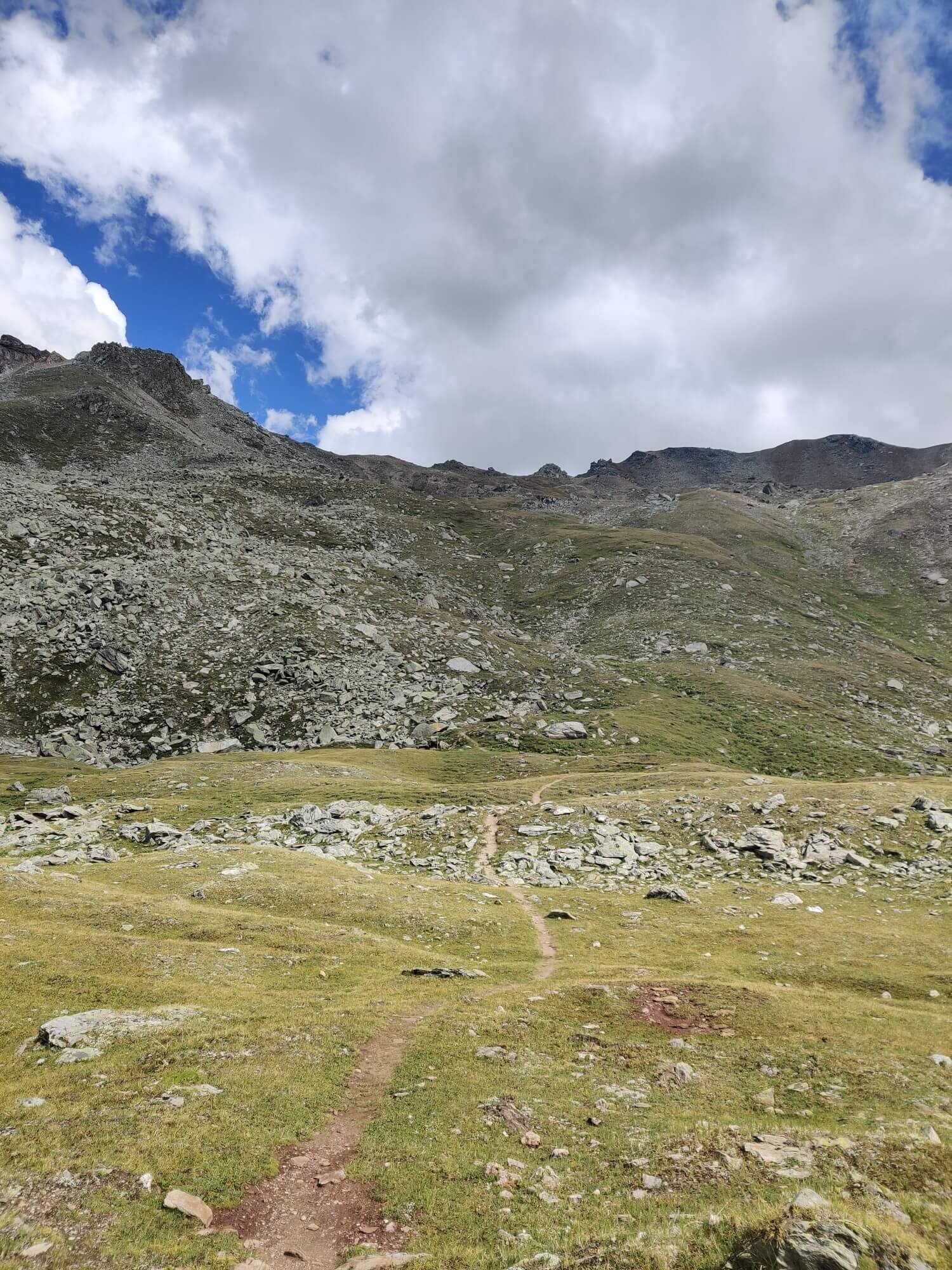
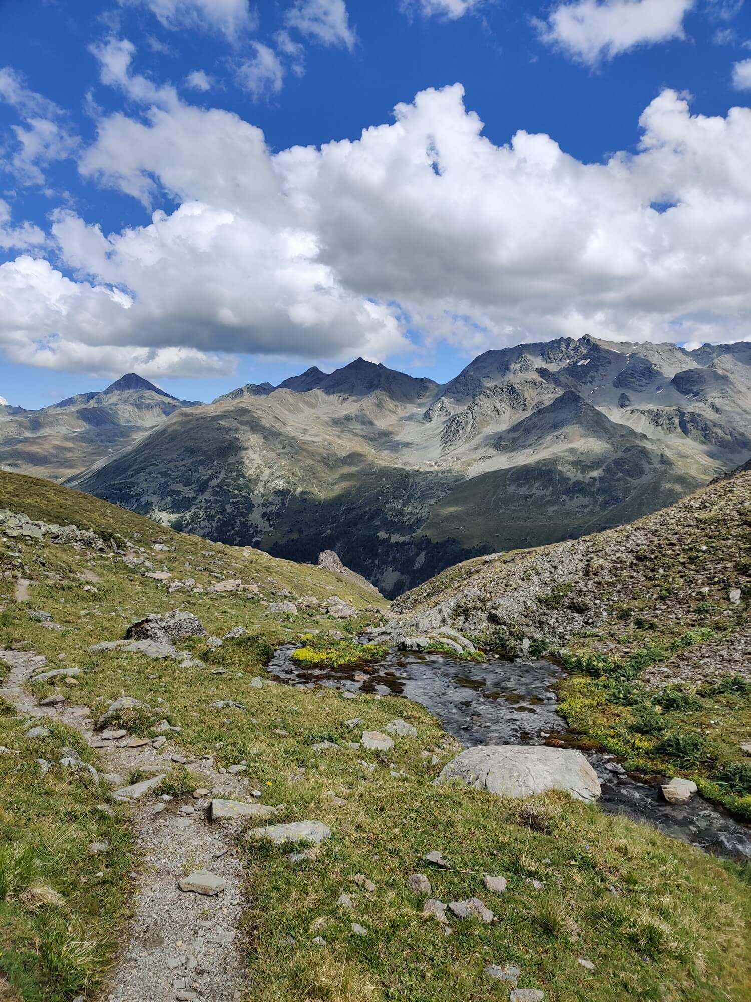
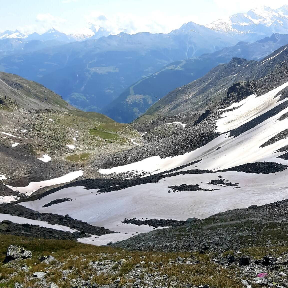
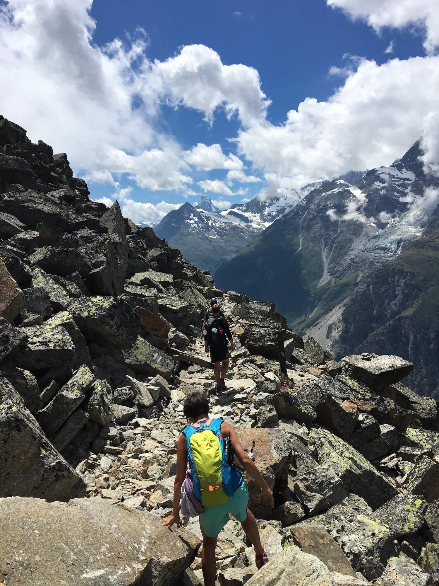
Trail Description: The trail climbs out of the Verbier ski area and onto a thrilling high balcony, the Sentier des Chamois, that traverses Val de Bagnes (Bagnes Valley). There are a few narrow sections which you might find challenging. For most, it is the first time hiking a long high mountain trail section, the very experience that draws most to the Haute Route in the first place. Le Chable and Sembrancher will disappear behind you as the Grand Combine massif now dominates your landscape ahead. At Col Termin, if you are staying at Cabane de Louvie you will descend to the lake below. If you are hiking directly to the Grand Desert, you will go through the pass and enjoy the views of the lake from above. This route continues along a balcony trail, with the route from Cabane de Louvie and Col de la Chaux rejoining, before crossing some final boulder fields on the way up to Col de Louvie and into the Grand Desert. This is a high altitude section of trail that all Haute Route hikers must complete. Cross the baron plain to Col de Prafleuri on the other side before descending to the backcountry outpost of Cabane de Prafleuri.
Difficulty: Mountain Trail
Is there an alternate route? Yes, there is a more direct route via Col de la Chaux that diverts at Cabane du Mont Fort and rejoins near Col de Louvie.
Transport Shortcuts: No.
Considerations:
For those hiking before mid July, it is important to check whether the Grand Desert is passable due to snow conditions. The Grand Desert trail stays between 2,800 and 3,000m (9,200ft and 9,800ft) and therefore is usually the last section of trail on the Walker’s Haute Route become passable. Follow our Instagram account to get the latest spring trail conditions each year. For last minute updates, Cabane du Mont Forte and Cabane de Louvie receive daily reports from mountaineers/hikers checking and crossing this section so ask them what the conditions are like before you head off. If you need to by-pass the Grand Desert, head back down to Le Chable and catch public transport (or a private transfer) to either Grande-Dixence to proceed on the Col de la Meina route, or Arolla/Les Hauderes to continue on the main trail.
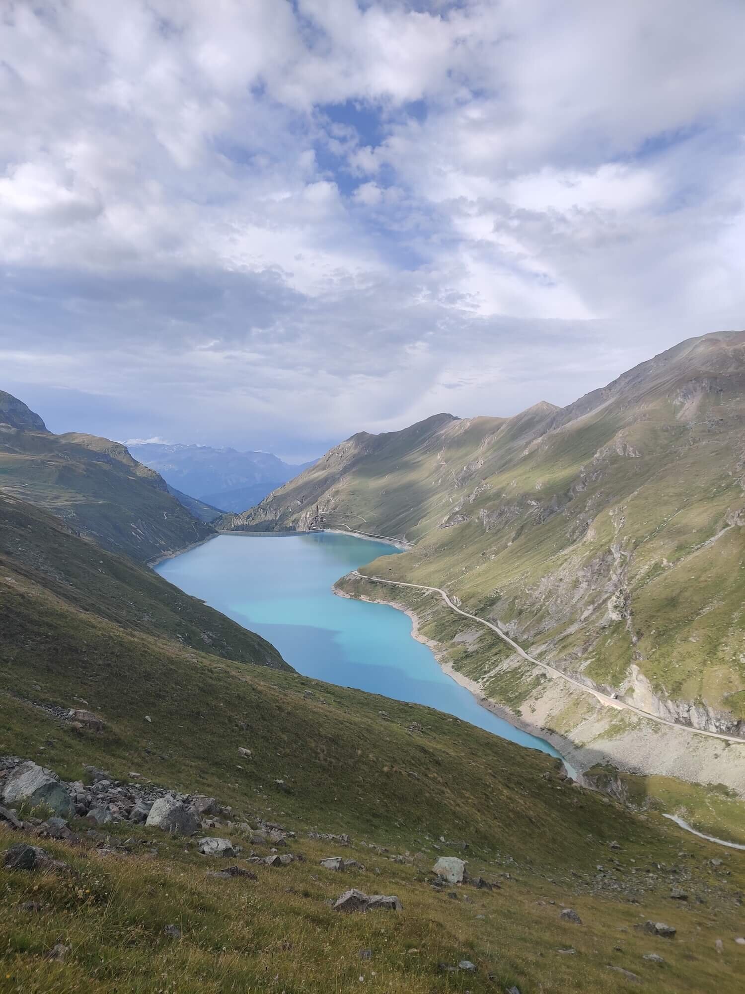
Val Des Dix Trail
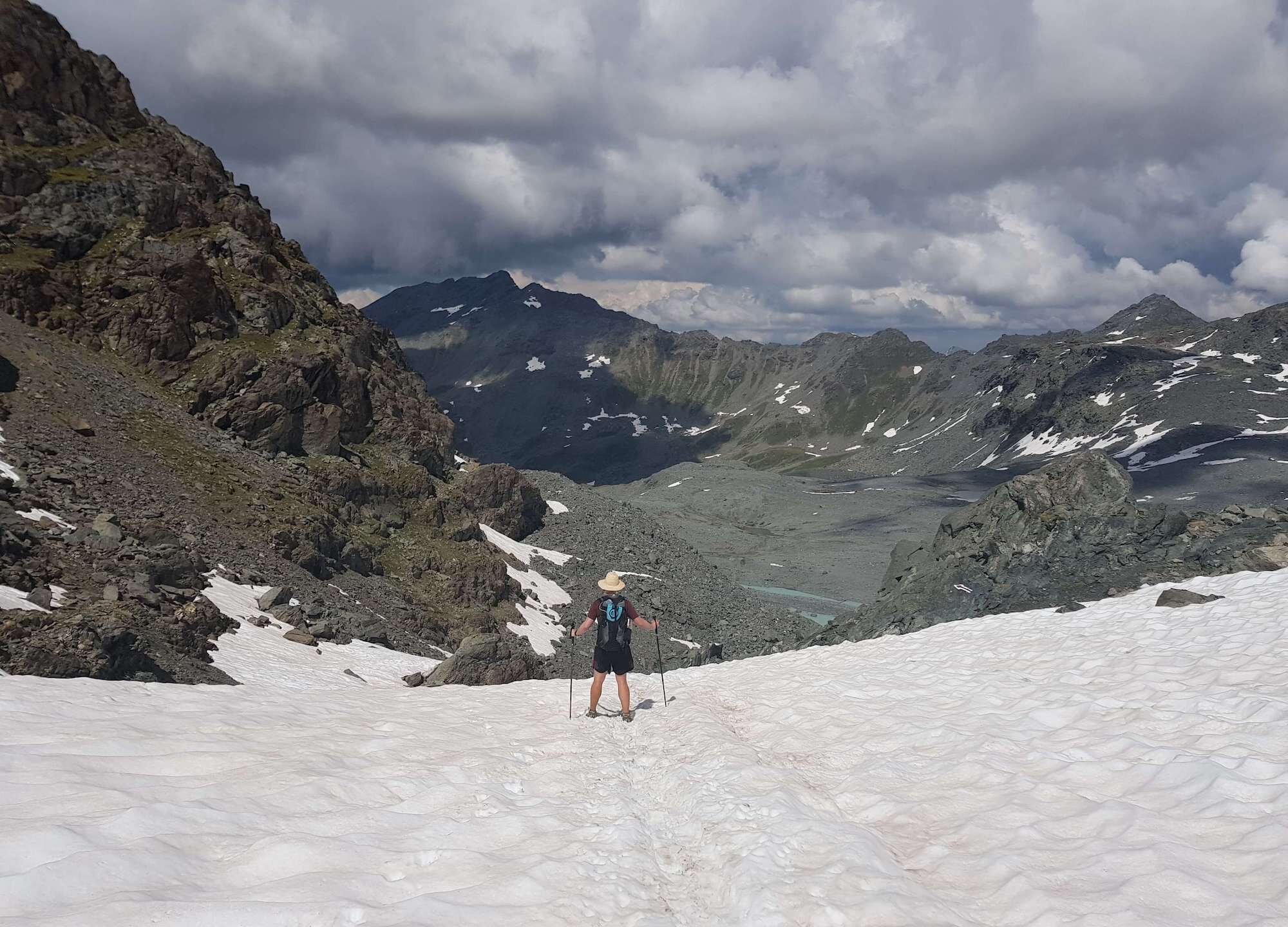
From Cabane de Prafleuri to les hauderes
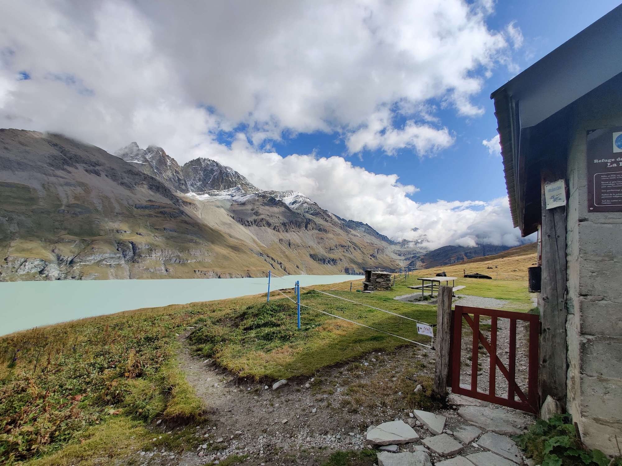
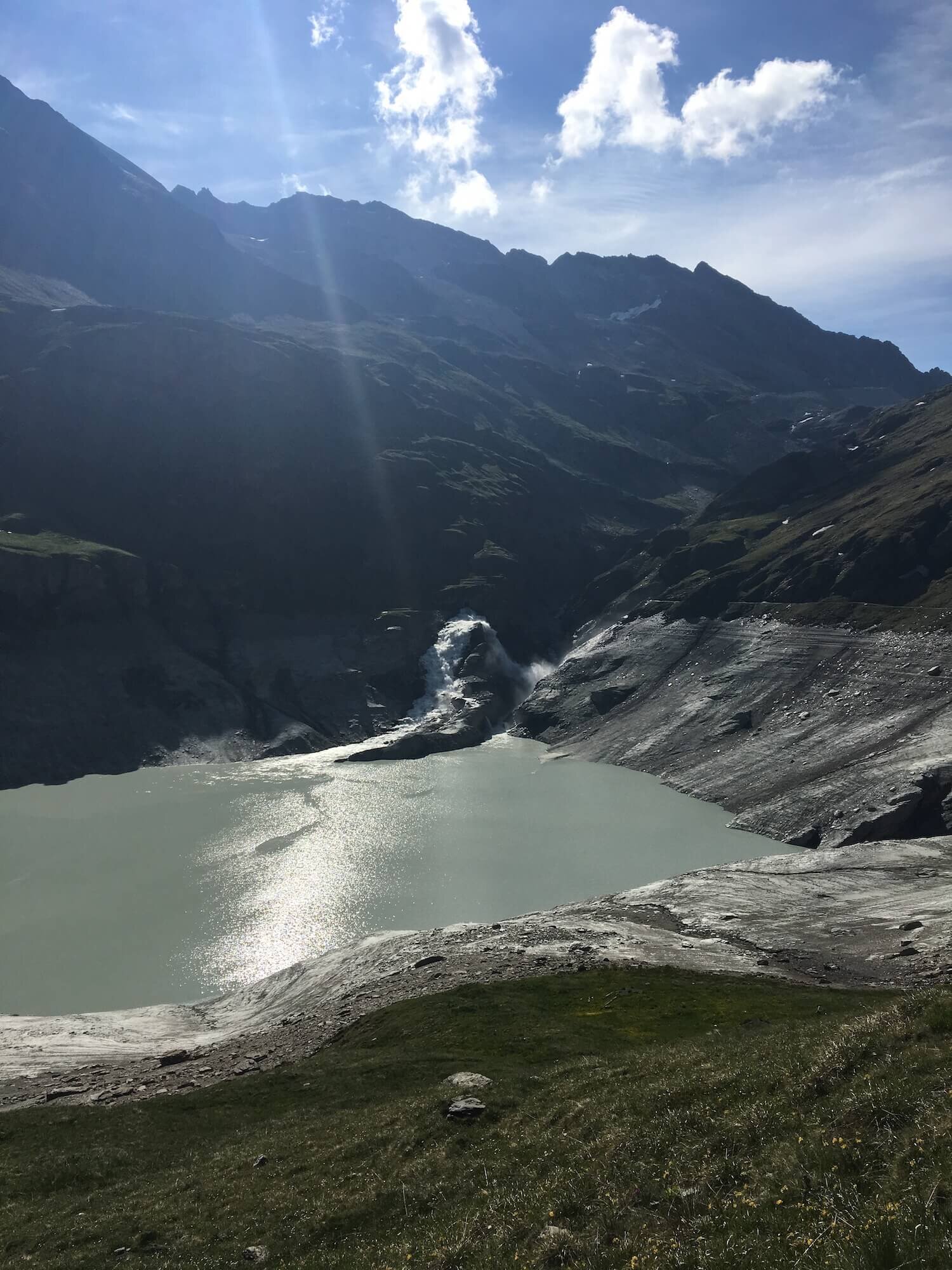
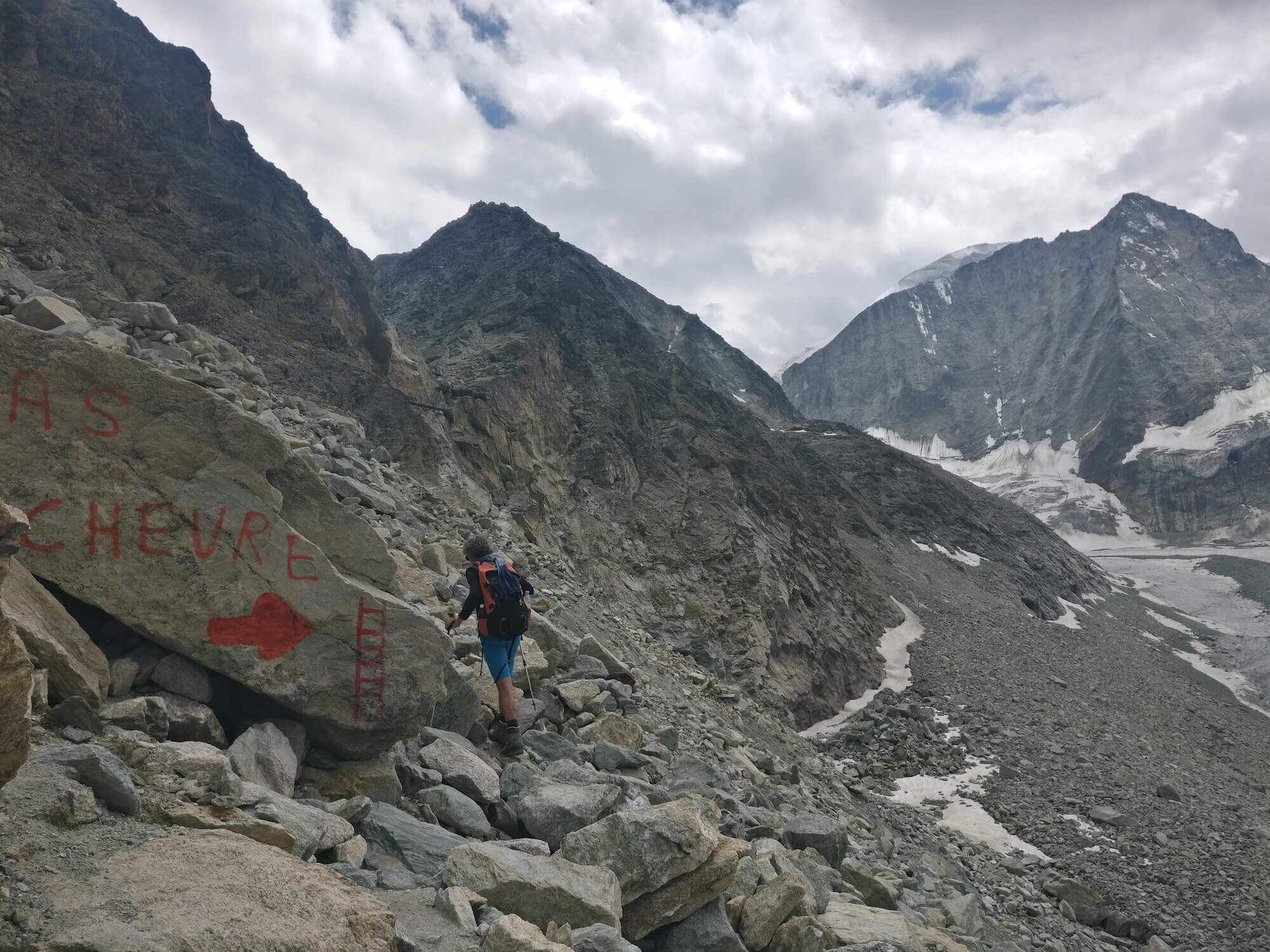
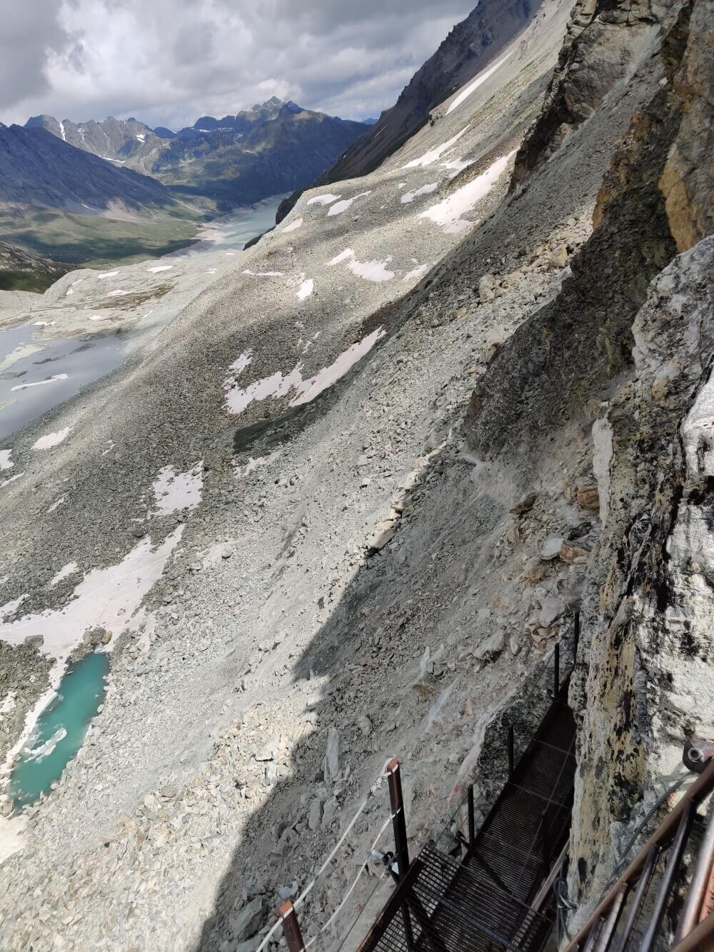
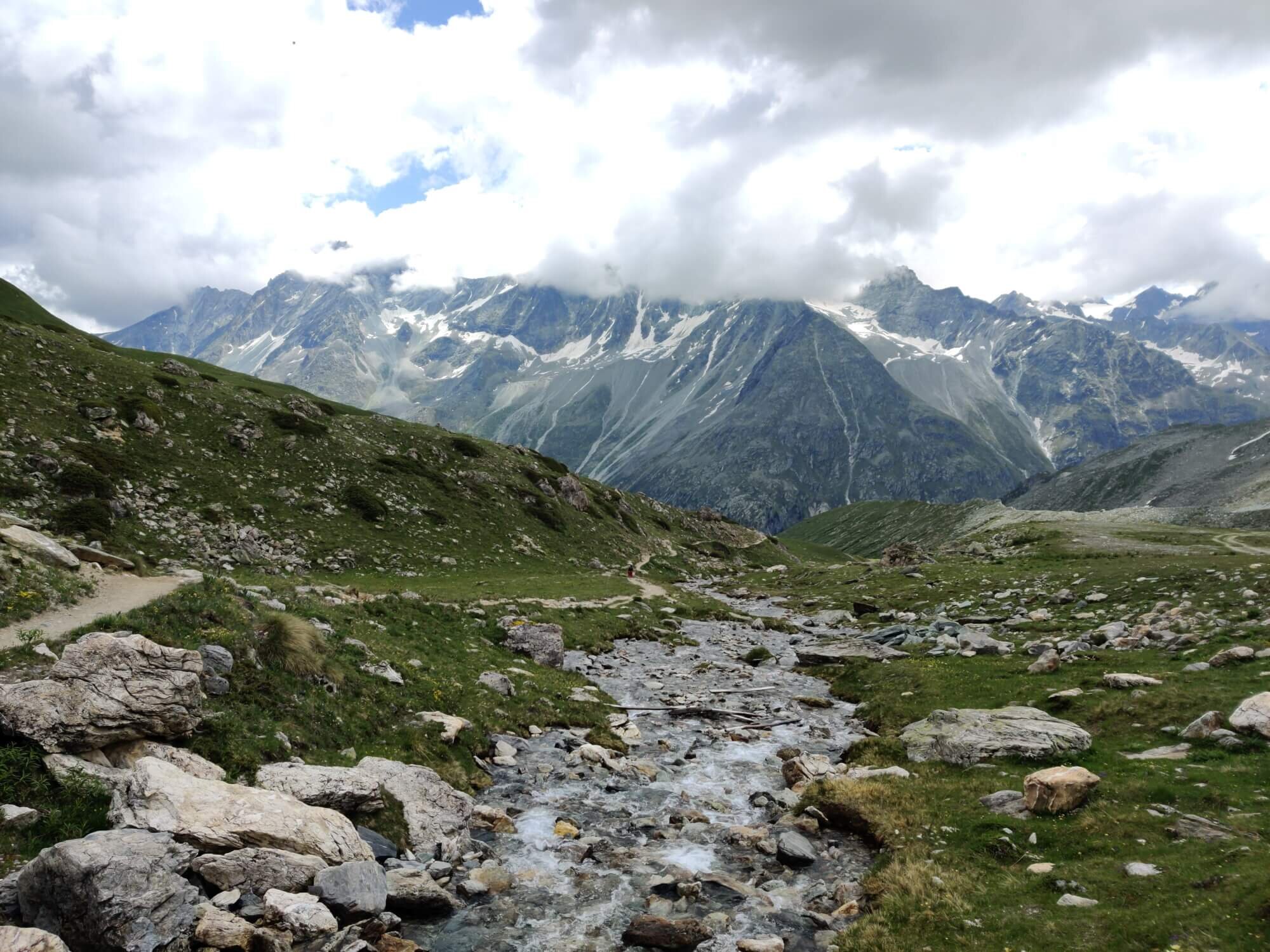
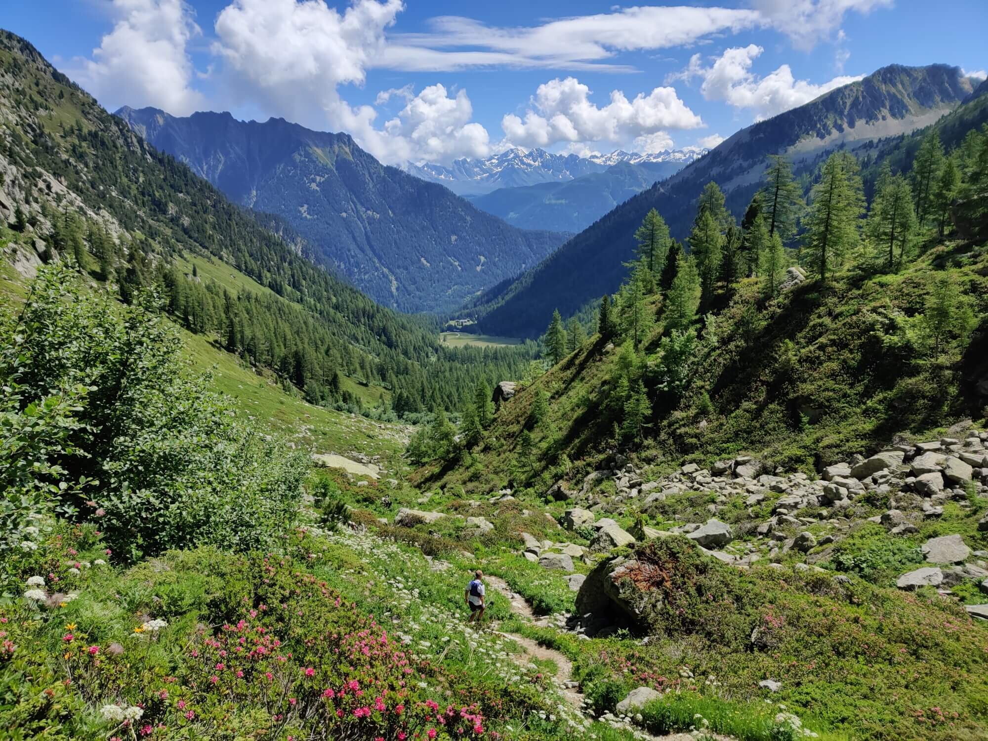
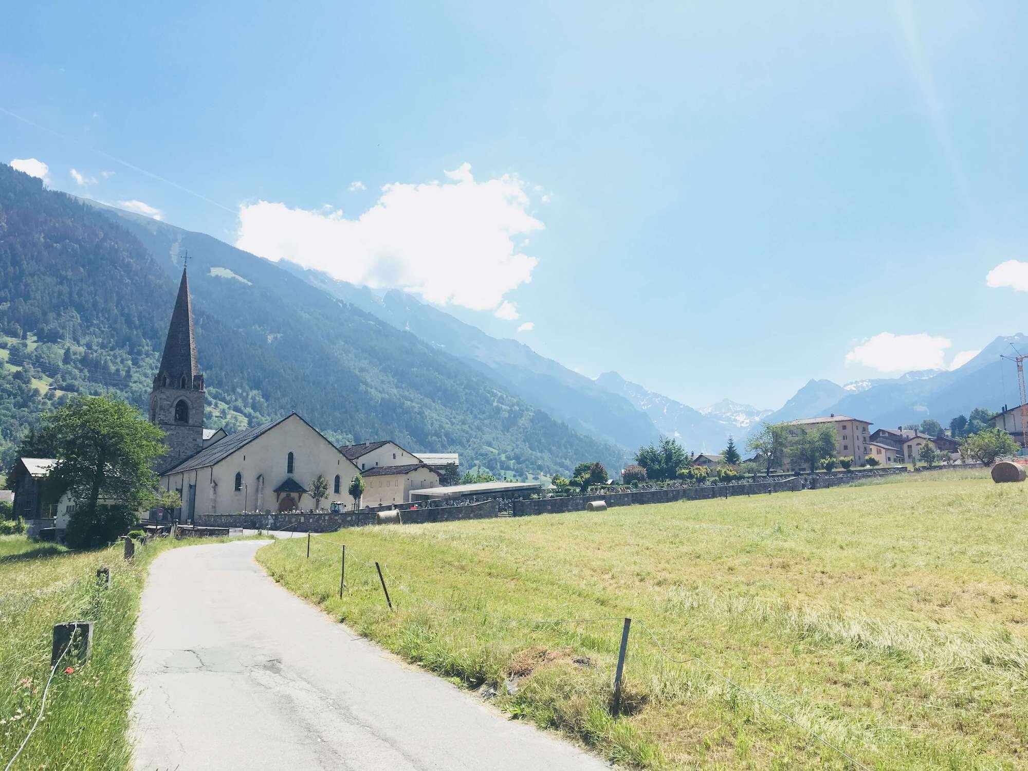
Trail Description: A short climb from Cabane de Prafleuri brings you to Col Des Roux where Lac Des Dix and green pastures can once again be seen after the desolate Grand Desert. Lac Des Dix is the tallest gravity dam in the world and the tallest dam in Europe. The trail descends close to the lake and follows a flat, wide, dirt road to the south end. From here, you have 2 options - the first is to hike up the ridgeline to Cabane des Dix and cross the Cheilon glacier, or take a more direct route to the base of Pas de Chevres (both options will be in the GPS map for those choosing the main trail). The rocky terrain is challenging and requires you to scramble over boulders and loose scree, before climbing up a set of long ladders. Once at the pass, the trail has a short, steep descent before entering the ski area. There are great views of the Tsijiore Nouve glacier on your right and the Aiguilles de la Tsa straight ahead, as you descend into the village of Arolla. The trail continues down the left/east side of the valley to the picturesque Lac Bleu before descending further into the forest and valley below where the alternative route via Col de la Meina rejoins at the village of Les Hauderes.
Difficulty: Combination of Alpine, Mountain & Hiking Trails.
Is there an alternate route? Yes, the Col de la Meina alternate route via Grande Dixence. It diverts at Cabane de Prafleuri and rejoins at Les Hauderes.
Transport Shortcuts: Bus between Arolla and Les Hauderes.
Considerations:
The Alpine Trail section is the Cheilon glacier crossing. This can be skipped by taking a detour at the south end of Lac Des Dix that goes direct to Pas de Chevres. Details of this detour are provided within our GPS map files.
For latest conditions of the Cheilon glacier, ask the guardian at Cabane Des Dix.
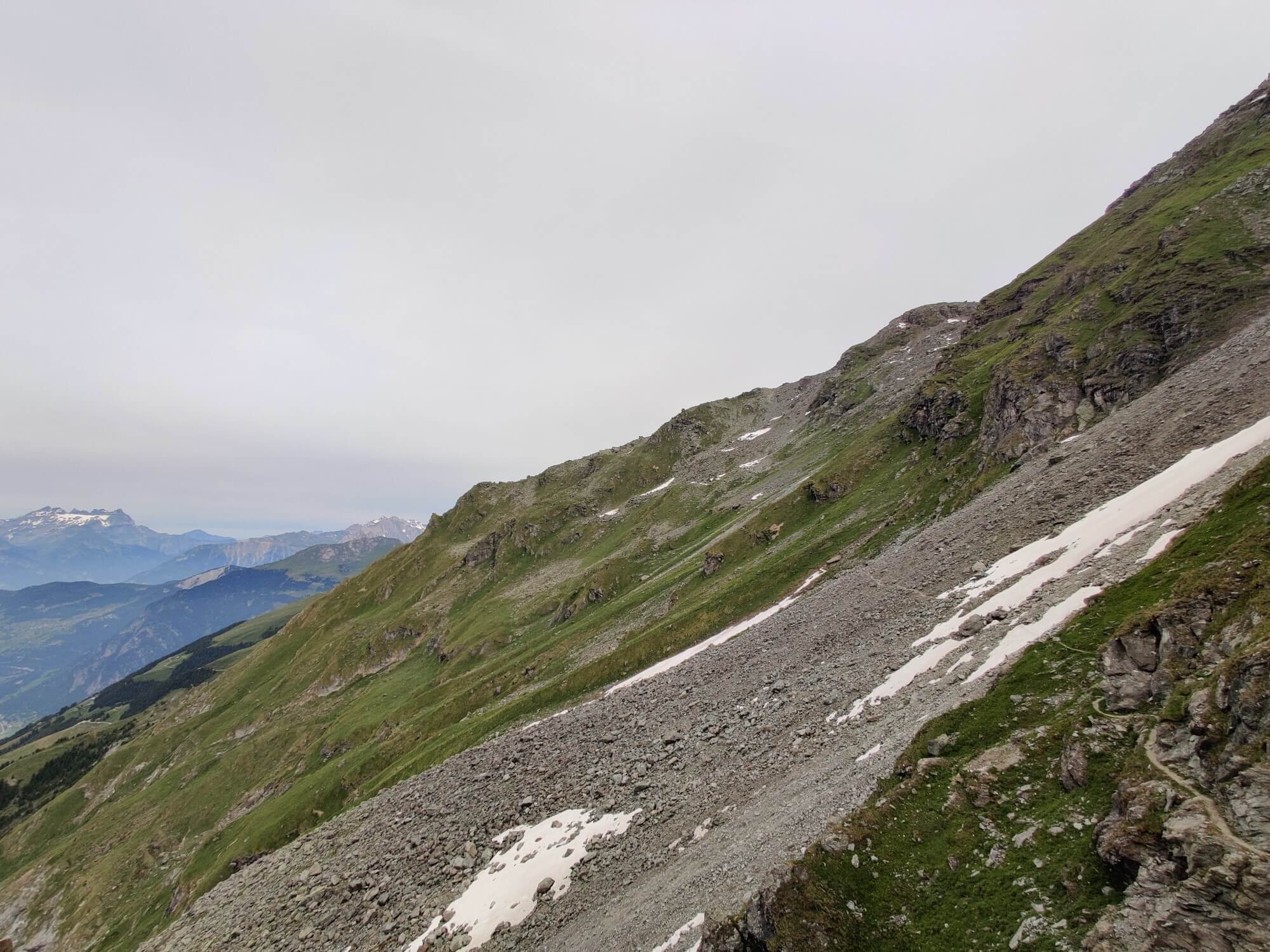
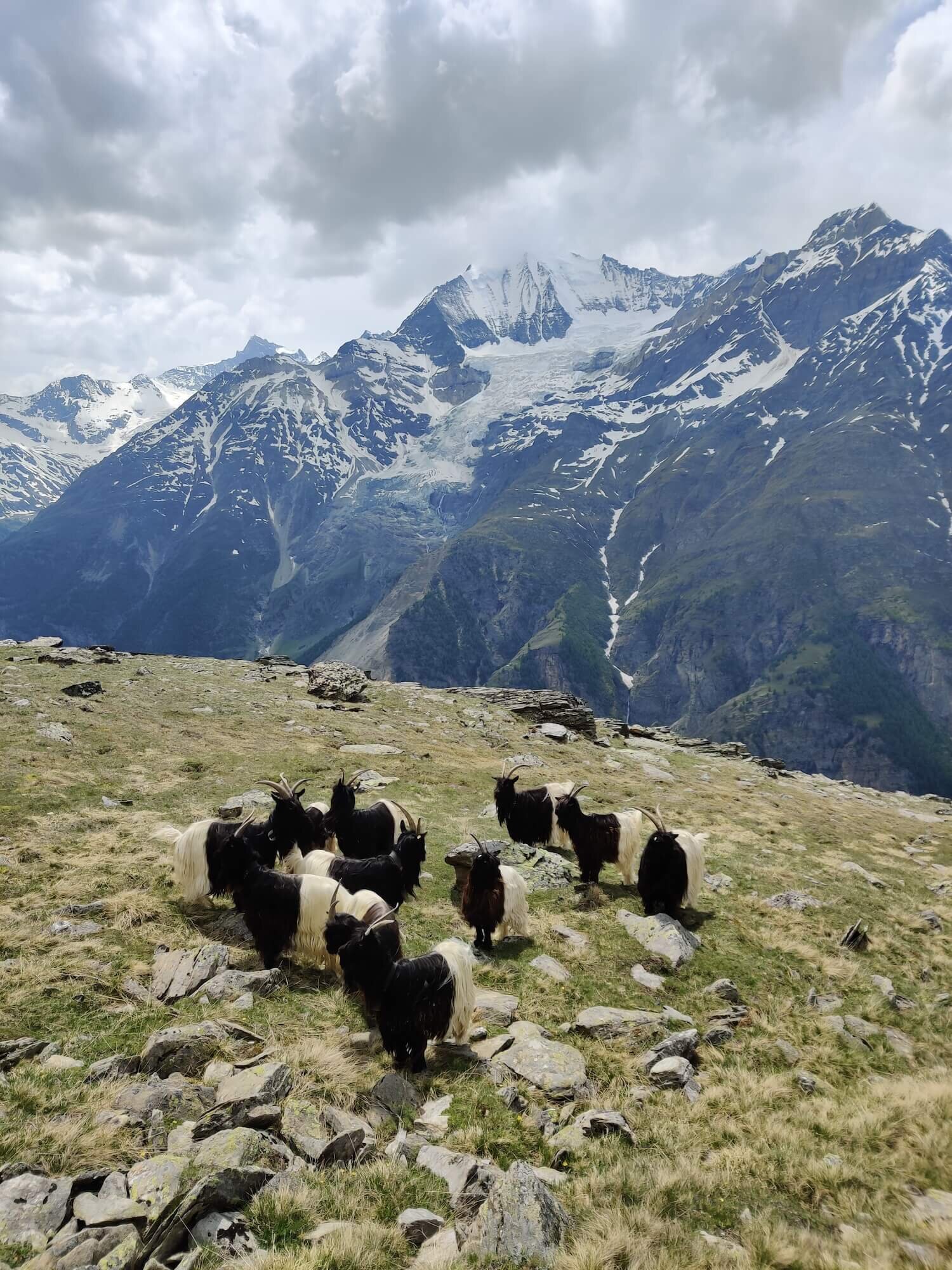
Glacier de Moiry and Col de Sorebois Trail
FROM Les Hauderes to Zinal
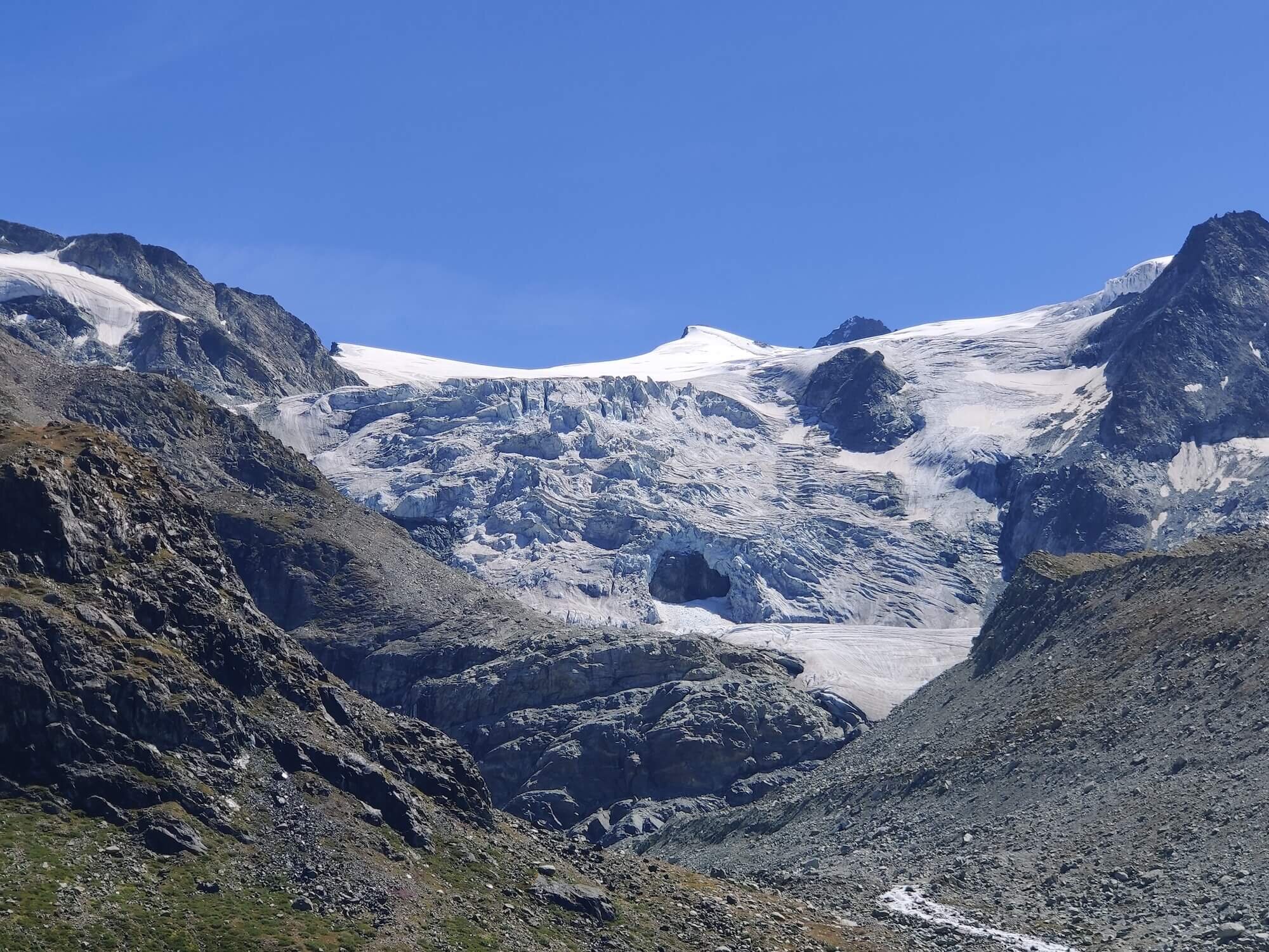
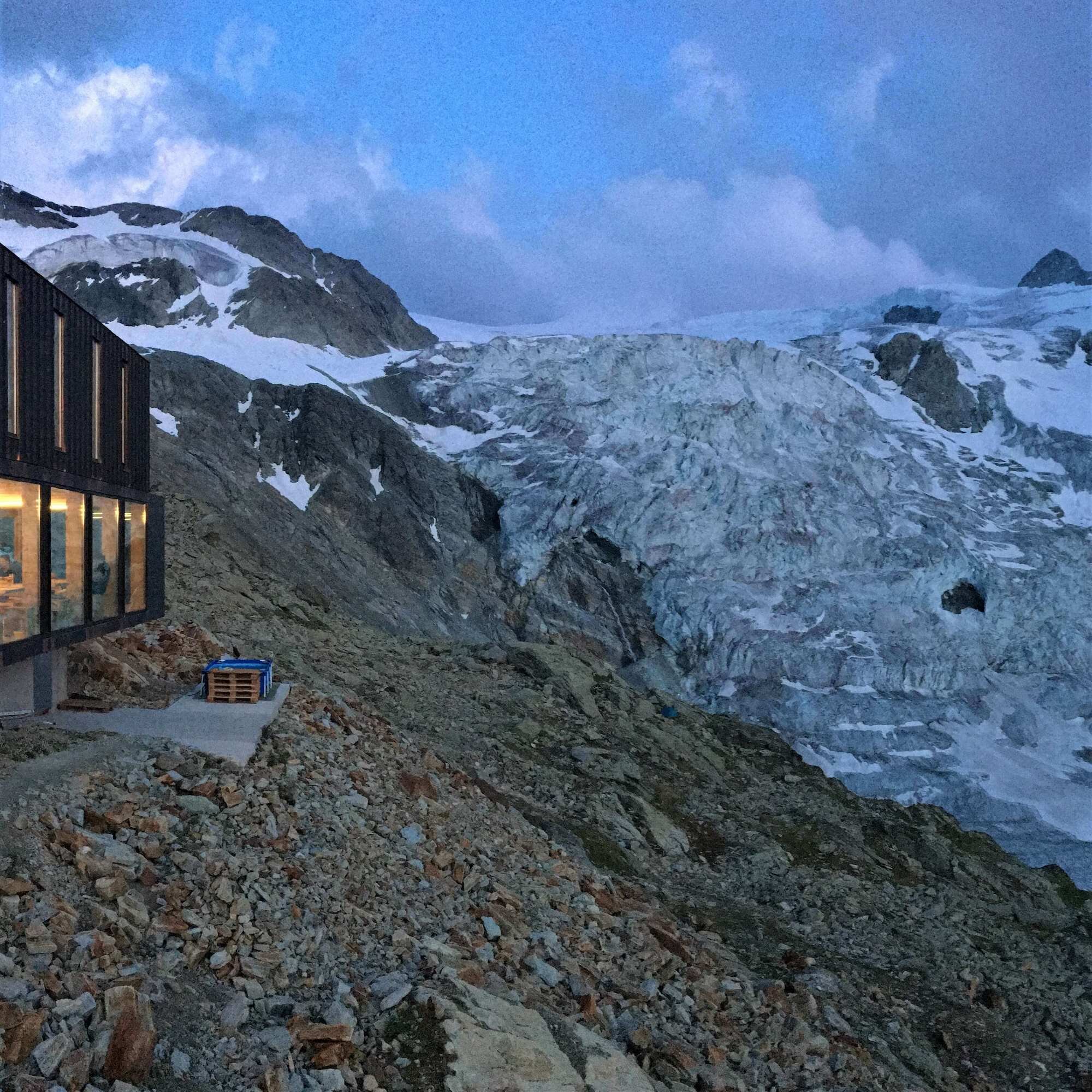
Trail Description: The main trail leaves the alternative route at La Sage which has many cute traditional houses decorated with potted flowers. It immediately starts to climb through alpine farmland to Col de Tsate. The blue Lac de Moiry and Moiry glacier will soon be seen and dominate your view on the descent. From the carpark at the end of Lac de Moiry, a rocky trail with some rope assists will lead you up to Cabane de Moiry. Although a short section, it is steep and can be icy if there is snow (caution needed!). Cabane de Moiry is situated directly beside the amazing Moiry glacier. It is truly a special experience to sit in the comfort of the dining room and watch dusk fall on the glacier as you catch up with fellow hikers over dinner, then see the first light breaking on it as you re-fuel at breakfast. This is a very popular hut for overnight visitors of the glacier and mountaineers who are summiting nearby peaks so it is important to reserve a bed ahead of time, especially on weekends, if you intend of staying overnight. The trail backtracks down to Parking du Glacier and follows alongside Lac de Moiry, which is fed from the glacial run-off.
When you reach Barrage de Moiry, the path climbs up the exposed trail to Col de Sorebois before travelling down through the Zinal ski area to the Sorebois lift that runs in the summertime. Those with the energy can continue the steep descent to the town of Zinal, which like many in the Swiss mountains close over lunch so the shopkeepers can have a break too!
Difficulty: Hiking and Mountain Trail.
Is there an alternate route? Yes, the Col de Torrent and Grimentz trail diverts at La Sage and rejoins at Zinal.
Transport Shortcuts:
Bus between Parking du Glacier and Barrage de Moiry/Zinal.
Cable Car between Sorebois and Zinal.
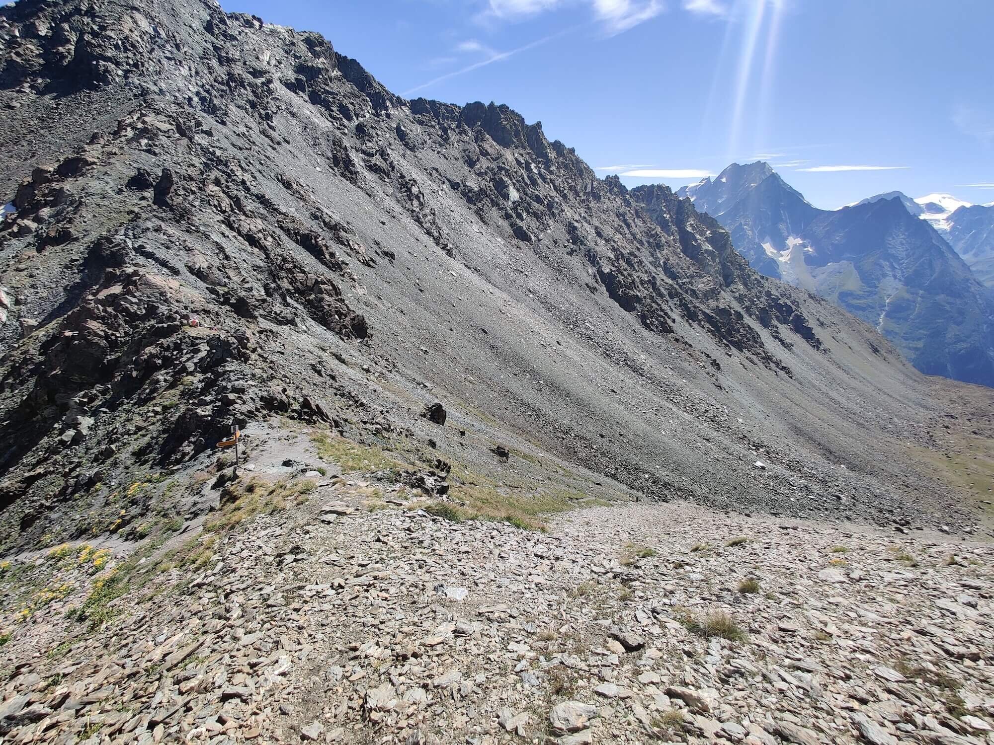
Col de Forcletta Trail
From Zinal to Gruben
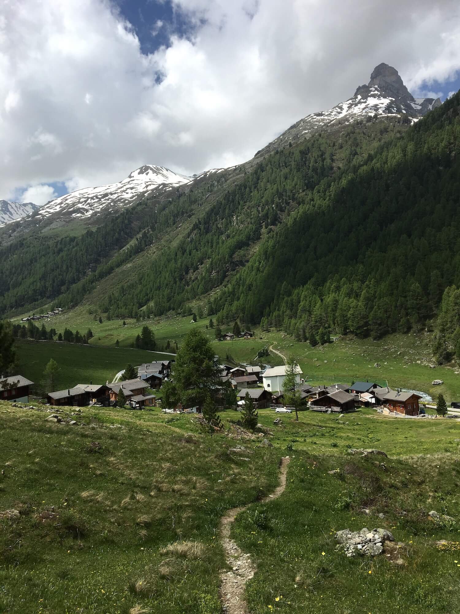
Trail Description: Leaving Zinal, the trail climbs straight out of town on the opposite side of the valley from where you came from branches right/east at Alpe Nava to ascend more steeply to the mountain pass of Forcletta. This pass marks the linguistic border where you will need to swap your French greetings for German phases. The trail runs beside a tranquil stream for part of the descent towards the alpine hamlet and working dairy farm of Chalte Berg, before contining through more farmland on the way to Gruben - a summer only village situated in the valley below.
Difficulty: Mostly Mountain Trail with short Hiking Trail section.
Is there an alternate route? Yes.
Hotel Weisshorn and Meidpass Trail diverts at Alpe Nava and rejoins at Gruben.
Turtmannhutte Trail that diverts at Chalte Berg and rejoins at Grueobu Oberstafel.
Transport Shortcuts: No.
Augstbordpass Trail
From Gruben to ST NIKLAUS
Trail Description: From Gruben, take the trail leading up the east side of the valley up to Augstbordpass which is the last of the 11 mountain passes on Walker’s Haute Route hike from Chamonix to Zermatt! Start the descent - which involves some boulder hopping - before the trail meets the Mattertal valley to give hikers one of the most picturesque landscape views of the trip. After taking a break here to soak it all in, descend through Jungen past the stations of the cross monuments that line the trail to St Niklaus.
Difficulty: Mountain Trail.
Is there an alternate route? No.
Transport Shortcut: Cable Car between Jungen and St Niklaus.
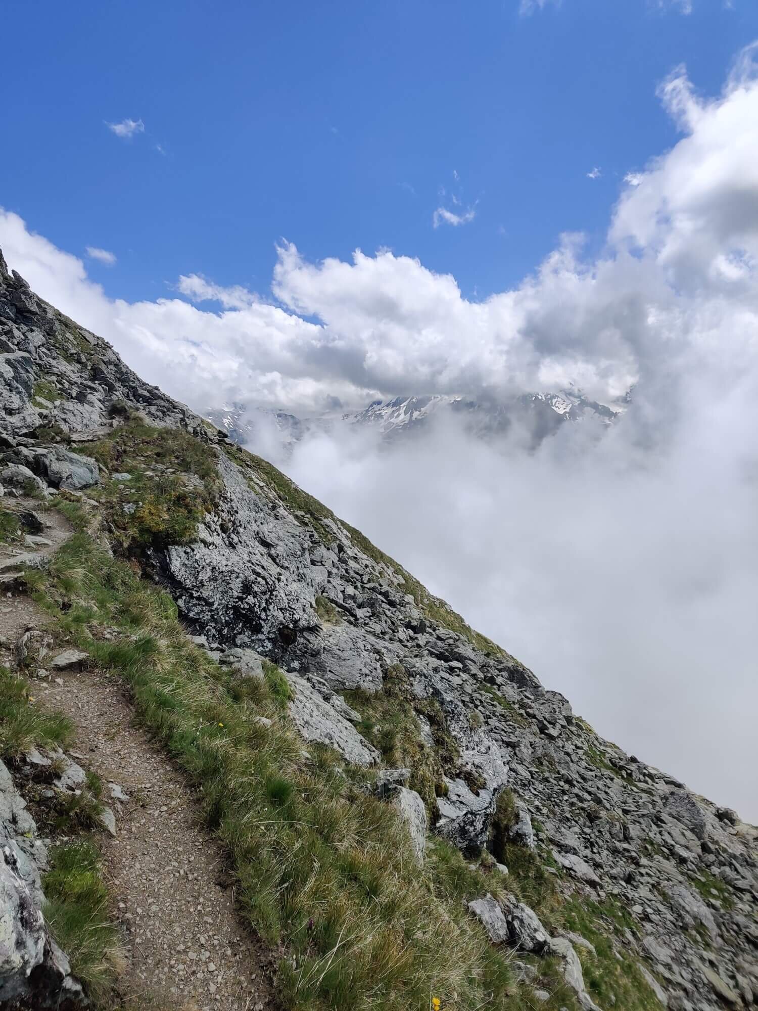
Europaweg Trail
FROM ST NIKLAUS and ZERMATT
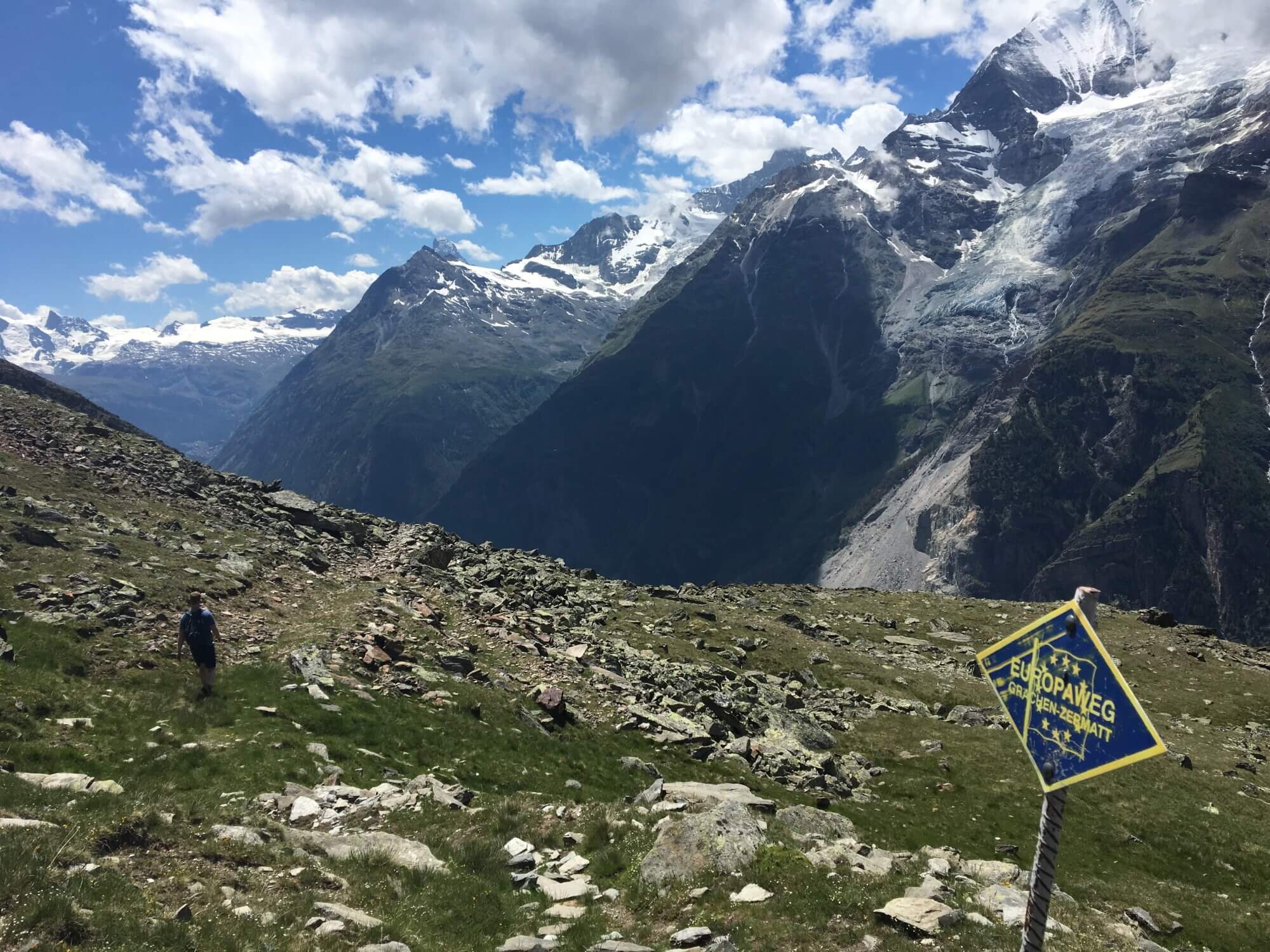
Trail Description: The lower valley section officially starts at Grachen and follows stays within the forest all the way to Herbriggen. This is a revised route that has only been in place for a few years since the permanent closure of the original trail Grat due to ongoing rockfalls. If you have stayed at St Niklaus, most people will hike up the Mattertal valley and join the Europaweg trail at Herbriggen.
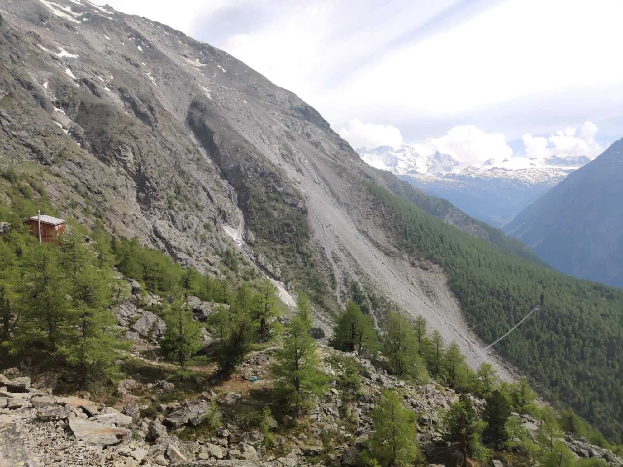
A new Europaweg section was opened at the beginning of 2021 to lead hikers up from Herbriggen to the Europaweg balcony trail. Previously, the trail went straight up to meet the Europaweg trail at Galenburg but it now joins closer to Europahutte.
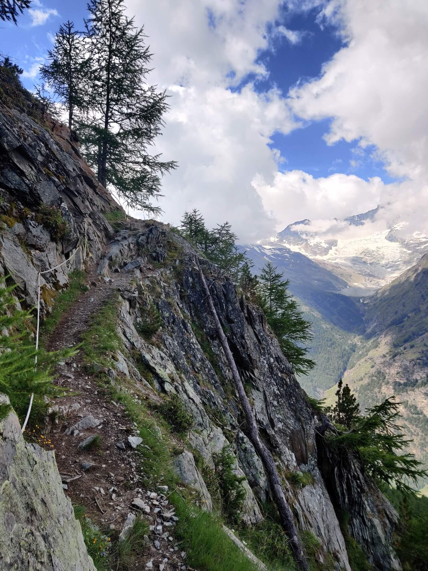
Shortly after Europahutte, you’ll arrive at the popular Charles Kuonen Suspension Bridge which is almost 500m /1,600ft long. Hikers have an option to descend to Randa and follow the river along the upper Mattertal valley section to Zermatt on an easier trail. Those continuing on the Europaweg trail will follow the original route which offers some breathtaking balcony views. This trail provides the best views of the Matterhorn and other mountains, such as the Weisshorn, that line the opposite side of the valley.
It is a standalone highlight and popular with weekend hikers as it can be completed in two days.
Difficulty: Mountain and Hiking Trail. The balcony trail is a well-maintained trail but there are still narrow sections and cables at times, boulder crossings, exposure, and an increased risk of rockfall impact.
Is there an alternate route? Yes, the Mattertal Valley Trail diverts at Herbrigeen and rejoins at Zermatt.
Transport Shortcuts:
Train between St Niklaus and Herbriggen
Train between St Niklaus and Zermatt
Funicular between Findeln Junction and Zermatt
Considerations:
The bridges that allow passage along the Europaweg trail are installed at the end of June (typically last weekend) so this section is impassable until this time.
The Europaweg trail has been rerouted over time due to rockslides. Although the official start of the Europaweg is in Grachen, the section to Herbriggen does not offer spectacular views or highlights, and adds unncessary distance and elevation. Therefore, the route we recommend starts from St Niklaus.
If you made it this far, I hope you are inspired to plan your own Walker’s Haute Route adventure! You won’t be disappointed.
- Brendan
Your Virtual Hiking Guide
READY TO START PLANNING YOUR OWN WALKER’S HAUTE ROUTE ADVENTURE?

Everything you need to plan, book, prepare and navigate your adventure. This package includes;

Access a trail expert to prepare an itinerary that meets your needs. This package includes;
Personalised itinerary designed by our trail expert