
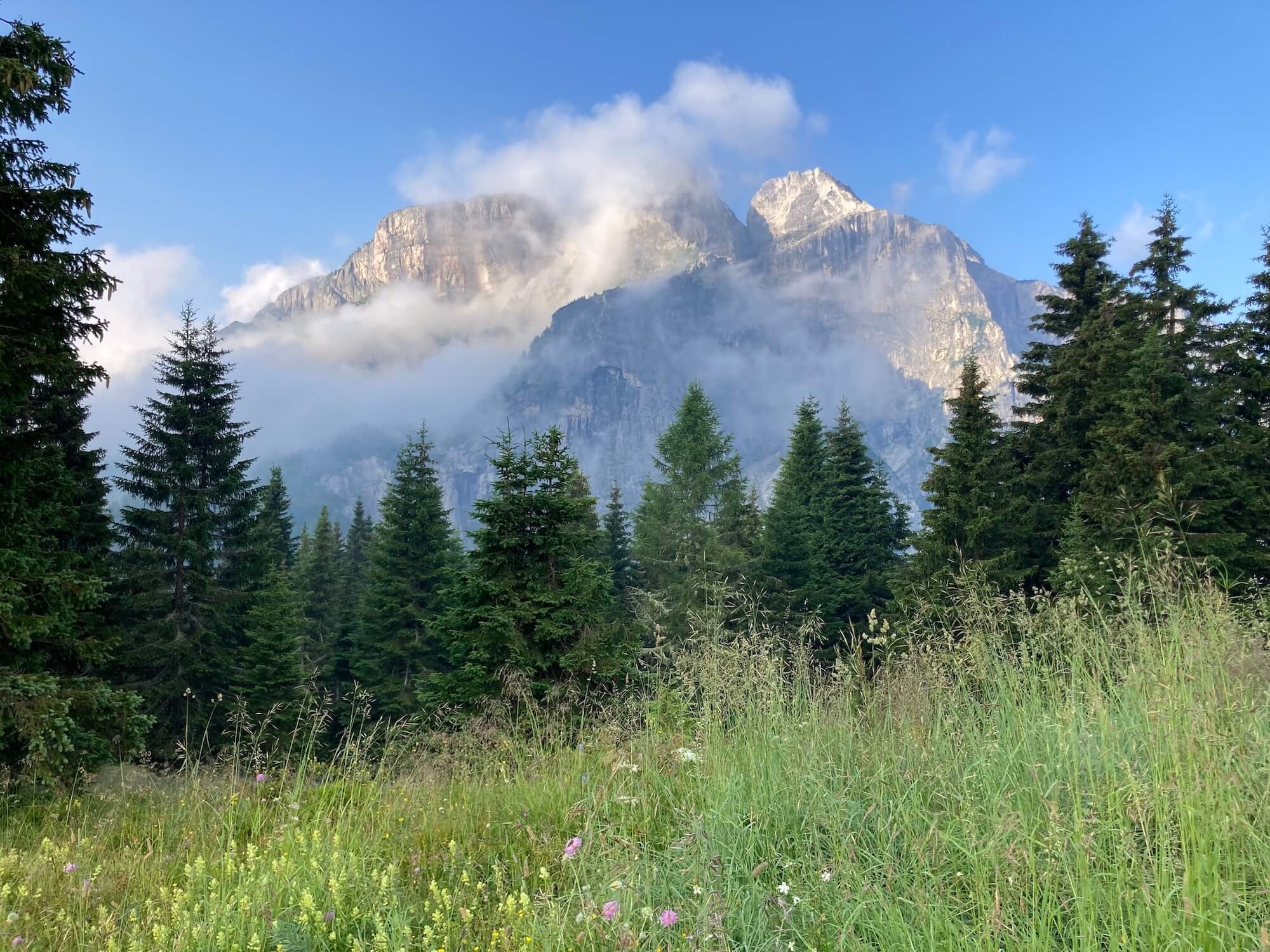
Alta Via 1 Dolomites is one of the most popular “alta via” (or high routes) in Italy, of which there are currently eight. Known as the “fairyland of the Alps” this trail leads you past spectacular alpine lakes, dramatic rock formations and lush green meadows. Although it is extremely popular, be aware that the trail travels through relatively remote areas, with some highly exposed ridges. It is not for the faint hearted!
For those that haven’t hiked in the Alps before, it is important to understand that the Alps offer a network of trails. There are countless trail junctions that offer different - or alternate - routes while hiking through the Dolomites.
As with all multi-day legendary trails in the Alps, there is a “main / classic” route and then many variants, shortcuts, and detours for hikers to choose from. The main route is:
Distance: ~120km / 75mi
Elevation gain: 6,665m / 21,833ft (South direction)
Highest point: 2,752m / 9,029ft
Many AV1 hikers choose to take one or more alternate routes along their journey to include a specific highlight (such as the Lagazuoi WWI tunnels), stay at a prominent accommodation option (such as Lago Federa) or take a more direct route (such as Passo Falzarego).
Find below a list of the popular main and variant routes for the Alta Via 1 (Dolomites), all of which are included within our new planning app for hikers to include in their self-guided hiking itinerary.
MAIN TRAIL ROUTES
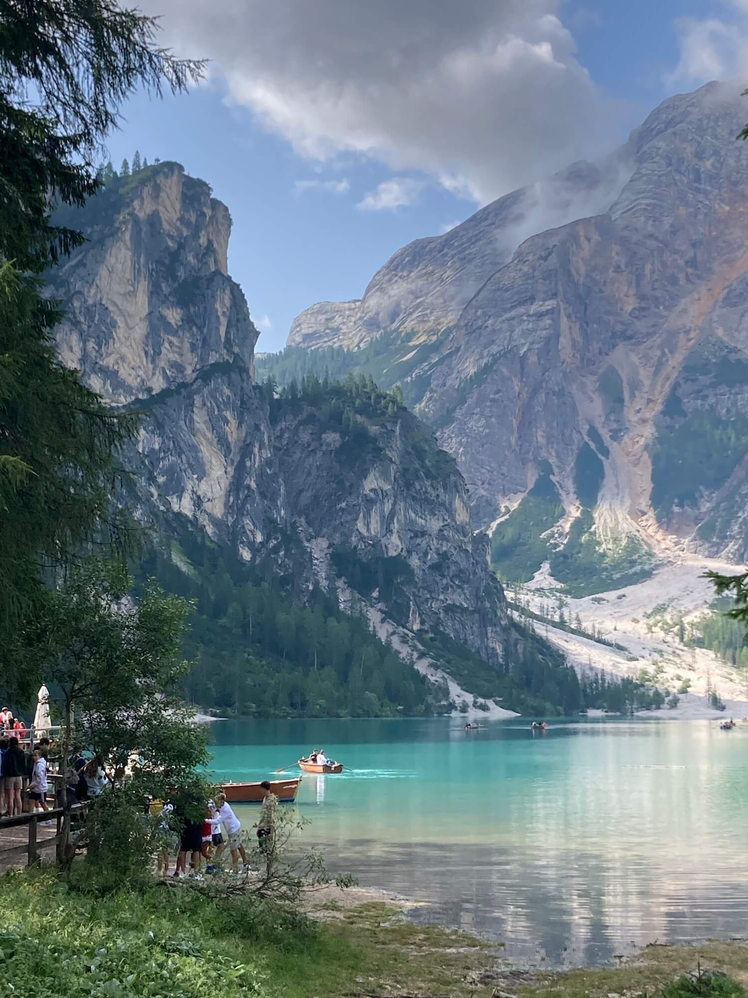
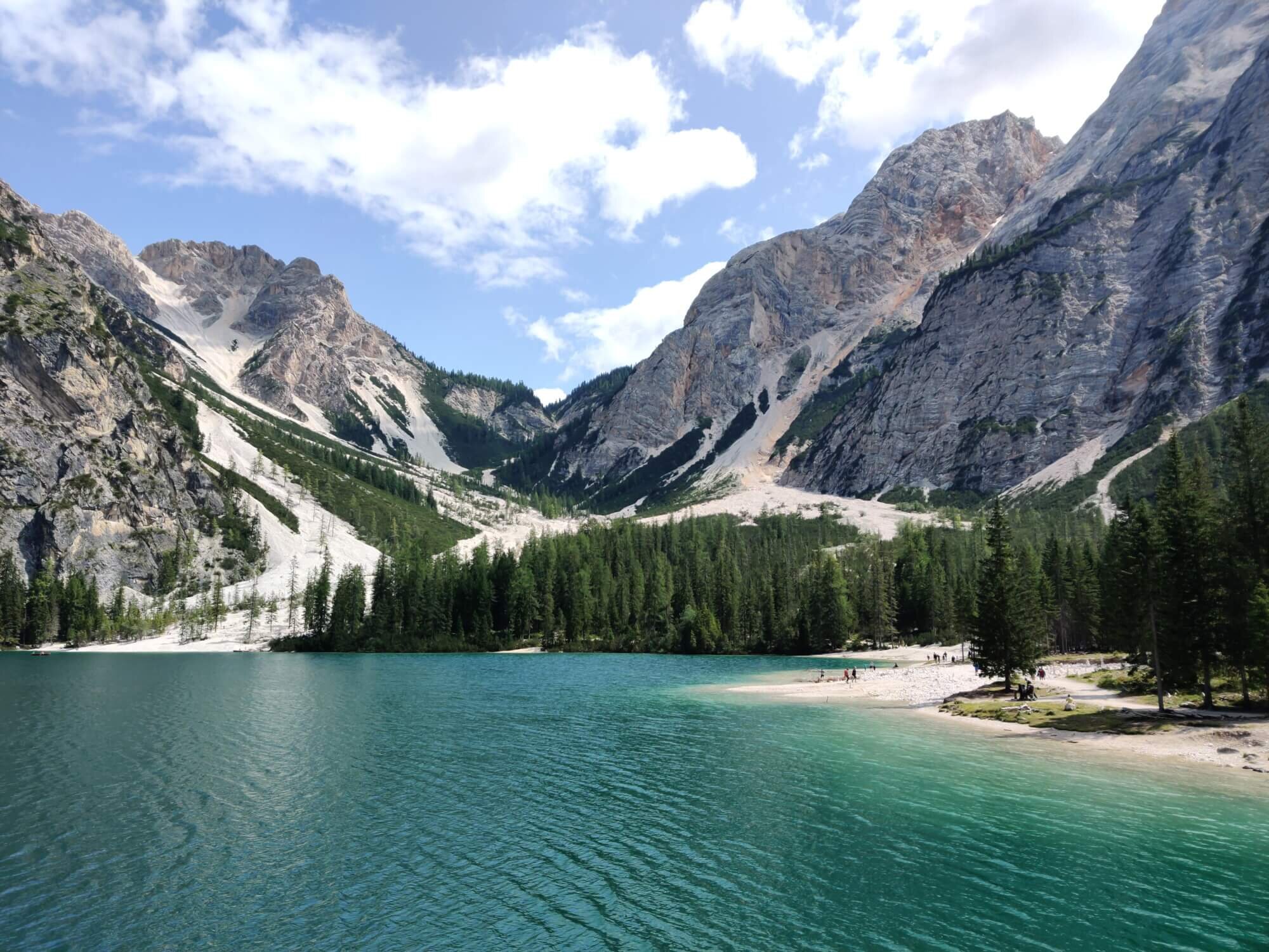
This trail passes by the famous Lago di Braies. Make sure to allow time to relax and enjoy the views.
Difficulty: Hiking Trail.

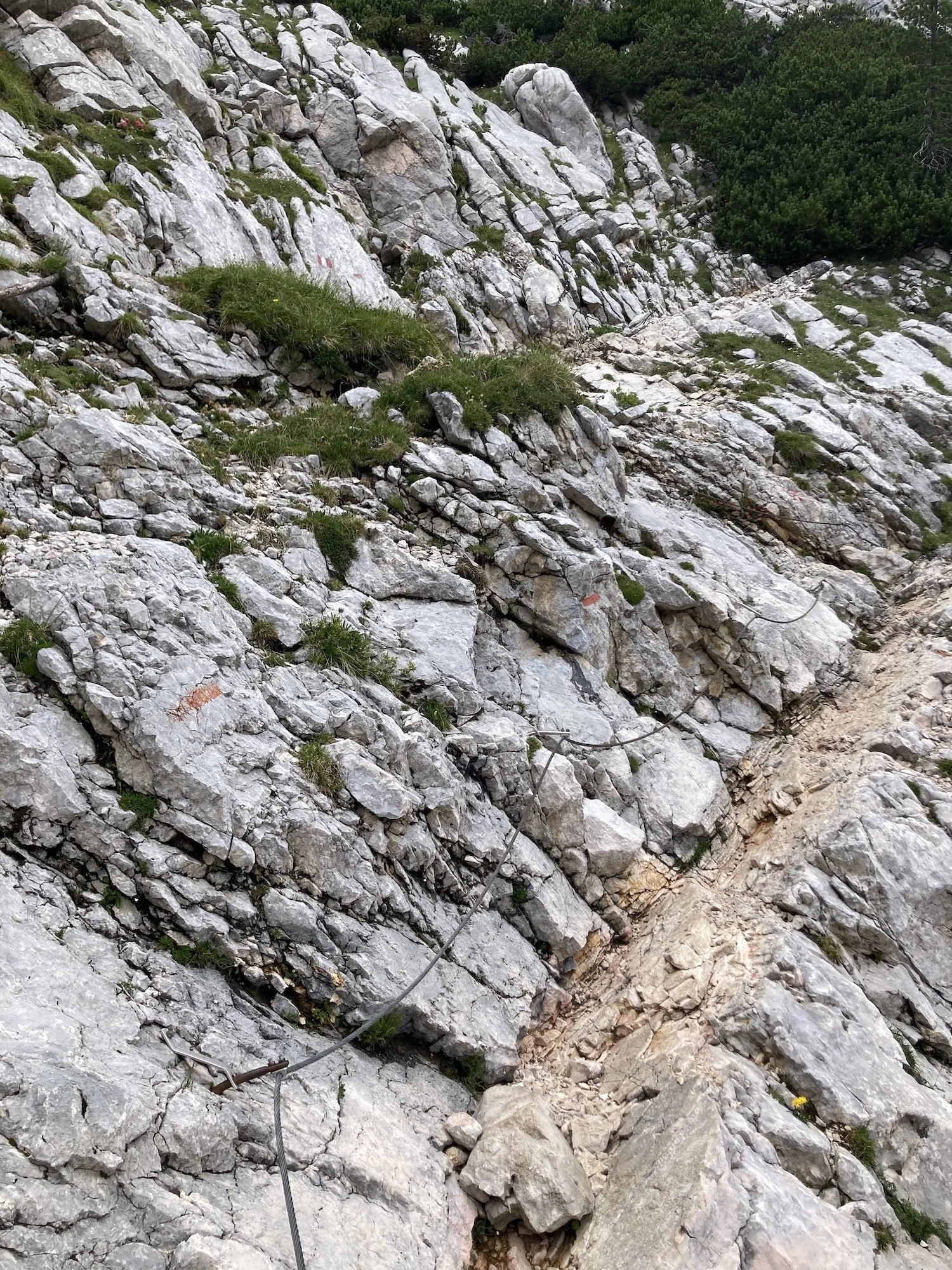
This section is rocky and steep, but provides glimpses of the lake below. There are some wooden steps and chains to assist in the more difficult sections. It is mostly exposed, with only some sections within the trees.
Difficulty: Mountain Trail.


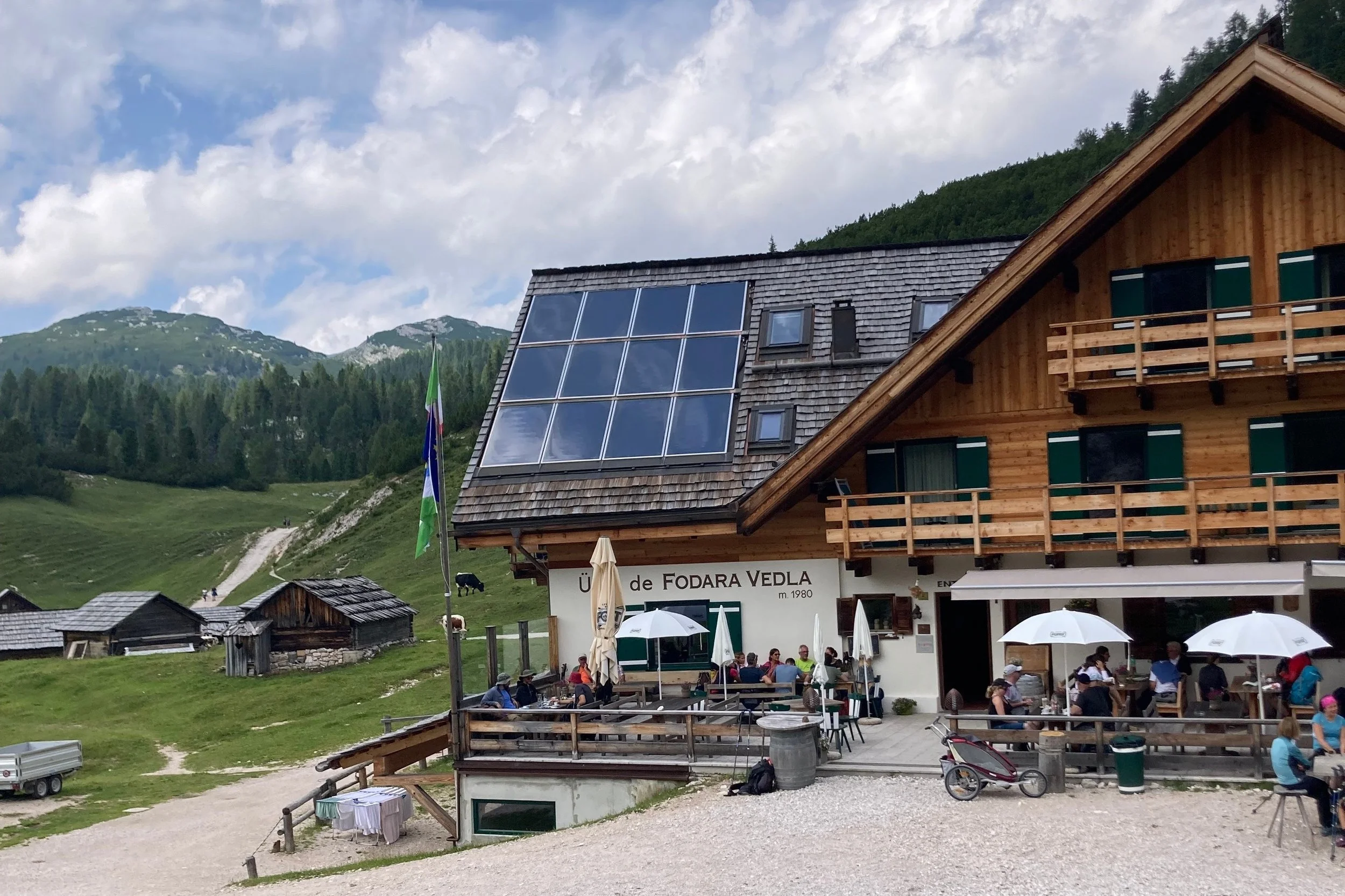
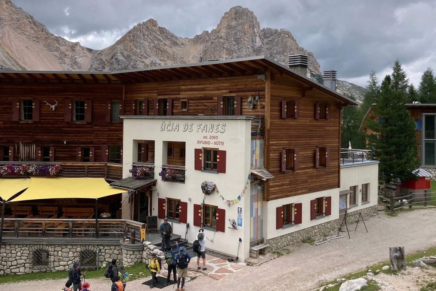
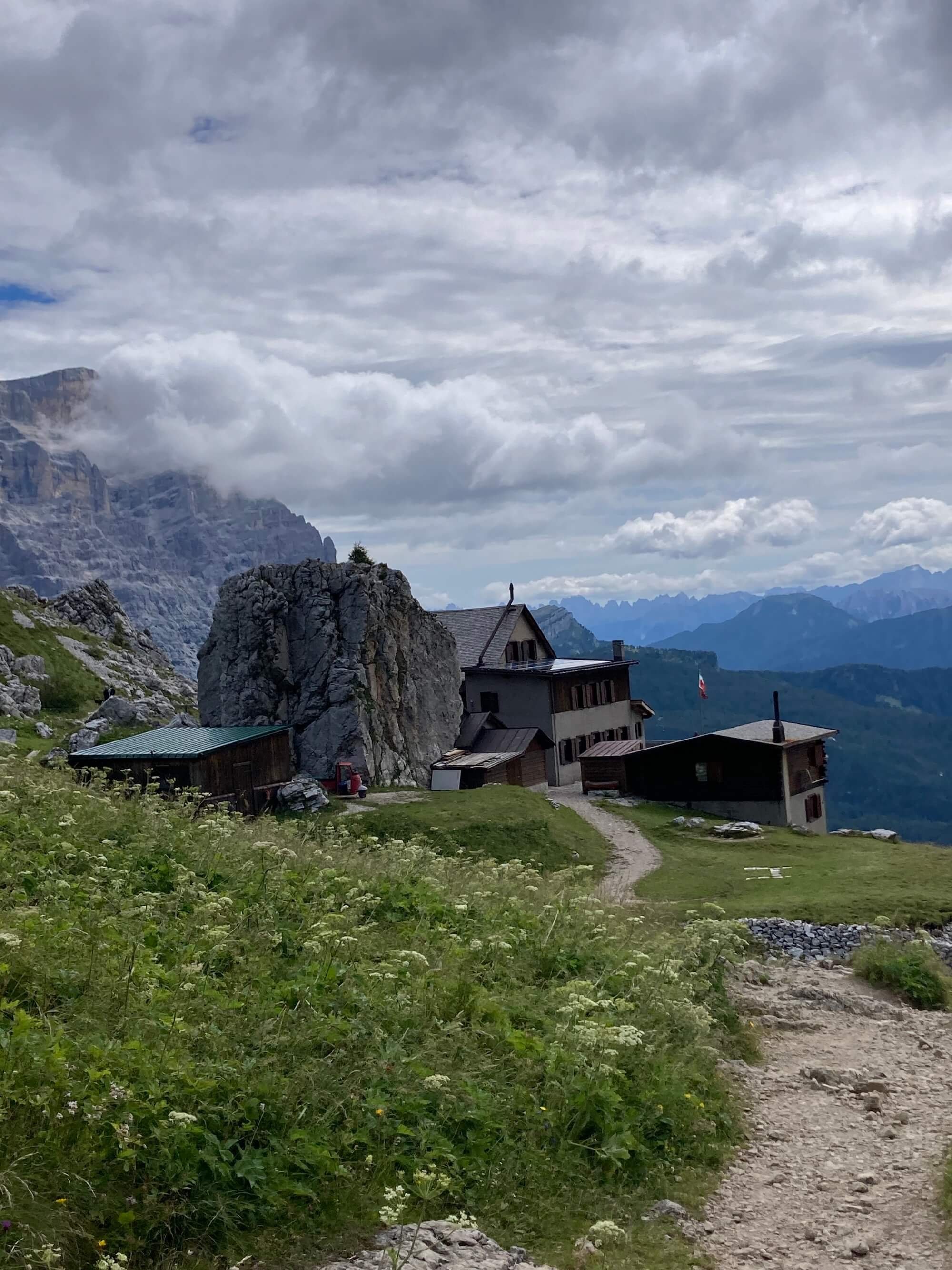
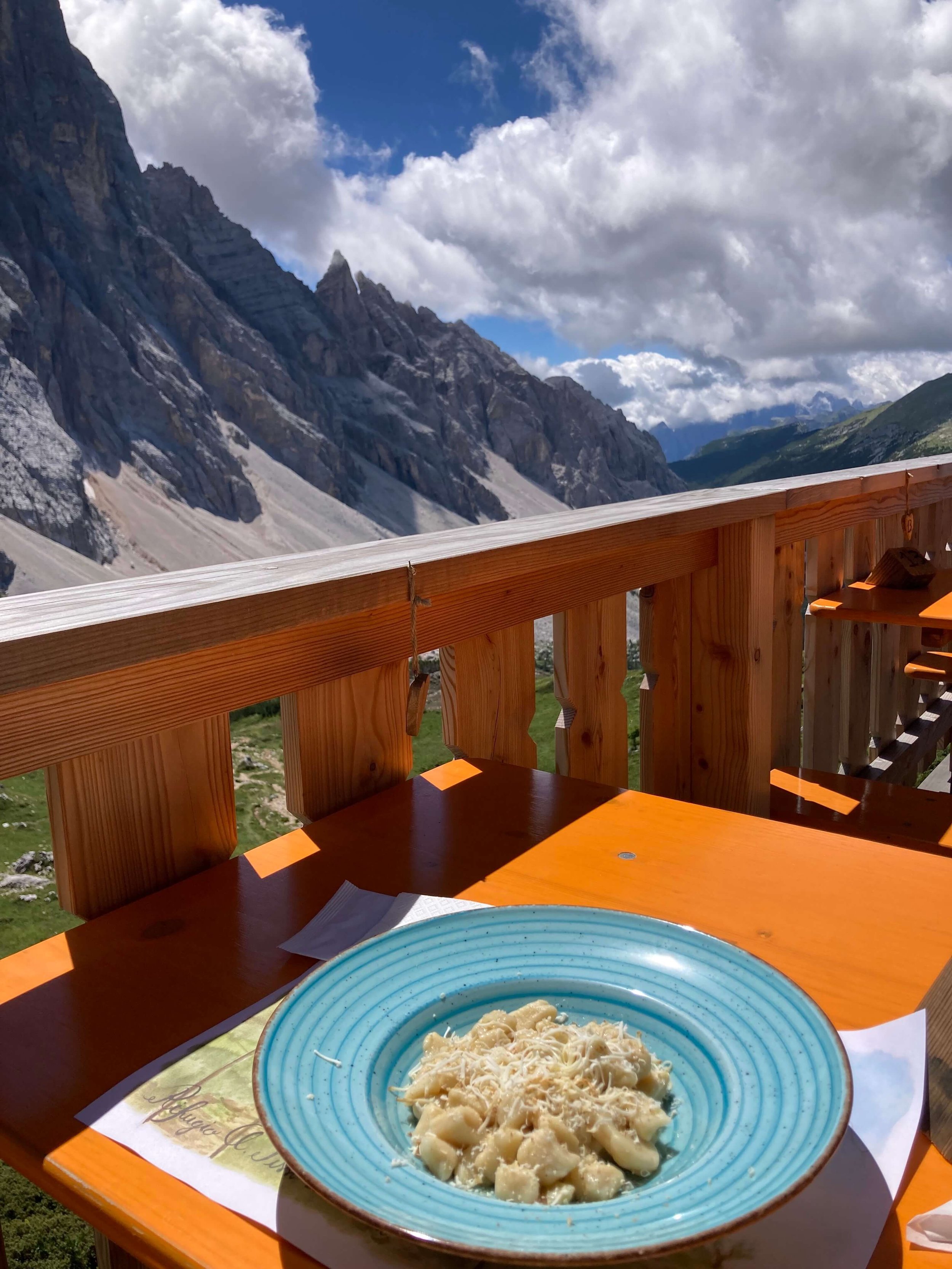
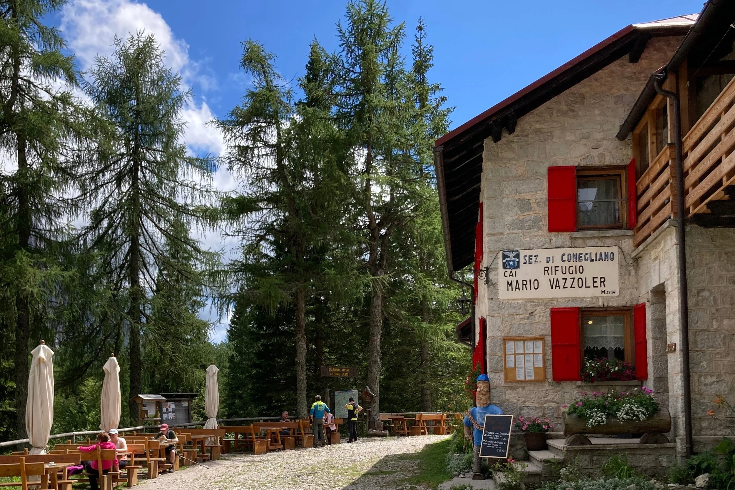
This trail sits high in the rocky, alpine plateau providing views of the surrounding peaks. It has steep switchbacks within the forrest on the North side of Pederu. Many rifugios to stop for coffee, cake, lunch, or to stay overnight. Cows also roam the surrounding farmland.
Difficulty: Mountain Trail.


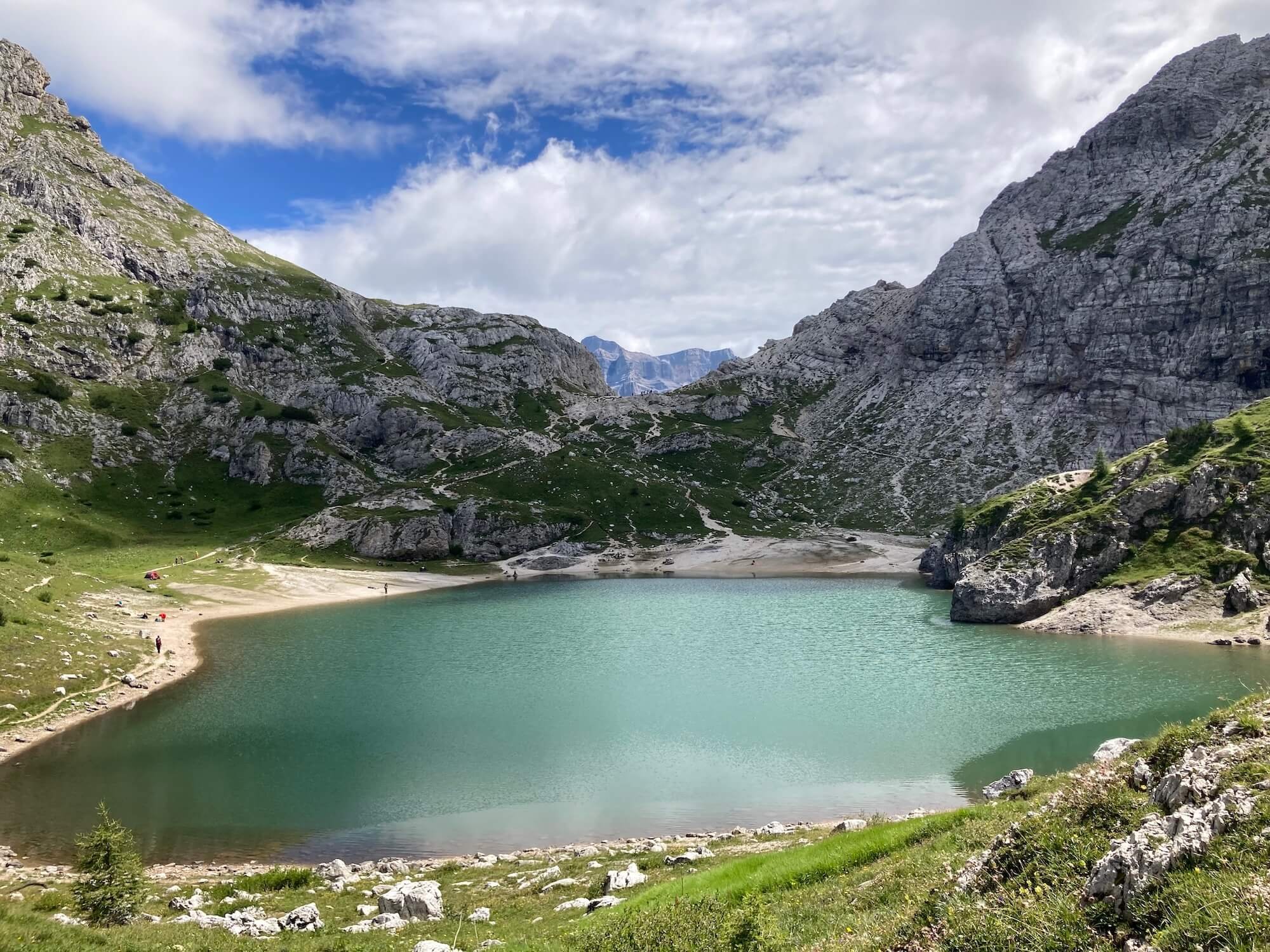
This undulating trail passes by a small alpine lake and provides views of the surrounding peaks.
Difficulty: Mountain Trail.


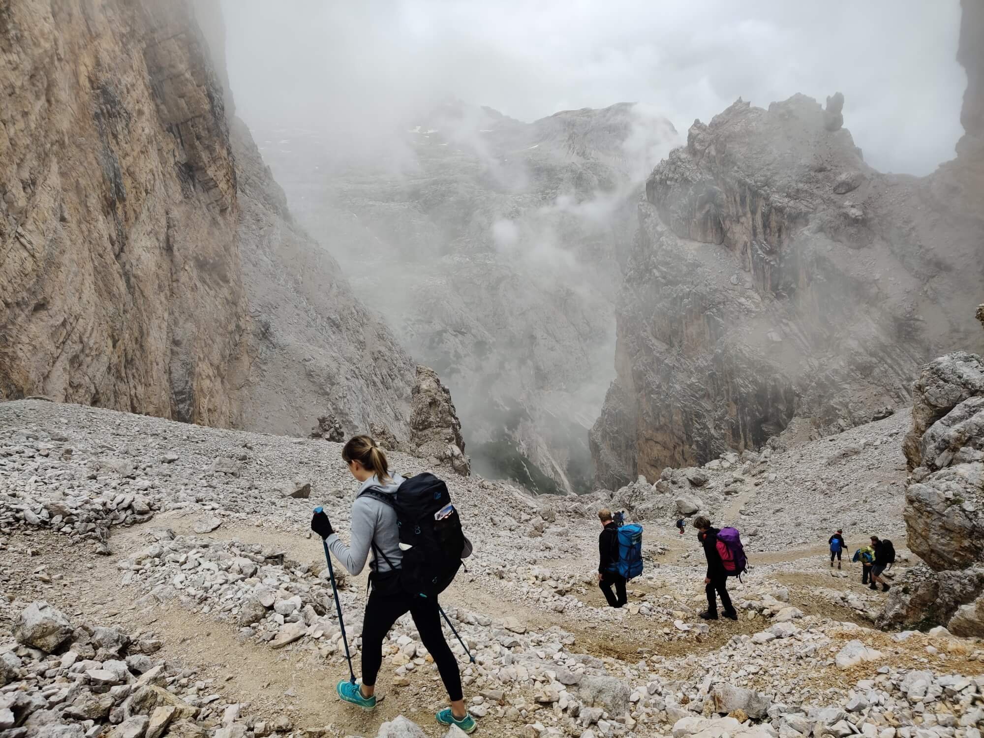
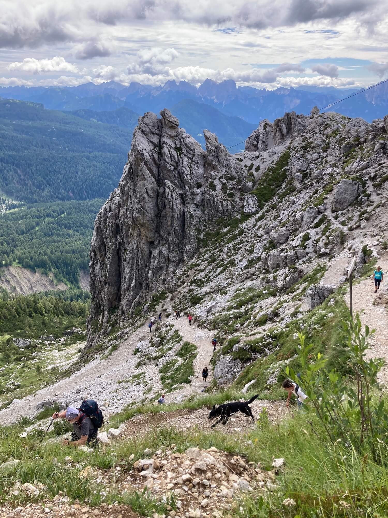
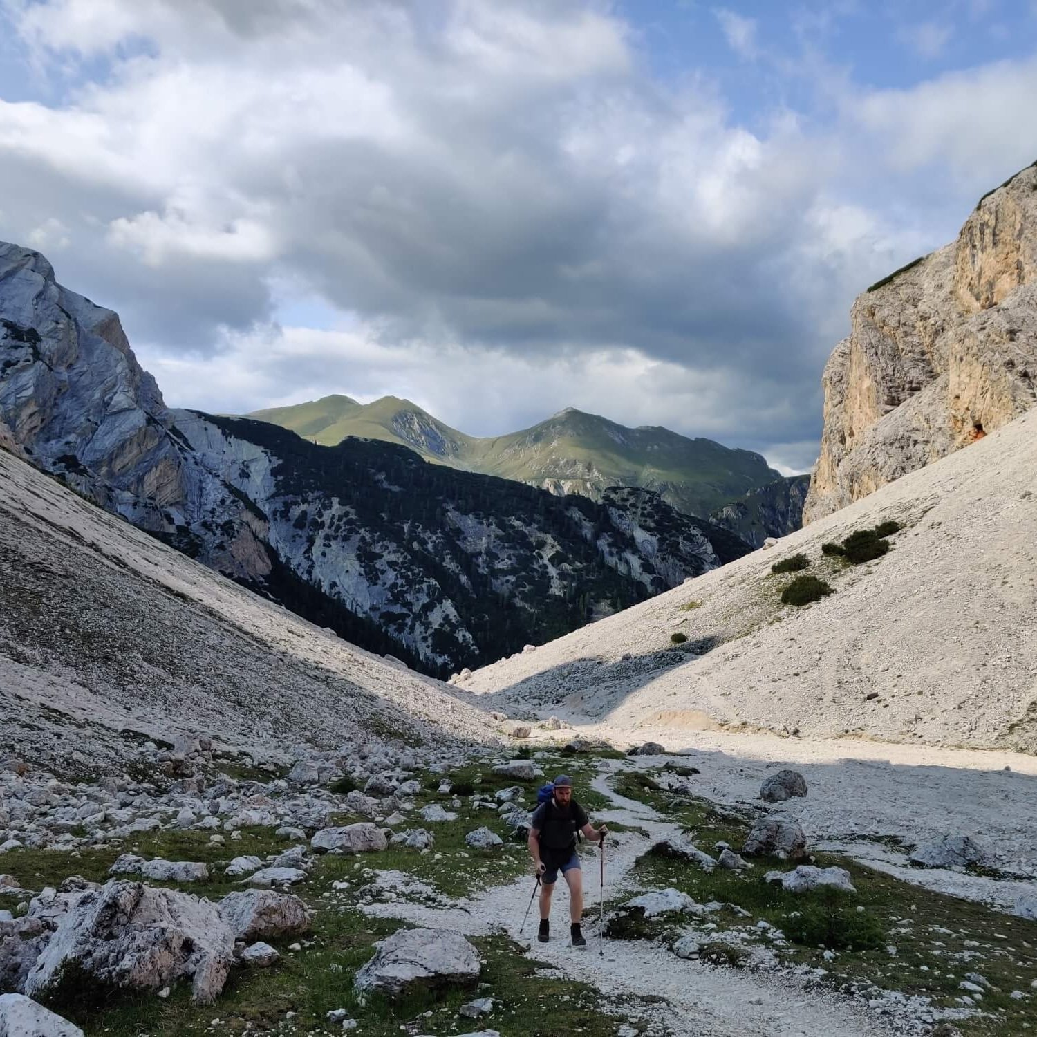
One of the more difficult, challenging, yet spectacular sections of trail in the region. The pass is rocky, steep and exposed. The south side of the pass has many steep wooden steps to help navigate this difficult section.
Difficulty: Mountain Trail.


This section walks below the towering peaks of Lagazuoi. Although not technically difficult, this section can be confusing to wayfind. There are many paths and it is often difficult to determine the "right" trail. Keep your GPS map handy.
Difficulty: Mountain Trail.

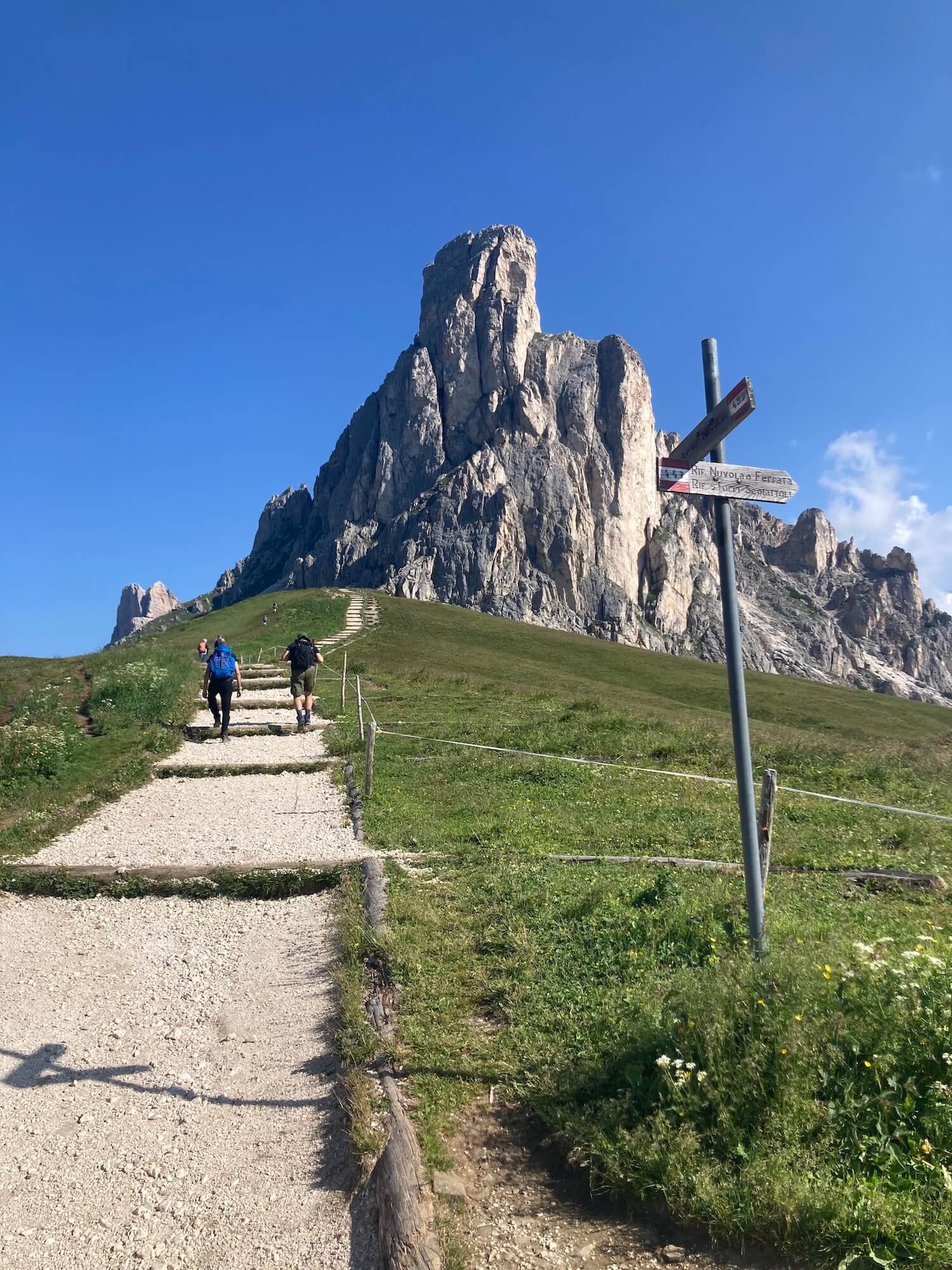
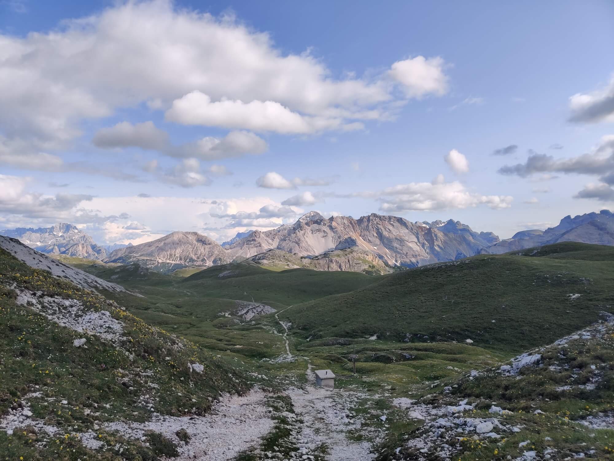
This balcony trail stays high along the ridge and provides spectacular views across to Cinque Torri and southern peaks.
Difficulty: Mountain Trail.


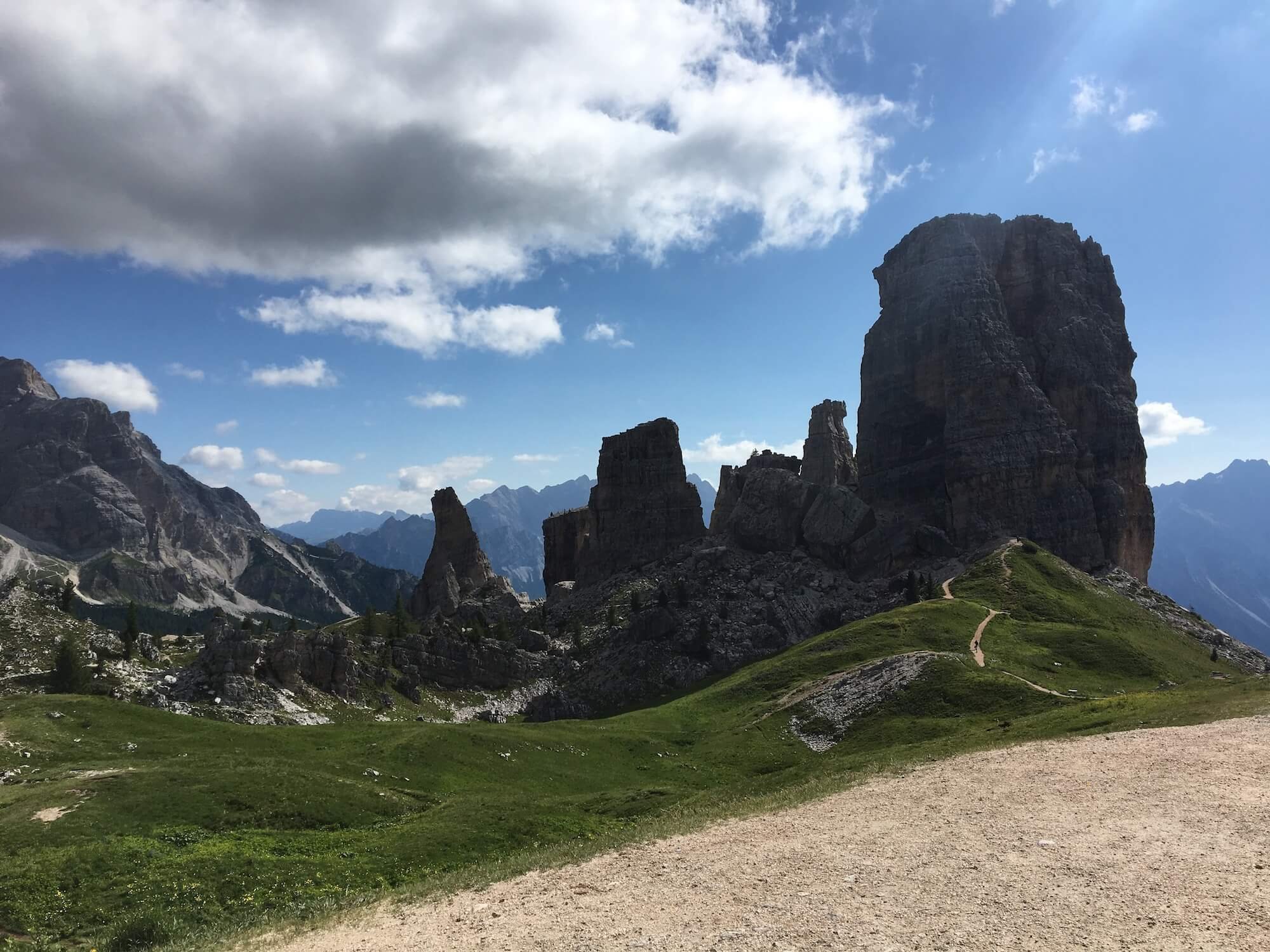
This route takes you up close and personal with Cinque Torri - the five rock pinnacles that attract rock climbers from around the world.
Difficulty: Mountain Trail.


This short trail is the main route between the Cinque Torri chairlift and Rifugio Averau. It is a wide trail that is well-troden with day hikers.
Difficulty: Mountain Trail.


This trail avoids Nuvolau and Via Ferrata Ra Gusela, and is an easy well-maintained trail.
Difficulty: Hiking and Mountain Trail.

This trail travels between Monte Cernera and the Lastoni di Formin massif.
Difficulty: Mountain Trail.


This trail passes the Southern end of the Croda da Lago mountain range and provides views of Monte Pelmo and Monte Civetta.
Difficulty: Mountain Trail.


This trail passes the Western side of Monte Pelmo, along the road nearby Passo Staulanza and then enters the Civetta ski area.
Difficulty: Hiking and Mountain Trails.


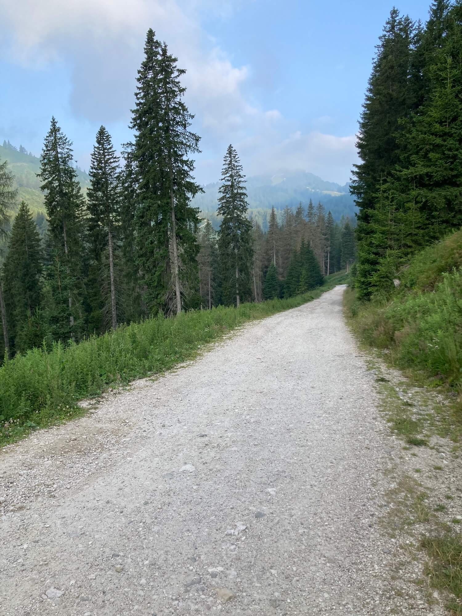
The trail is a combination of road and dirt track. It passes through the Civetta ski area offering wide, easy paths.
Difficulty: Hiking and Mountain Trails.
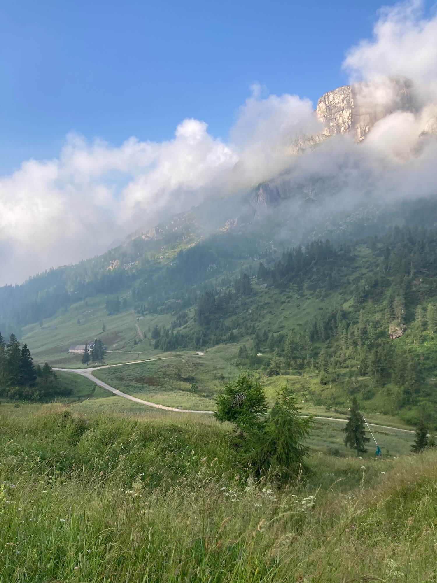
This trail walks below the towering walls of Monte Civetta (3,220m / 10,564ft), past the spectacular Lago Coldai and spectacular views from Rifugio Tissi.
Difficulty: Mountain Trail.


This section is relatively quiet as it is "off-the-beaten-track". Passing through pine forrests and farmland, the trail hugs the dolomite peaks above.
Difficulty: Hiking and Mountain Trail.


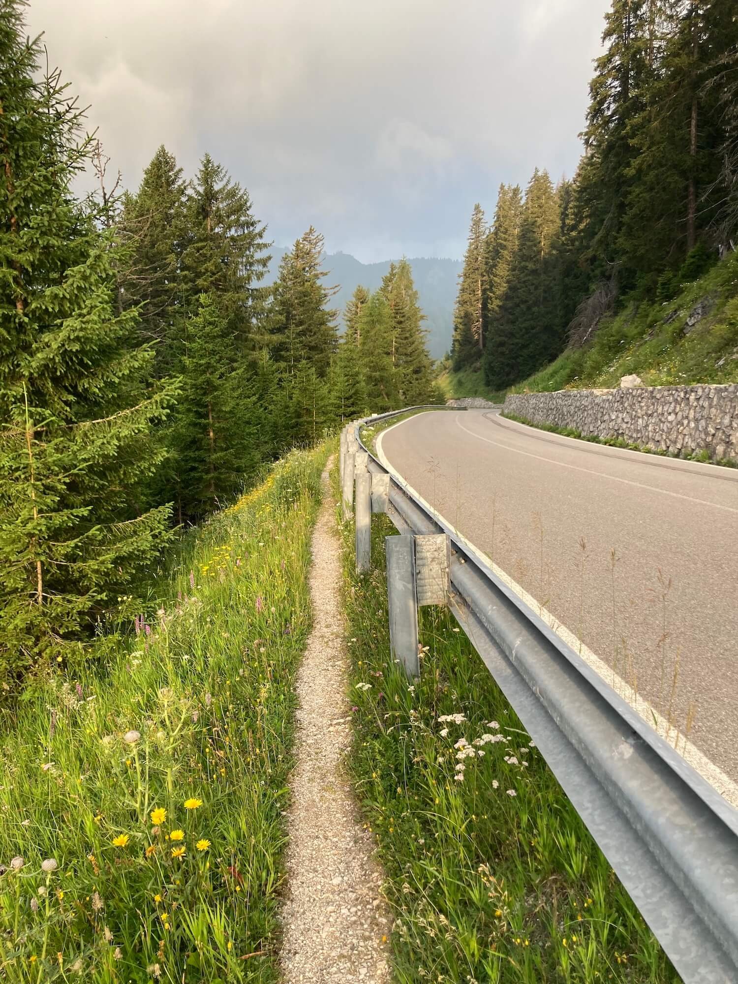
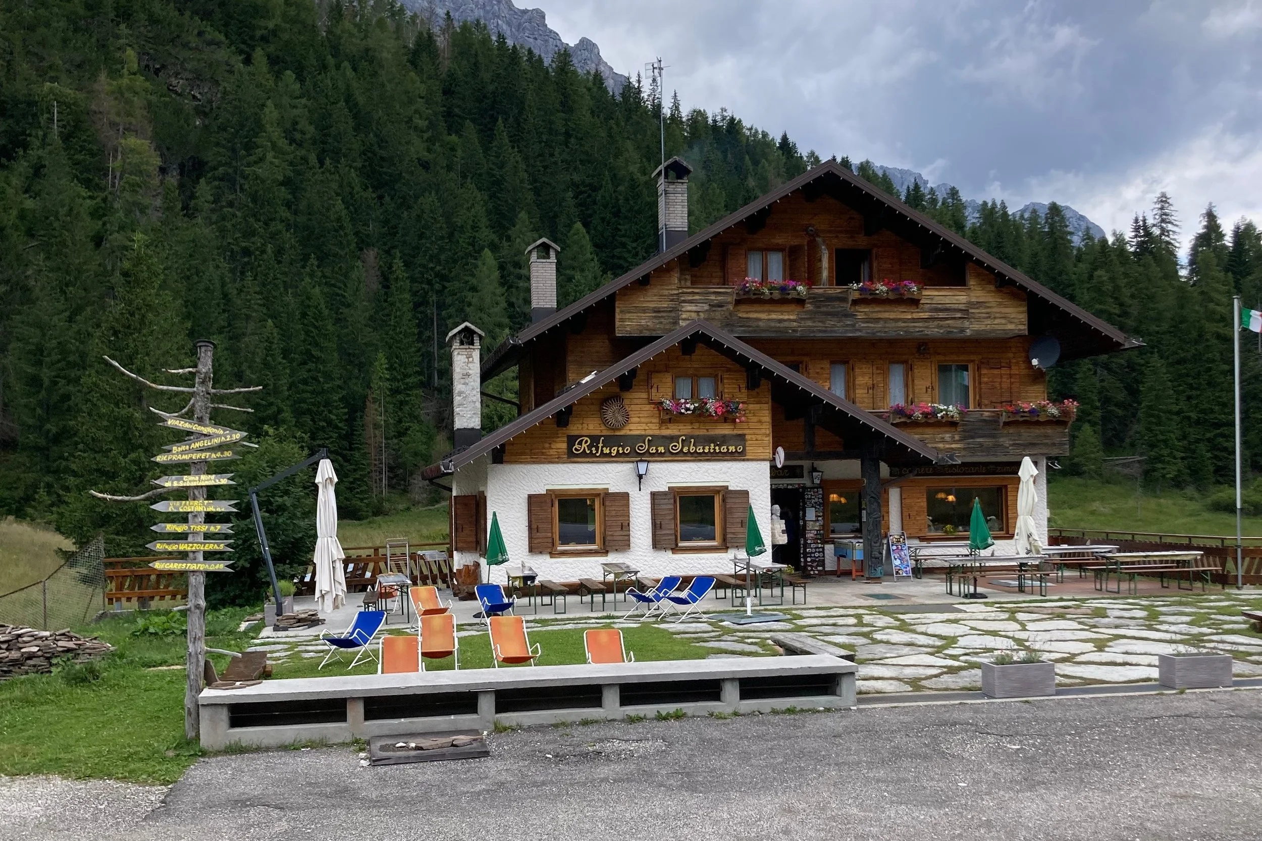
This trail is a combination of road and mountain trail, and is quite remote. No rifugios or towns along this section so make sure you have enough food and water.
Difficulty: Hiking and Mountain Trails.


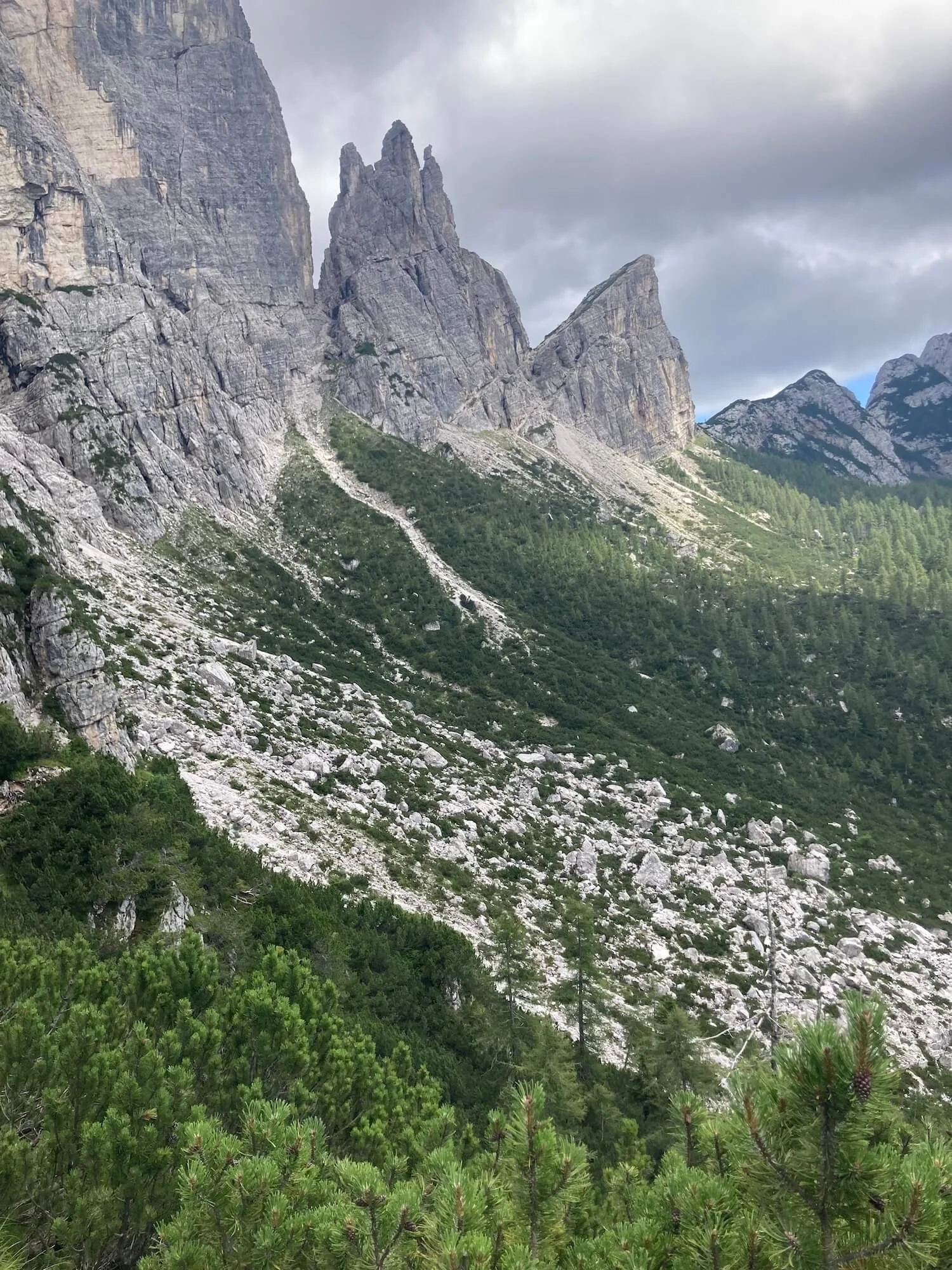
This trail is considered one of the more difficult due to steep climbs/descents and a short, narrow exposed ridgeline. The spectacular views are a good distraction!
Difficulty: Mountain Trail.


This trail is very different to the rest, whereby the majority is within the forrest within minimal views. It is a significant elevation change so be prepared for sore knees.
Difficulty: Mountain Trail.


ALTERNATIVE ROUTES
A more direct route for those that wish to skip Rifugio Biella. It is rocky and steep, feeling relentless at times. It is less frequented than the main trail, making it more quiet and peaceful. Unfortunately you miss the views of Lago di Braies that the main trail offers.
Difficulty: Mountain Trail.
The route is suitable for those choosing to stay off the main trail (options includes rifugios, campgrounds and hotels) for a night or rest day. It is also a great alternative for those that would like to avoid Forcella di Lago due to its exposed, steep and rocky trail, or in case of bad weather. The trail drops down to the valley below and passes by a small river, great for cooling off. There are a few short sections with steep switchbacks that will get the heart pumping.
Difficulty: Hiking and Mountain Trail.


A quieter alternate route that provides great perspective of the towering Lagazuoi peaks to the North and across the valley to Monte Castello. A good option for those stopping at Rifugio Passo Valparola, or those wanting to explore the WWI tunnels.
Difficulty: Mountain Trail.


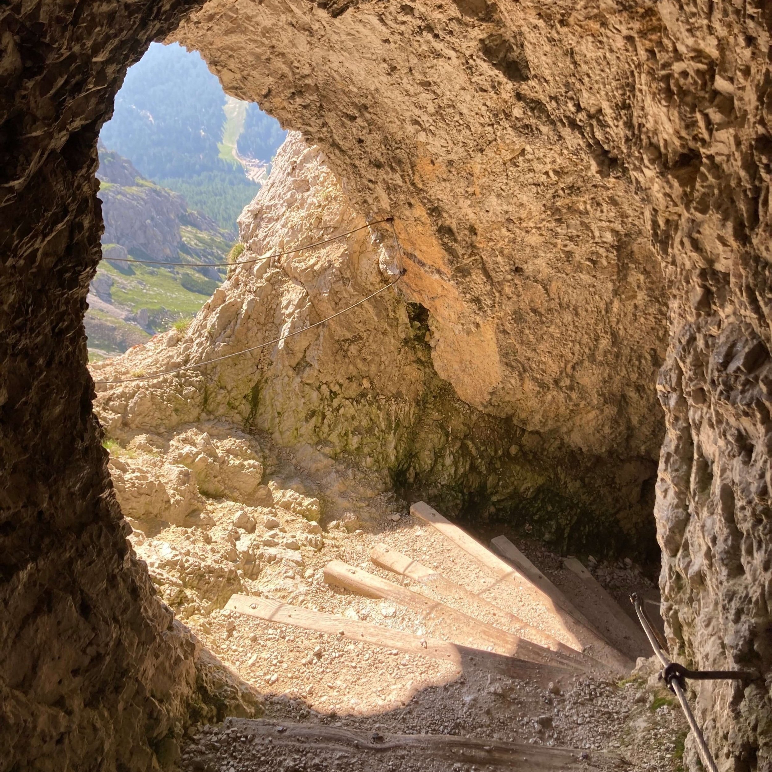
A unique opportunity to walk through the WWI tunnel system that weaves down within the mountain. It is recommended to rent a helmet from the cable car station, and bring a torch. It is steep, dark and can be wet underfoot. Allow time to enjoy the experience.


A short trail that connects the WW1 tunnel system and Passo Falzarego. It is rocky and can be quite busy during peak periods.
Difficulty: Mountain Trail.


This route is suitable for those wishing to skip ahead along the trail. It passes through the Cinque Torri ski area with great views north to Lagazuoi.
Difficulty: Mountain Trail.


For those wanting one of the best views of the area, hiking up to Nuvolau provides unparralleled views. For those not wanting to continue on to the Via Ferrata Ra Gusela, this is an out and back route well worth the extra effort.
Difficulty: Mountain Trail.


This beginners via ferrata trail does not present significant technical difficulties. However, every hiker must assess their level of risk and gear choice.
Difficulty: Via Ferrata.


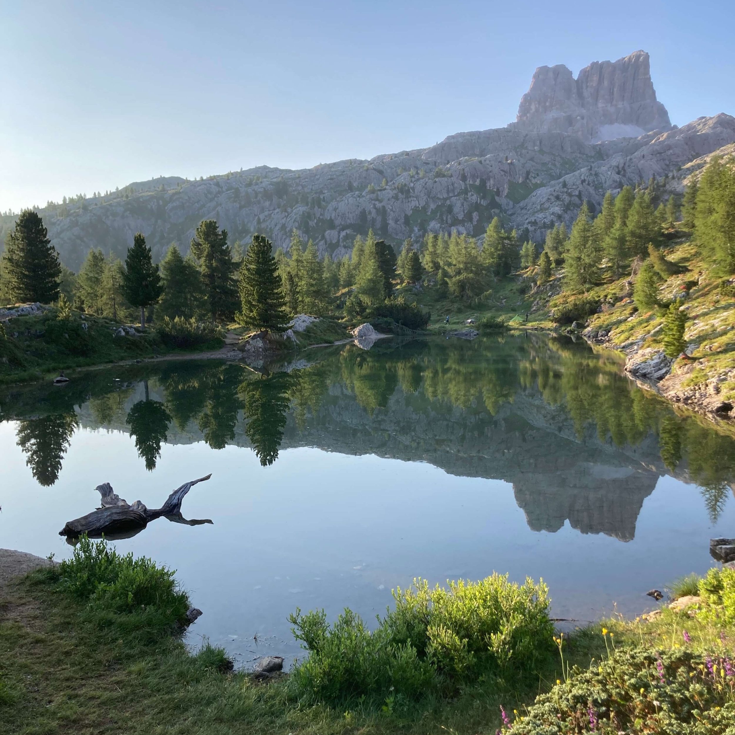
This route visits the beautiful alpine lake, Lago Federa and hugs the Northern end of the Croda da Lago mountain range. Rifugio Croda da Lago is a great location to stay overnight or stop for lunch (or cake!).
Difficulty: Mountain Trail.


This route is suitable for those seeking alternative accommodation, who want to catch transport to skip ahead, or exit the trail.
Difficulty: Hiking Trail.


This challenging alternative route is not for the faint hearted. There are steep, exposed sections on very friable rocks with some cables to assist. The scree is difficult to navigate, both on descent and ascent.
Difficulty: Mountain Trail.


This route is suitable for those staying in Palafavera, completing the route around Monte Pelmo, or who want to exit the trail via bus.
Difficulty: Mountain Trail.


