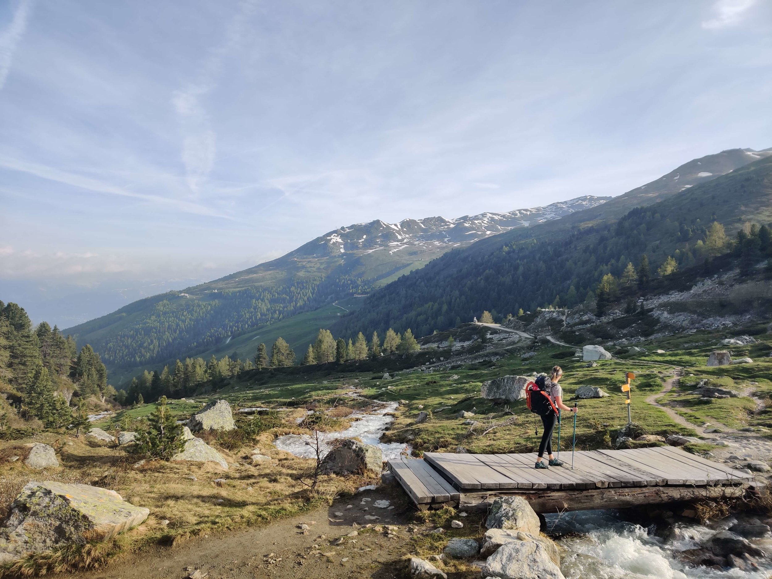
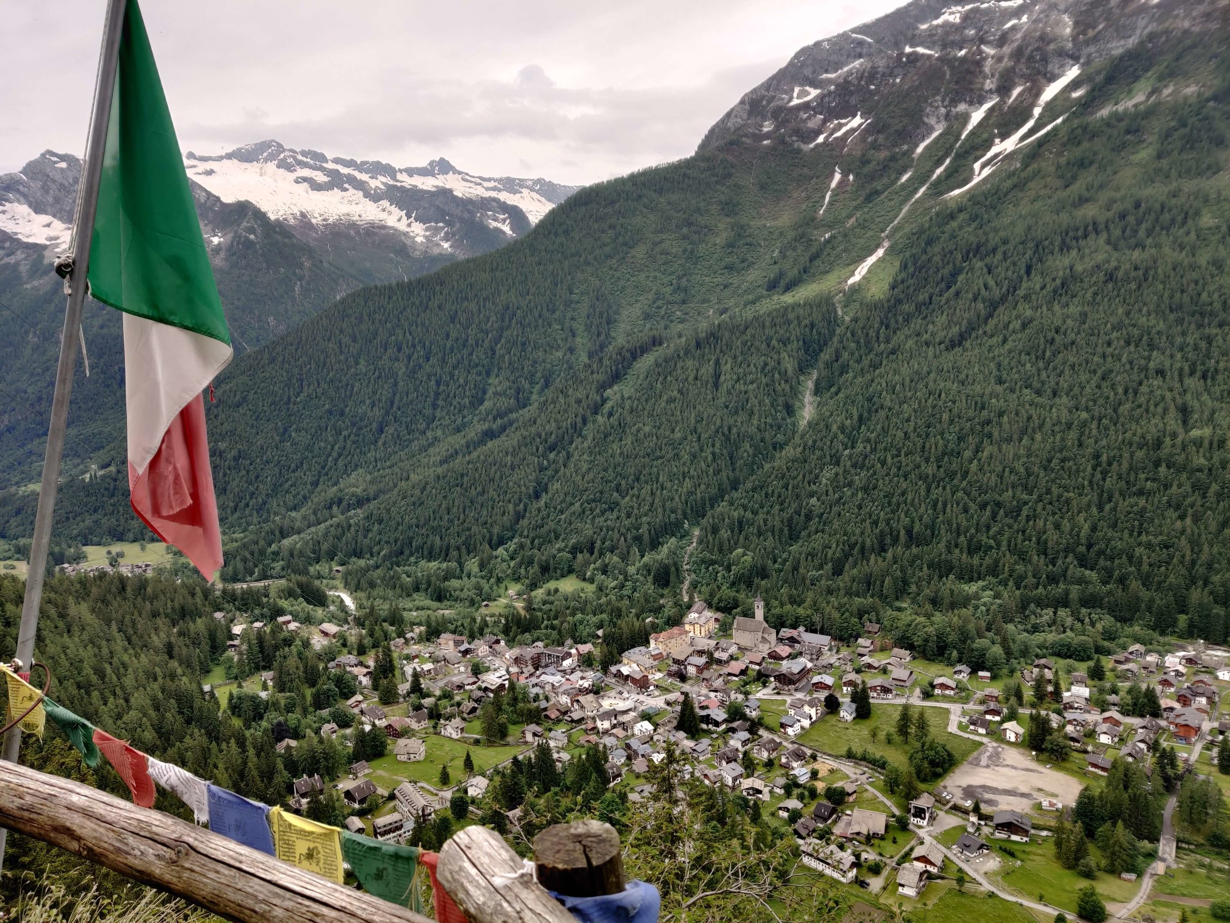
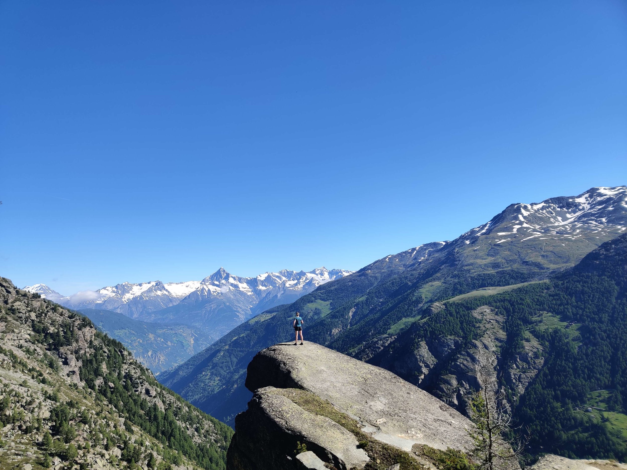
Hiking the “Triple M” in June 2019
Tour du mont blanc
Walker’s Haute Route
Tour of Monte Rosa
During June 2019, I completed 3 of the most famous multi-day trails in the Alps, back-to-back. The goal of this journey is to provide self-guided hikers with up-to-date trail conditions for the 2019 hiking season so they know what to expect and bring with them.
The adventure started with the Tour du Mont Blanc then followed the Walker’s Haute Route to the Matterhorn, before finishing with a Tour of Monte Rosa. By removing the overlaps between each of the 3 trails, my planned route was a total 486 km / 302 mi, with over 30,000m of elevation gain and loss, over 18 hiking days.
I’ve not been able to find an official name for completing all three trails in one go so have dubbed it the Triple M: Around Mont Blanc, to the Matterhorn and around Monte Rosa.
Why DID I do this epic adventure?
To provide 2019 self-guided hikers of these trails with confidence
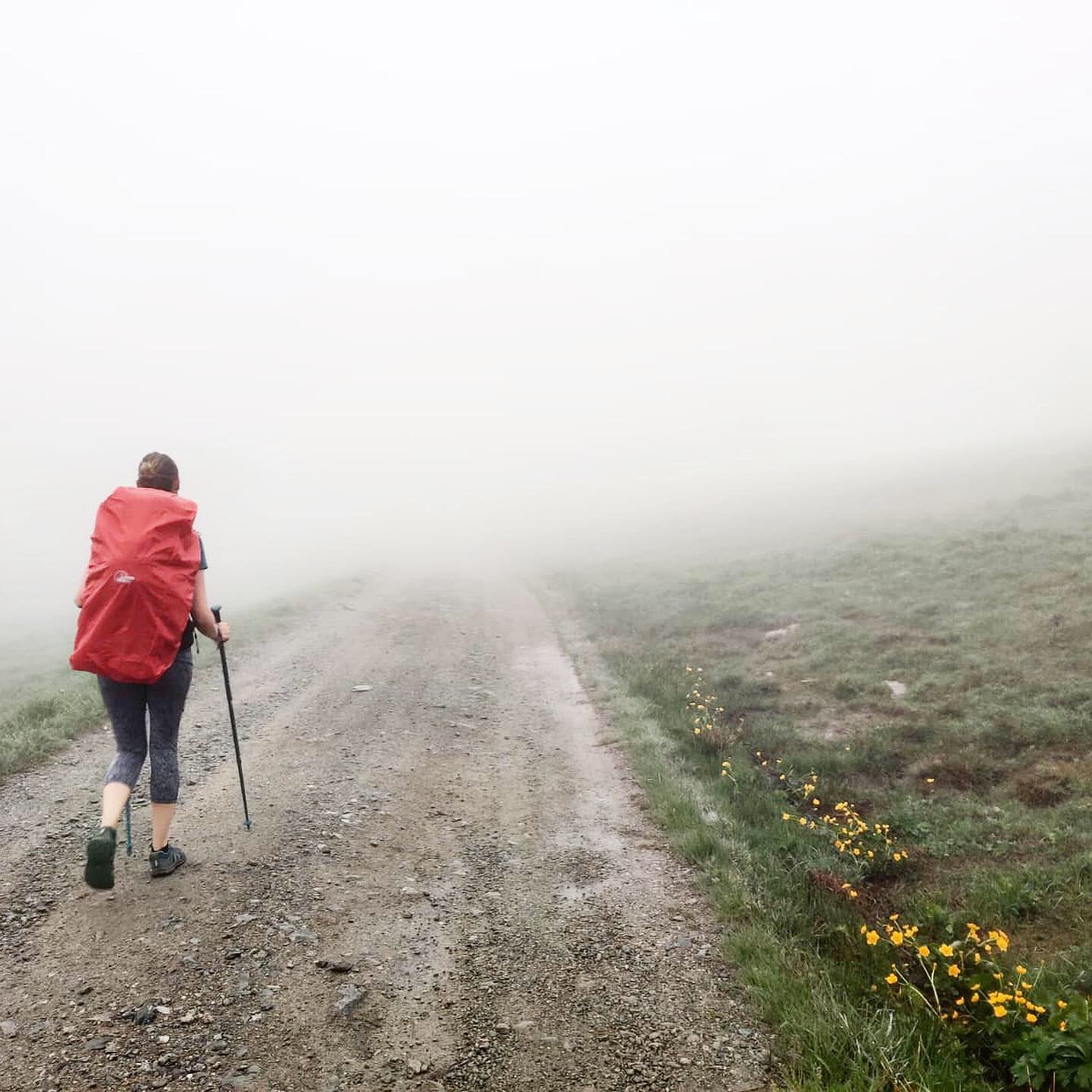
Medium distance hiking in the Alps can be difficult to plan with confidence, especially if your aim is to embark on your adventure during June or early July. Snow level uncertainly on high mountain passes and unknown trail conditions after the winter can require significant detours which can be difficult to navigate, particularly if it is your first time on the trail.
Starting my hike at the start of June is 2-4 weeks before it’s recommend hikers attempt these trails due to snow cover on mountain passes requiring mountaineering equipment and skills, some trail markings still being buried and unstable Spring weather still lurking around.
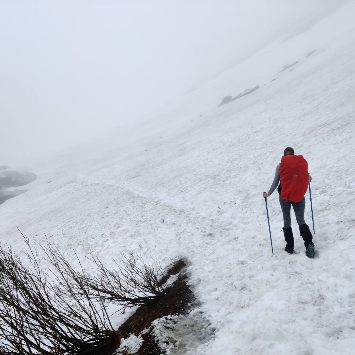
I have experience on the trails during all seasons, carried appropriate mountaineering/safety gear for the snow, used the GPS offline mobile maps I’ve designed for navigation and had the right clothing for the conditions.
HOW CAN I KEEP up to date on trail conditions?
Sign-up here to receive updates on upcoming season trail updates.
If you’ve signed up to the newsletters of Haute Route Hiking or Tour du Mont Blanc Club, you’ll already be on the mailing list.
Follow on Instagram to get real-time updates on these trails
TRIPLE M Hiking Itinerary
This following statistics were for the planned itinerary. As you will see from the updates below, some detours and changes were necessary due to the conditions.
Key Trail and Hiking Stats | values have been rounded
Total Distance: 486 km / 302 mi
Average hiking distance per day: 27 km / 17 miles
Average hiking time per day: 9 hours
Average elevation change per day: 3,500 m / 11,500 ft
Longest hiking day: 36 km / 22.5 mi (Walker’s Haute Route/Tour of Monte Rosa - St Niklaus > Zermatt)
Biggest elevation change day: 4,550 m / 14,950 ft (Walker’s Haute Route - Hotel Weisshorn >> St Nikalus)
Rest Days
1 day in Champex-Lac after TMB / start of Walker’s Haute Route
1 day in St Niklaus before starting of Tour of Monte Rosa / end the Walker’s Haute Route

Tour du Mont Blanc
170 km / 106 mi
Trail Updates: Tour Du Mont Blanc


June 4th, 2019: le peuty >> montroc
Total Distance: 14 km / 9 mi
Total Elevation Gain: 1,143m / 3,753ft
Snow line: 1,830m / 6,000ft
Snow depth at Col de Balme & Col des Posettes 0m / 0ft
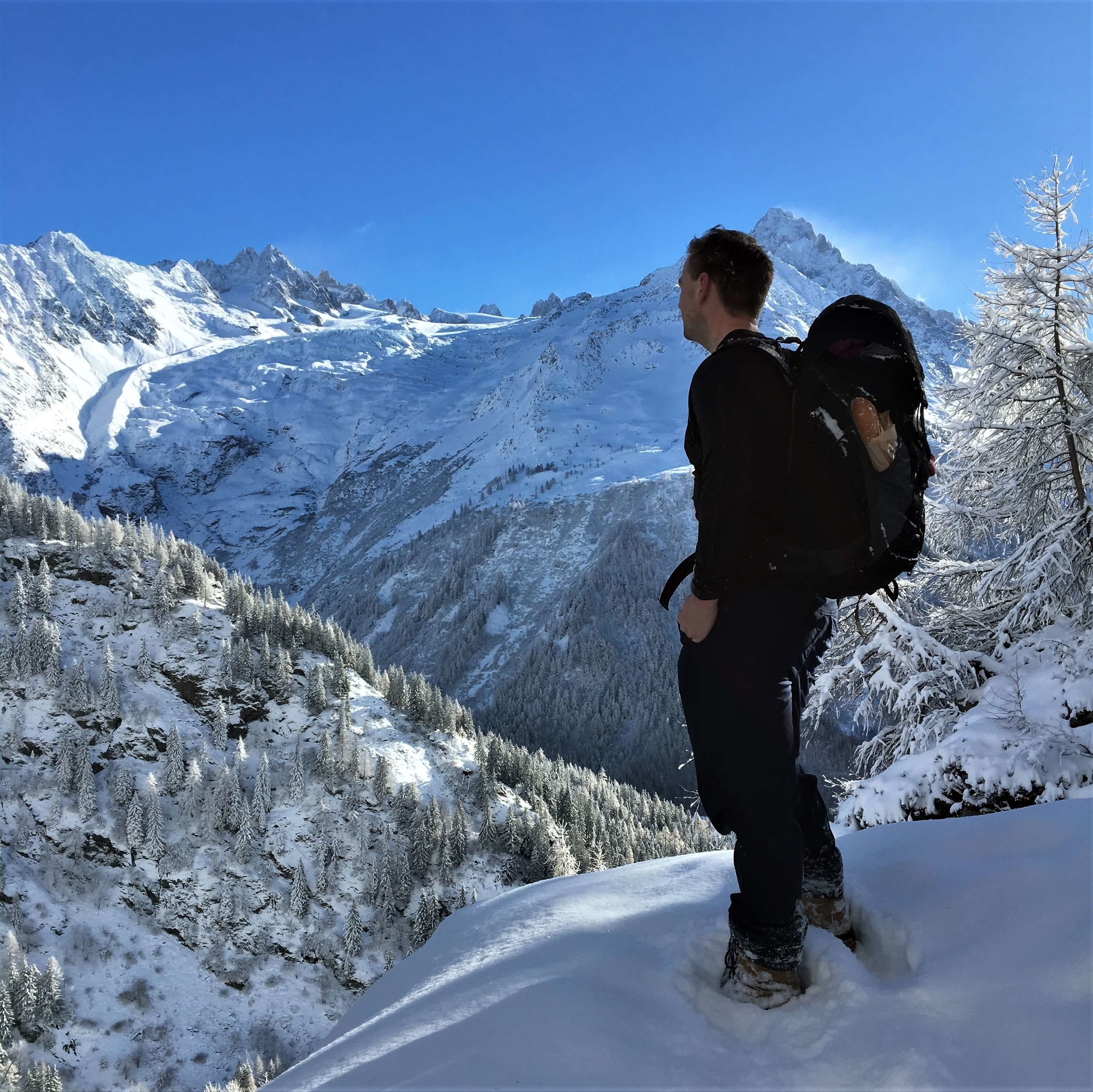
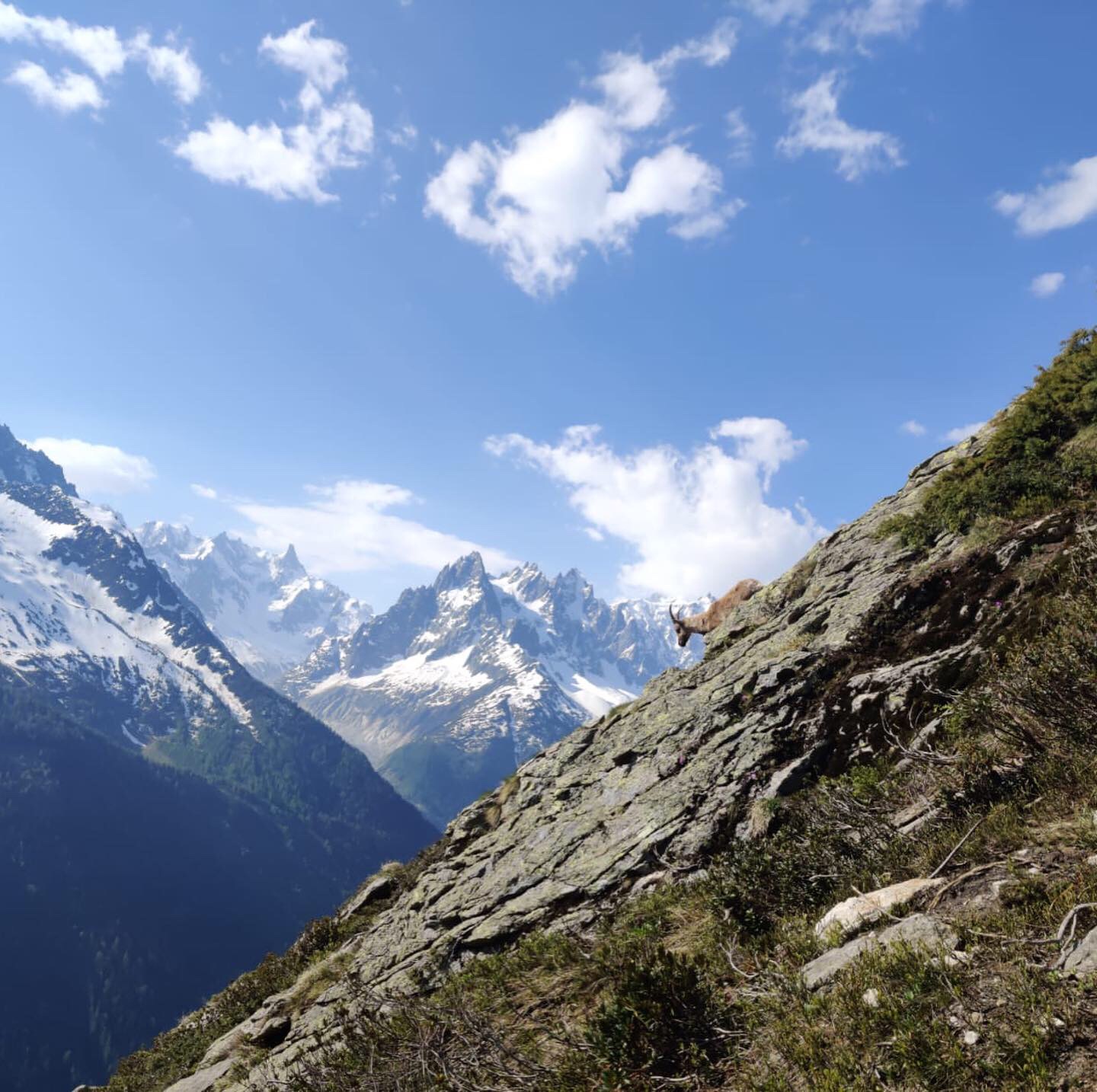
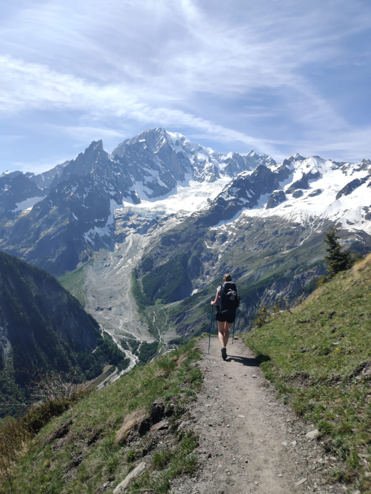
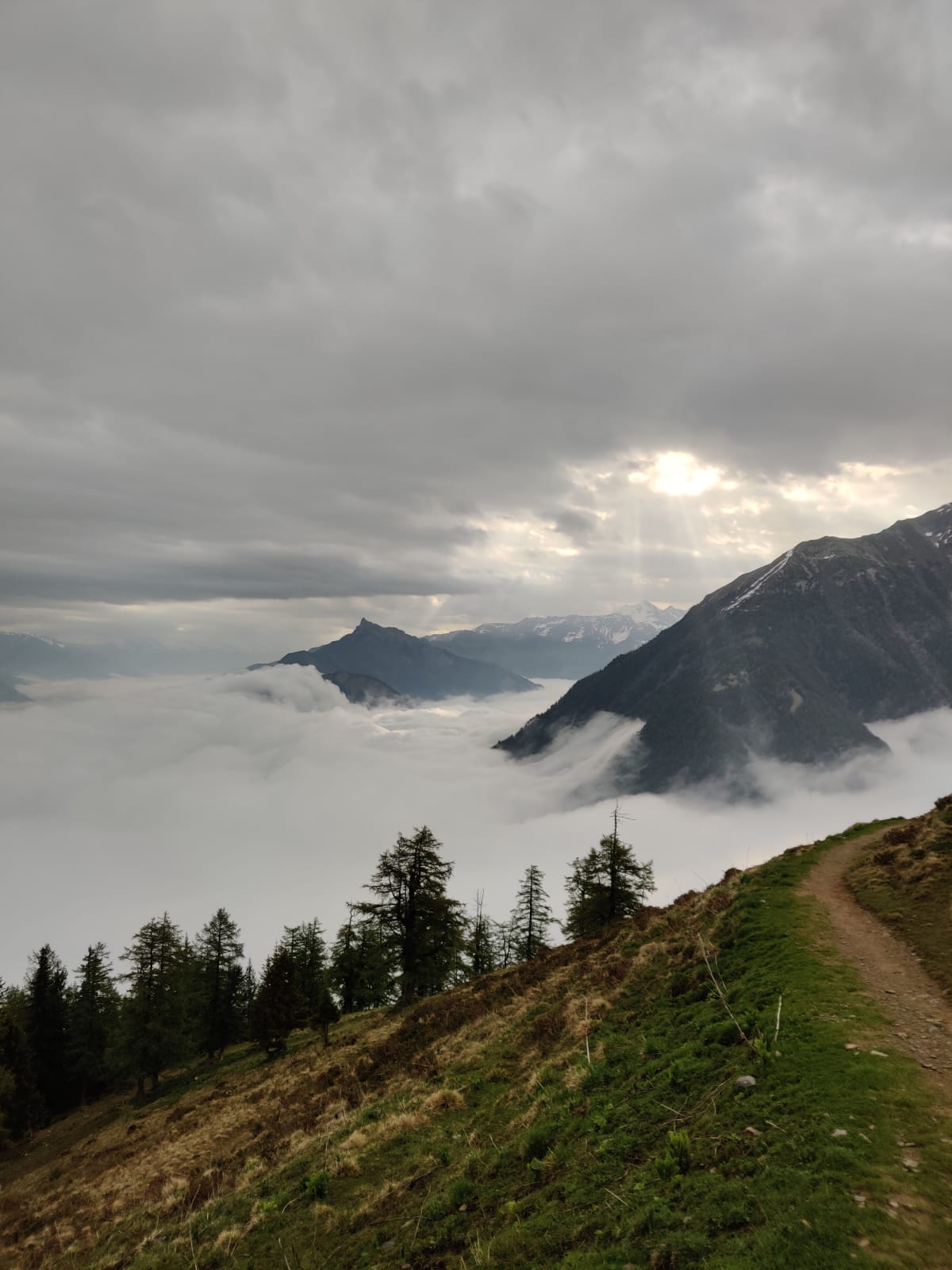
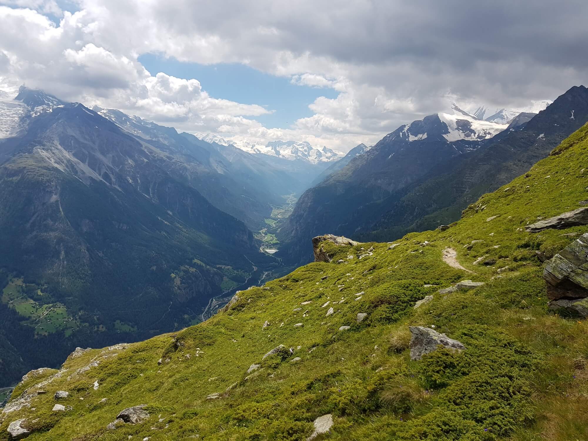
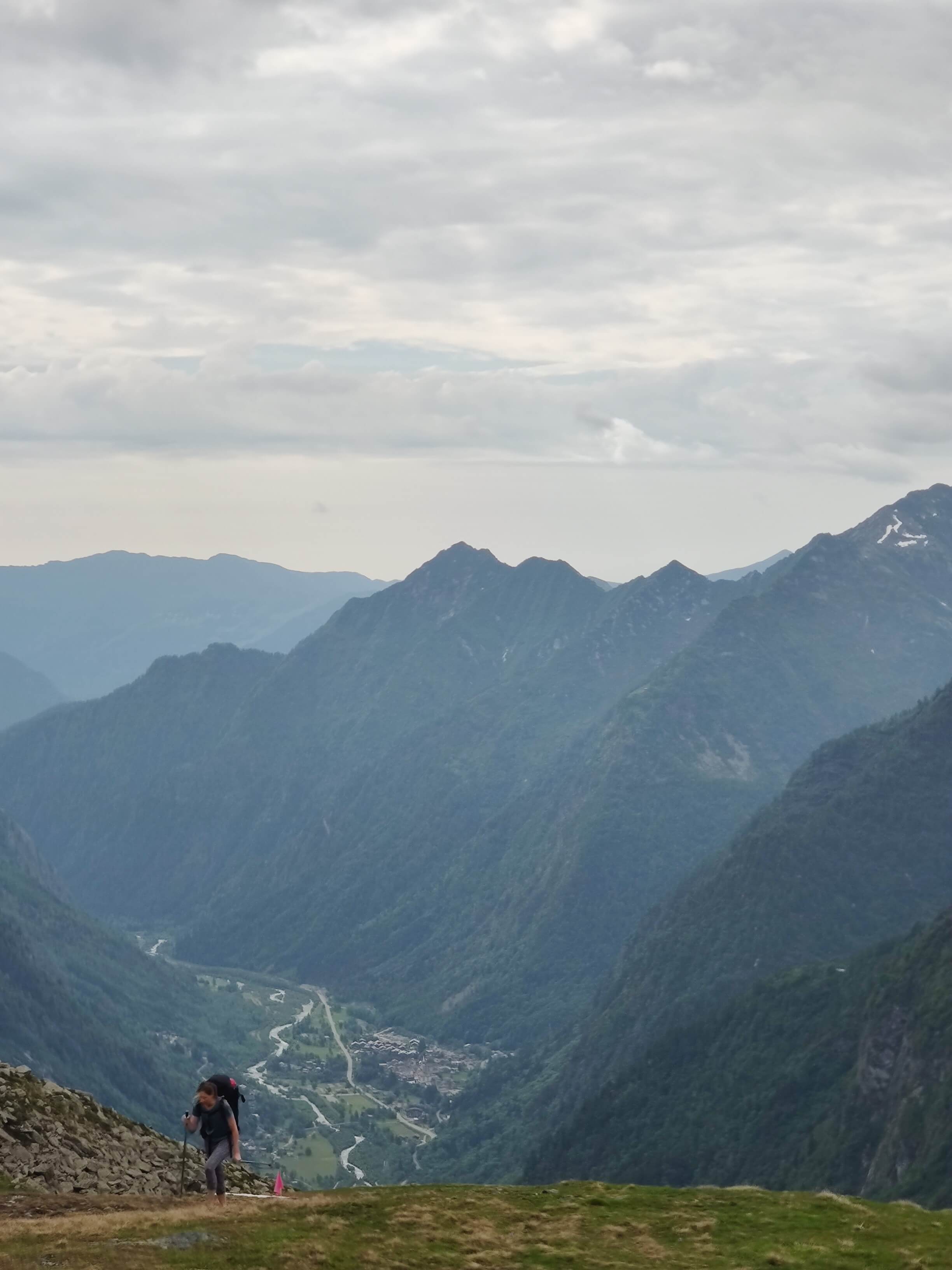
First day of our Triple M hike and we expected much more snow. At the highest point on the trail today - Col de Balme (2204m) - there wasn't any snow. But there is still plenty of snow on either side of the col. Coming from Le Peuty, we hit the snow line at 1,830m and used our poles and microspikes to easily navigate through the soft, slushy snow. As we continued past Col de Balme, the views from Aiguillette des Posettes did not disappoint! Such a spectacular spot to see Mont Blanc massif in all its glory.


June 5th: Montroc >> LES HOUCHES
Total Distance: 22 km / 14 mi
Total Elevation Gain: 1,300m / 4,265ft
Snow line 1,950m / 6,400ft (Above the ladders near Aiguillette d'Argentiére)
Route: Aiguillette d'Argentiére >> Lac Blanc >> Plan Praz >> Chamonix
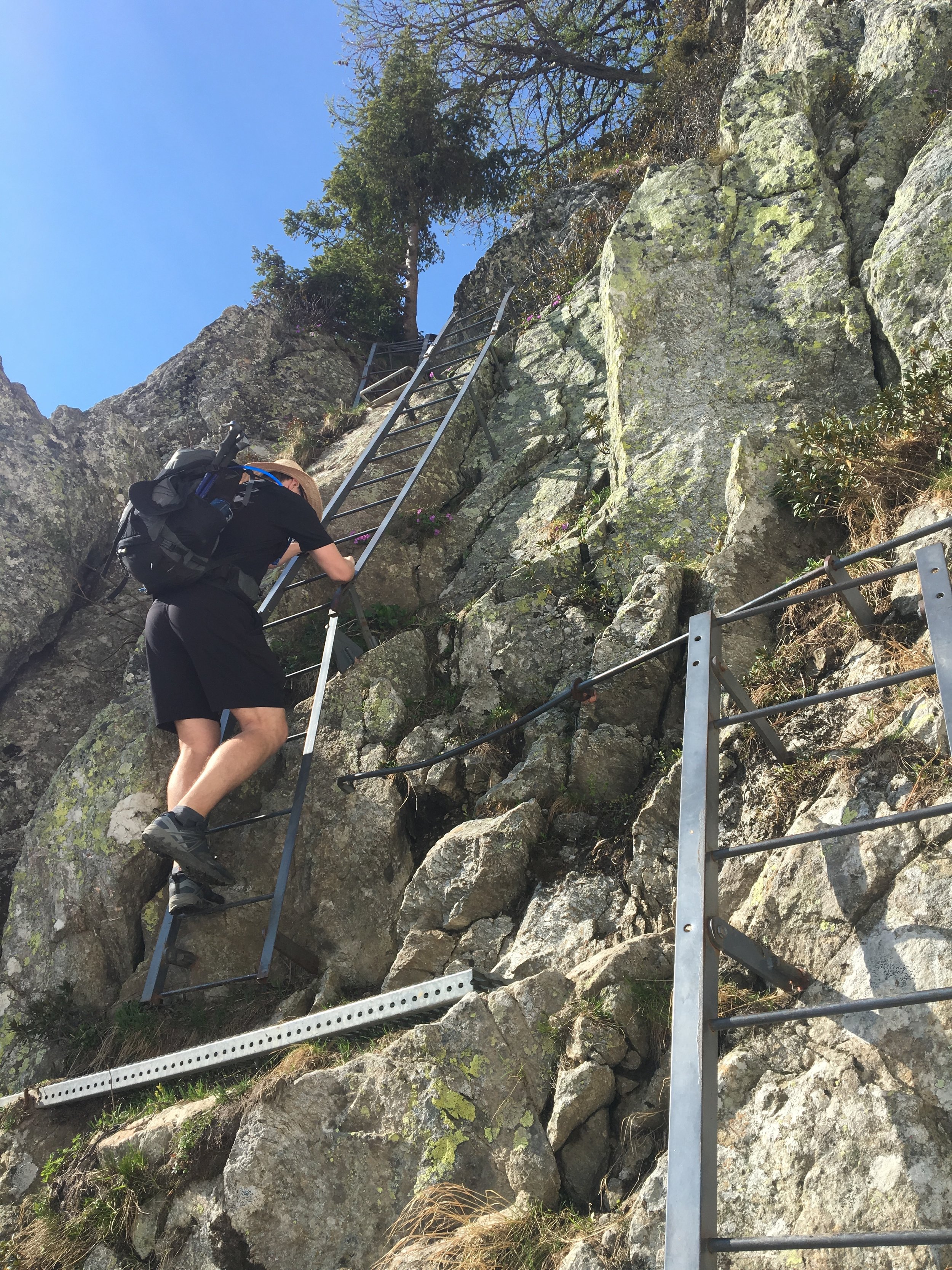
Another beautiful, hot day in the Chamonix valley today. We weren't able to complete the full Montroc to Les Houches section as planned, due to snow conditions. We were happy to start the day amongst the trees in the trail up to Aiguillette d'Argentiére, as it was already 20+ degrees at 8am! We saw some very approachable locals - ibex - along this section of the trail. We decided to head up to Refuge Lac Blanc to check out the snow conditions. This section was a little slow going due to the snow and unfortunately the lake was still all covered in snow. Fingers crossed for the snow to melt before the opening of the refuge lac blanc mid June! We made the decision on the trail between Plan Praz to Col du Brévent not to continue on. The steep snowy slopes slowed us down to the point where we didn't think we'd make it to Les Houches until well into the evening, especailly with the extra effort of using ice-axes to safely traverse. Therefore we decided to head back down into the valley from Plan Praz via the "Chamonix Grind" - a name I've given to the section of the trail that is extremely steep and requires a lot of concentration. All in all a good day! If any of you tackle the trail section between Col du Brévent and Refuge de Bellachat, let me know how it goes!
Don't forget that along this section of the TMB trail Refuge La Flégère & La Flégère Gondola are closed for the 2019 summer season. We were able to avoid this impacting our hike as we completed this long section in 1 day. For those that would like to split it into 2 sections/days you'll need to either stay at Refuge Lac Blanc or down in the Chamonix valley. Read our blog post for more details on alternative routes and maps.

June 6th: LES HOUCHES >> LES CHAPieux
Total Distance: 35km / 22mi
Total Elevation Gain: 2,345m / 7,693ft
Snow line 1900m / 6,233ft, Snow depth at Col de la Croix +1m
Route: Les Houches >> Bionnassay >> Les Contamines >> Col de la Croix >> Les Chapieux
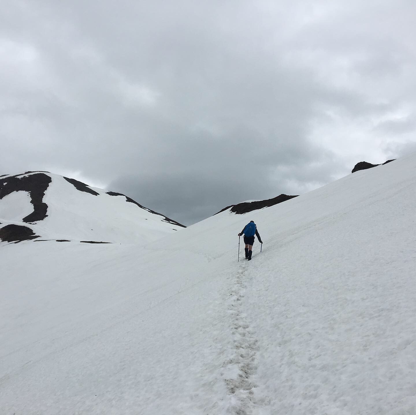
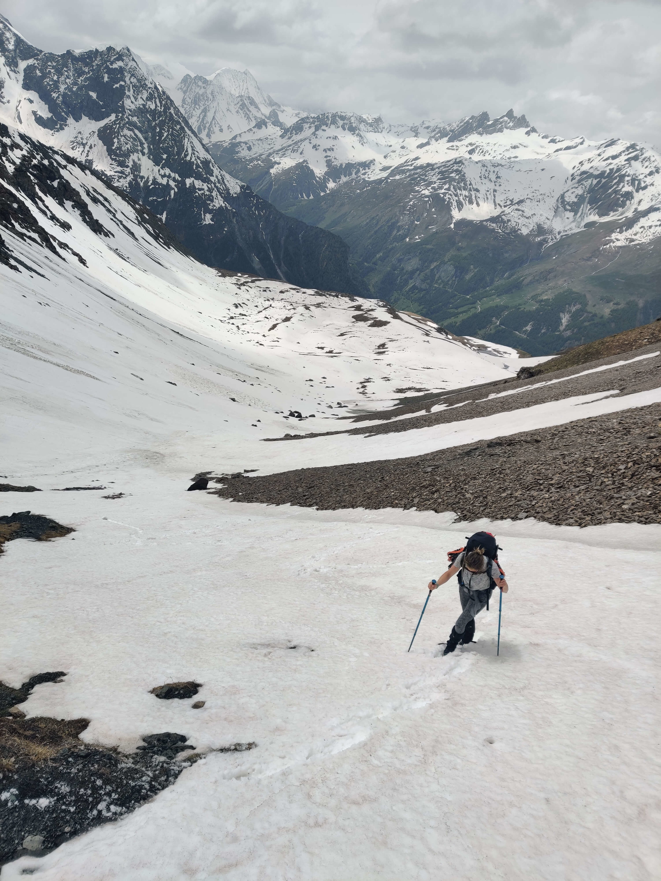
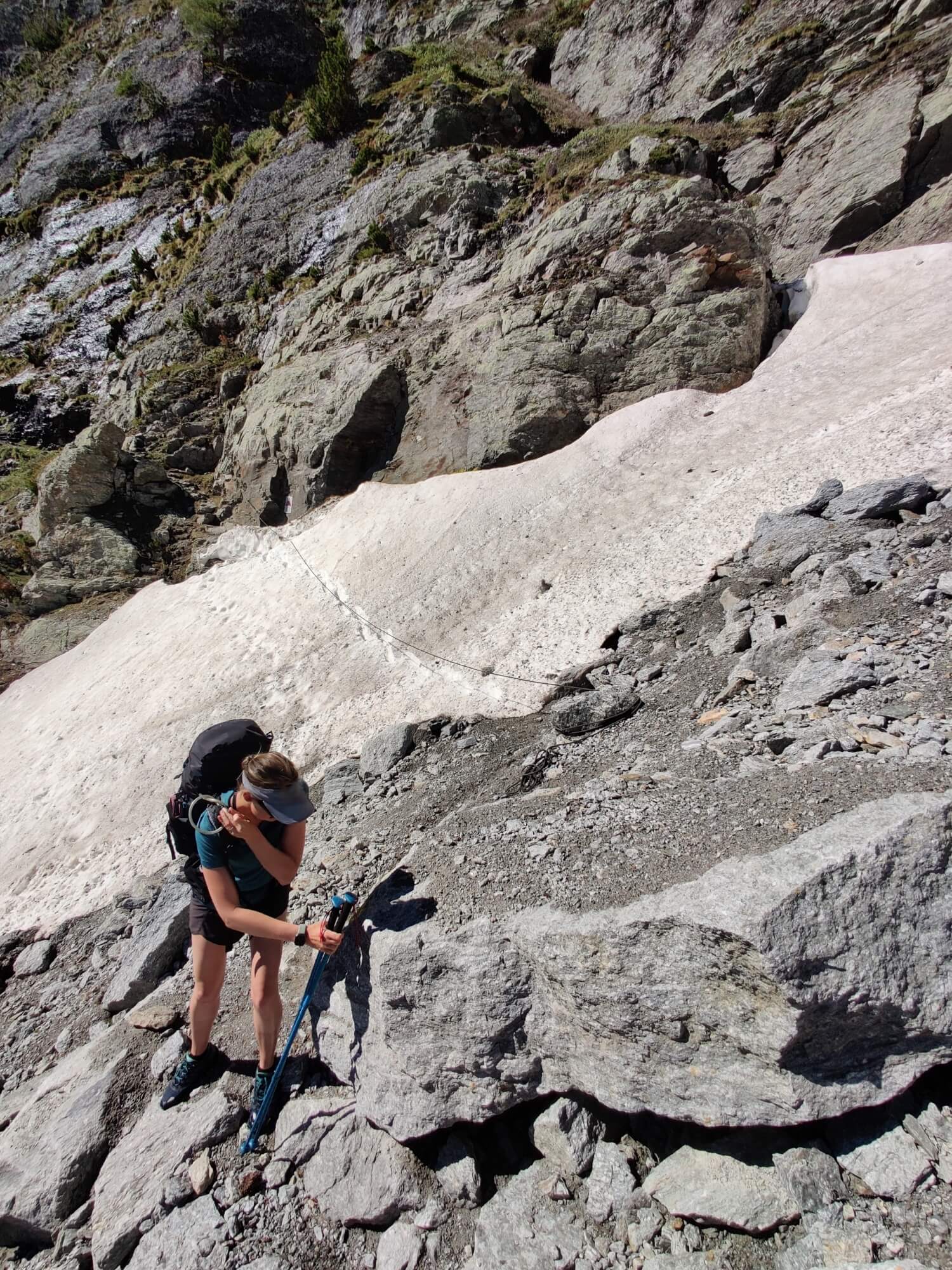
What a difference a day makes! Today was cooler and we walked through mist/fog for most of our hike until the sun finally came out in our descent into Les Chapieux. The trail was free of snow until 1km past Refuge de la Balme. For the next few hours, we hiked with microspikes to Col du Bonhomme and then ice-axe to Col de la Croix. There were only a few footprints to follow, however there were a few wooden sticks with red and white markings/tape along the way to keep you on track.
I estimate that 15 people completed this section today and we were the only ones that had ice-axes. You didn't really need it today though because the snow was soft and you could get a good foot hold. Last year at the end of June this section had become very icy so those hiking in the next few weeks should keep following updates to see if it ends up this way again, if so an ice-axe would be advisable.
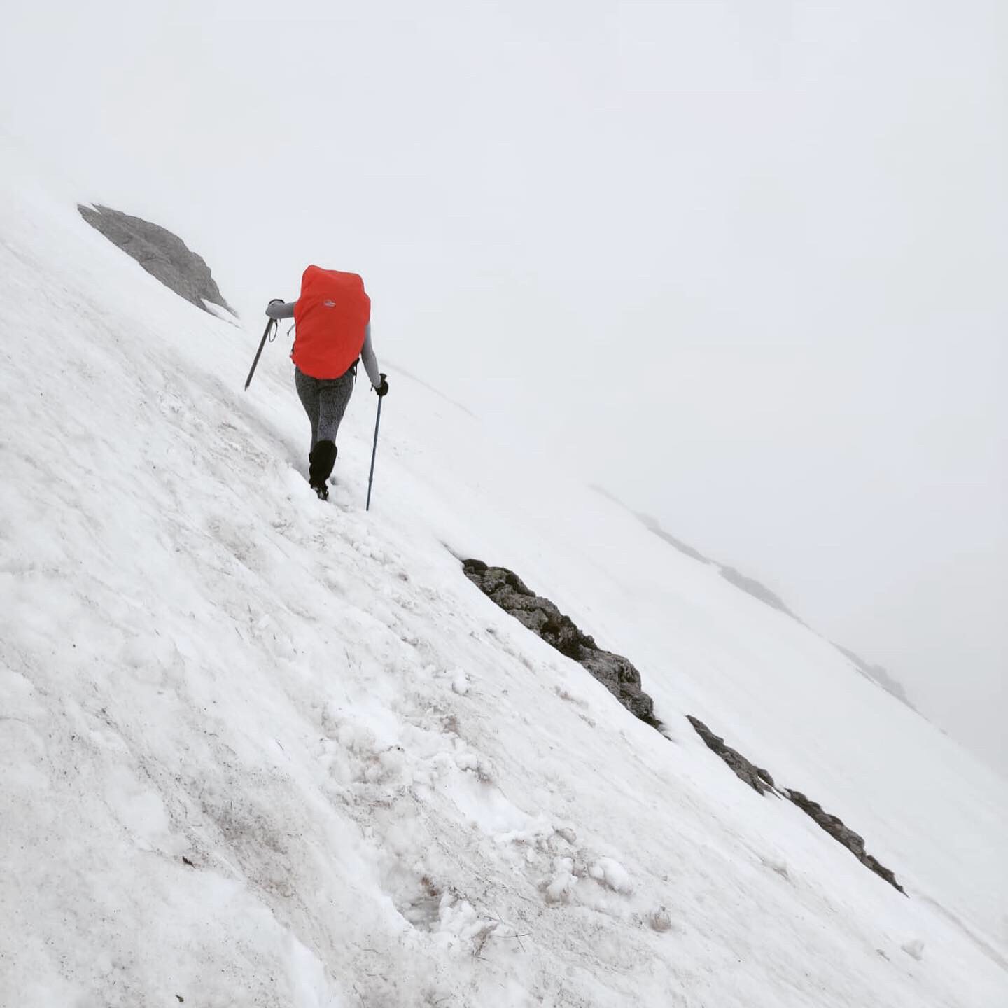
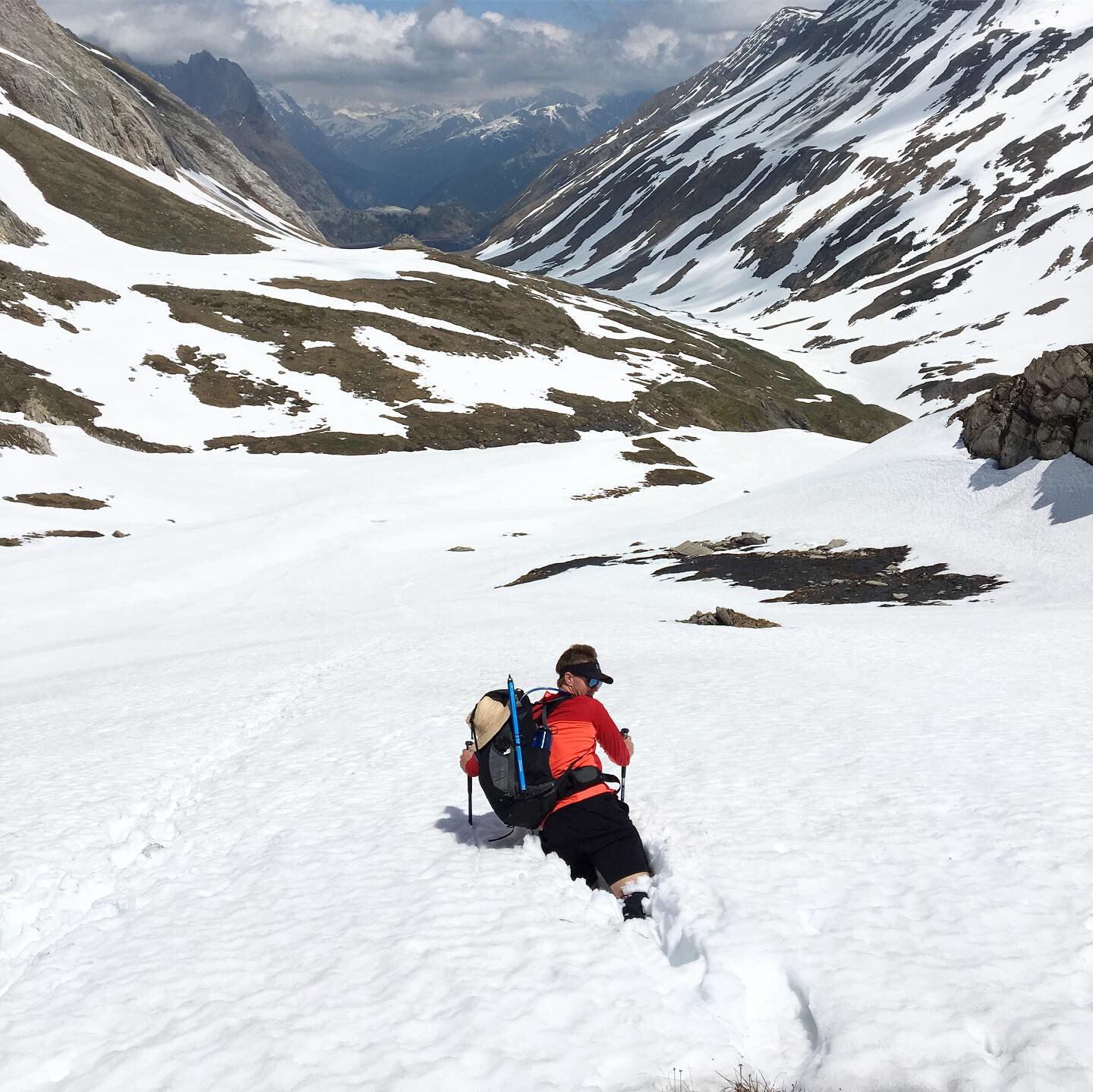
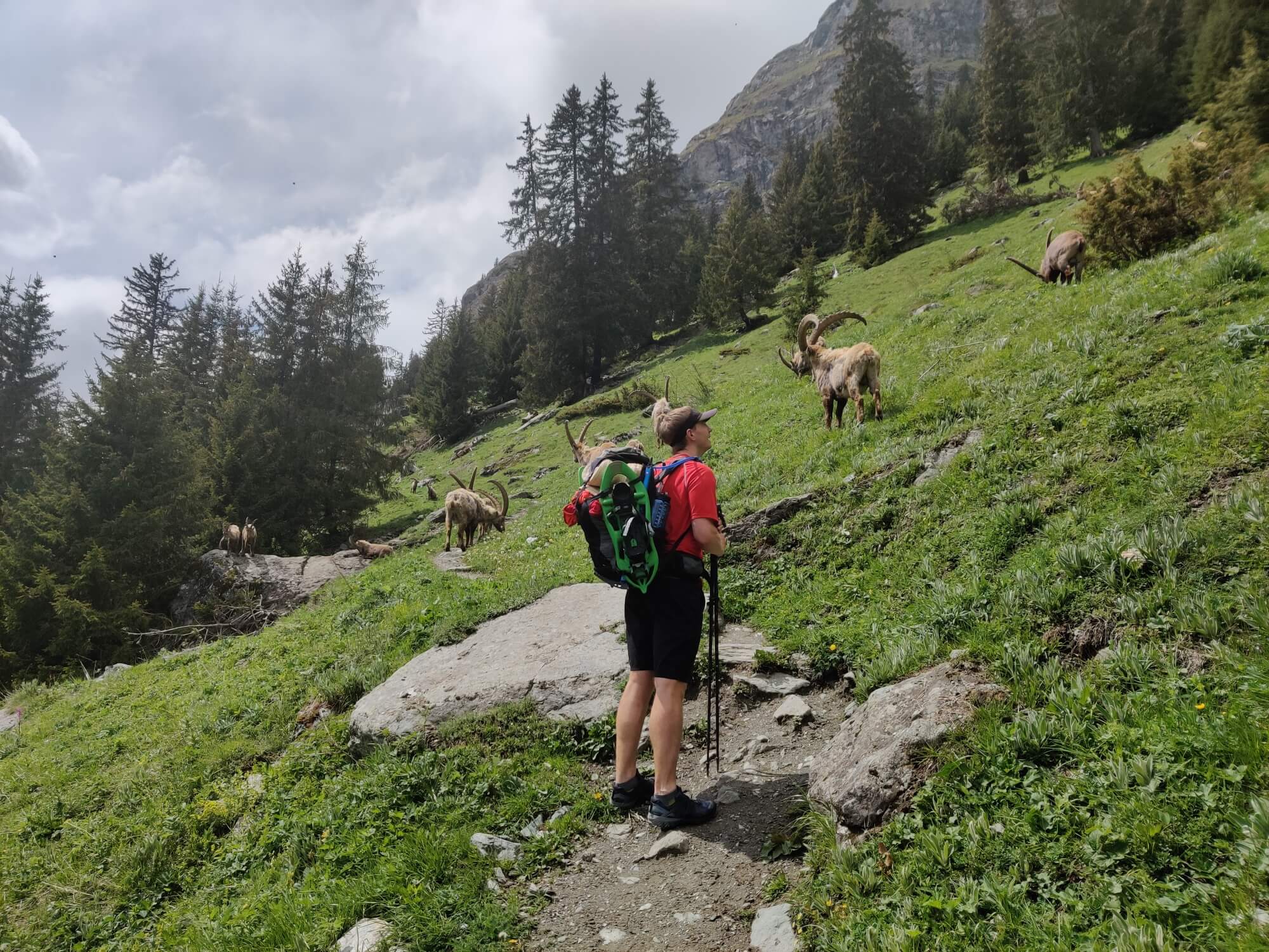
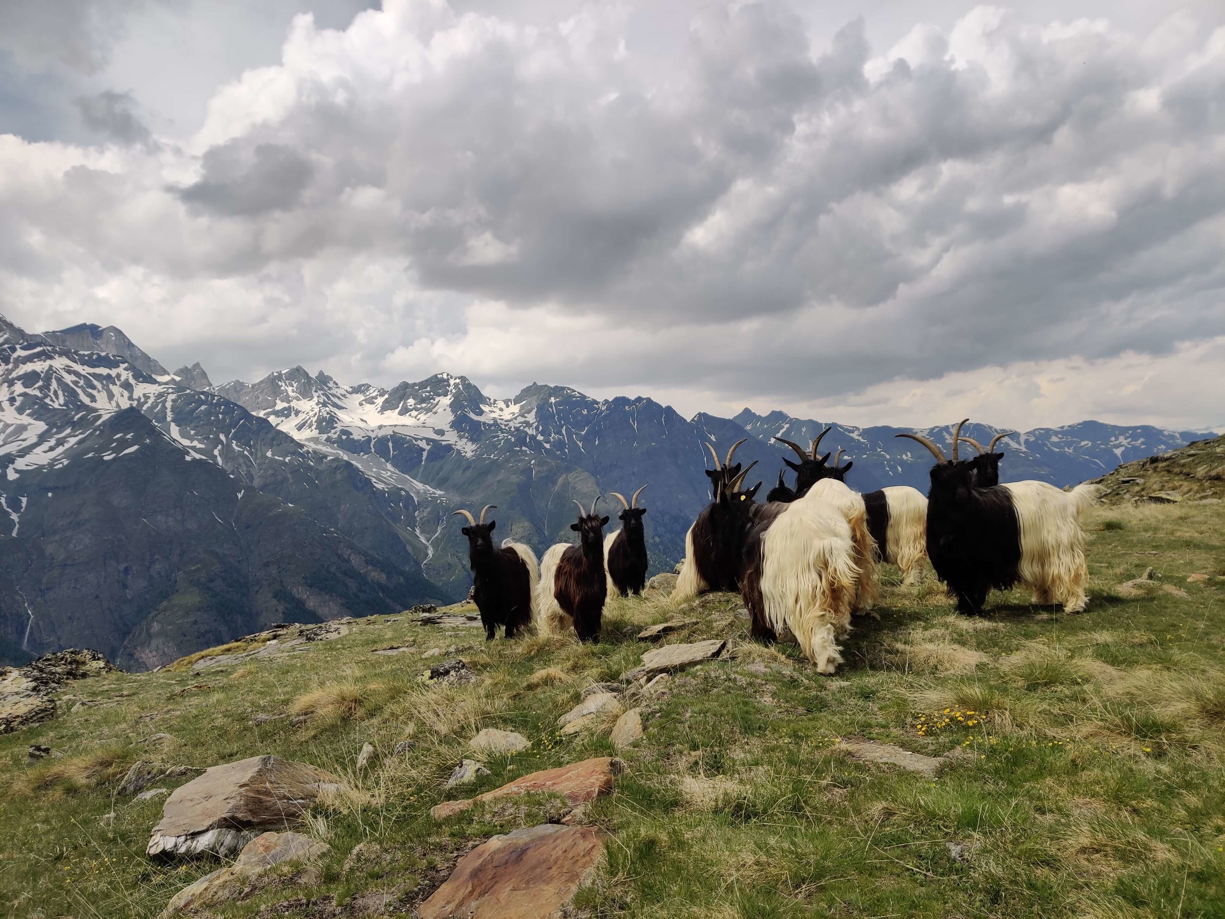
Towards the top of Col de la Croix, we were sinking thigh deep into the snow, which definitely slowed us down. The guardian at Refuge de la Croix had already opened the hut so we warmed up with a hot chocolate. The descent to Les Chapeiux was quite fast as there was still a lot of snow to be able to easily descent until Chalets de Plan (2000m). The descent was even more enjoyable as there were a few groups of ibex running around the alpine meadows and farmland, close to Les Chapieux, the most southerly point on the TMB.
june 7th: les chapieux >> Rifugio Elisabetta

Total Distance: 15km / 9mi
Total Elevation Gain: 1,072m / 3,516ft
Snow line at 2,300m/7,545ft on ascent to Col de la Seigne - haven't reached it yet on the way down :)
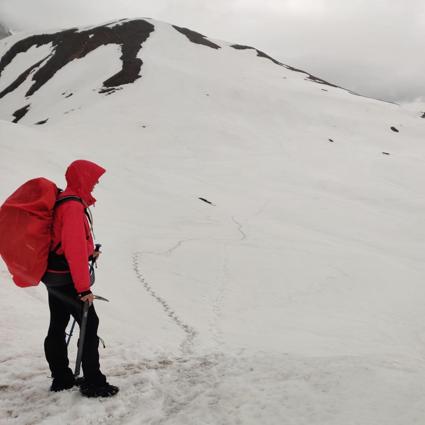
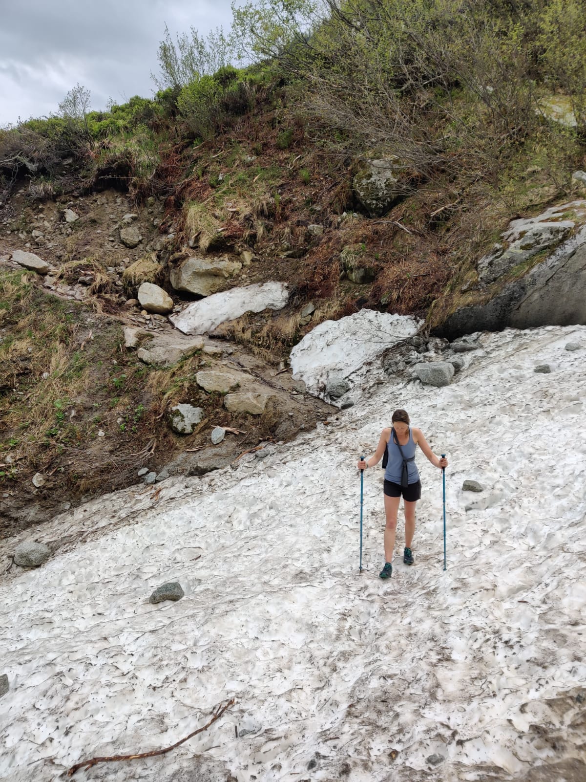
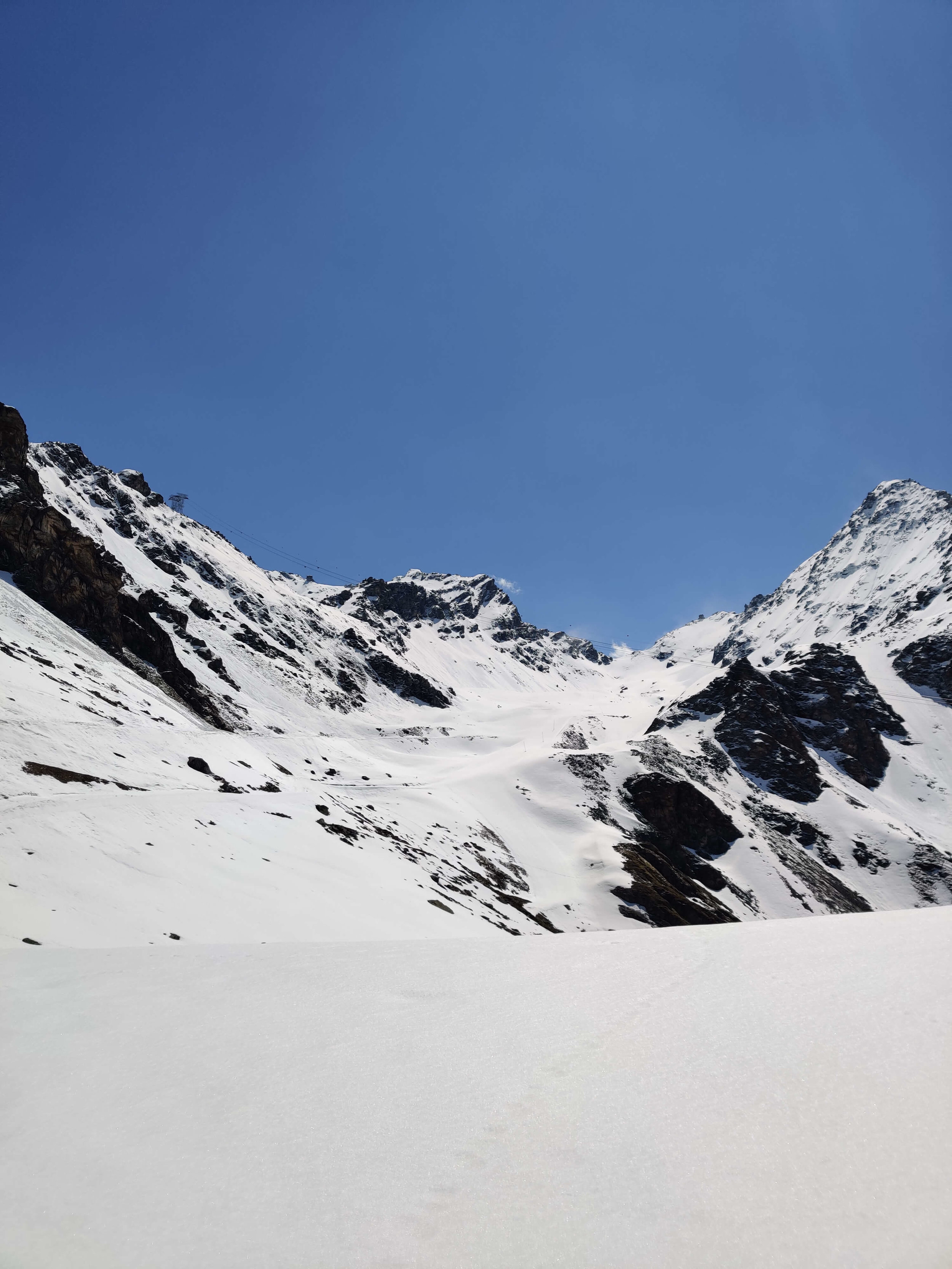
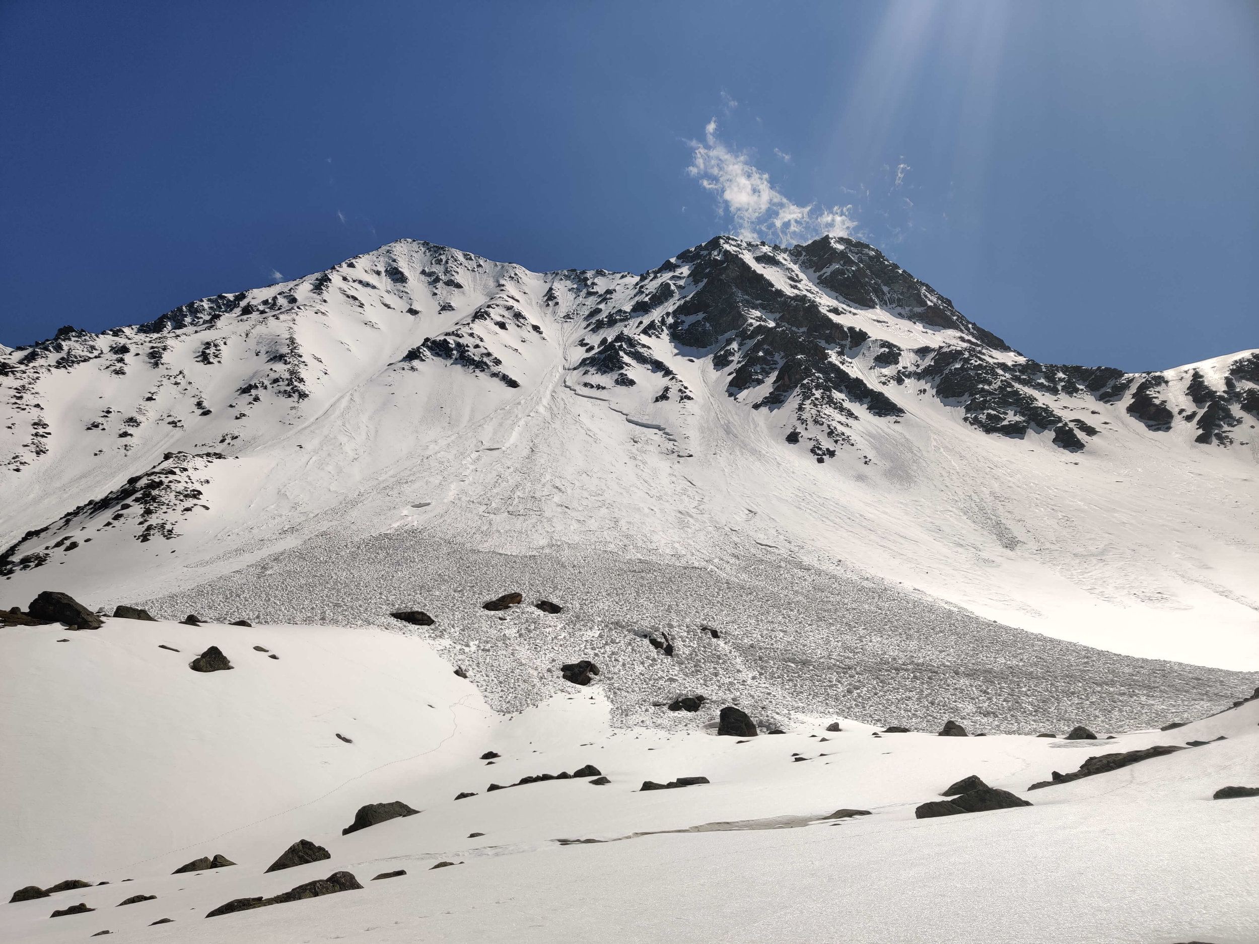
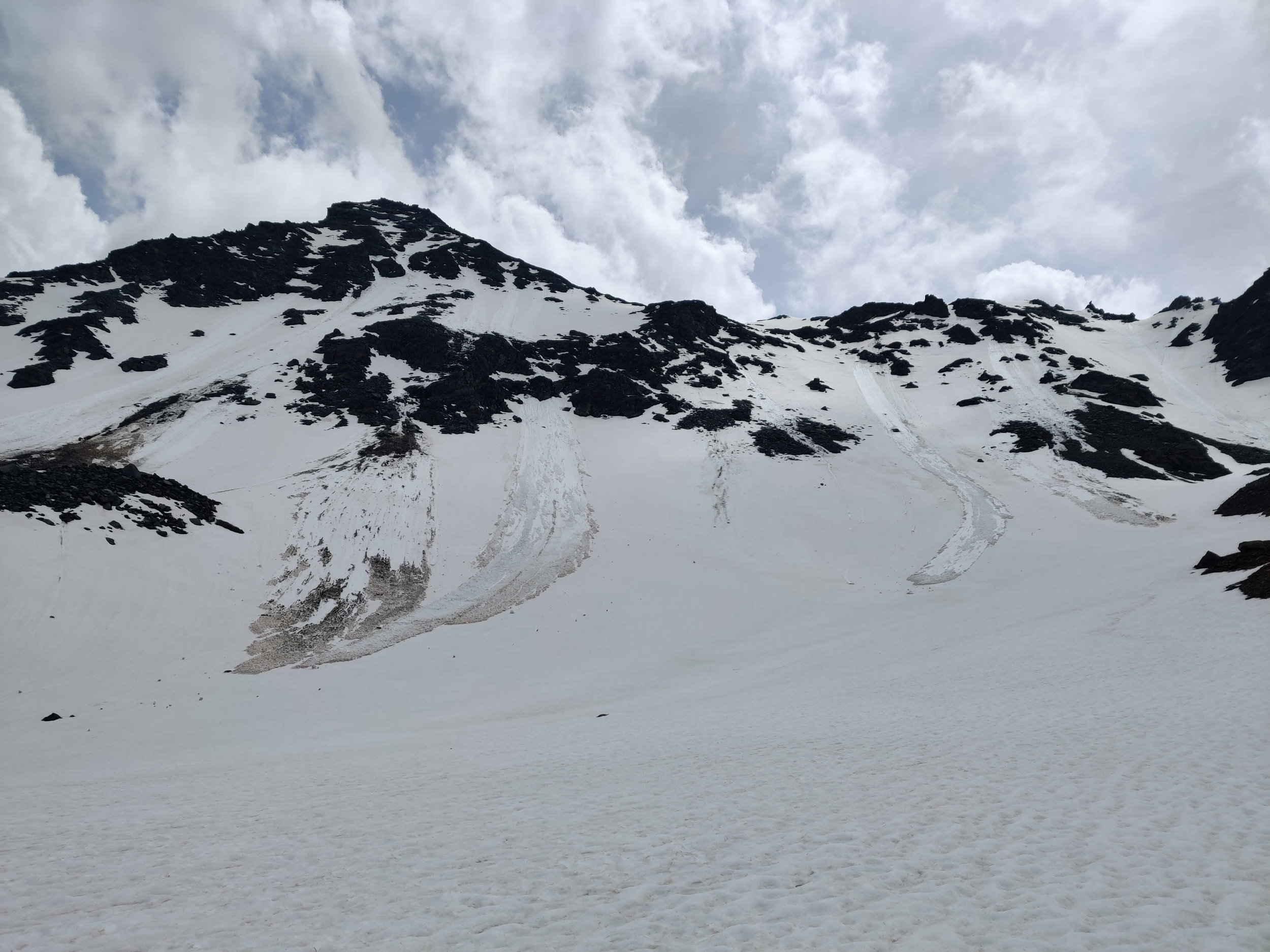
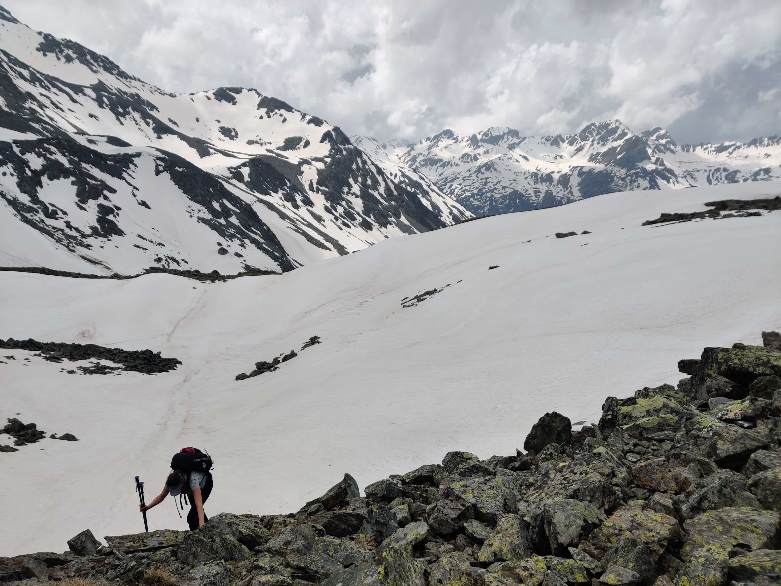
Today was the battle of the winds. We had gale force head winds for most of the day, which made the climb through Vallée des Glaciers and then up to Col de la Seigne quite tough! There were some patches of snow along the trail in Vallee des Glacier and we reached the snowline around 2,300m/7,545ft on the south west facing slope to the Col. There was no need for microspikes or any technical equipment due to the low gradient of the slope, we just had to deal with wet feet!
On the north east side of Col de la Seigne there was still a lot of snow - waist deep in some areas. Be careful not to get stuck in this deep snow section as it can be tough to get back out (see the photos/video for our experience!). Col de la Seigne marks the border between France and Italy. Time to switch our Bonjour for Buongiorno!
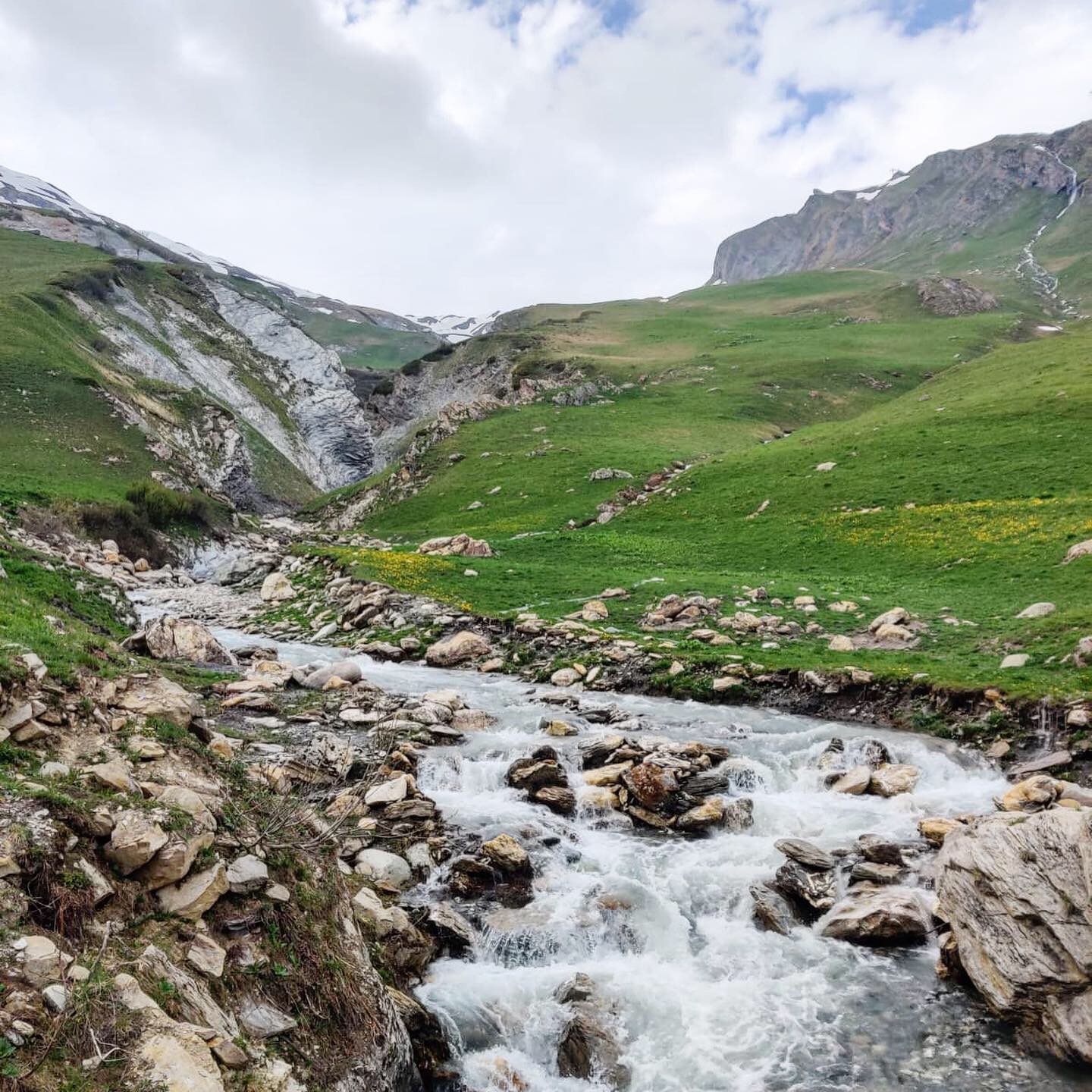
The path from Col de la Seigne to Elisabetta was covered in snow, with only a few small patches where the trail was clear. Lots of marmot sightings today - its definitely spring in the Alps.
june 8th: Rifugio Elisabetta >> Rifugio Bonatti


Total Distance: 28km / 17.5mi
Total Elevation Gain: 1,550m / 5,100ft
Snow line at 2000m / 6,550ft (just above Lac Combal) and from Mont Farve Spur at 2,430m/ 8,000ft to just above the Val Veny ski area, although patches continued to just above Refugio Maison Vieille
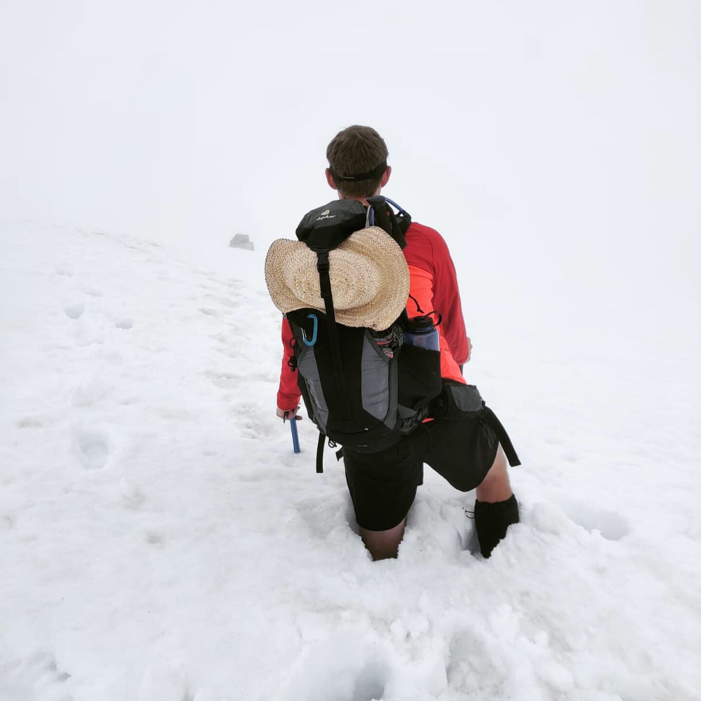
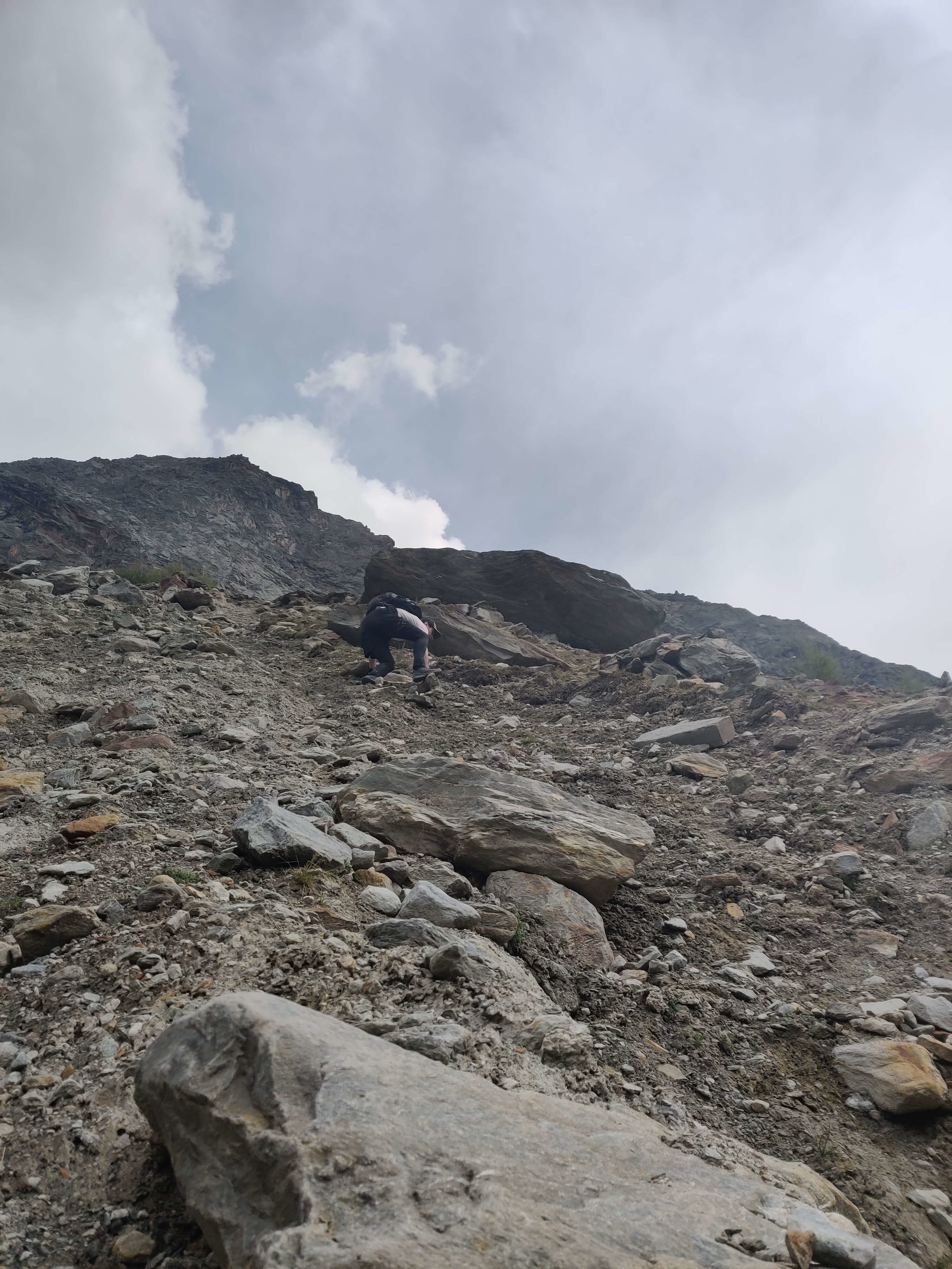
We left Refuge Elisabetta just after 7am and descended across the snowy slope to Lac Combal (it's easier once snow softens later in the day). We took the Val Veny balcony trail and after crossing some snow at the start, managed to avoid most other patches by going around them. The descent from Mont Favre Spur was a different story with large snow crossings unavoidable and the deep, soft snow leading to lots of postholing which made for very slow progress. There was also a couple of steep traverses which we used our ice axes on but with the soft snow today, I think poles would have been sufficient. On the approach to the Val Veny ski area, there was finally some extended sections of trail and we picked up speed from Refugio Maison Vieille to Courmayeur on the descent which is clear of snow.
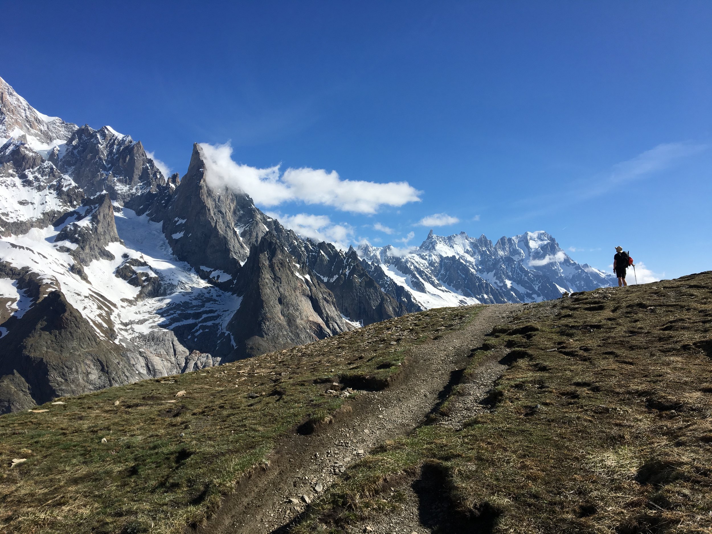
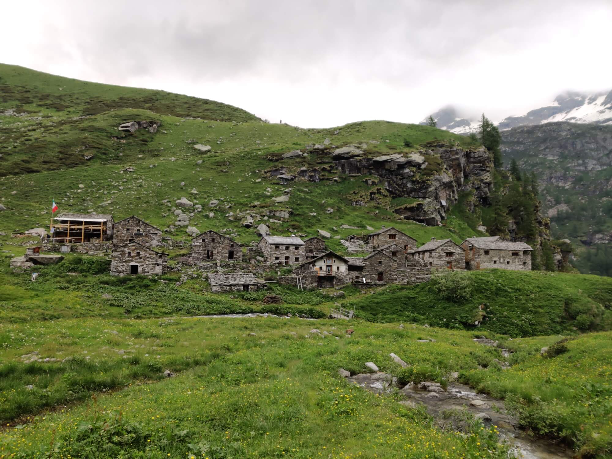
We ended up arriving over an hour later into Courmayeur than planned and pretty exhausted from our soft snow swimming. Therefore, we decided that it would be too much to complete the Col Sapin variant and focused on re-fuelling by consuming nearly a kilogram of focaccia between us (they sell by the gram!). With a full belly, we started the climb to Rifugio Bertone and appreciated the shady trail given it was nearly 30 C / 86 F. After enjoying a drink and the views over Courmayeur, we continued on the main balcony trail to Bonatti which was clear of snow (just a couple of patches - probably won't last a week) and provided stunning views of the Mont Blanc massif. We arrived at Bonatti around 6.15pm - just enough time for a shower before dinner :)
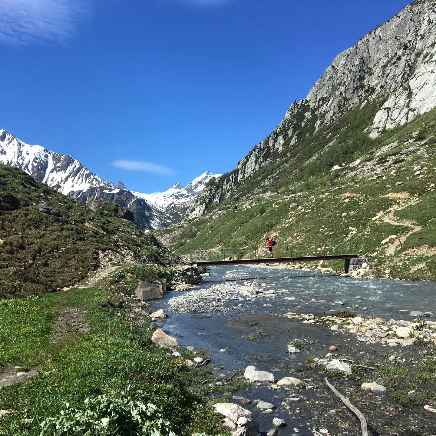
june 9th: Rifugio Bonatti >> Champex-LaC


Total Distance: 34km / 21mi
Total Elevation Gain: 1,440m / 4,727ft
Trail Conditions: Snow line from Refugio Elena side 2,400m / 7,875ft, Snow line from La Peule side 2,300m / 7,546ft (Snow patches down to 2,000m / 6,561ft on both sides)
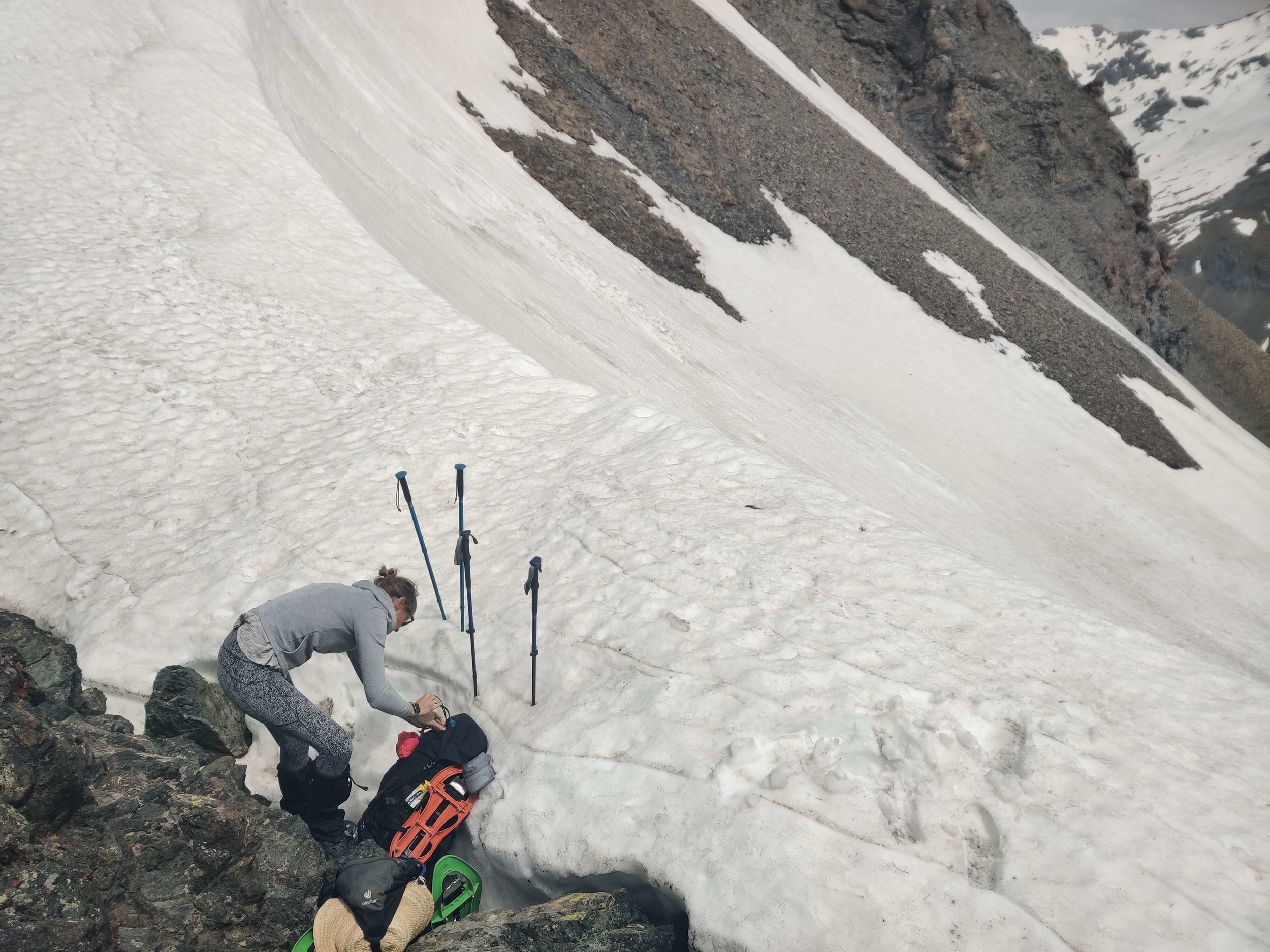
We'd heard there was soft, knee-deep snow to cross Grand Col Ferret so we set out early to give us enough time in case we had to wade through the snow. The descent to Chalet Val Ferret from Refugio Bonatti was mostly snow free but still a few steep snow patches to deal with. Lots of foot holes to help out though! The trail from Refugio Elena up to Grand Col Ferret isn't very obvious as there is snow covering major sections. Therefore hikers before us had chosen different paths to take. We used our microspikes and ice axe (mostly for confidence) to make it up to the snow line (2,400m 7,875ft). From there, we were completely on firm snow tracks up to the Col and then down the other side for ~2km / 1.2mi.
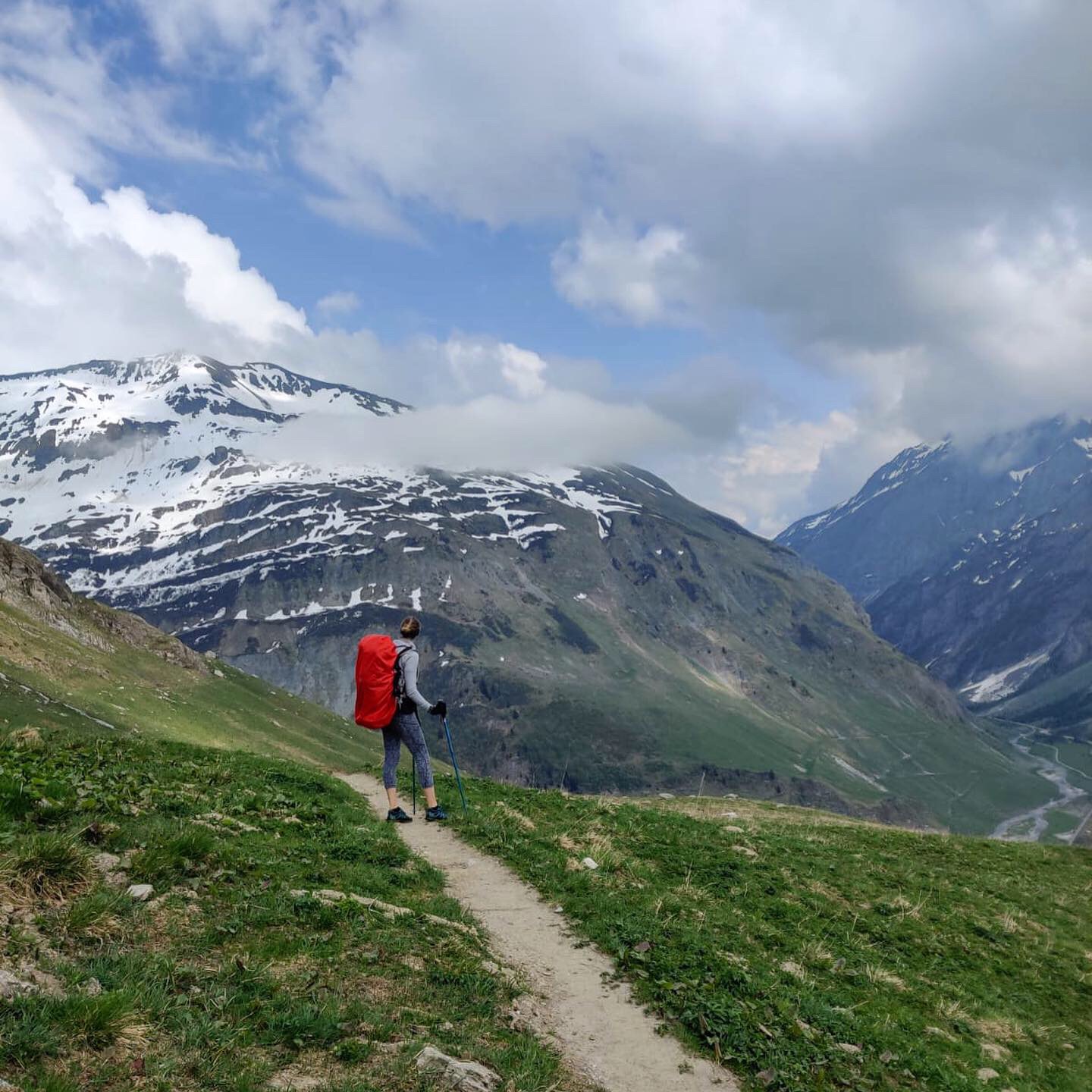
Compared to previous sections, the ascend to Grand Col Ferret wasn't as difficult due to the firm snow. We weren't too lucky with the weather until this point. Mostly fog and rain. But for those minutes when the clouds cleared, the views back to Mont Blanc and glacier Pre de Bar were spectacular! Grand Col Ferret marks the border between Italy and Switzerland.
From La Fouly onwards, we followed the gushing La Dranse de Ferret river all the way down to Issert, when we turned off to complete the final, gruelling climb up to our finishing point of the day, Champex-Lac. Our fondue dinner was an unimaginable delight! Happy to be back in Switzerland!
JUNE 10th: Champex-LaC >> LA PEUTY (AND BACK!)
Total Distance: 15km / 10mi (31km / 19mi return)
Total Elevation Gain: 753m / 2,470ft
Snow Conditions: Minimal
Originally we had planned to take the Fentre DÁrpette variation, but due to current snow conditions, we decided its not a safe option for us. Therefore, we'll be back to update on this variation in a few weeks. Instead, we took the Alp Bovine trail which only has a few flat snow patches, otherwise snow free. It was nice to have basically a snow-free day! No major trail updates on this section - only notable thing is that one of the major rivers on the way up to Alp Bovine was flowing strong and most of us got wet feet crossing it. A tame issue to deal with compared to other days! ;)
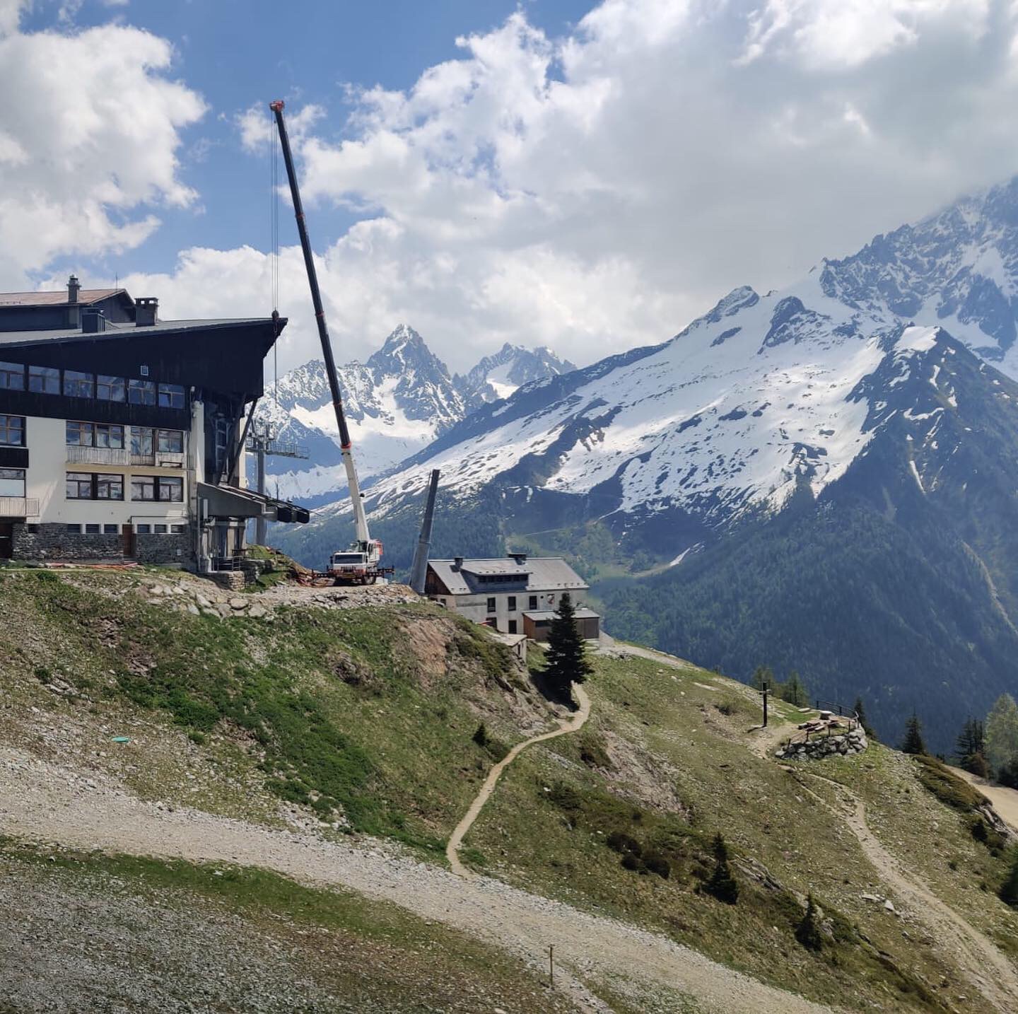
Today marks our final stage on our TMB journey this time. Tomorrow we have a rest day before we start our next hike as part of our Triple M hike, the Walker's Haute Route. This trek is usually from Chamonix to Zermatt, but as we've already completed the Chamonix to Champex-Lac sections as part of the TMB, we will start from here and head towards the Matterhorn.
JUNE 11th: Rest Day in Champex-LAc
Soak the body in the lake
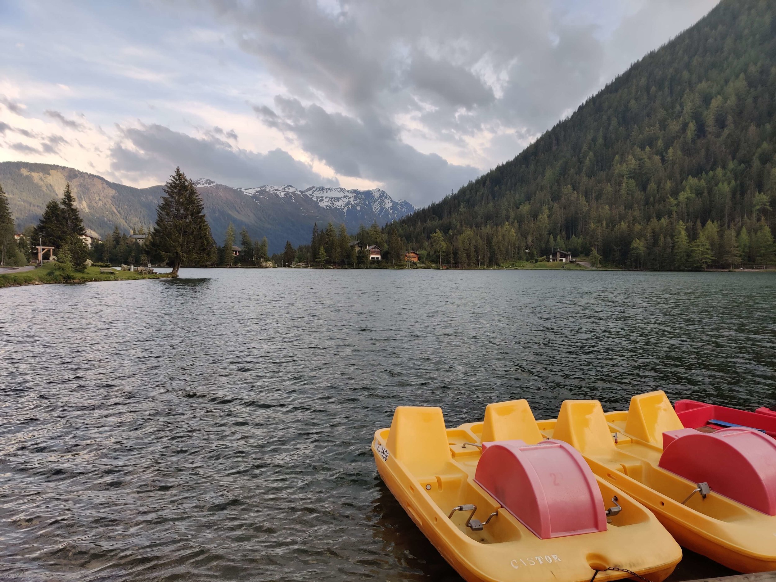
✔
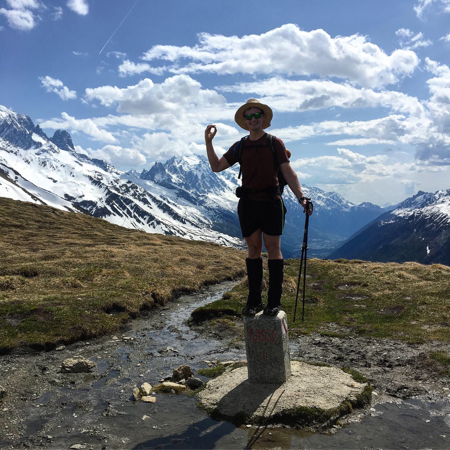
Walkers Haute Route
211 km / 131 mi
Trail Updates: Haute route
June 12th (Part 1): CHAMPEX >> Cabane du Mont Fort

Distance: 27km / 17mi (we shortcut most)
Elevation Gain: 1,815m / 5,950ft (we shortcut most)
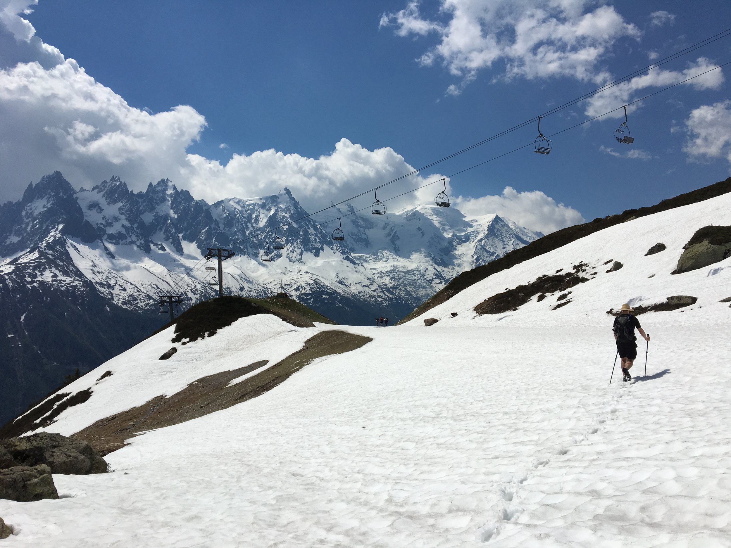
Snow Conditions: Snow patches from Les Ruinettes, Snow line at 2,300m / 7,550ft
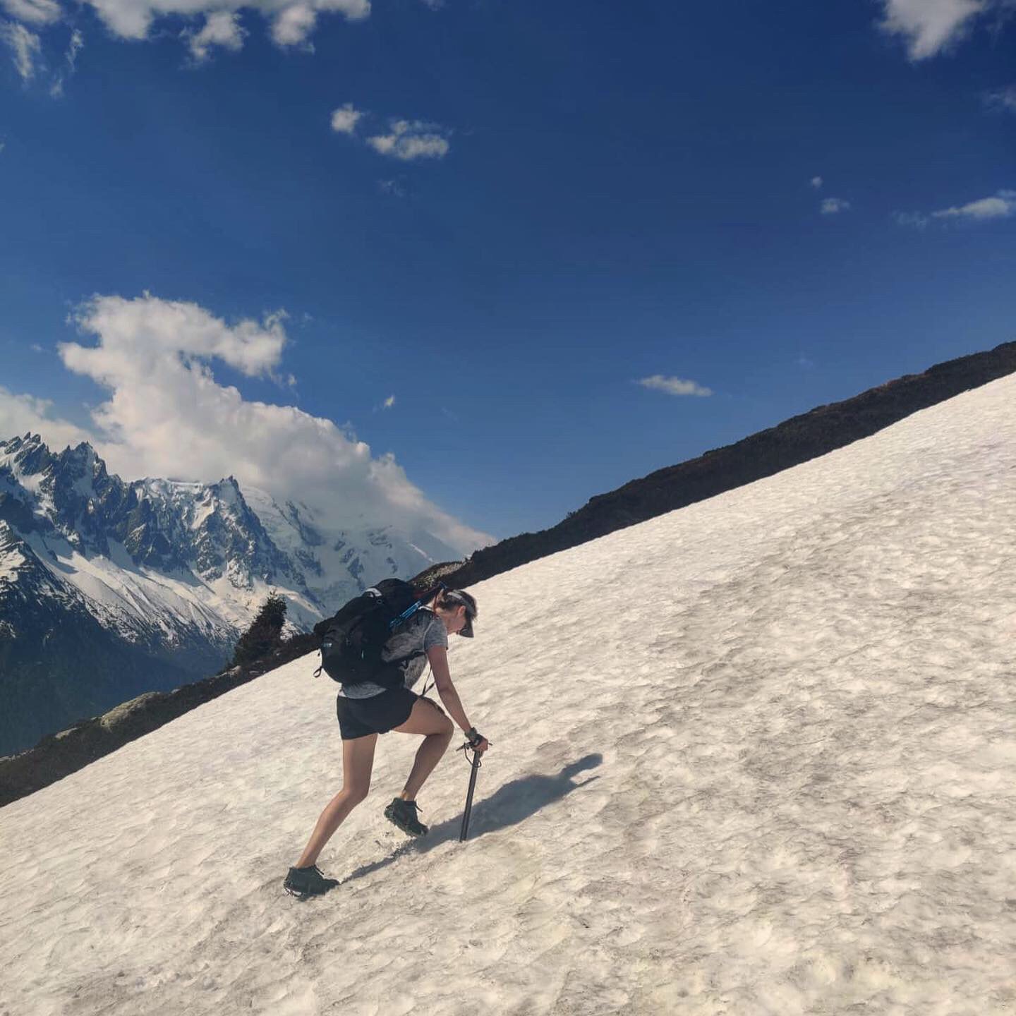
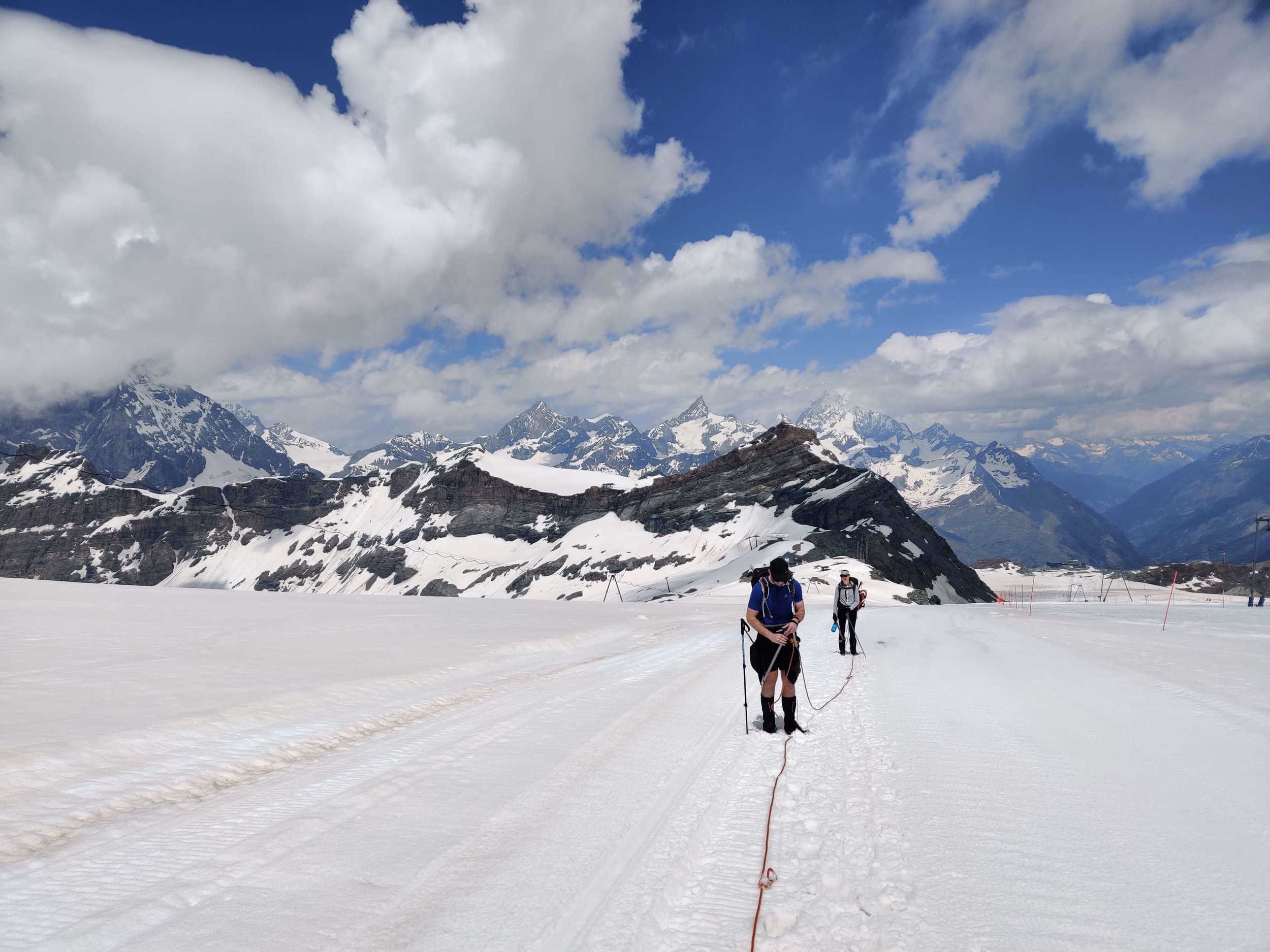
We'd heard from the guardian at Cabane de Louvie that we could not make it there from Cabane du Mont Fort as the trails were not yet passable due to the amount of snow still around. The Sentier trail traverses a steep slope which requires mountaineering equipment/skills to pass when there is snow and col de la Chaux follows a ski run nearly to the top before becoming very steep for the final ascent. We decided to acquire some snowshoes and use a few shortcuts (bus/train/gondola) to reach Les Ruinettes (everything before this is clear of snow!) by mid morning and give ourselves time to determine whether we should attempt either of these trails. On the way we read the latest avalanche report that mentioned that there was a considerable risk of avalanche due to the amount of snow still around and the warmer weather creating instability in the snowpack. The Verbier tourism office also highlighted that the Sentier trail and Col de la Chaux both have an avalanche risk due to their slope gradients. We had clear trail until about 2.5km (1.5mi) from Cabane du Mont Fort where we strapped on the snowshoes and slowly continued on the soft snowpack. Arriving at the closed Cabane, we made a picnic lunch on the deck and discussed our options. We decided that the avalanche risk was too great and we wouldn't have time to reach Cabane de Louvie if we attempted but did not make either of the trails so decided to come down and take the alternative route to Louvie via the valley. The trails between Cabane du Mont Fort and Cabane de Louvie aren't expected to be passable for at least another two weeks.
June 12th (Part 2) and 13th (Part 1): Fionnay >> Col Termin (Return)


Distance: 6km / 4mi (12.5km / 8mi return)
Snow Conditions: Snow patches starting from 2,100m, snow line from 200m before Cabane de Louvie
The trail up to Cabane de Louvie is snow-free until the last 500m when snow patches begin and then the snowline appears. This area of the valley is a nature reserve and you are likely to see herds of ibex with big horns. The ascent/descent to Louvie doesn't require any special gear (i.e microspikes etc) as there are many tracks that mark the trail and provide foot holes. The trail up to Col Termin (and Col de Louvie for that matter) has not been tracked yet. We were the first ones to attempt to get to Col Termin. This section is mostly covered with snow - ranging from softer, deep snow to harder, rock and snow slides. We used microspikes and ice-axes to make it up close to Col Termin. At this stage its not possible to continue on to Cabane Mont Fort via Sentier trail as there is still too much snow and the avalanche risk is high. The guardian at Cabane de Louvie expects it to be unpassable to Cabane Mont Fort or Cabane de Prafleuri for at least another 2 weeks.
For those that had planned to cross the Grand Desert in the next 2 weeks, I recommend considering a few alternate routes:
(1) A day hike from Verbier up to Cabane Mont Fort (and back!) is still worth while. You can then return to Le Chable and take transportation to Arolla.
(2) Hiking up to Cabane de Louvie (if you hadn't planned) either for the day or to stay the night is as beautiful and scenic as the Sentier Trail. There is daily bus transfers from Le Chable to Fionnay.
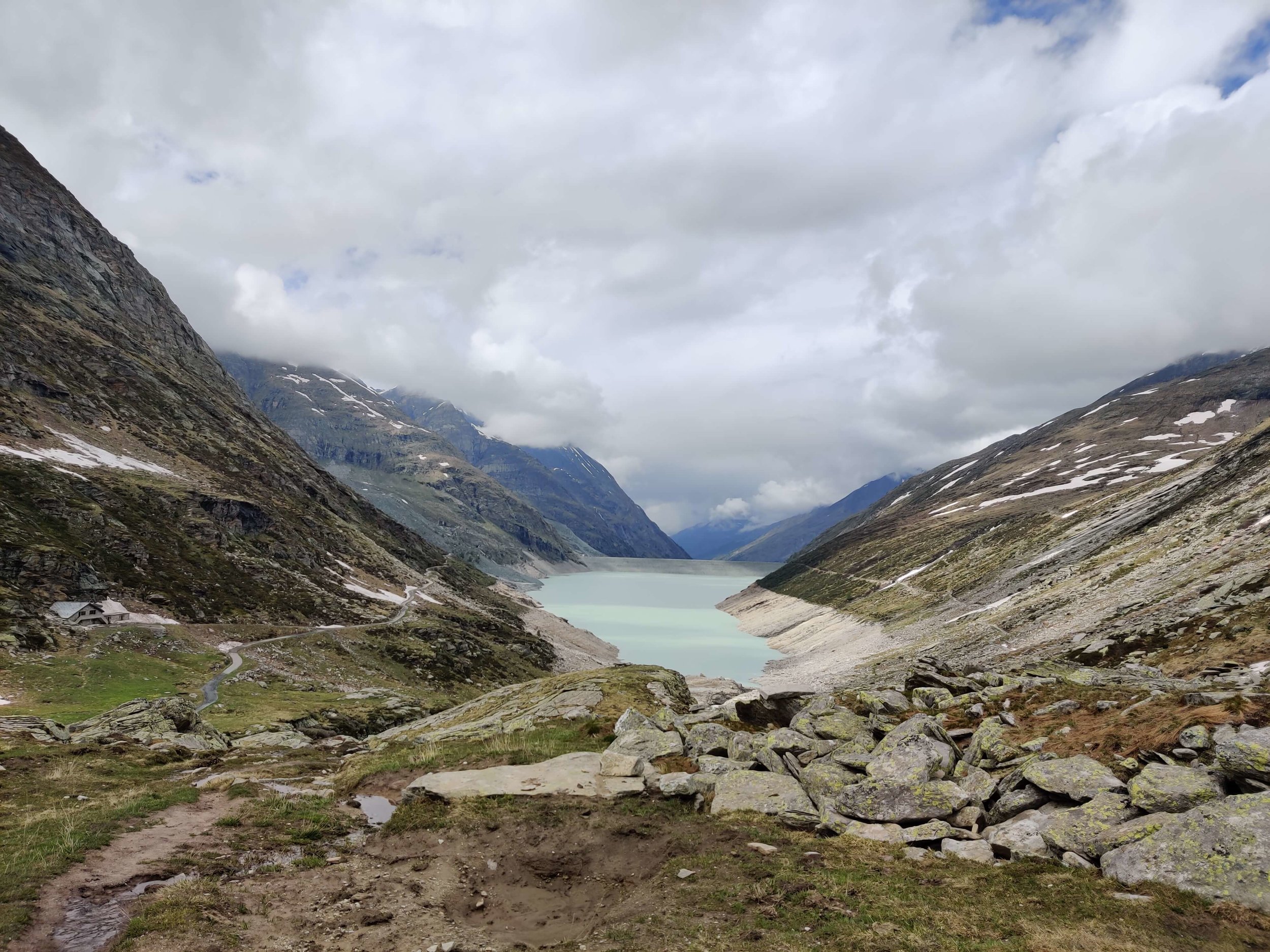
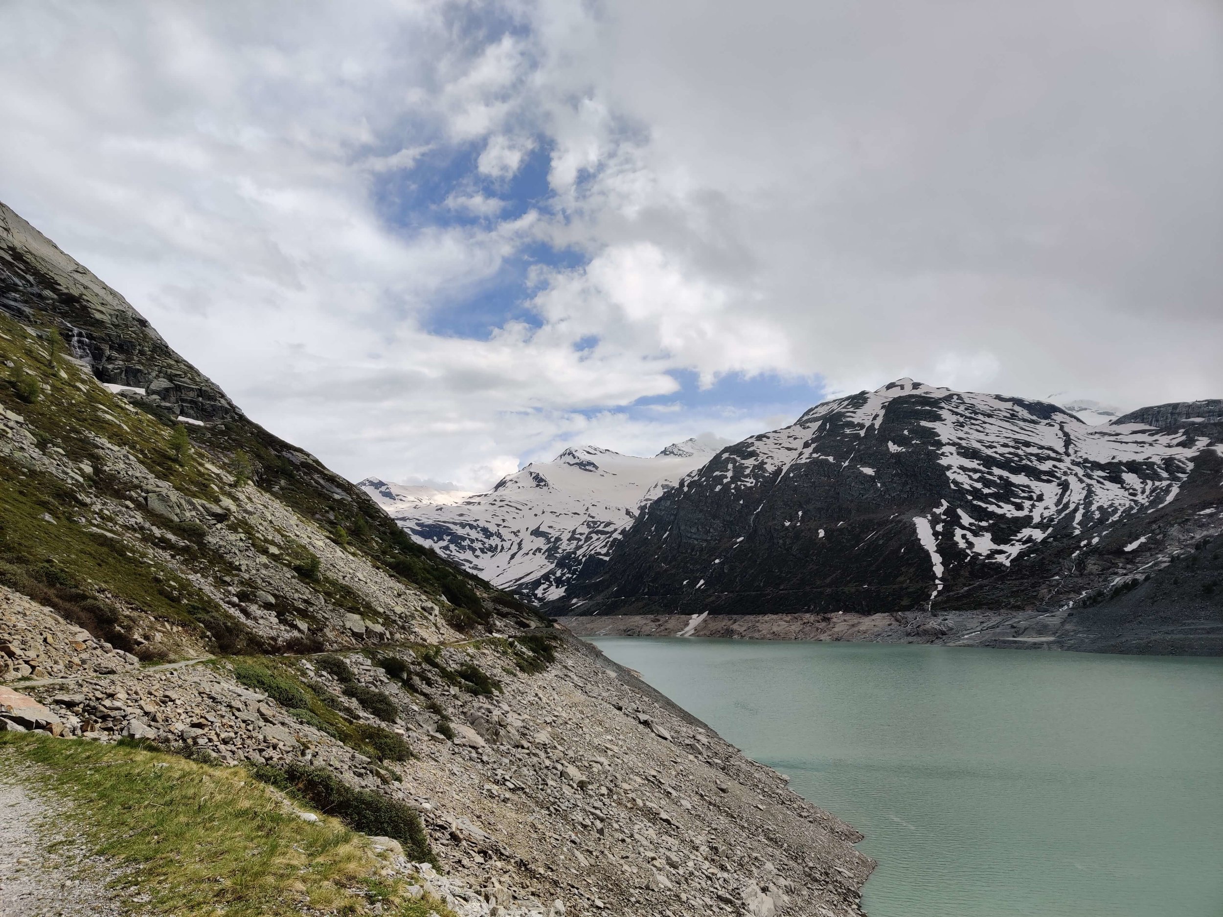
(3) Take a transfer to Grande-Dixence for either the day or stay overnight, to explore Grande-Dixence Dam, the highest gravity feed dam in the world. Then take transportation to Arolla.
(4) Head straight to Arolla from Le Chable and hike/snowshoe up to Pas de Chevres (and back) to see the Des Dix valley, containing the Cabane and Lac.
June 13th (Part 2): Pas de Chevres to Arolla (return)


Distance: 5km / 3mi (10km / 6.5mi return)
Snow Conditions: Snow line starts at the top of the main valley chairlift (2,500m / 8,200ft)
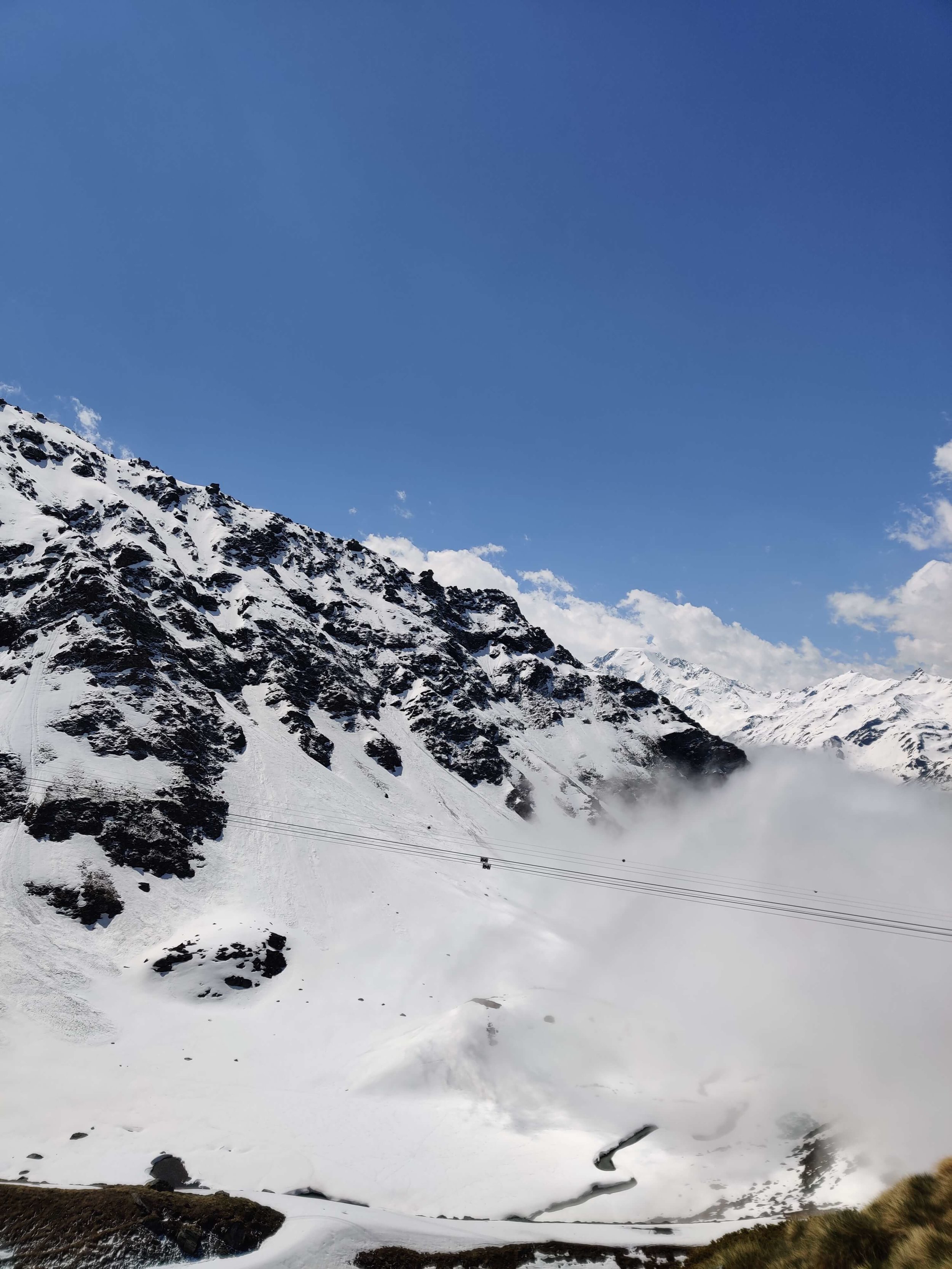
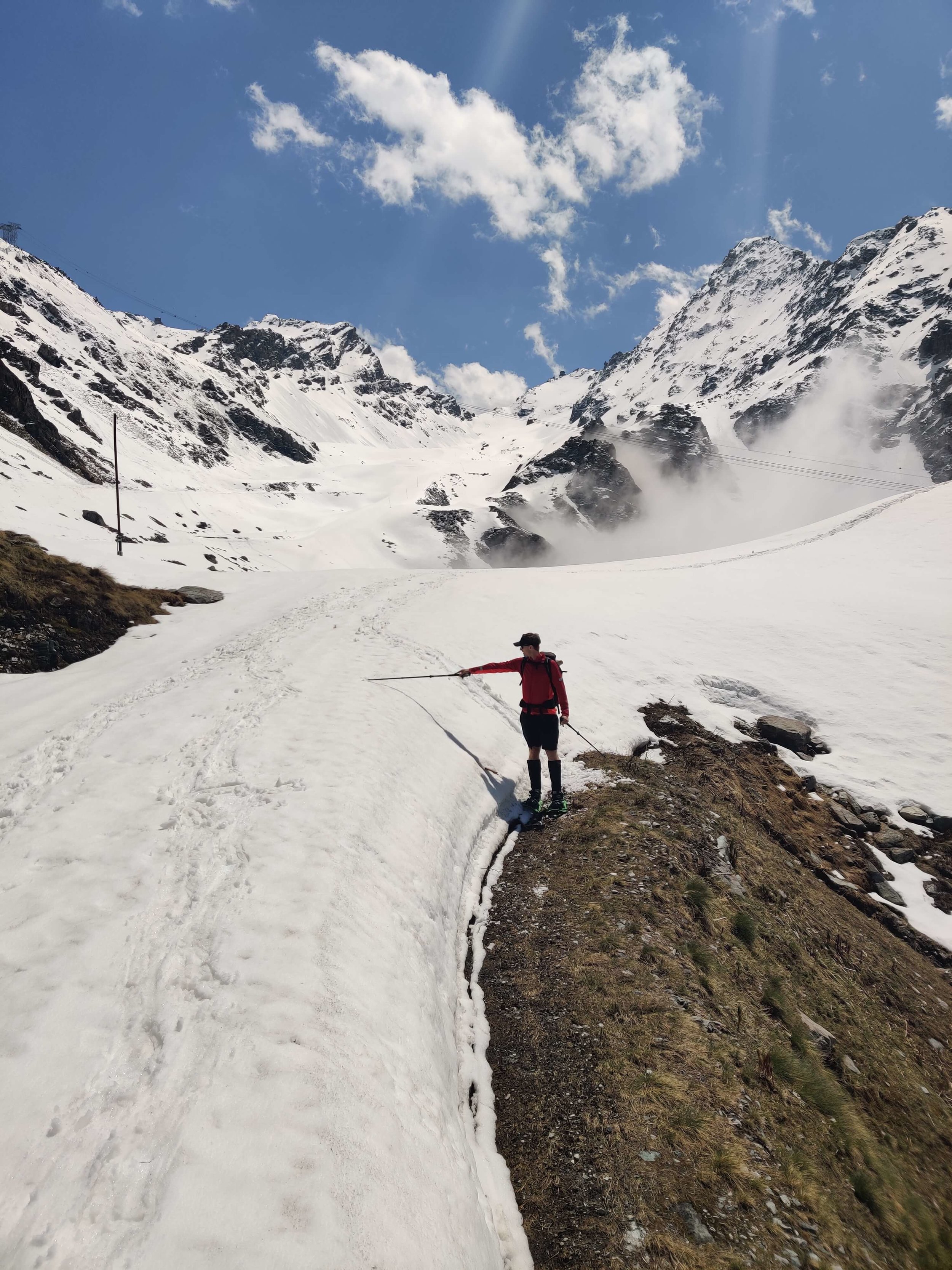
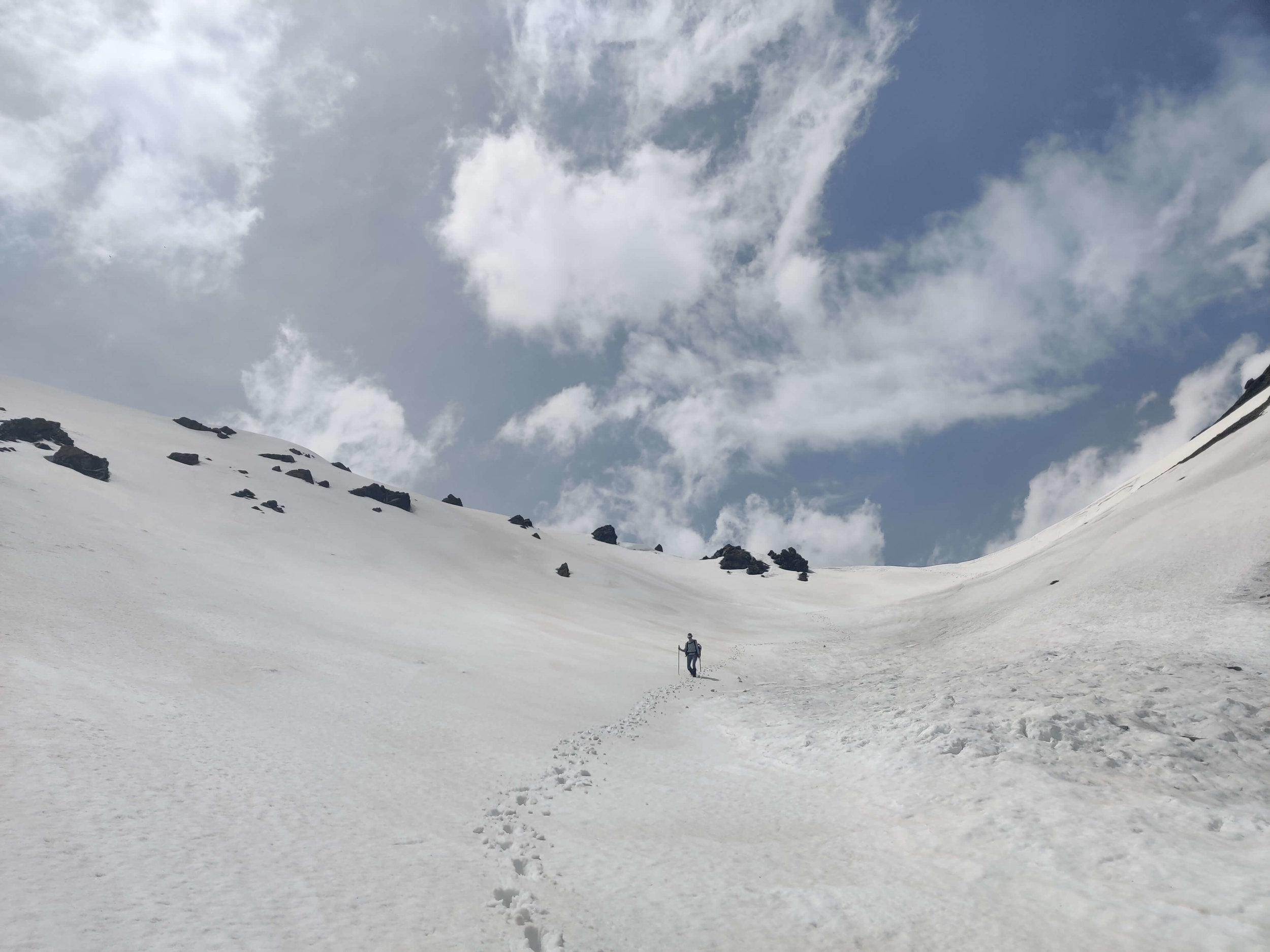
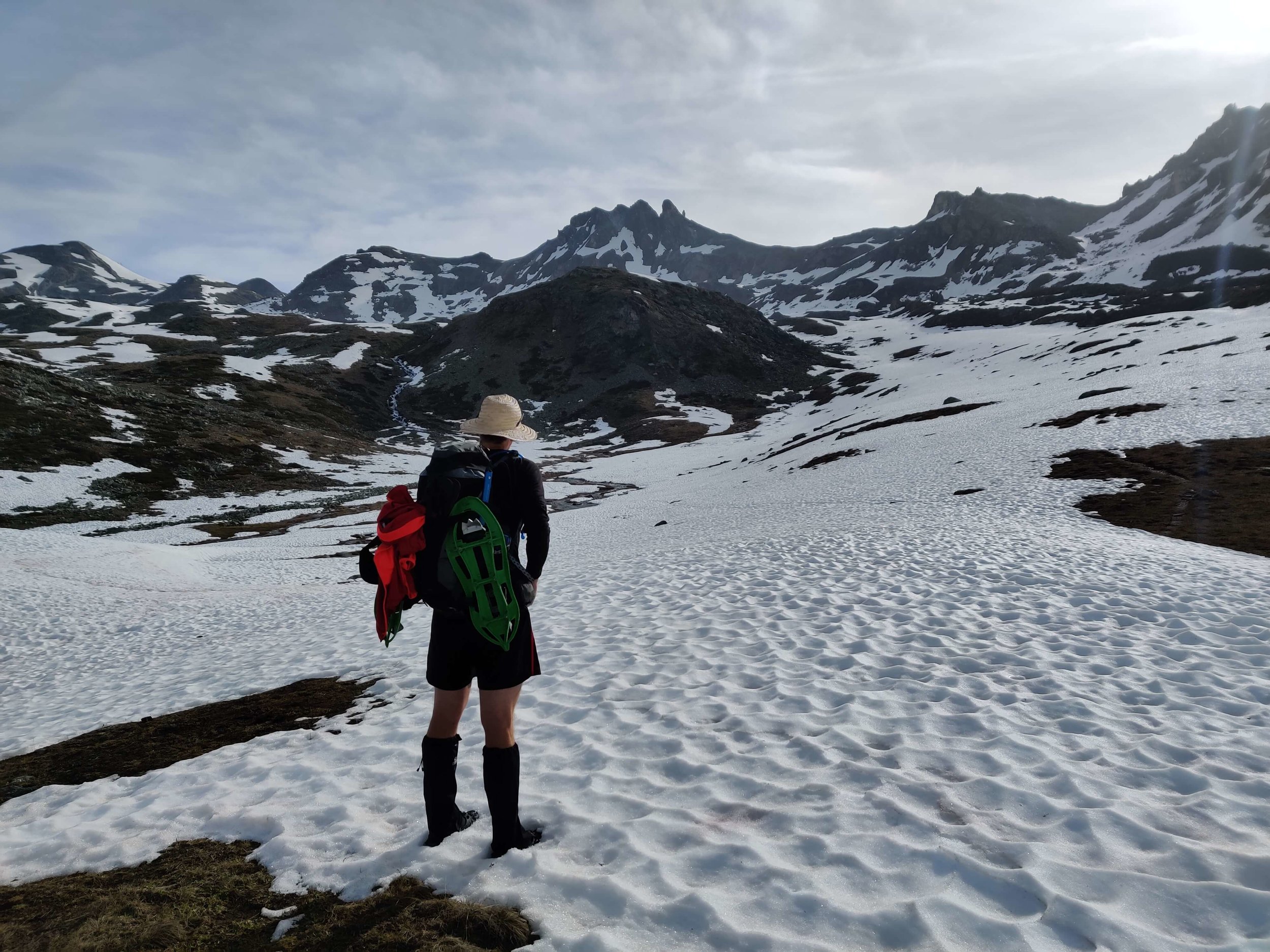
Today's update is in 2 parts because we weren't able to cross the Grand Desert due to the amount of snow and avalanche risk. The previous 2 posts provides an update on the trail from the Verbier and Cabane de Louvie side, and this update is from the Arolla side. We hiked/snowshoed up/back from Arolla to Pas de Chevres to check out the trail conditions and see what its like in the Des Dix valley.
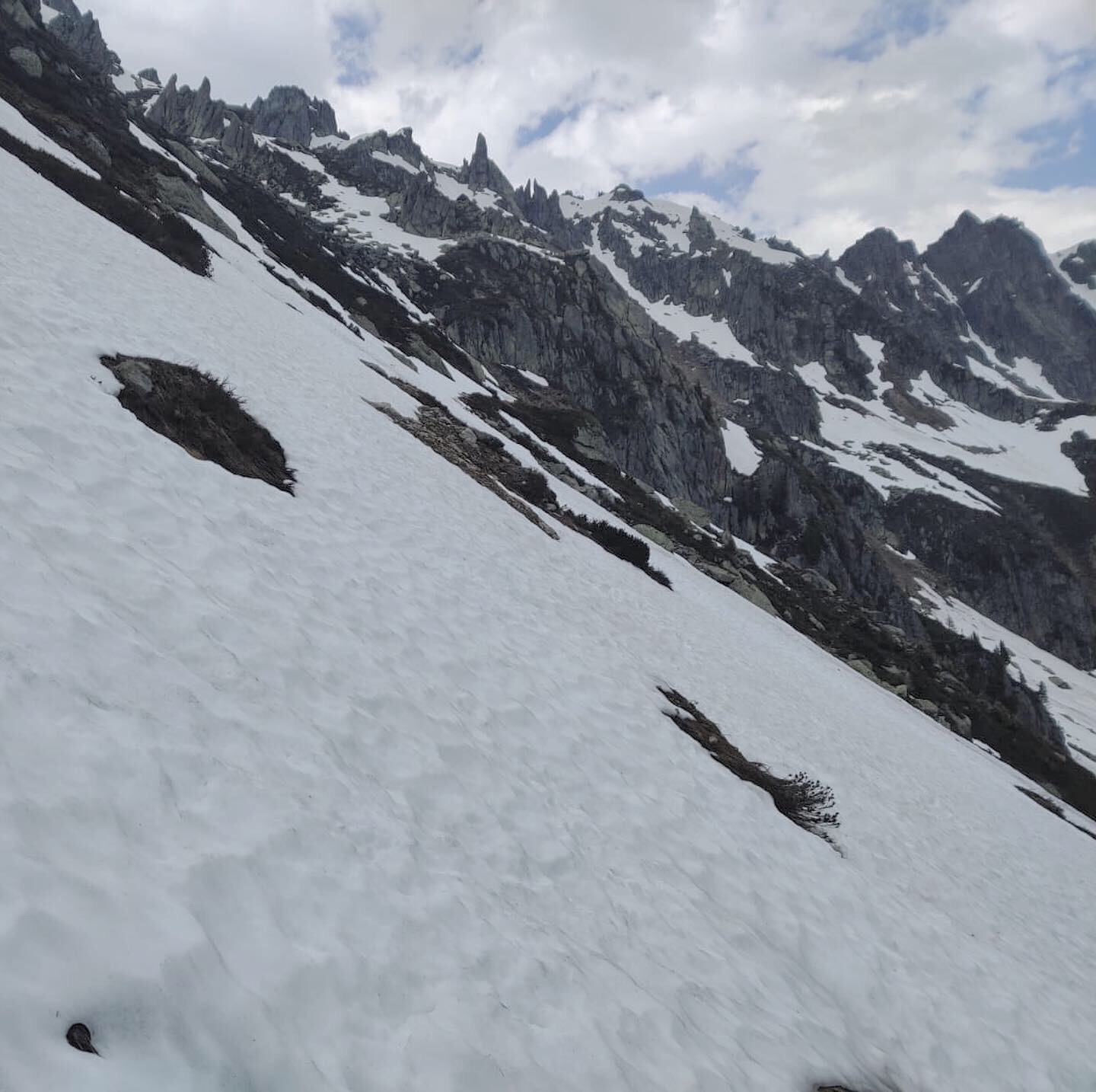
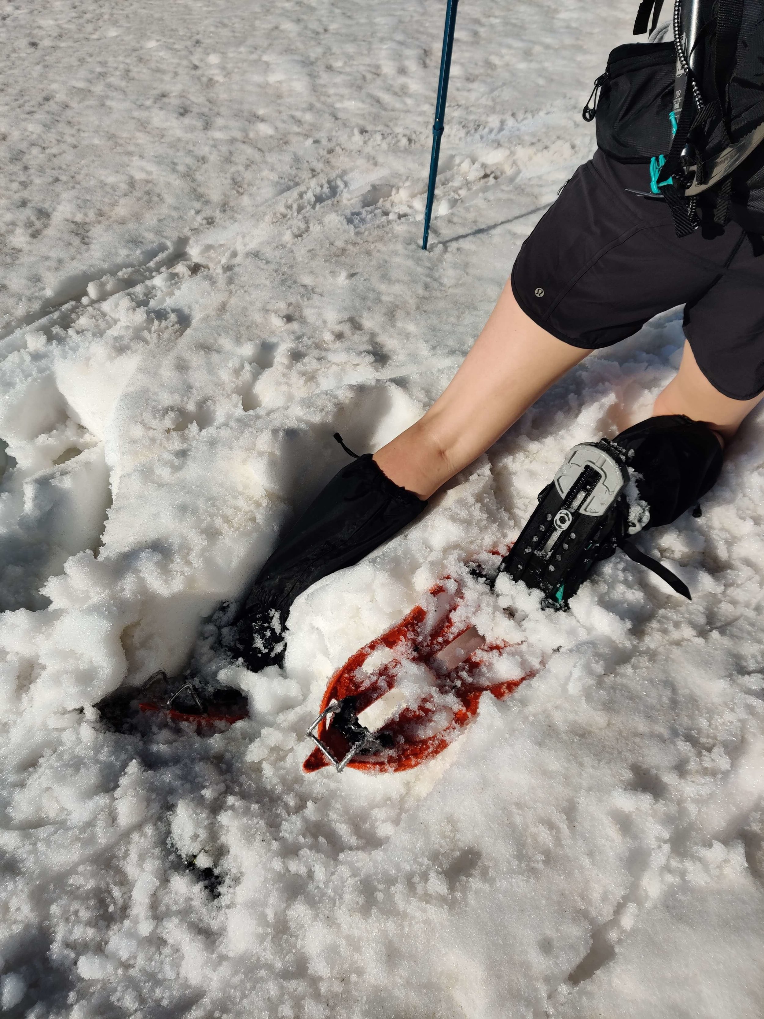
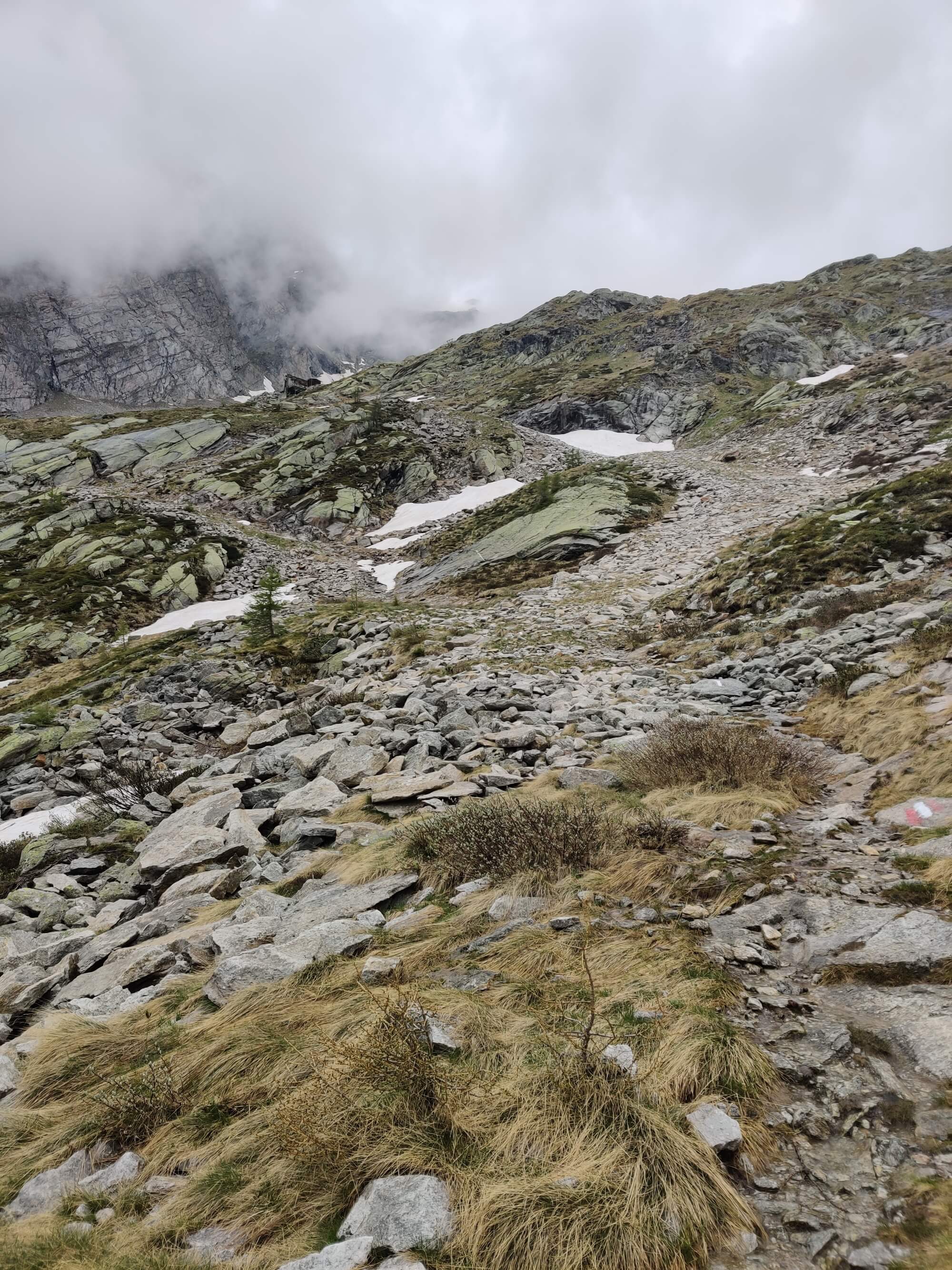
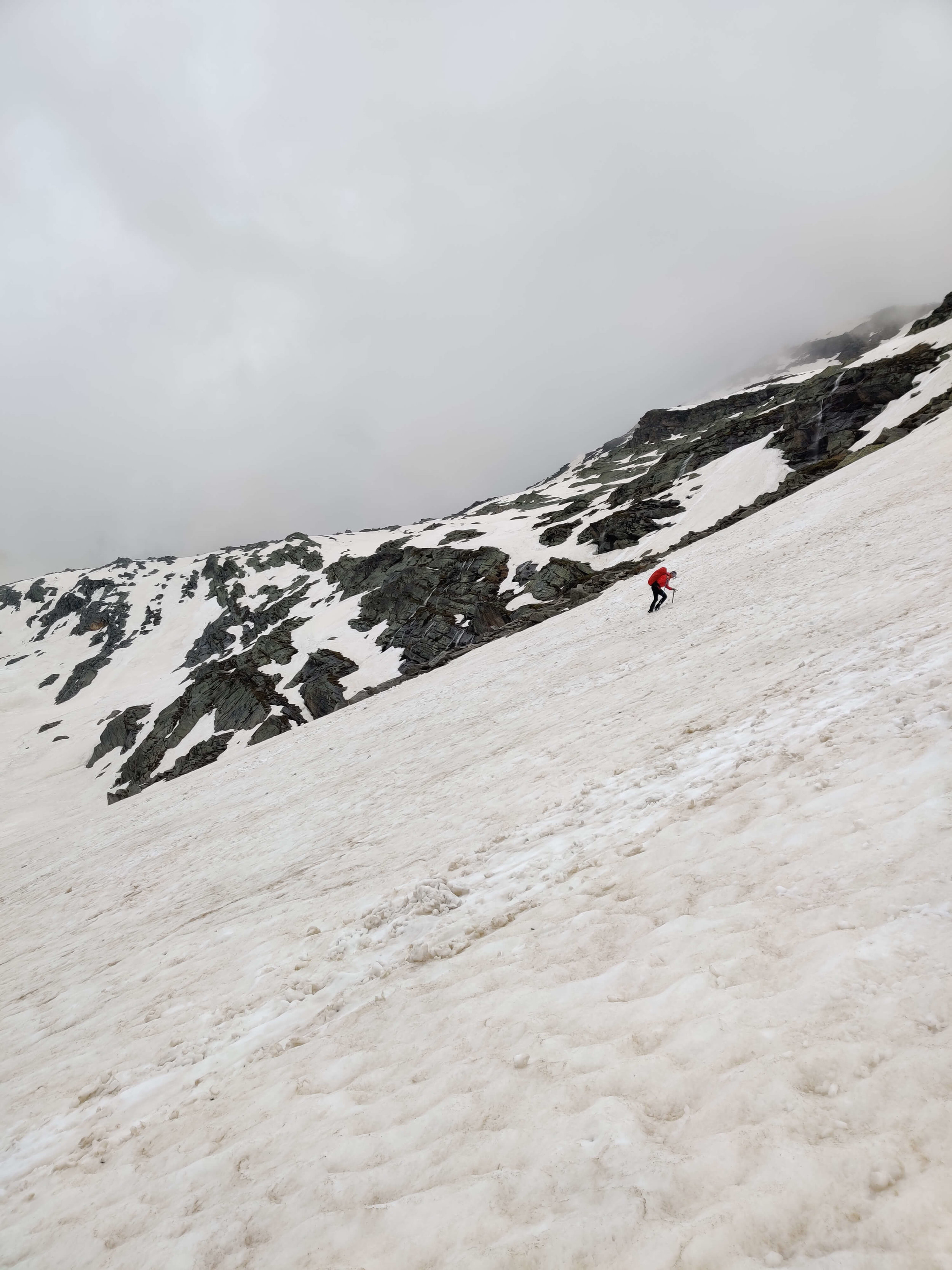
As you can see from the photos, there is a significant amount of snow in the Des Dix valley. We snowshoed up to Cabane Des Dix about 2 months ago and the amount of snow between Pas de Chevres and the Cabane doesn't look much different! It's going to be a few more weeks until a lot of the snow has melted and the glacier crossing is safe for hikers. Due to the snow, there are no visible trail markers on the first 2km descent into Arolla ski area due to snow from the pass. The first section is quite steep but so far there aren't any icy sections so you end up half walking, half sliding. After the steep section we were able to move quite quickly as we had our snowshoes with us, preventing us from postholing in the deep, soft snow. If you are unfamiliar with the first section of trail, make sure to stay to the north side (or left side when hiking down) to avoid where a large avalanche has come down onto the trail (See photos). The trail after the snow line is a nice easy descent into the Arolla valley.
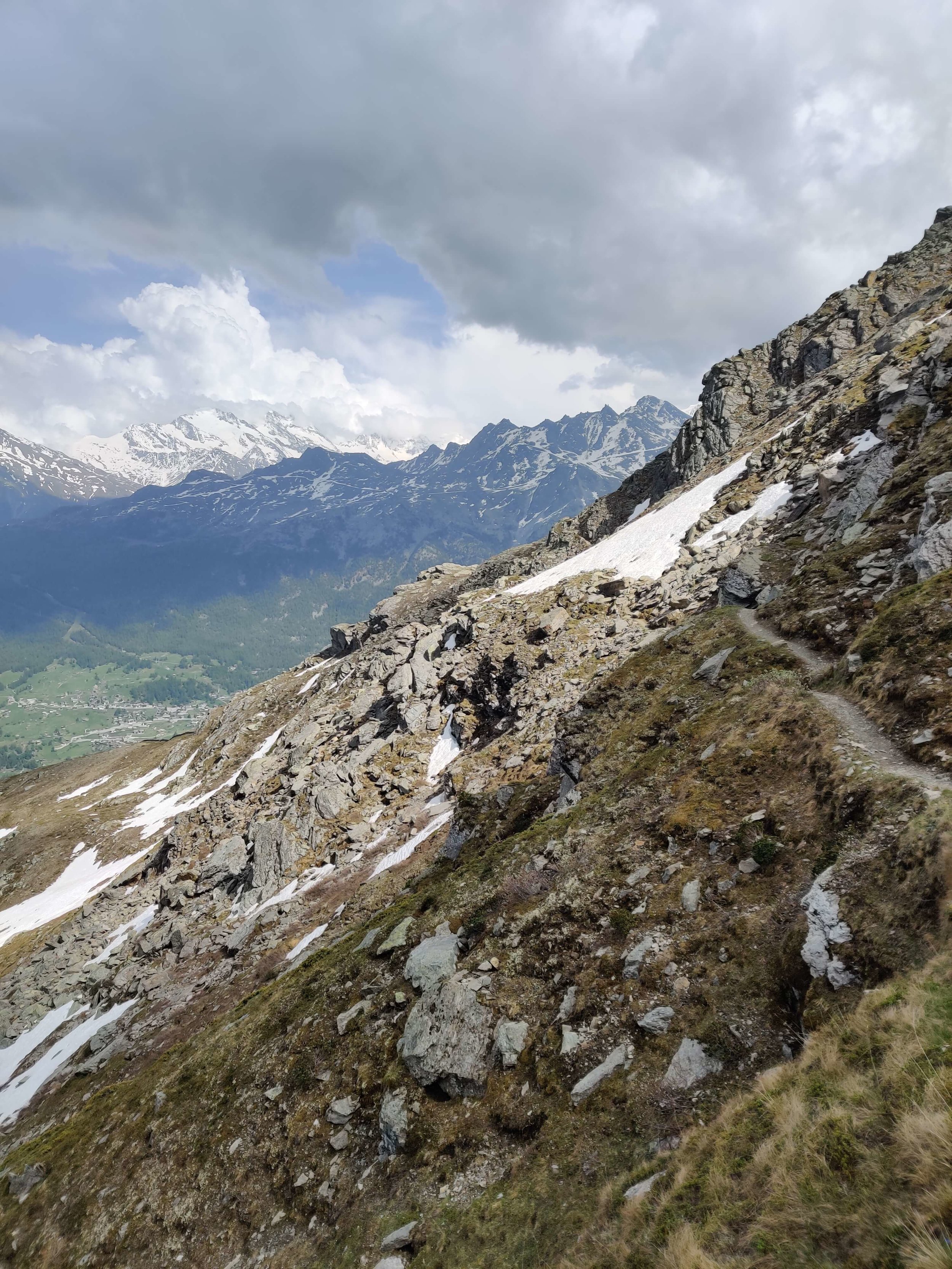
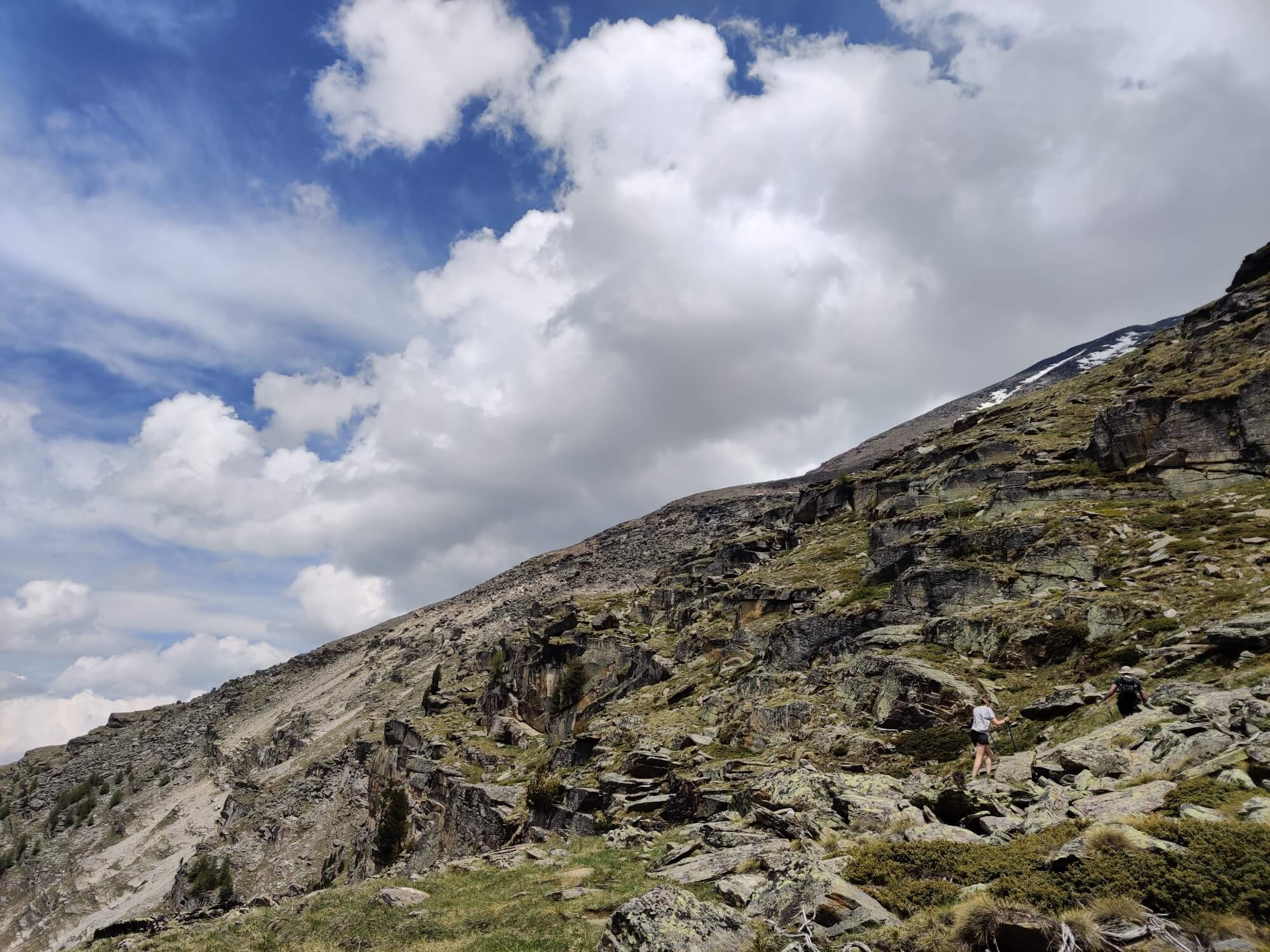
June 14th: Les Haudères to Parking du Glacier (via Col du Tsate)
Distance: 10km / 6mi
Snow Conditions: Snow line on ascent to Col du Tsate at 2,550m / 8,370ft (although could go around most of it) - snow line down to 2,400m / 7,900ft on descent
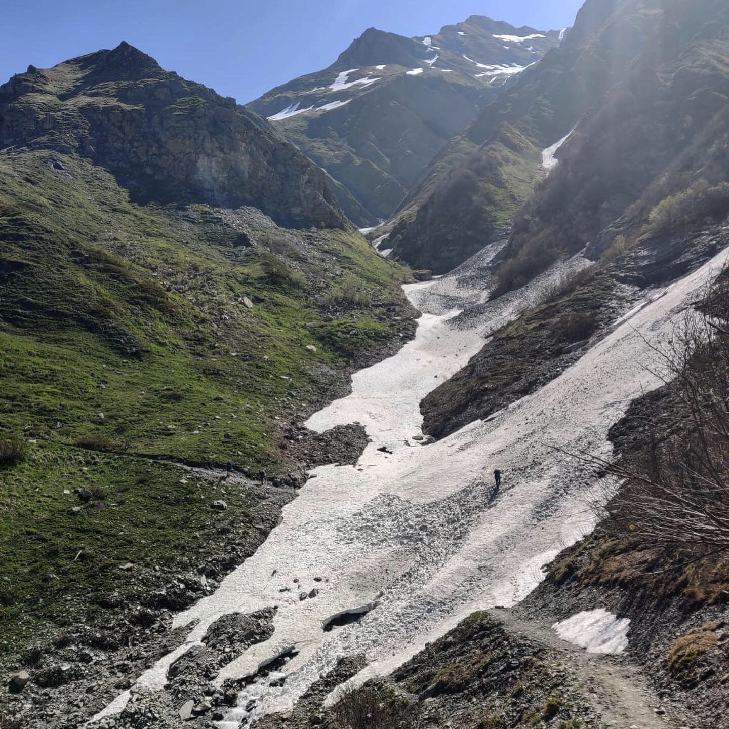
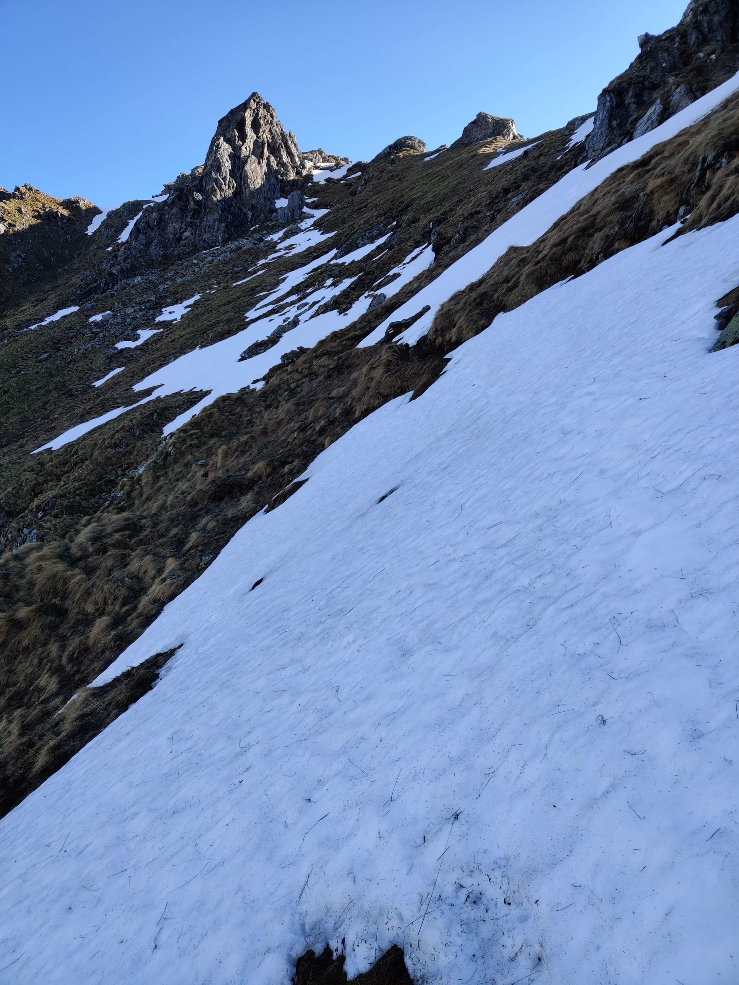
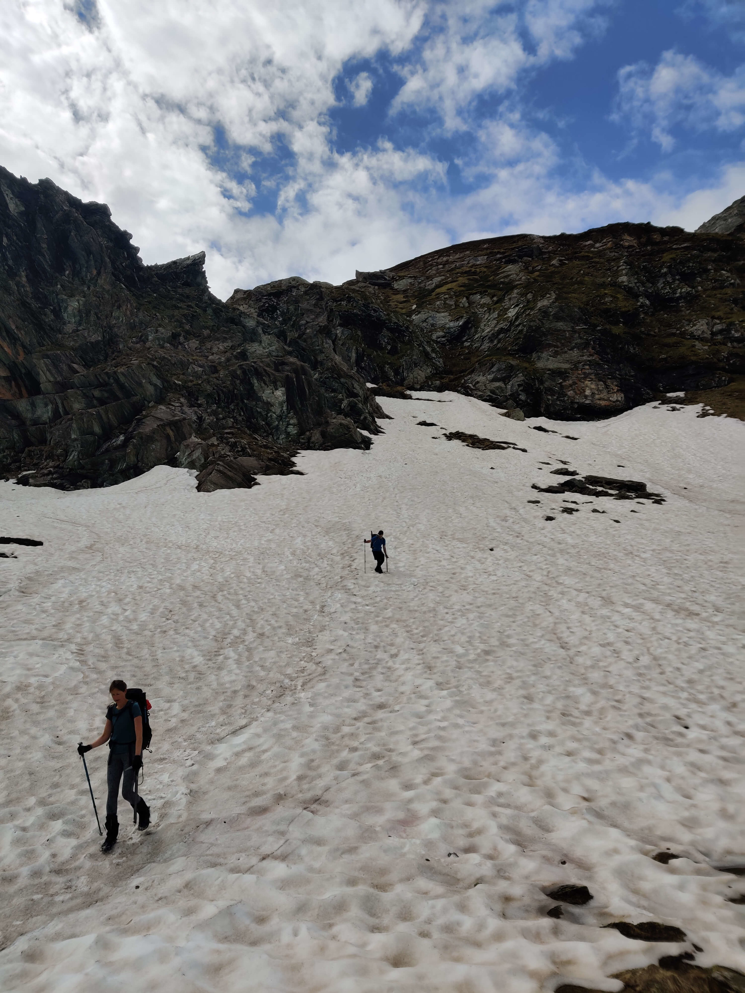
The climb from Les Hauderes to Col du Tsate is tough on the best of days with a 1,400m / 4,600ft elevation gain. Luckily, due to the trail mostly staying to the south-facing side of the valley, there were only a few snow patches until the last ~1km (0.6mi) where it was covered by snow. The last 100m was the most challenging as we zig-zagged up a steep snow section to get to avoid ascending on loose shale.
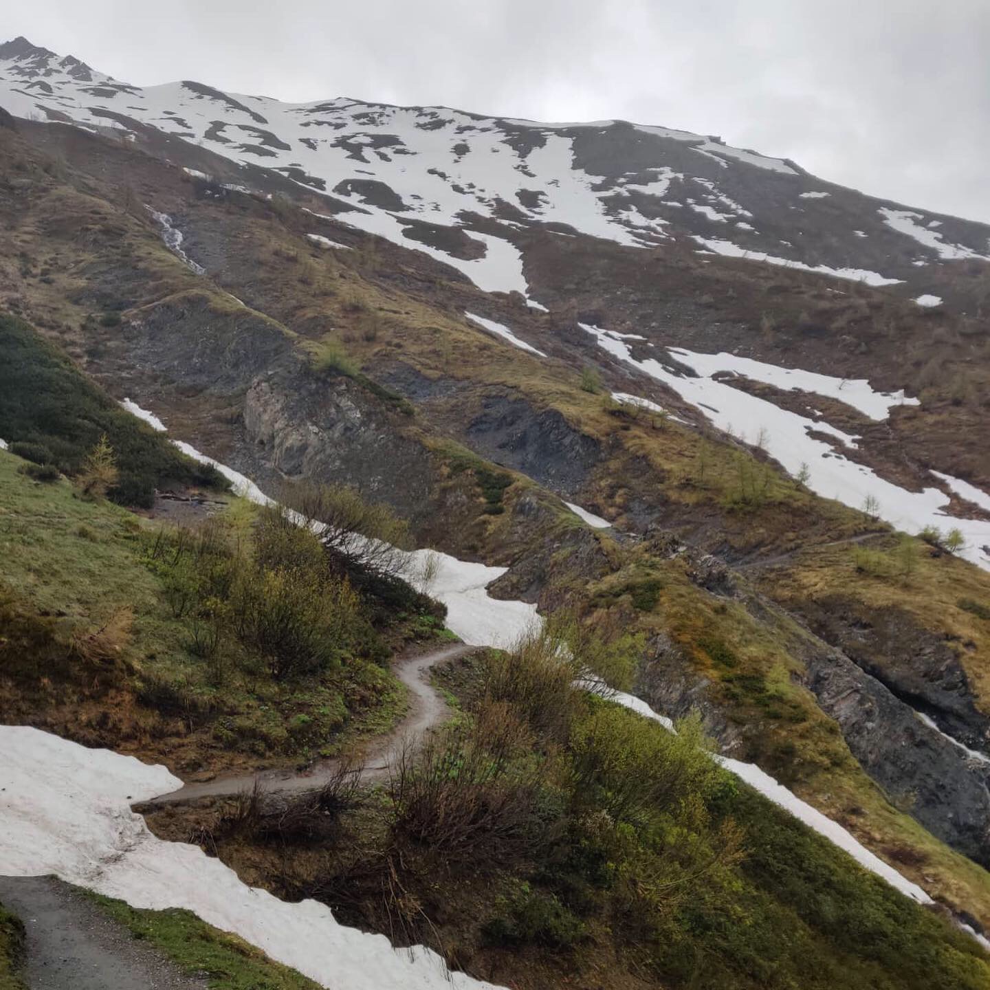
The descent on the Moiry side was a whole different story! It was quite intimidating on arrival at the Col as the snow bank is ~2m immediately in front of you. So straight away you have to step up onto this and complete a steep traverse across/down the snow. We used microspikes and ice-axes to safely cross this first section, zig-zagging until we reached an easier gradient where we continued down the left side of the bowl to avoid the avalanche risk on the right. The snow was mostly firm enough for us to walk in microspikes and not sink too much for ~1.5km. There were no visible trail markers so we used our mobile map to stay close to the trail. We struggled a bit at the junction point to Parking du Glacier and Barrage Moiry as the snow got quite soft and we begun sinking thigh deep - not fun. We tried to choose a better path but failed a few times which chewed up a bit of time. With snow patches all the way to just above Parking du Glacier (2351m), it was a tough 500m descent.
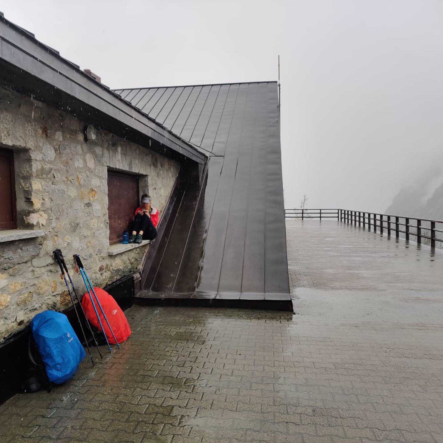
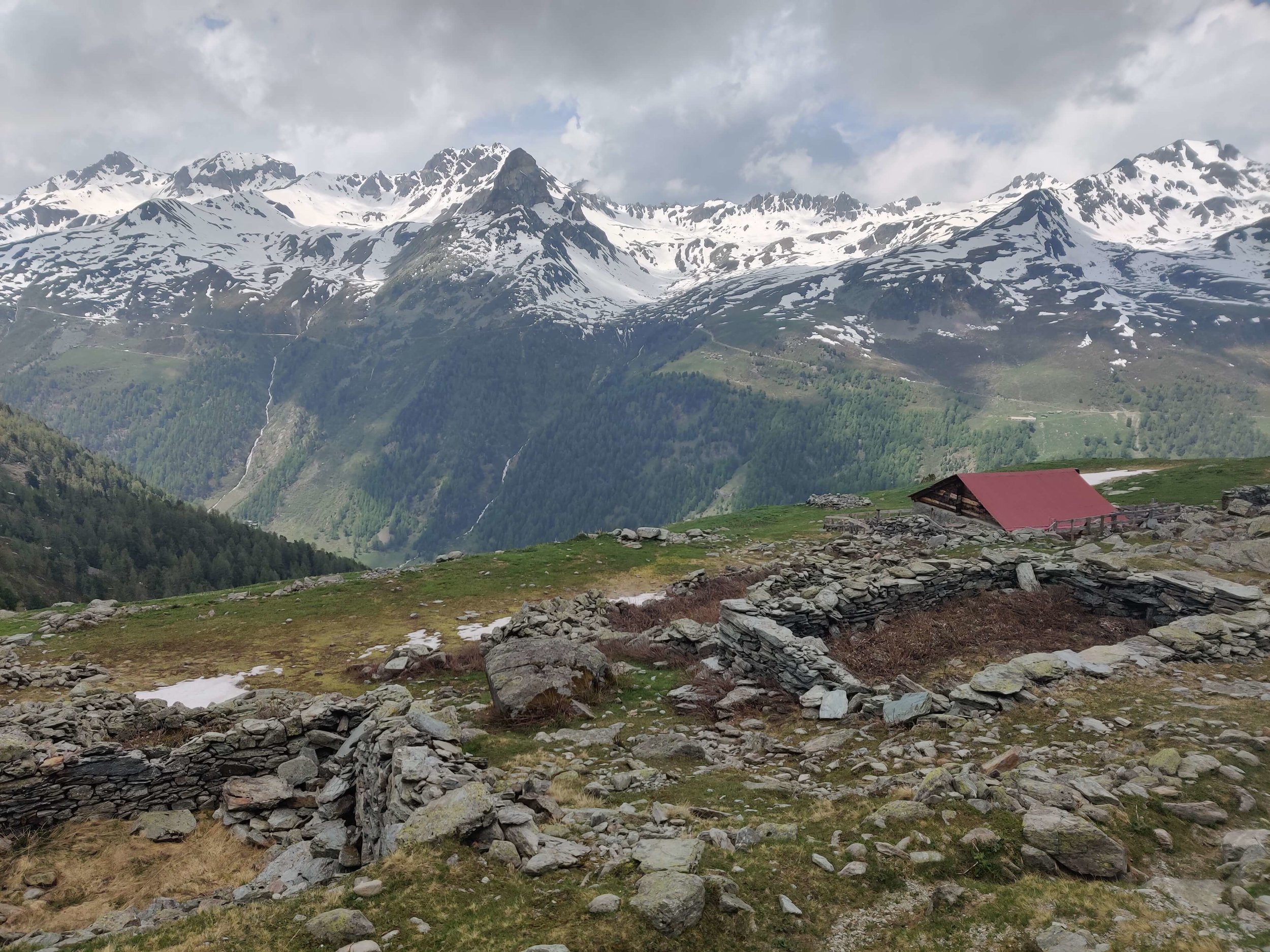
Unfortunately Cabane de Moiry wasn't open so we didn't attempt the trail. There did seem to be a lot of snow still covering the last section to the cabin so it will be great to hear an update now that the cabin is open. Instead, we hitch-hiked and caught a bus to St Luc then hiked up to Hotel Weisshorn for a little luxury.
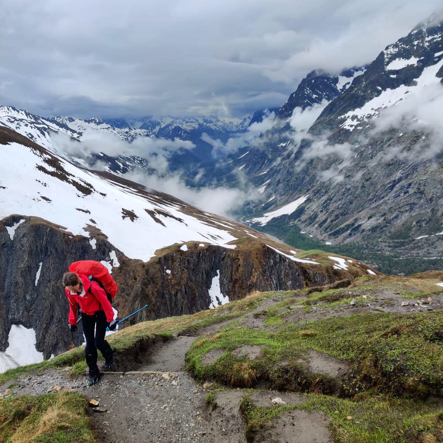
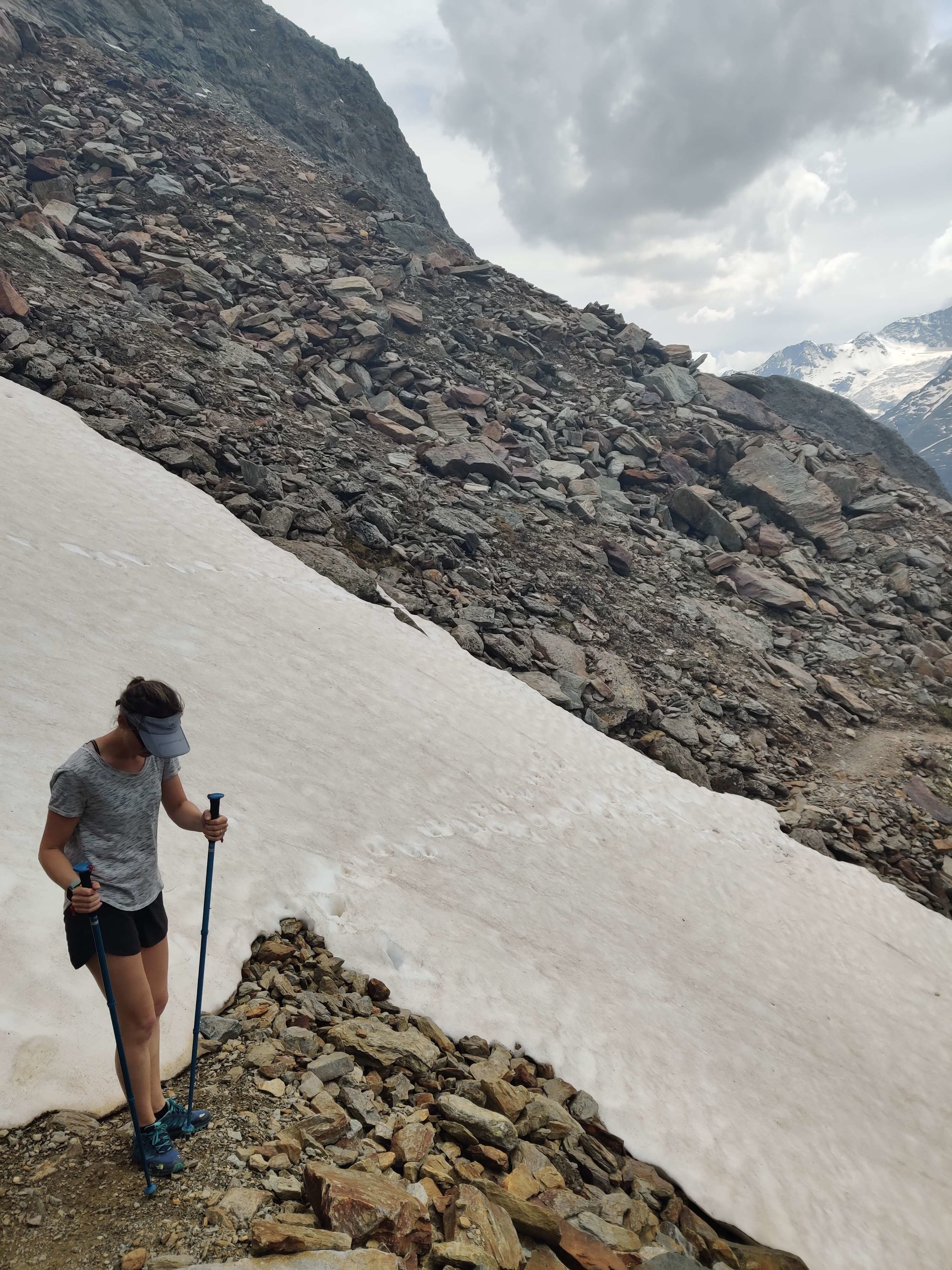
June 15th (Part 1): Hotel Weisshorn >> Gruben

Distance: 10.5km / 6.5mi
Snow Conditions: Snow line at 2,450m / 8,000ft on ascent , snow line at 2,400m / 7,900ft on descent
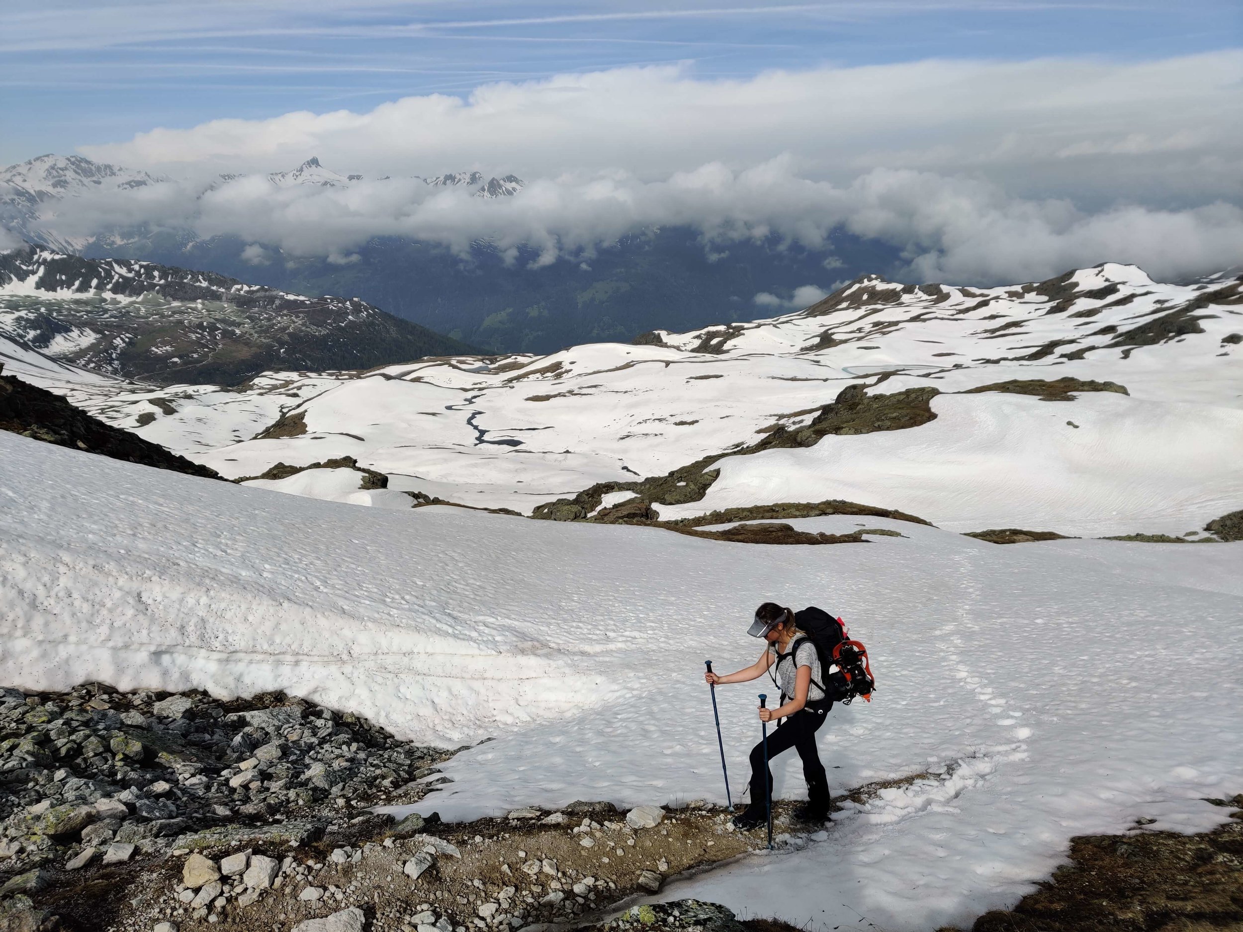
We set off early to give plenty of time to tackle Medipass (2,790m / 9,150ft) as we didn't have any trail updates from previous hikers. The snow line was at 2,450m / 8,000ft, about 2km / 1.25mi from the summit. It was firm enough that we didn't fall through and we're able to ascend with microspikes. The conditions weren't too difficult but due to the low snow line, trail markers weren't often visible so we had to keep checking our mobile map to ensure we were following the right route.
Upon summiting Medipass we were faced with an immediate steep descent. Without any previous hikers footsteps to follow, we needed to choose our own route down. We slowly zig-zagged down the steep, firm snowpack section using ice-axe and then put on our snowshoes when flat enough so we could move faster across the softer snow. There was snow for 3km / 2mi from the top, until ~2,400m / 7,900ft. Once we reached the first hamlet, there wasn't any more snow. We descended into the forest and made our own down towards Gruben.
No major concerns with this section - just make sure you factor in more time to descend the steep snowy sections and trudge through the deep, softer snow. This isn't a time to set a new PB!
June 15th (Part 2): Gruben >> St Niklaus


Distance: 17km / 10.5mi
Snow Conditions: Snow line at 2,500m / 8,200ft on both sides
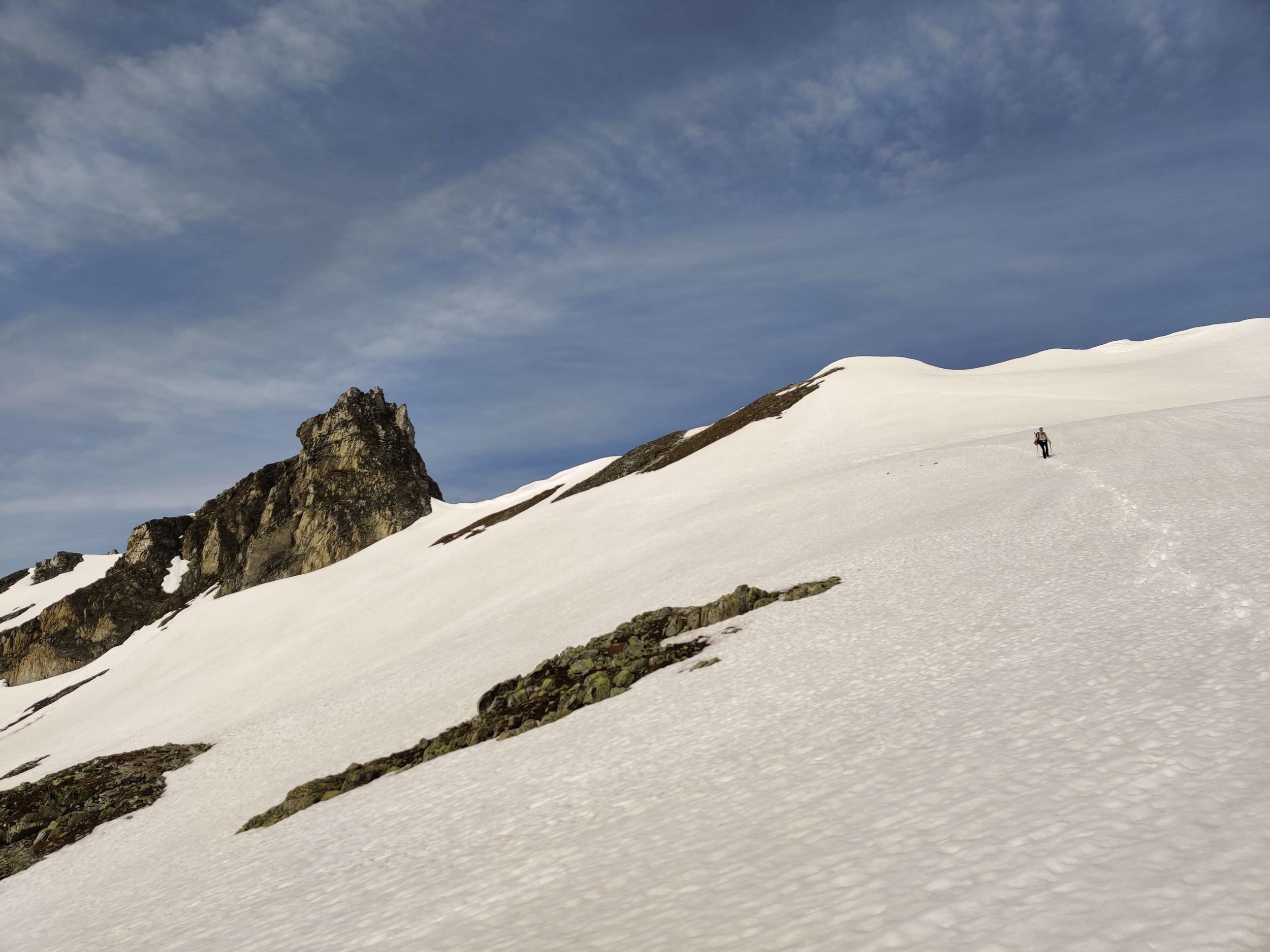
Leaving Gruben, the climb begins quickly and puts you straight into 4WD. As you climb through the forest there is nice shade cover and views back over Gruben and across the valley. Once you rise out of the forest you can see Augstbordpass from a long distance. The snowline appears 2km / 1.25mi from the summit. Instead of following the trail (which isn't visible due to snow), we decided to climb straight up the middle of the snowpack using our microspikes. This made it easier to make a direct route to the top, rather than snaking around the varied landscape. The last 100m was snow free and we zig-zagged easily to the top. The climb overall wasn't too difficult, just brace yourself for wet feet as you stomp through the soft snow.
Upon reaching the summit, the view across Augstbordpass and into the Mattertal is quite spectacular. Unlike previous passes, the initial descent is snow-free. You then hit the snowline at ~2,500m / 8,200ft and it's important you navigate on this section so you don't end up on the wrong side of the wide bowl. The official trail takes you up on the right side of the valley - across one of the few avalanches in this section. We stuck to the official trail but would not recommend it as there are some very steep and dangerous snow crossings.
Alternate route: There is a junction 1.9km / 1.2mi down the valley from the pass and instead of taking a right and going high, hugging the mountain, you can go straight and head steeply down and under the official trail. This will mean you avoid the dangerous snow crossings and shouldn't add too much time on your approach to Jungen.
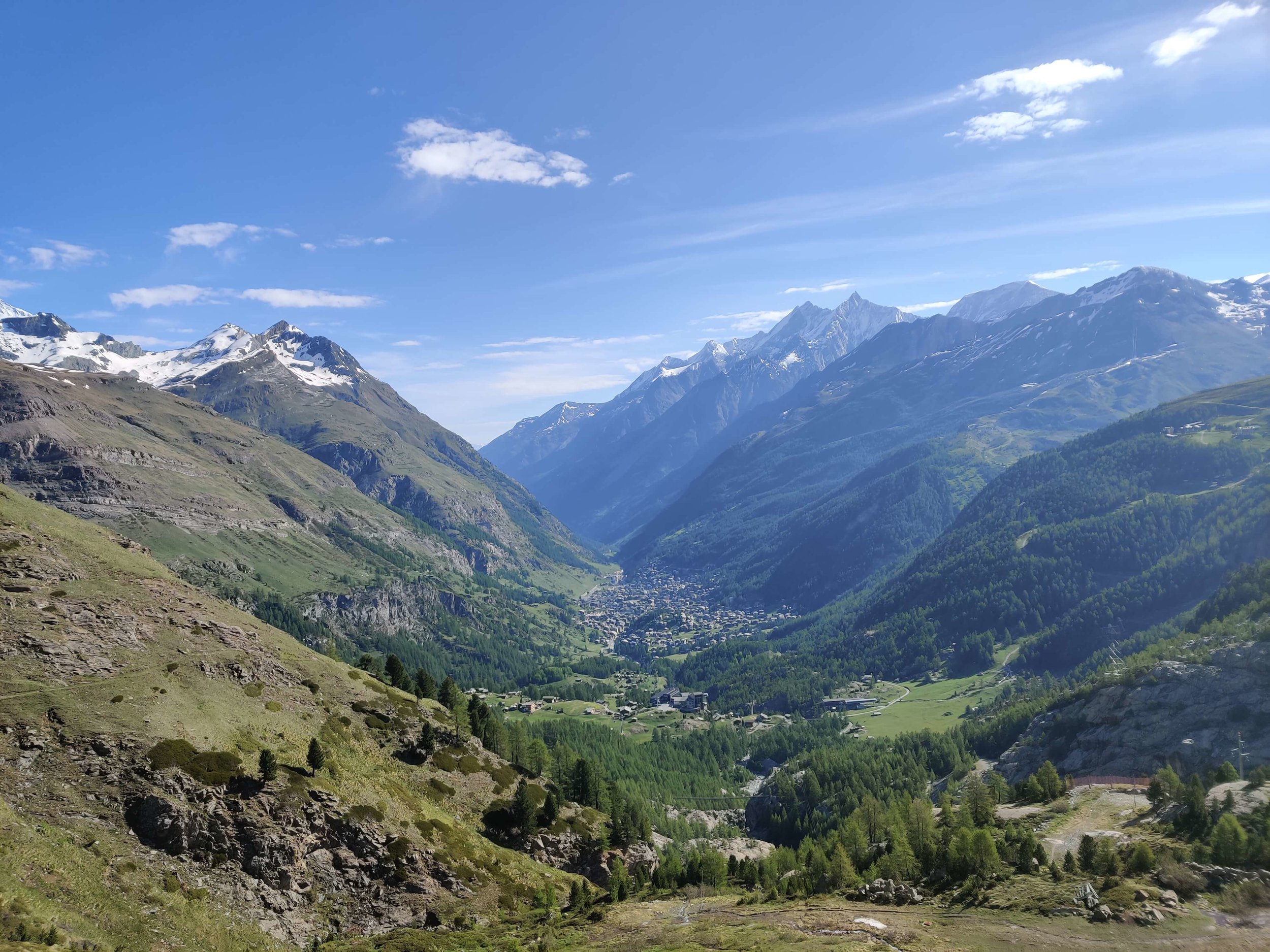
Once you turn into the Mattertal valley, it is snow-free all the way to St Niklaus. If you are looking for a shortcut, the gondola from Jungen is a great option!
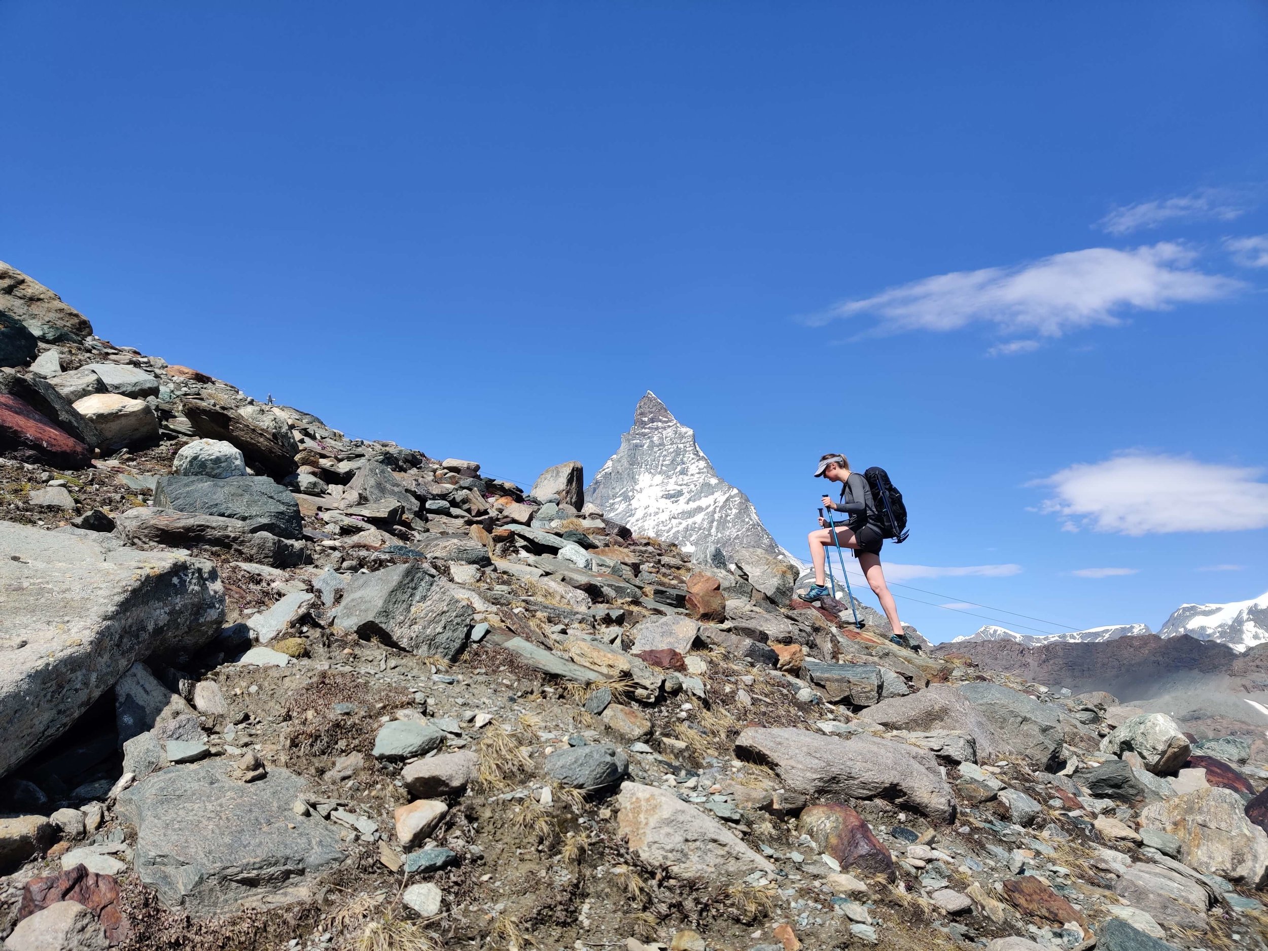
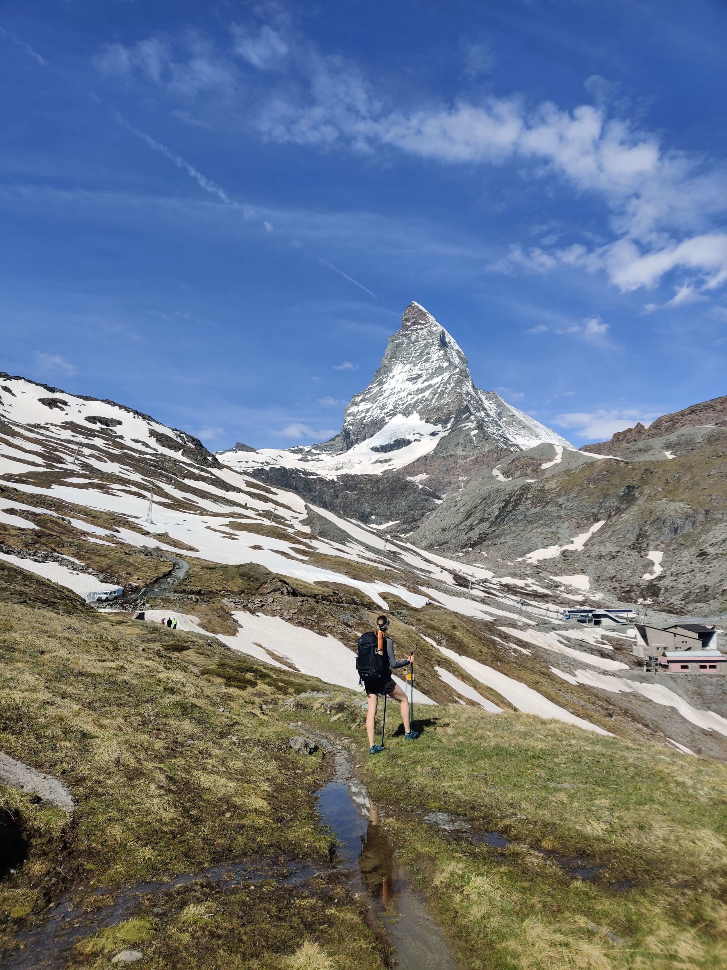
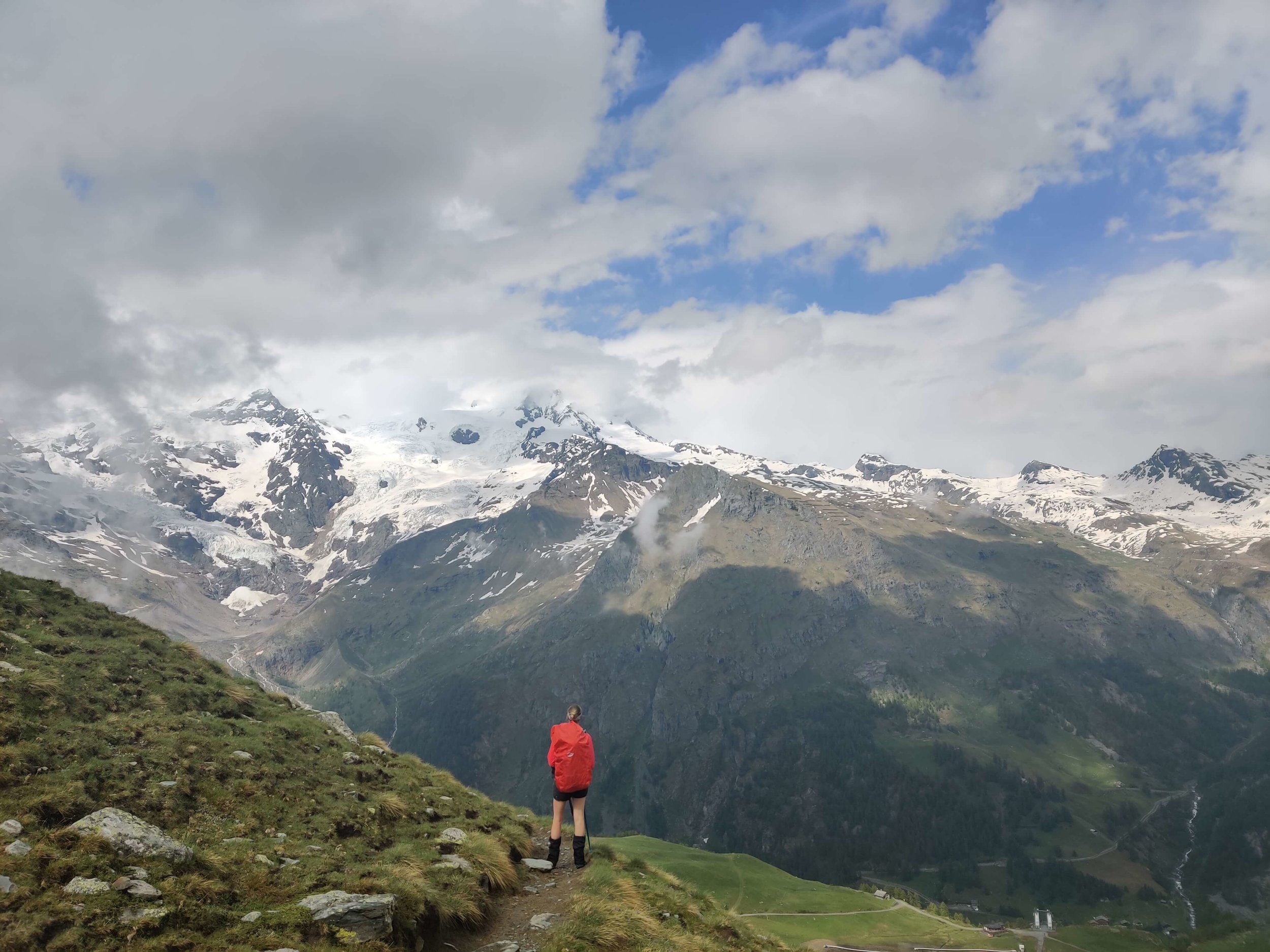
Rest/Hike around Zermatt
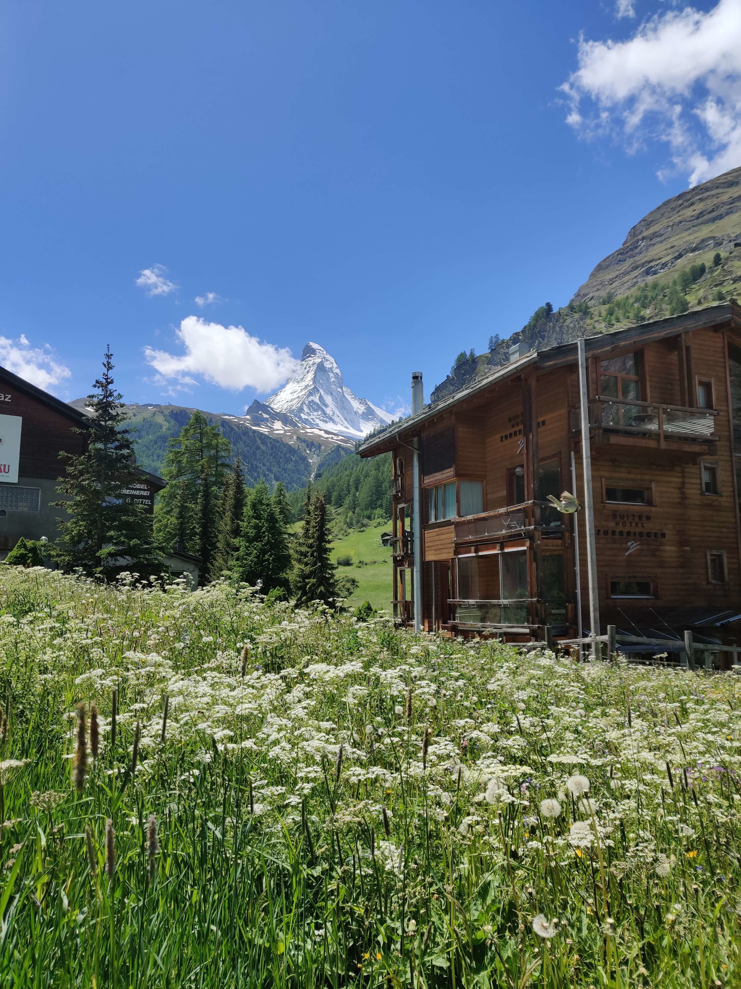

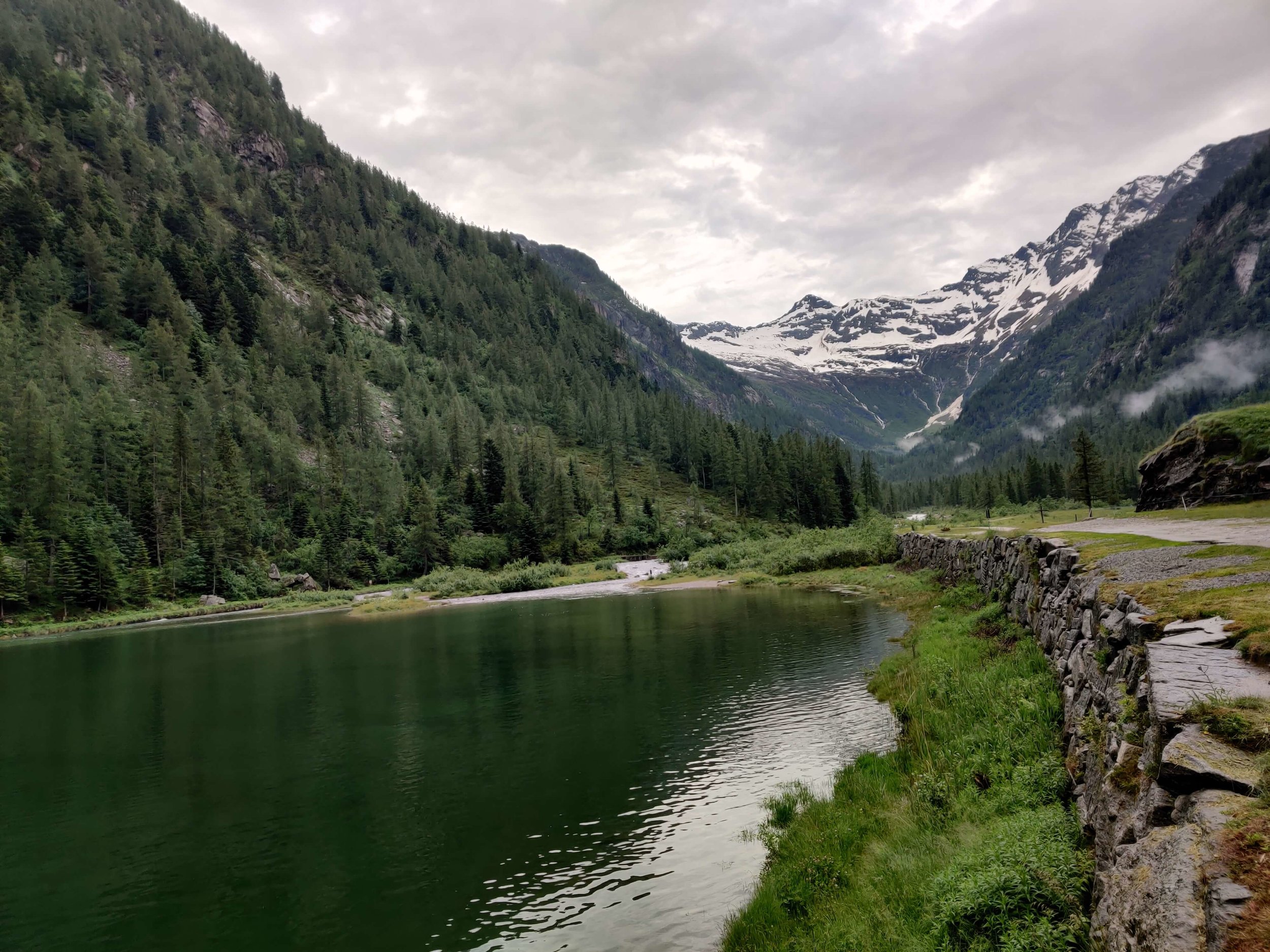
Tour of Monte Rosa
153 km / 95 mi
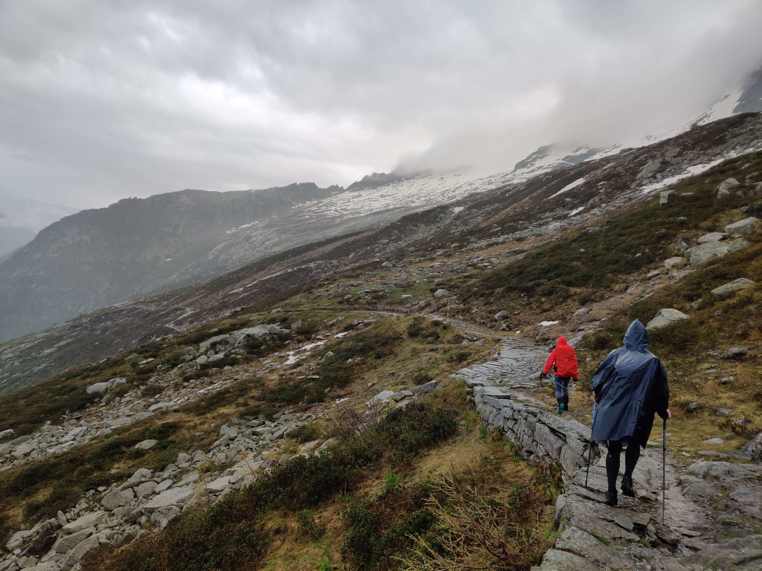
June 18th: Grachen >> Randa via Detour 1
Distance: 24km / 15mi
Snow Conditions: All below the snow line. Only a few easy, short snow patches on Europaweg
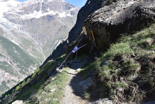
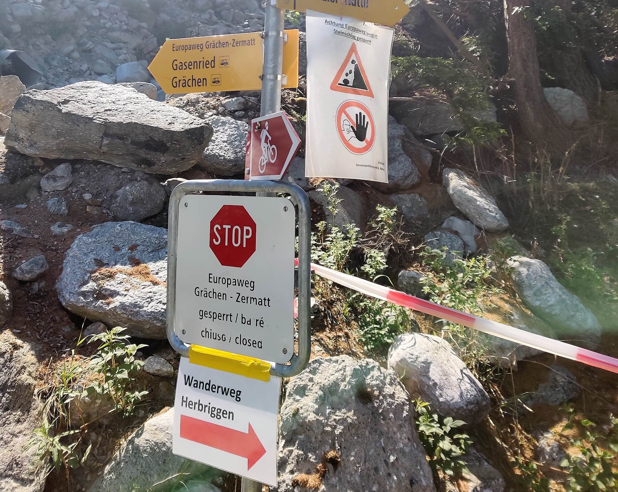

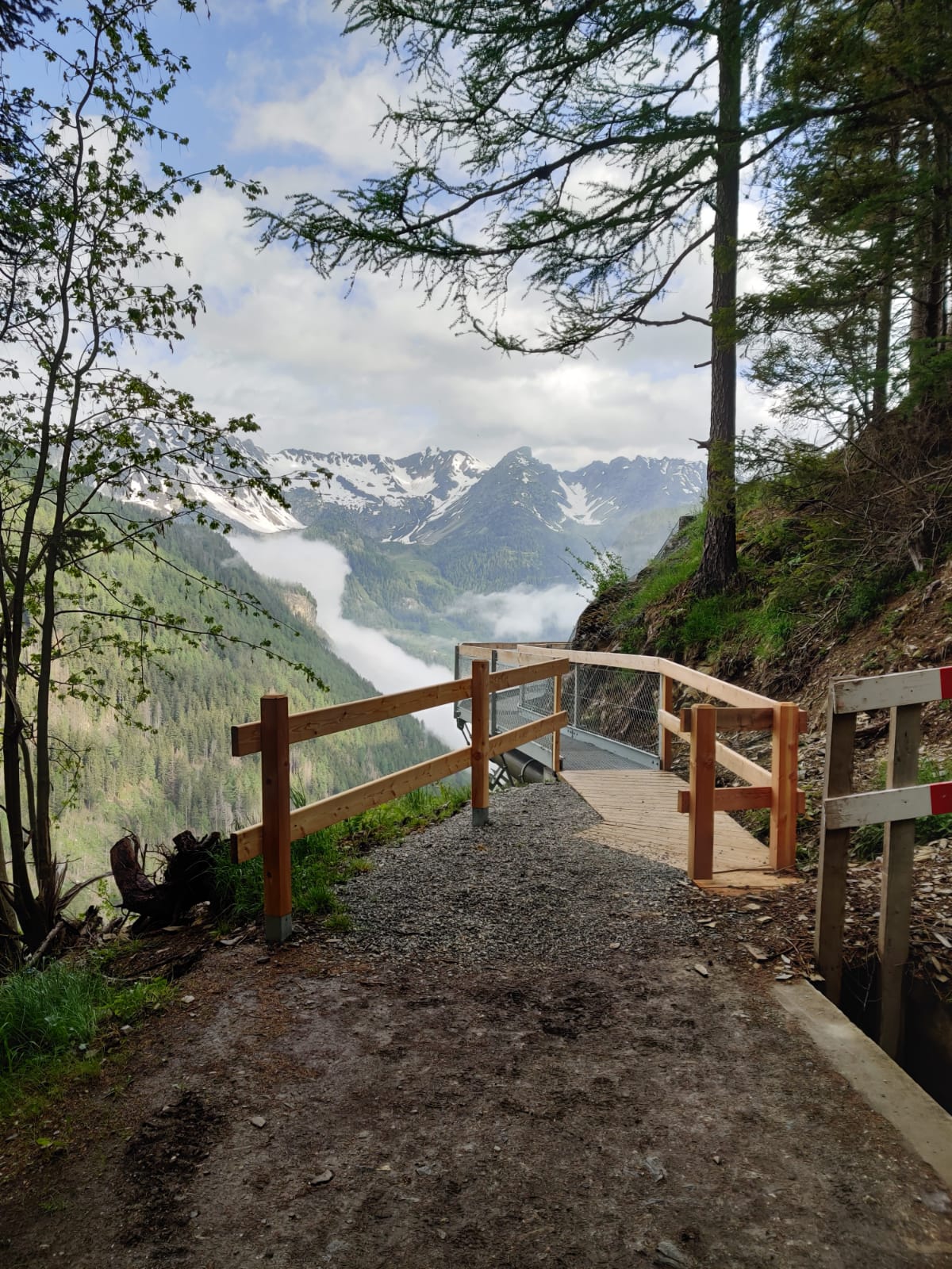
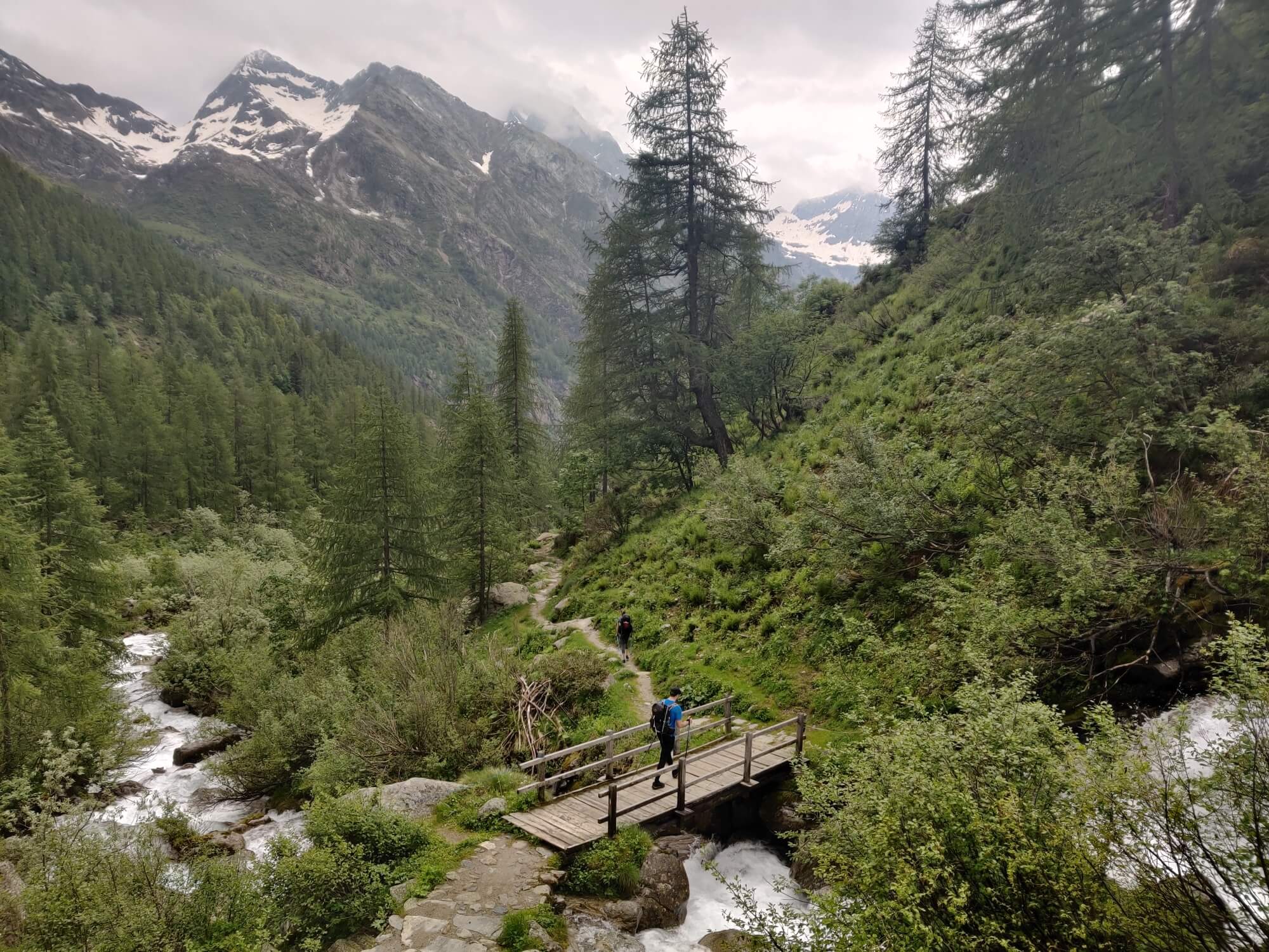
Today we tackled the start of the Europaweg trail to check the trail diversion due to the rock slide (see our blog for more details). We started in Grächen and walked to Gasenreid. The usual junction up to Grat just passed the Riedbach river is taped off and closed. Therefore continue along the track and follow the plastic signs to Herbriggen. This is a lovely trail through the forrest and just before Herbriggen there is a great waterfall you can cross behind. After ~7km / 4.5mi from diversion, you will reach Herbriggen. This is when the gruelling climb up to Europaweg begins. From Herbriggen to Galenburg, it is a 1,320m / 4,330ft ascent. The trail is quite unforgiving as you climb up through the forest, across boulders and steep exposed areas that are supported by ropes. It was a tough climb but we made it up in under 3 hours. We then hiked along the Europaweg but unfortunately one of the main bridges wasn't yet built for the season so we had to rock jump/climb across. This bridge should be in place in the next week or so, according the the Europa Hut guardian. We passed Europa Hut (opens 29th June) and headed across the Suspension Bridge - very spectacular with no other hikers around. The descent to Randa was quite quick and direct.
We didn't complete the 2nd section of Europaweg from the Suspension Bridge to Zermatt. Apparently there is also still one bridge not yet built for the season but will be in place by the end of next week.
What the Rest of the Tour of MOnte Rosa Updates?
The updates for the remaining Tour of Monte Rosa sections as well as a bunch of information to plan your own trip will published with our new platform supporting self-guided hikers to complete this trail from 2020. If you would like to be the first to know when we launch this platform, fill out the form here.
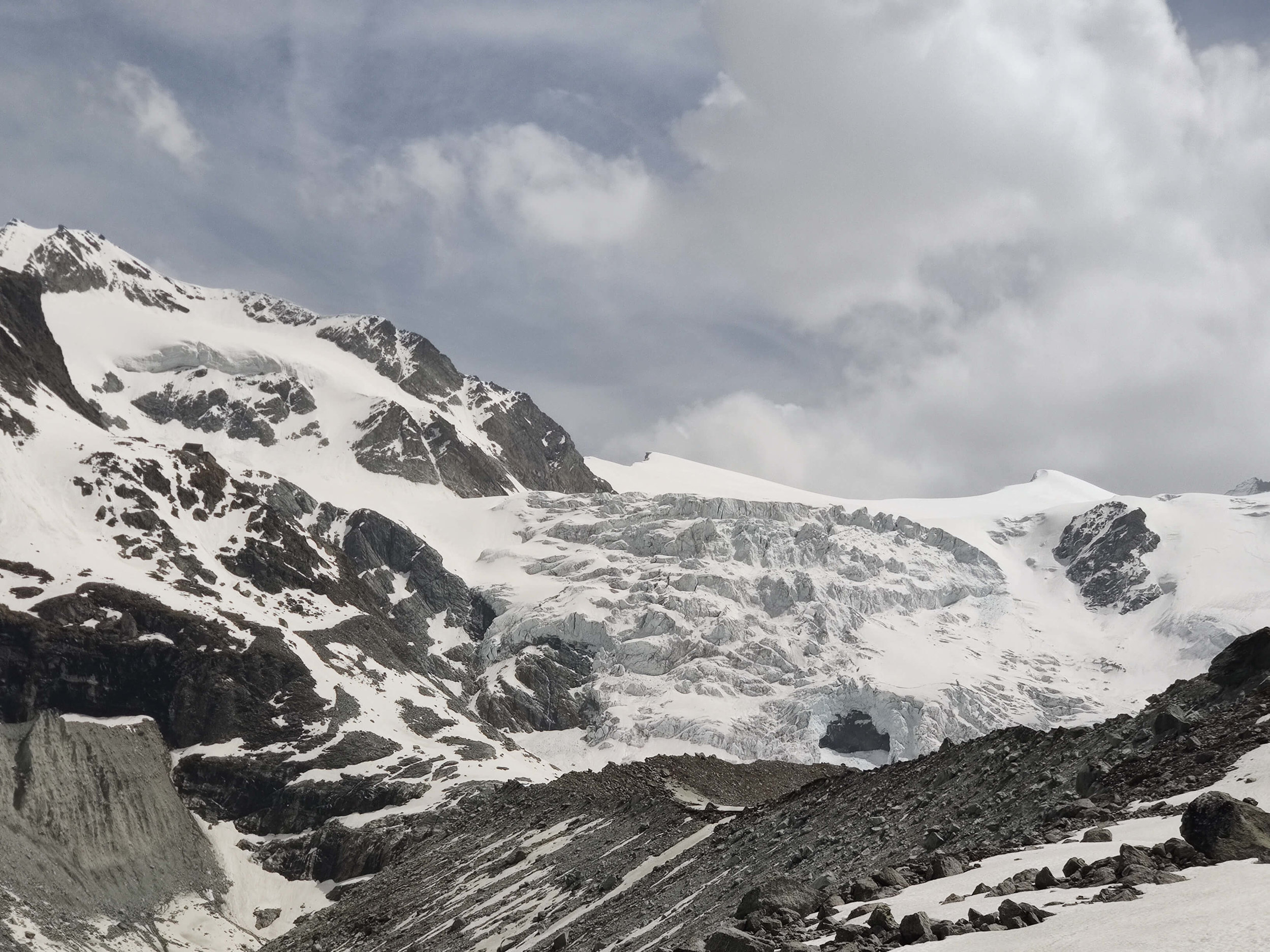
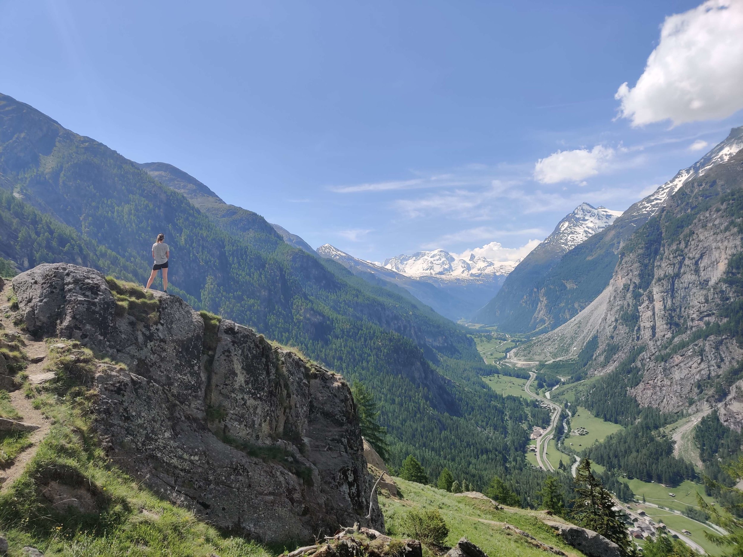
In the meantime, you can enjoy some pictures from this epic trail below :)
June 19th: Zermatt >> Rifugio Guide del Cervino

June 20th: Rifugio Guide del Cervino >> Staffal


June 21th: Staffal >> Macugnaga


June 22nd: Macugnaga >> Saas Fee


June 23rd: Saas Fee >> Grachen
Celebrate, Rest and Prepare for the next hiking adventure!
would you like to help keep this report with the latest trail information?
If you are hiking the Tour du Mont Blanc, Haute Route or Tour du Monte Rosa this summer, we would love to receive your trail updates so we can share it with the community! Email me (info@thehikingclub) or msg me on Instagram (@thehiking.club).