Updated March 2024
The Europaweg Trail between Grächen and Zermatt is one of the most famous two-day hikes in the Alps, as well as forming part of the Walker’s Haute Route and Tour of Monte Rosa. It offers a quintessential Swiss hiking experience, including crossing the longest suspension bridge in the Alps and finishing at the base of the iconic Matterhorn.
In the past few years, there has been some confusion about where exactly the Europaweg trail goes, due to the original route still appearing on some outdated maps, apps and guidebooks. In this updated post, I share details about the Europaweg trail, clarify where the route goes and share a brief history of trail changes in recent years.
The blog post includes:
up-to-date hiking routes and stats
OUR SELF-GUIDED HIKING PACKAGES
Are you planning to hike the Walker’s Haute Route and Tour of Monte Rosa? You can use our planning app, which is included with our self-guided packages, to get up-to-date and accurate hiking routes and stats, including the Europaweg.
What is the Europaweg trail?
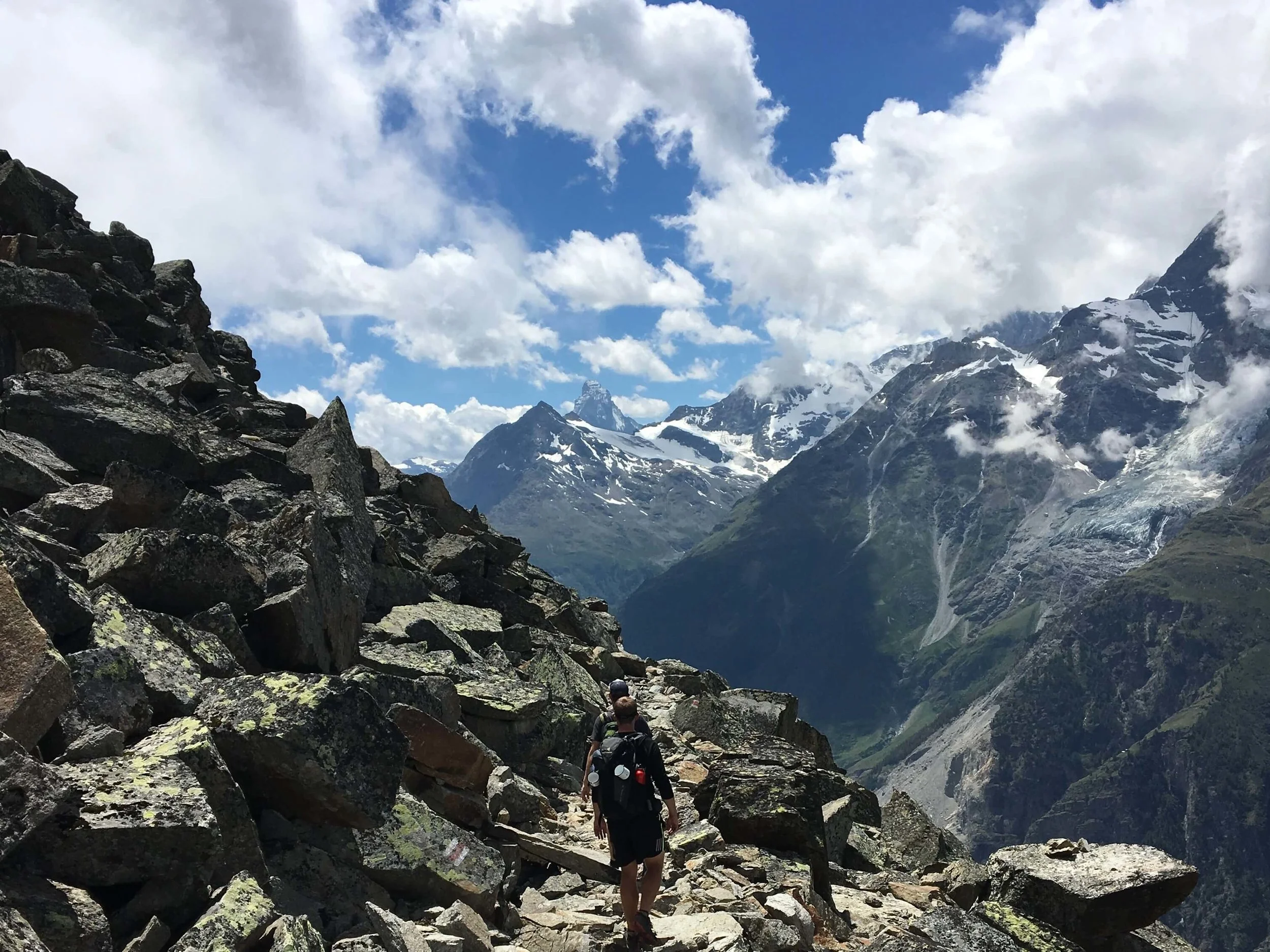
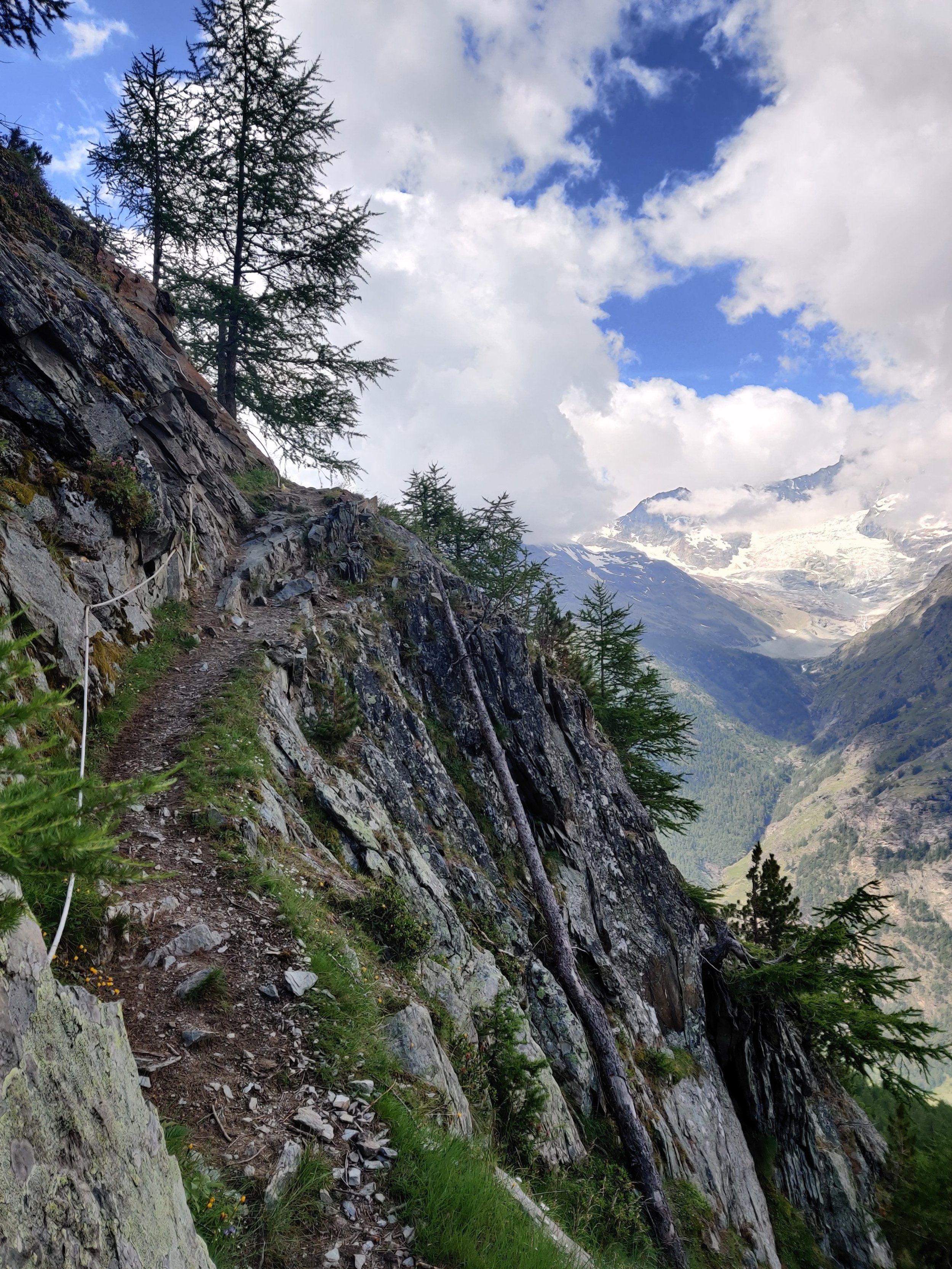
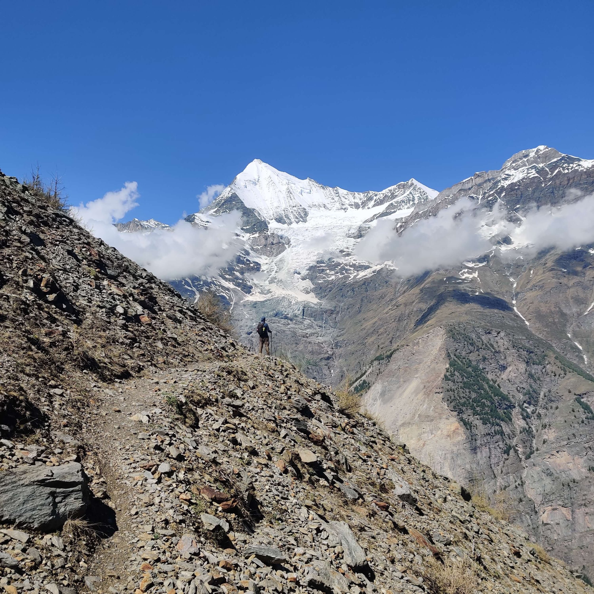
The Europaweg is a balcony trail that runs along the Mattertal Valley providing landscape views of the stunning Ried glacier, Weisshorn and iconic Matterhorn. It is a fitting end for hikers completing their Walker’s Haute Route from Mont Blanc, an inspiring start to the Tour of Monte Rosa or a perfect weekend adventure that showcases a special hiking experience in the Swiss Alps.
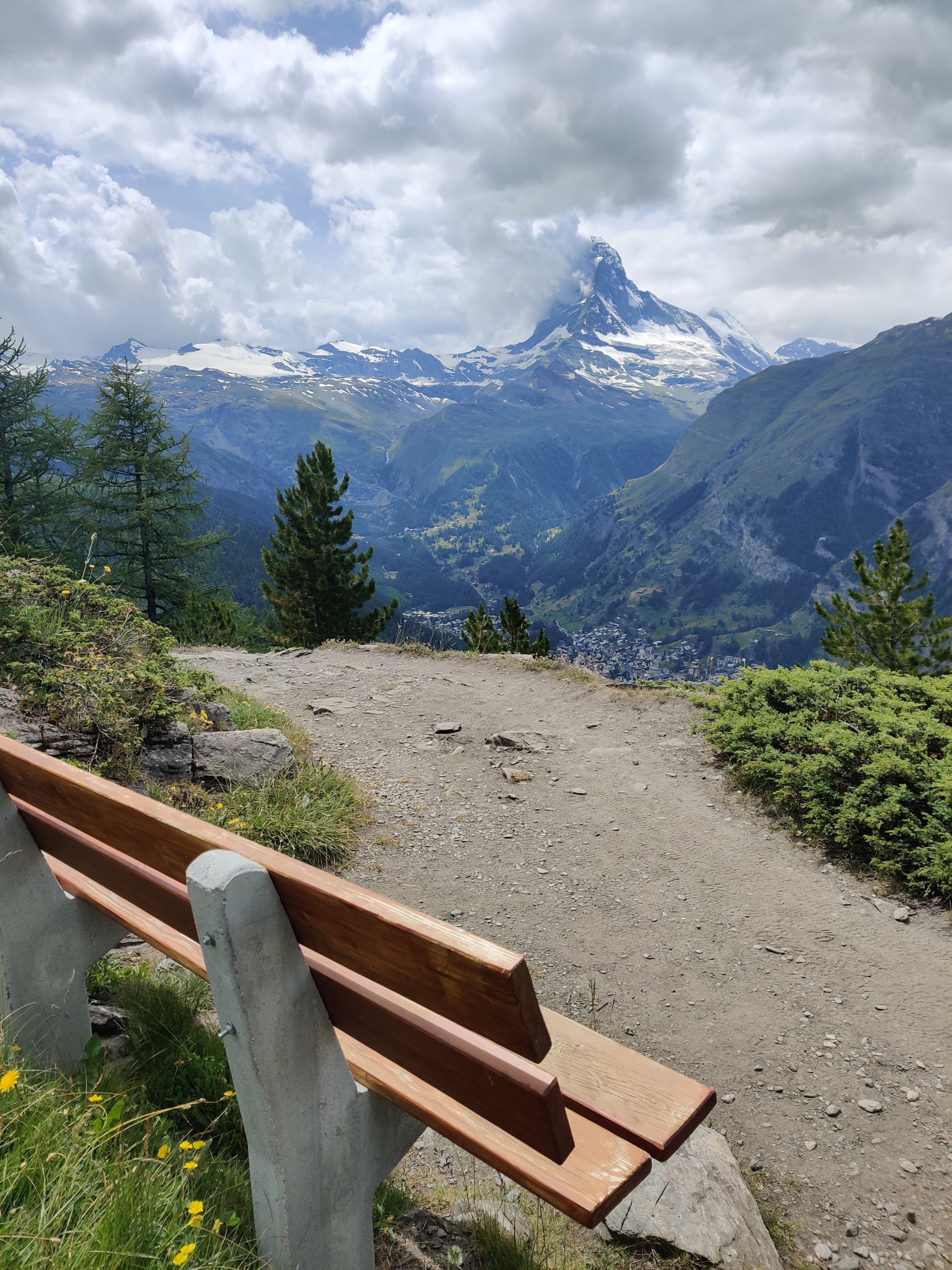
Europaweg: The Matterhorn commands your attention as you approach Zermatt on the Euroapweg trail.
Where is the Europaweg trail located?
The Europaweg trail is located in the Canton of Valais, Switzerland. It connects the village of Grächen with Zermatt, by traversing along the east side of Mattertal Valley.
How long does it take to complete the Europaweg Trail?
From Grächen, the distance to Zermatt is ~35 km / 22 mi, and it requires a total elevation gain (and loss) of just under 2,300m / 7,400 feet. Although trail runners/fast packers can complete the Europaweg in one day, the average mountain hiker takes about 14 hours to complete it, which is typically done over 2 days.
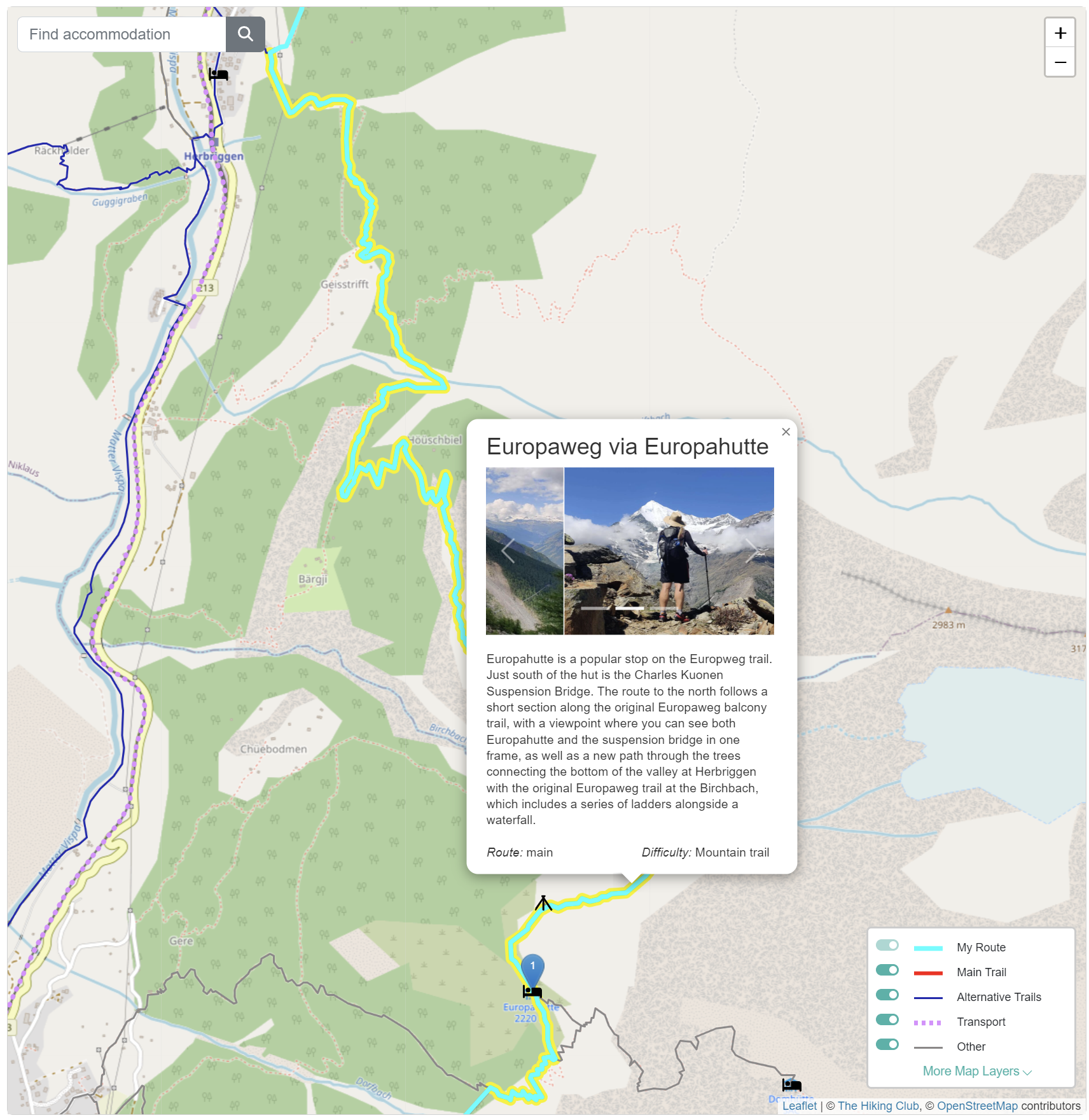
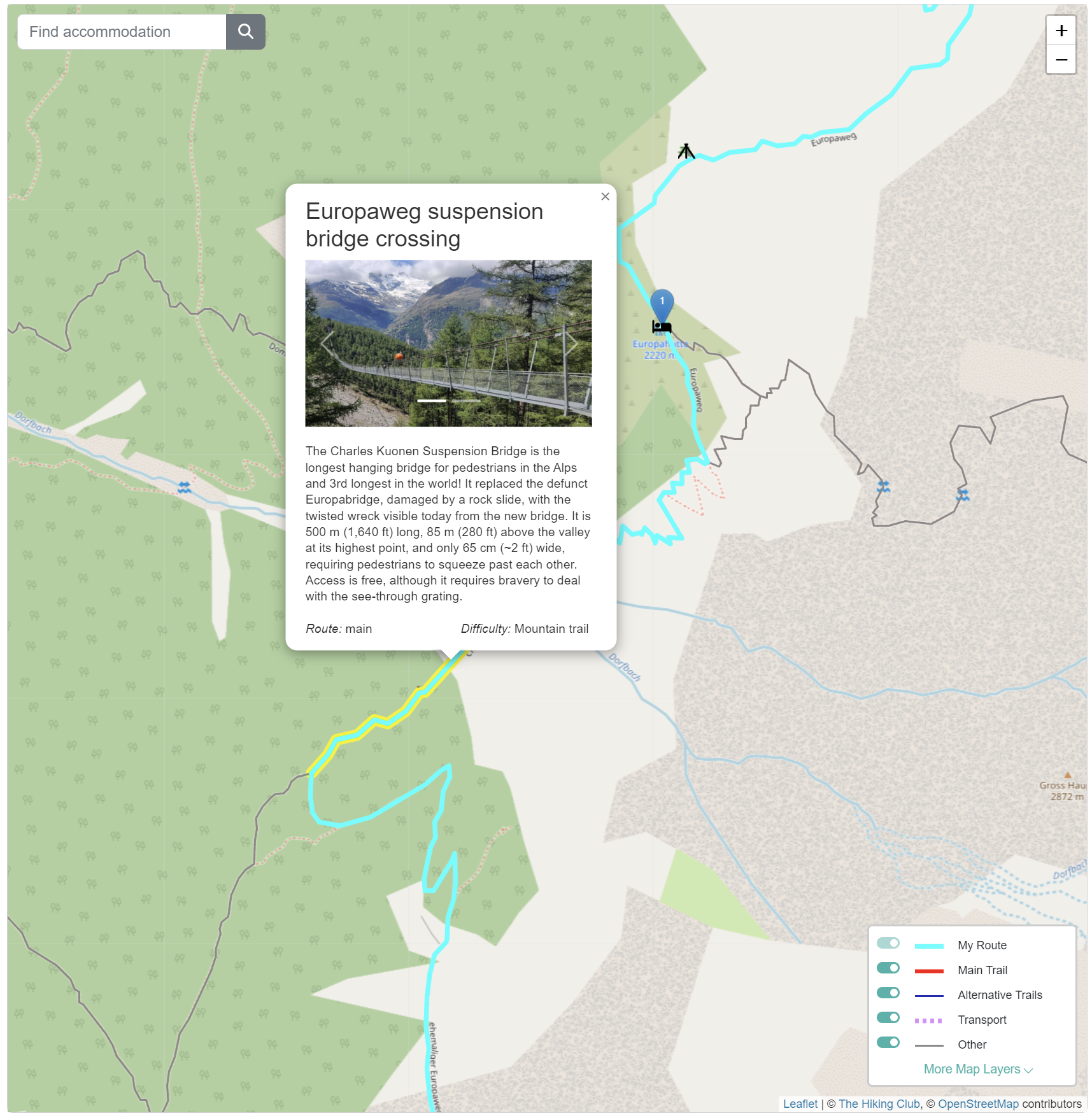
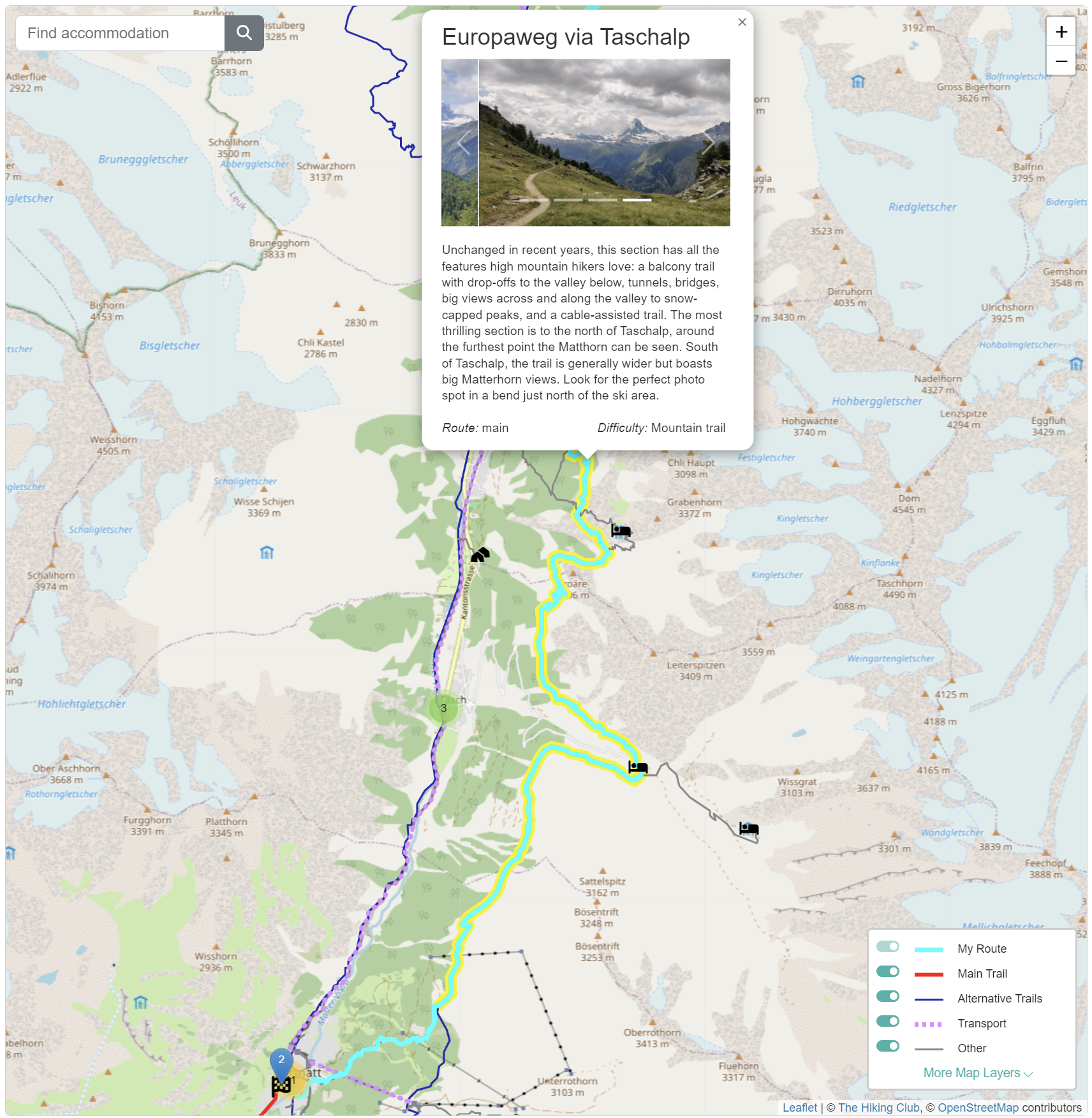
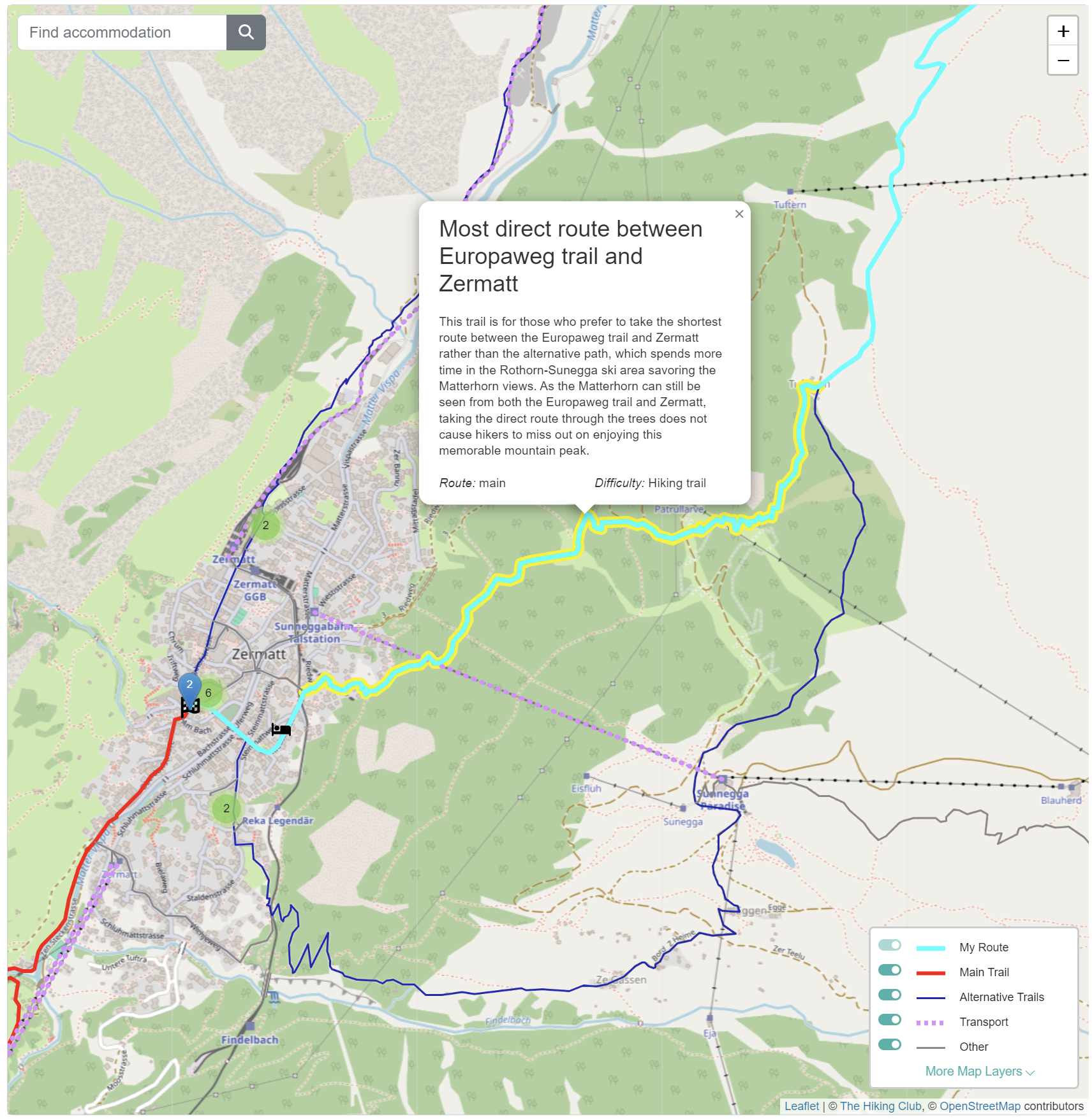
Planning app: The Europaweg trail (highlighted in light blue in the image) is between Grächen and Zermatt and forms part of the Walker’s Haute Route and Tour of Monte Rosa hiking trails. You can plan these trails with our app (the image shows the Tour of Monte Rosa module).
What accommodation is located on the Europweg trail?
It is important to reserve your accommodation on the Europaweg trail as the most popular places do book out and alternatives can add extra hours to your hiking plan. Europahütte is located directly on the trail and considered the most popular place to stay given it most evenly splits the amount of hiking between 2 days. Täschalp Restaurant & Lodge and Herbriggen are the next most popular locations located directly on the trail, however, by staying here, hikers will need to complete a bigger (10.5 hrs) and smaller day (3.5 hrs). There is also some accommodation located off the trail which can be utilised to enable hikers to complete the Europaweg trail. Further up the mountain, there are the alpine huts of Domhütte, Kinhütte and Täschhütte which add between 1-3.5 hours of additional hiking to the overall journey. In the valley, Randa is a village located approximately in the middle of the trail and has some accommodation which adds about 3 hours of hiking to the overall journey.
Is the Europaweg a challenging trail?
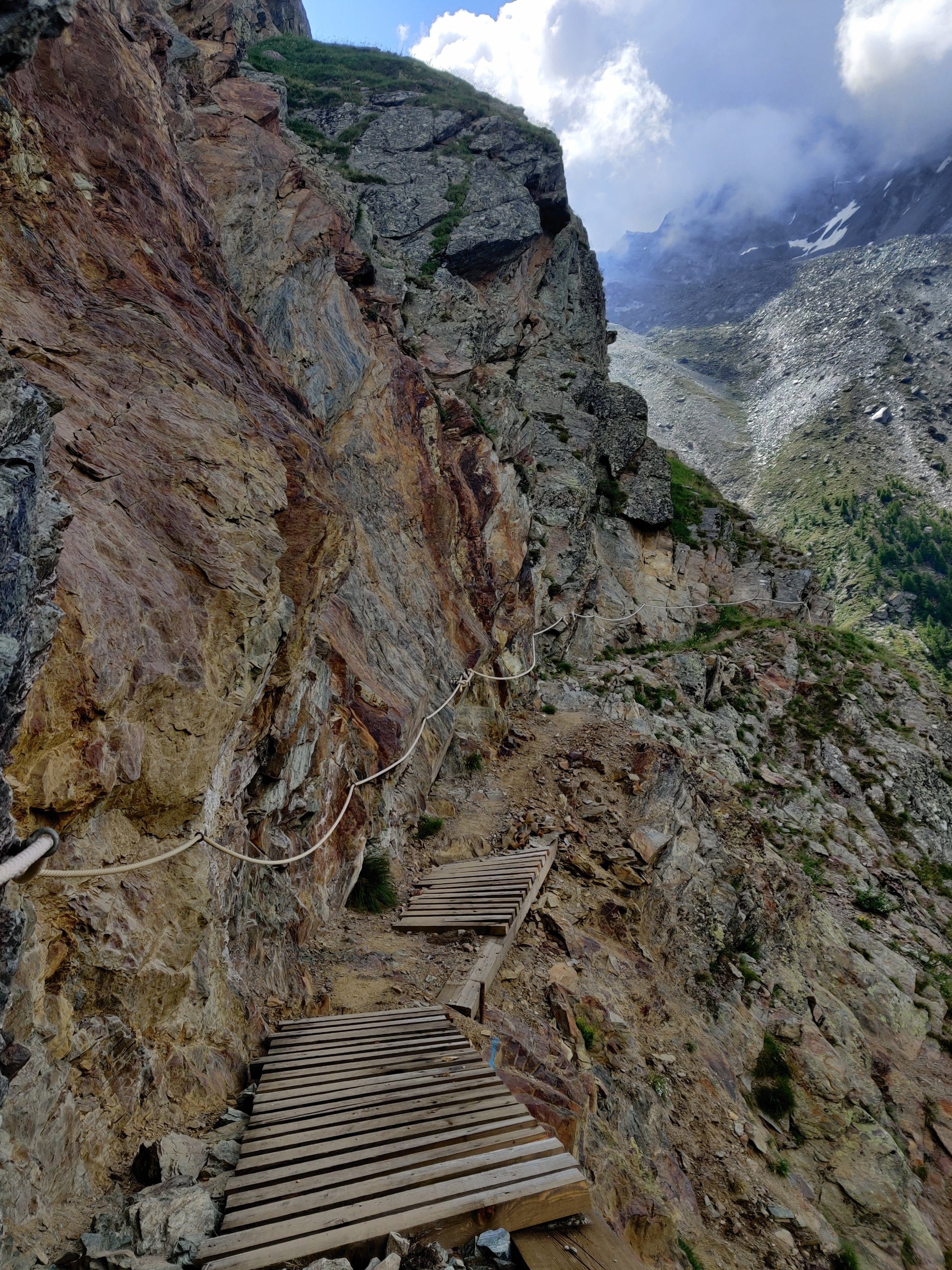
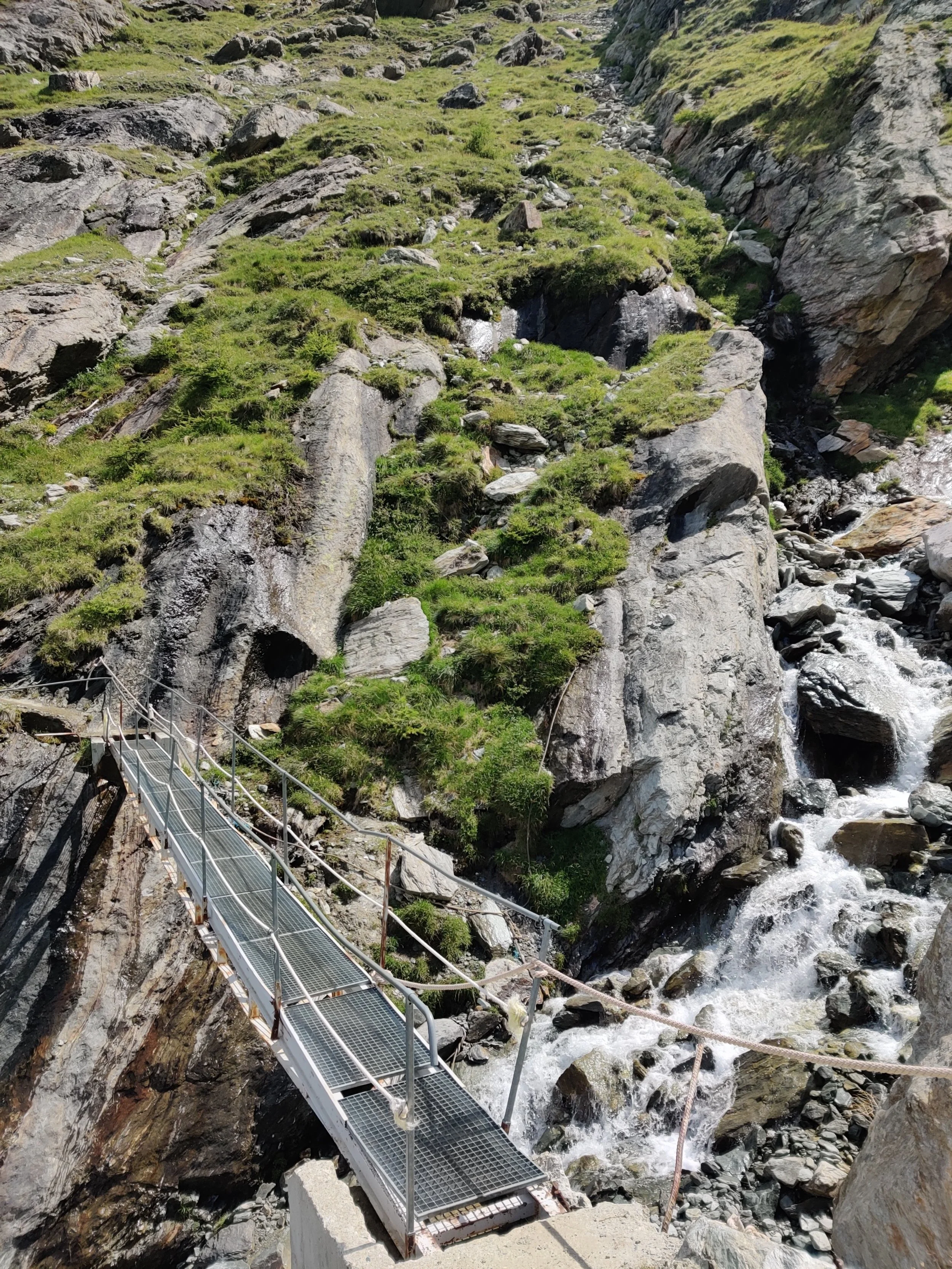
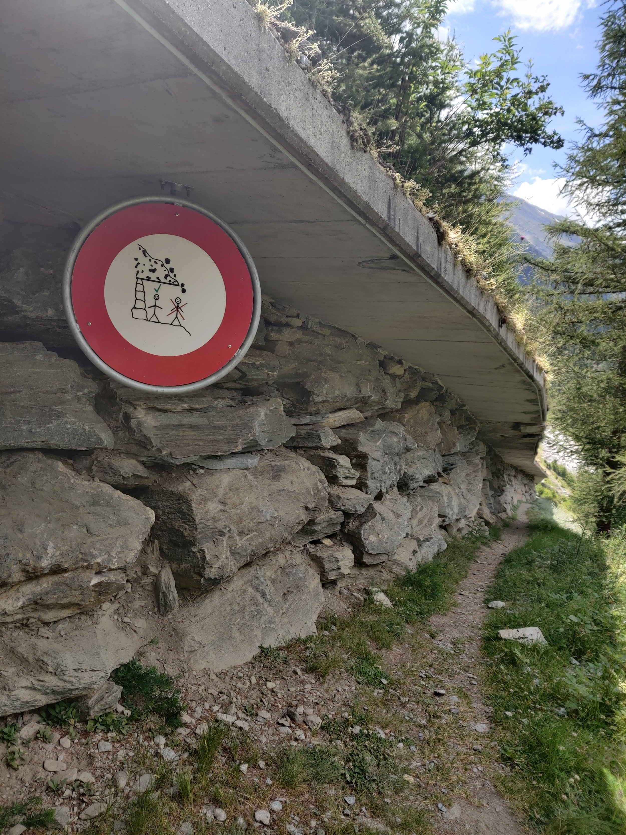
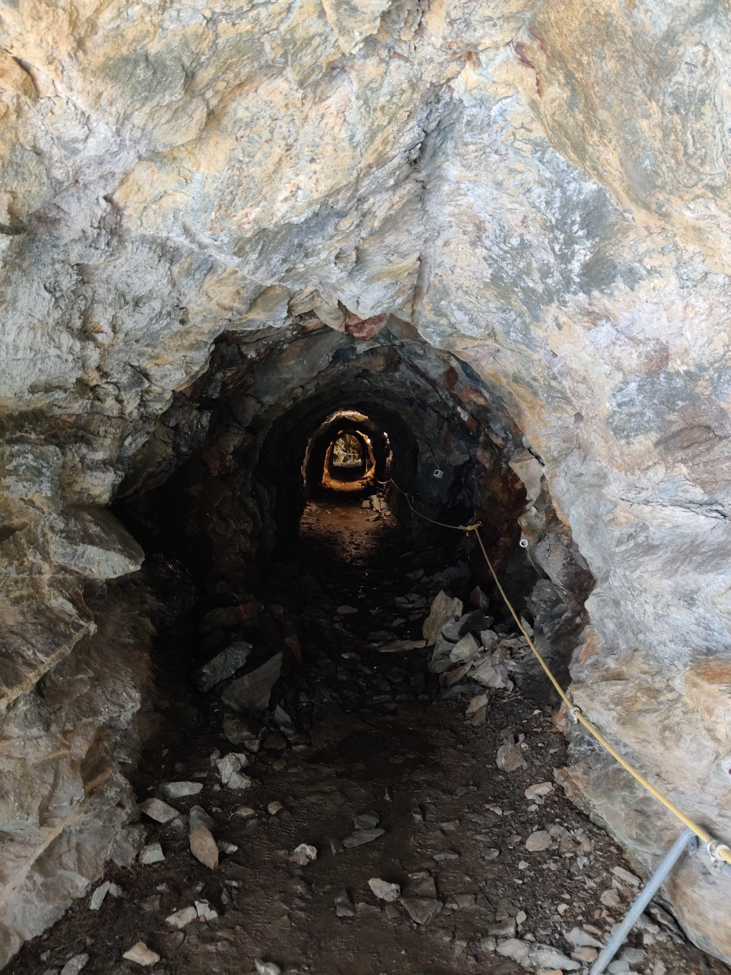
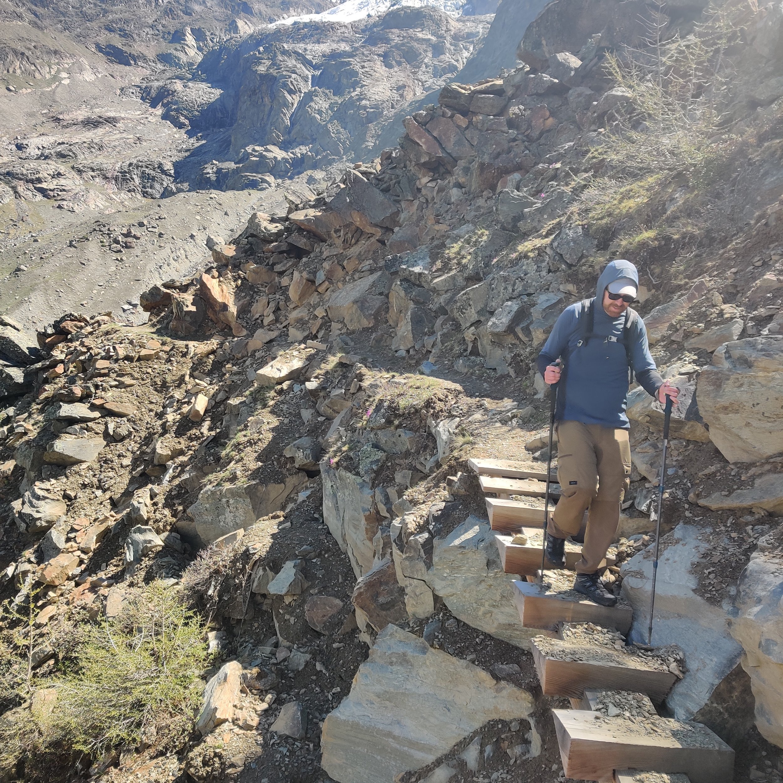
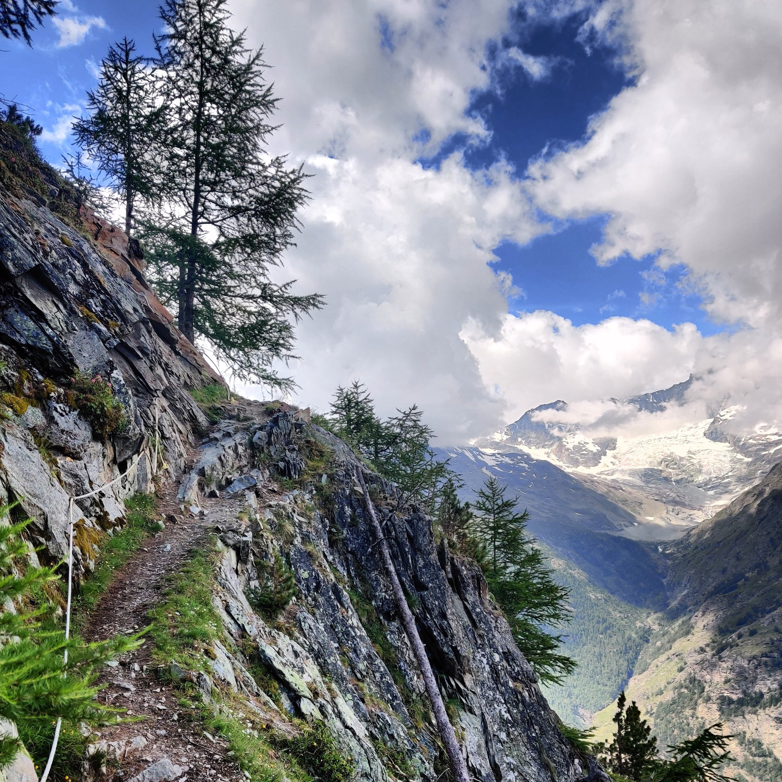
Most of the Europaweg is on wide, well-groomed trails, which will be manageable for most hikers. However, there are some thrilling sections that are attractive to high-mountain hikers but not for the faint-hearted. These include traversing narrow ledges with fixed support cables to assist, crossing boulders from past rock falls, passing through caves and under avalanche protection barriers, and going over bridges, including the longest suspension bridge in the Alps!
Is the Europaweg trail popular?
The Europaweg trail forms part of the main trail for the Walker’s Haute Route and Tour of Monte Rosa, with nearly every hiker choosing to include the trail as part of their route. The experience is a notable highlight by compacting interesting trail features and wide ranging views of surrounding glaciers and mountain peaks into a relatively small section compared to the rest of their journeys. For this reason, the Europaweg trail is also a popular standalone experience that provides a complete experience of what high-mountain hiking in the Alps is all about.
What are the different sections?
There are 5 main sections of the Europaweg trail
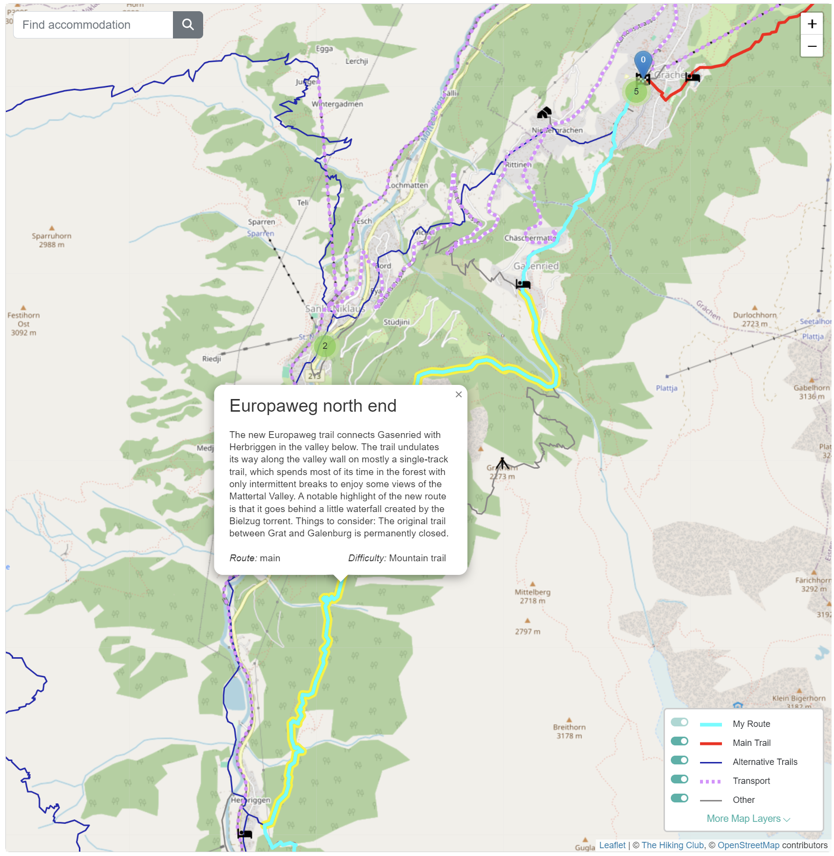
1. Europaweg North End (GrÄchen to Herbriggen)
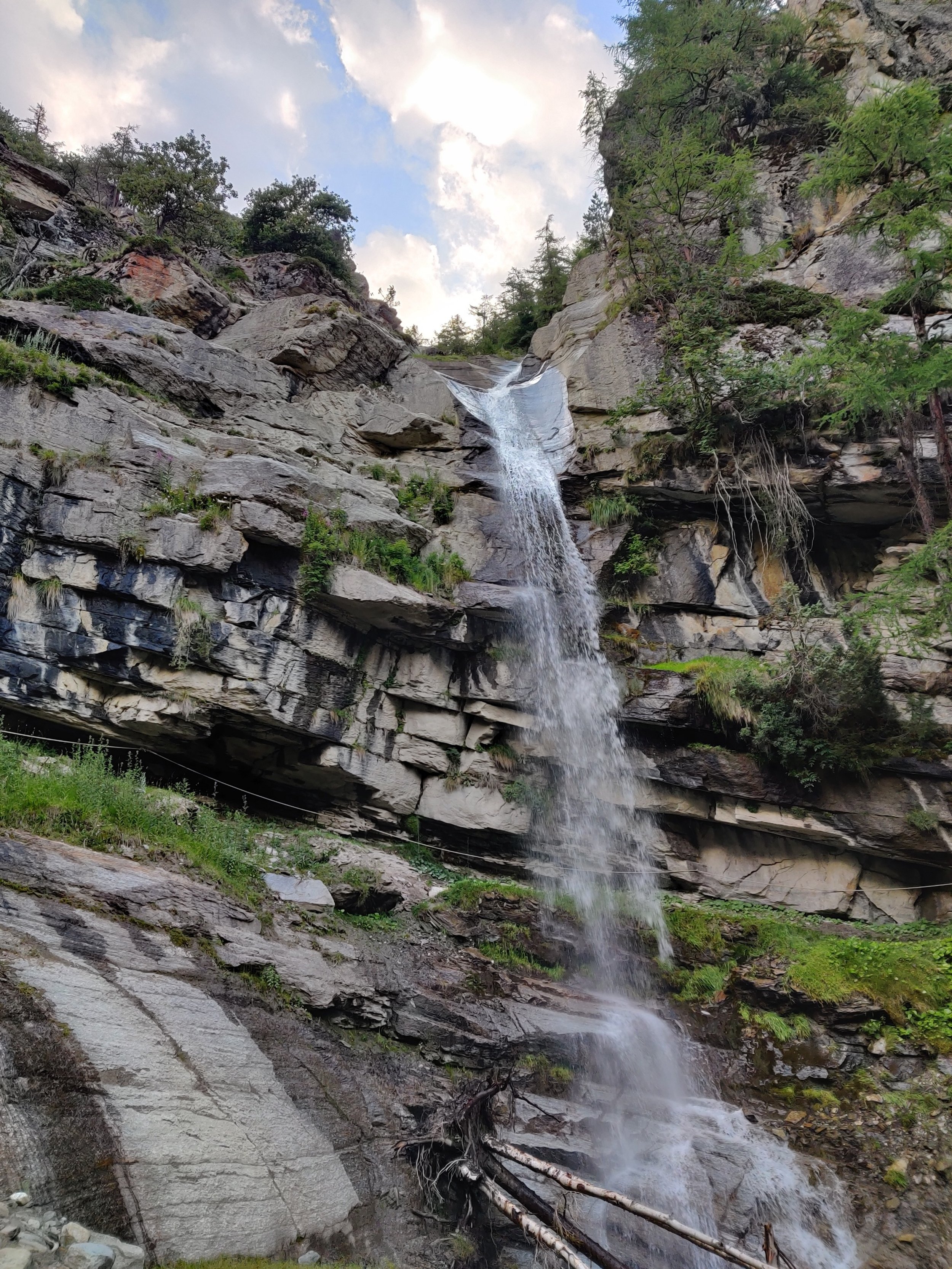
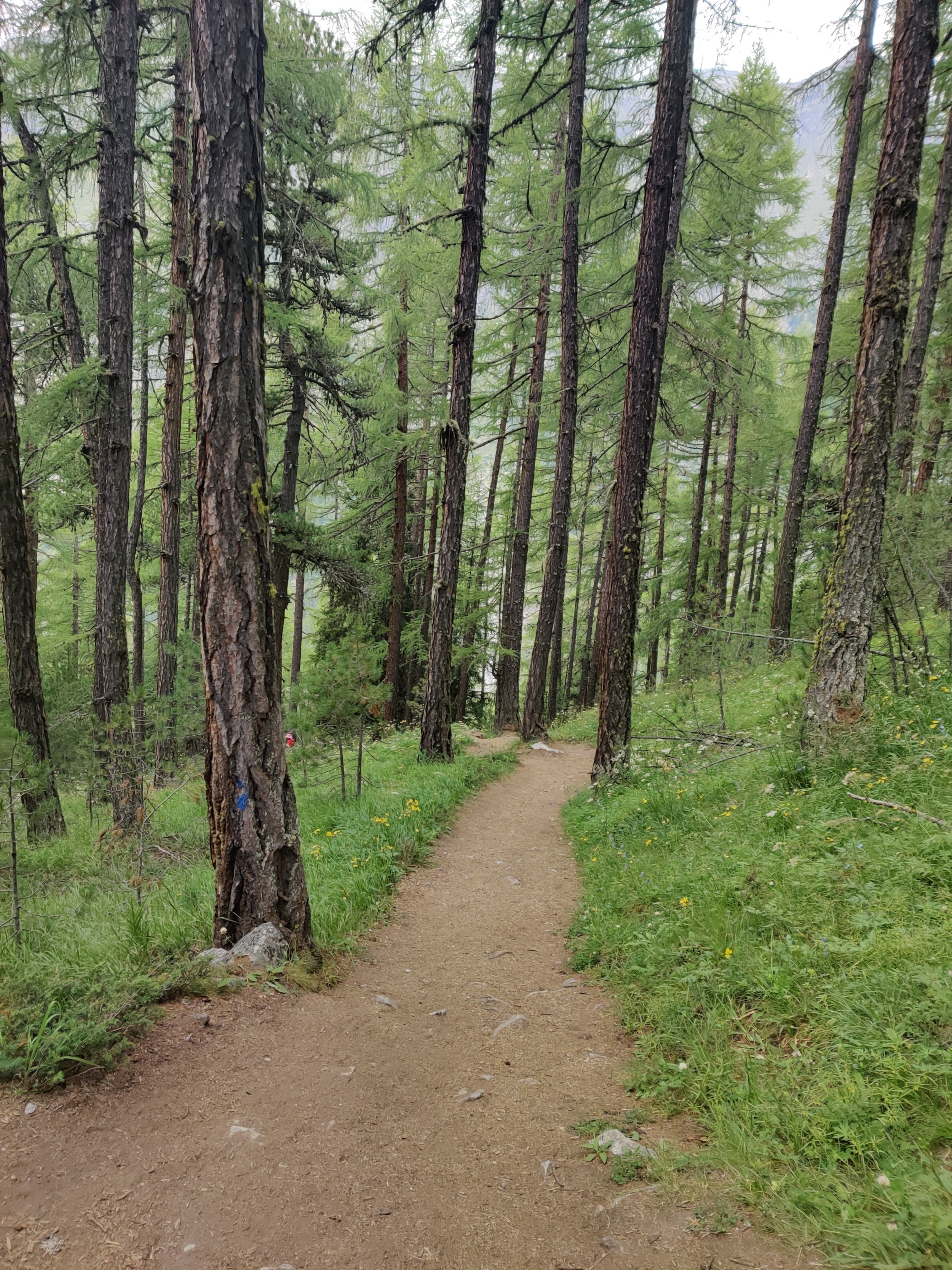
Officially beginning in the village of Grächen, the Europaweg trail starts by following quiet (car-free in Grächen!) roads until just beyond Gasenried, where the path changes to a track. After crossing the Reidbach torrent, the new trails stay on the track, which shortly becomes a single-track trail for the rest of the route to Herbriggen. After Gasenried, the path spends most of its time in the forest with only intermittent breaks to enjoy some views of the Mattertal Valley. A notable highlight of the new route is that it goes behind a little waterfall created by the Bielzug torrent.
2. Europaweg via EuropahÜtte (Herbriggen to Suspension Bridge)
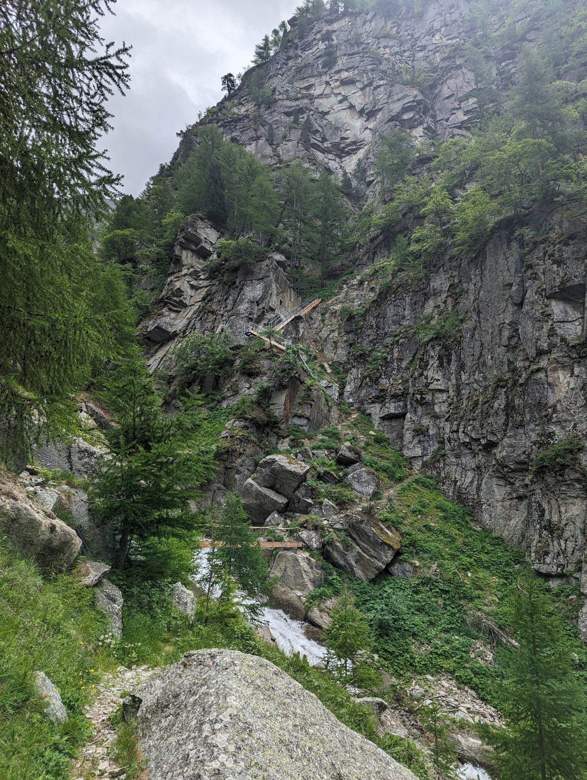
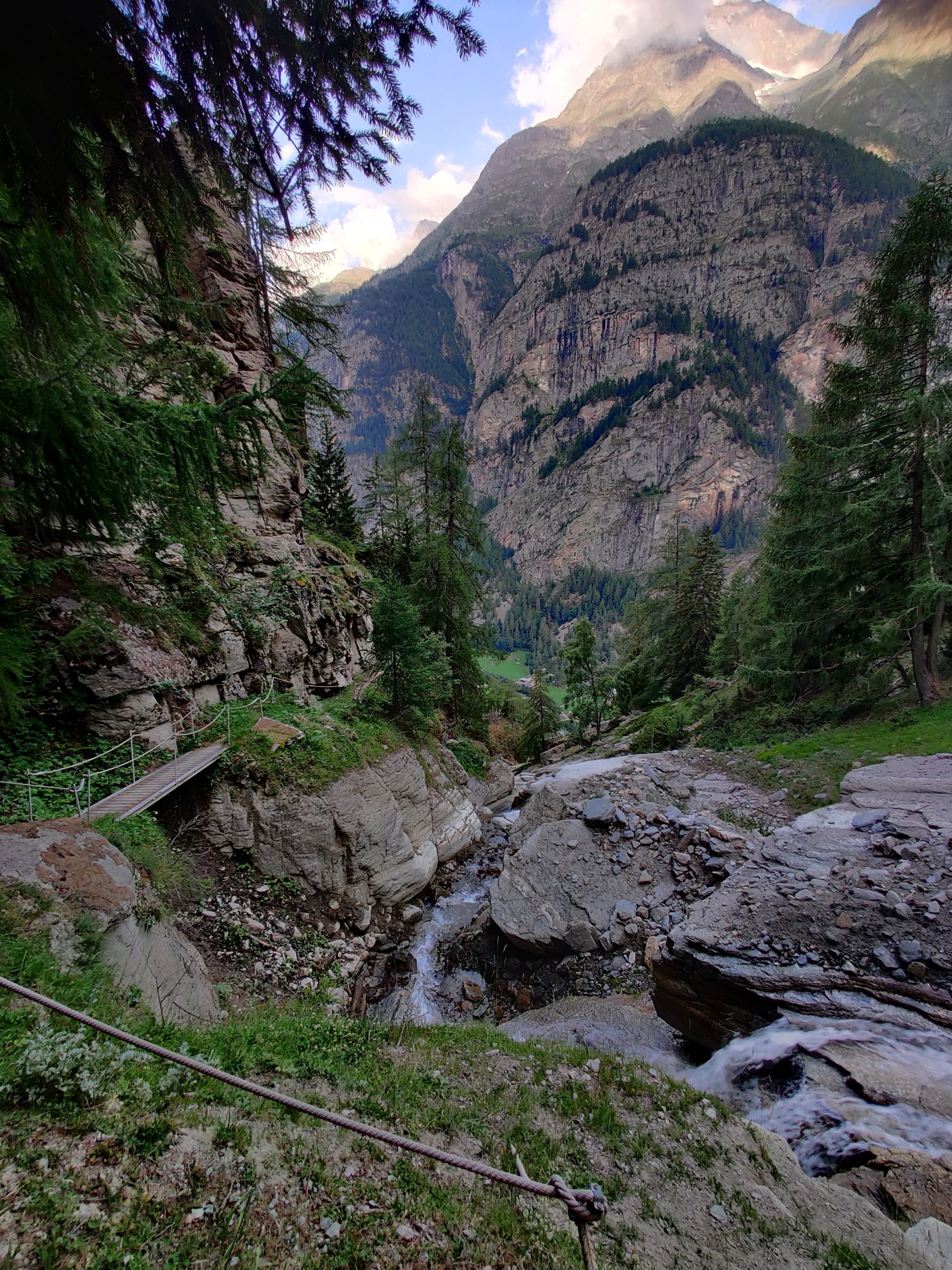
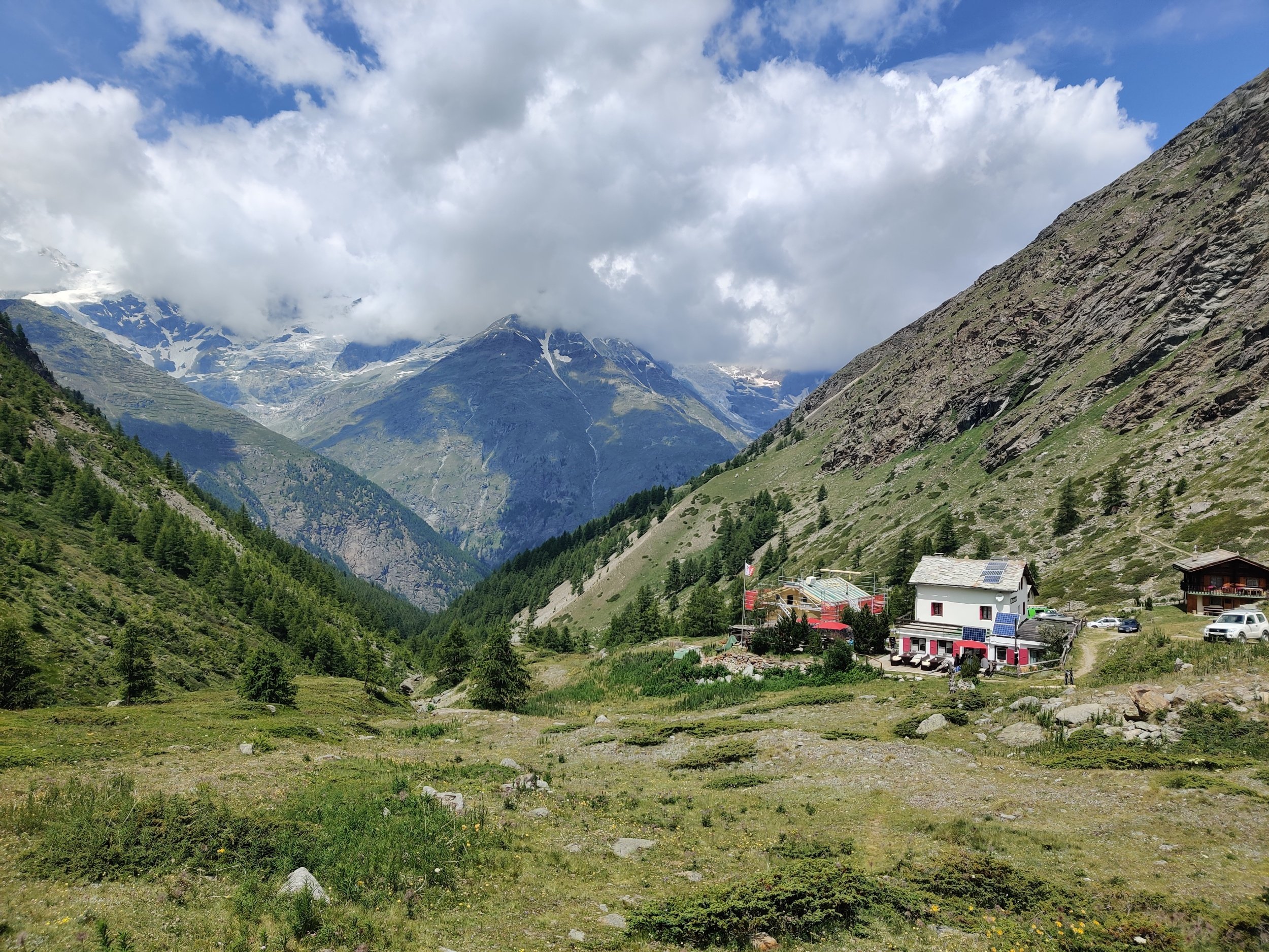
A new trail was built in 2021 between Herbriggen in the valley and the original Europaweg trail at the Birchbach stream. This section of the mountain trail spends most of its time in the forest as it leads hikers between the valley floor and the top of the tree line and includes a series of ladders alongside a waterfall - a unique feature of the entire Alps trail network. Once reaching the original Europaweg balcony trail, hikers immediately experience what the Europaweg trail is all about with sweeping views across the valley. A picnic spot at Miessboden and a unique viewpoint where you can see Europahütte and the suspension bridge in one frame are notable highlights at the end of this section.


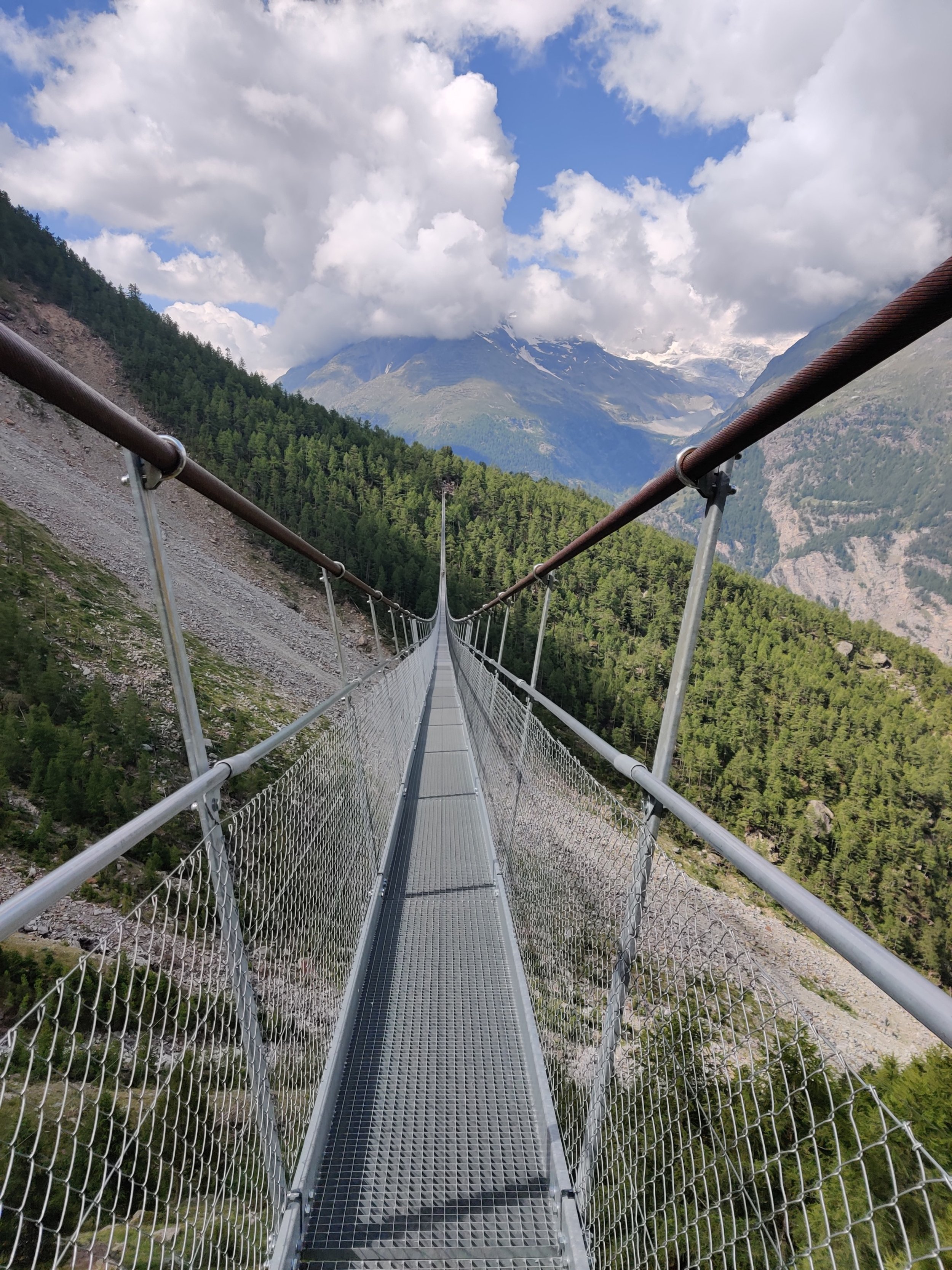
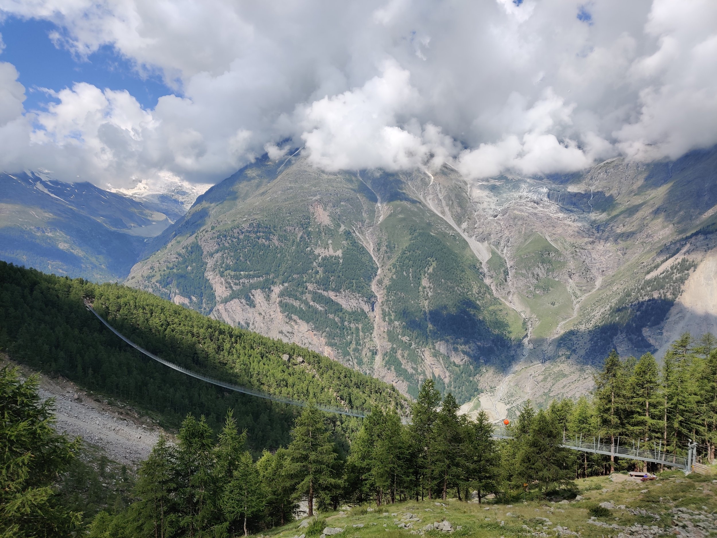
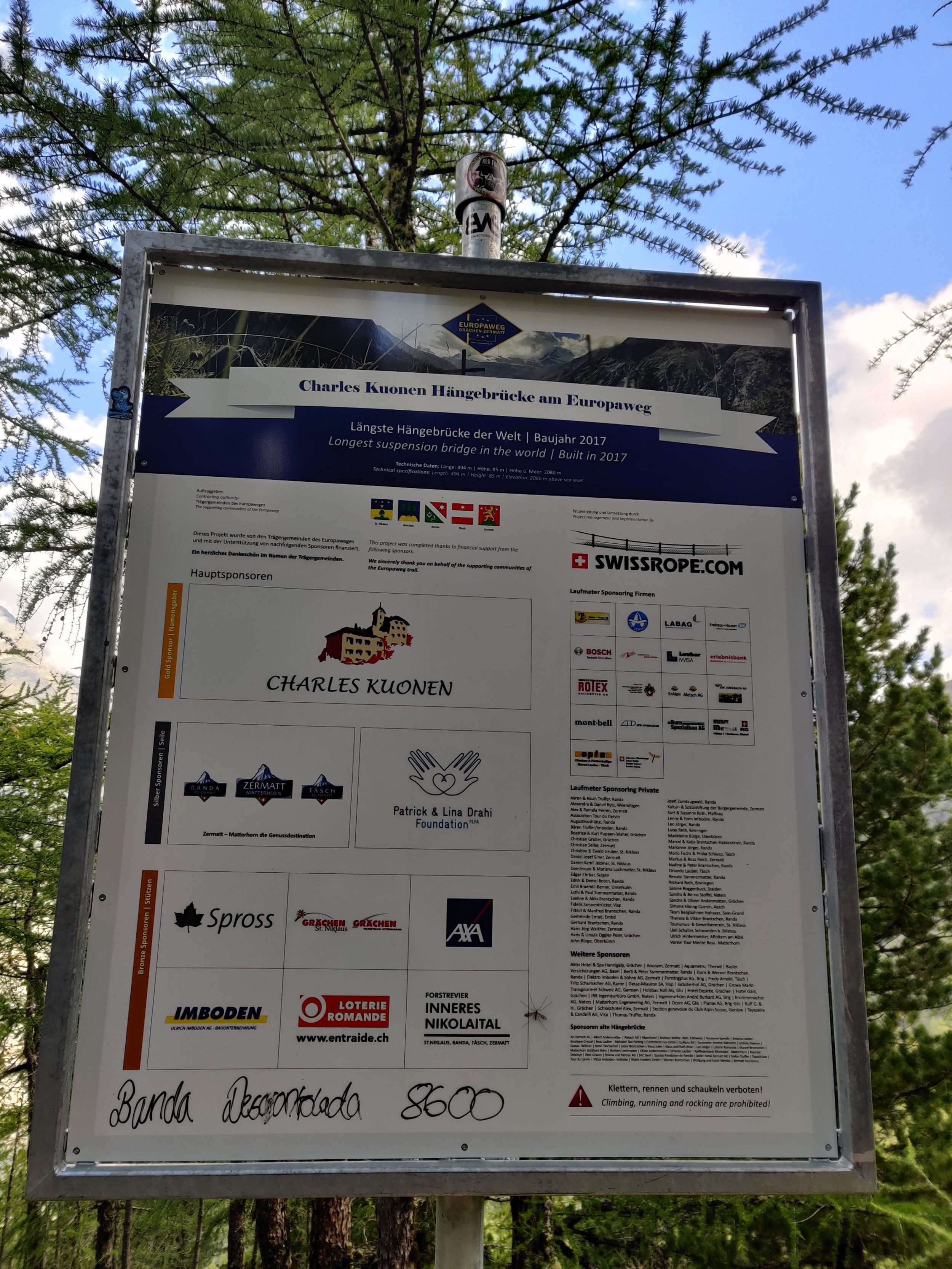
3. Charles Kuonen Suspension Bridge
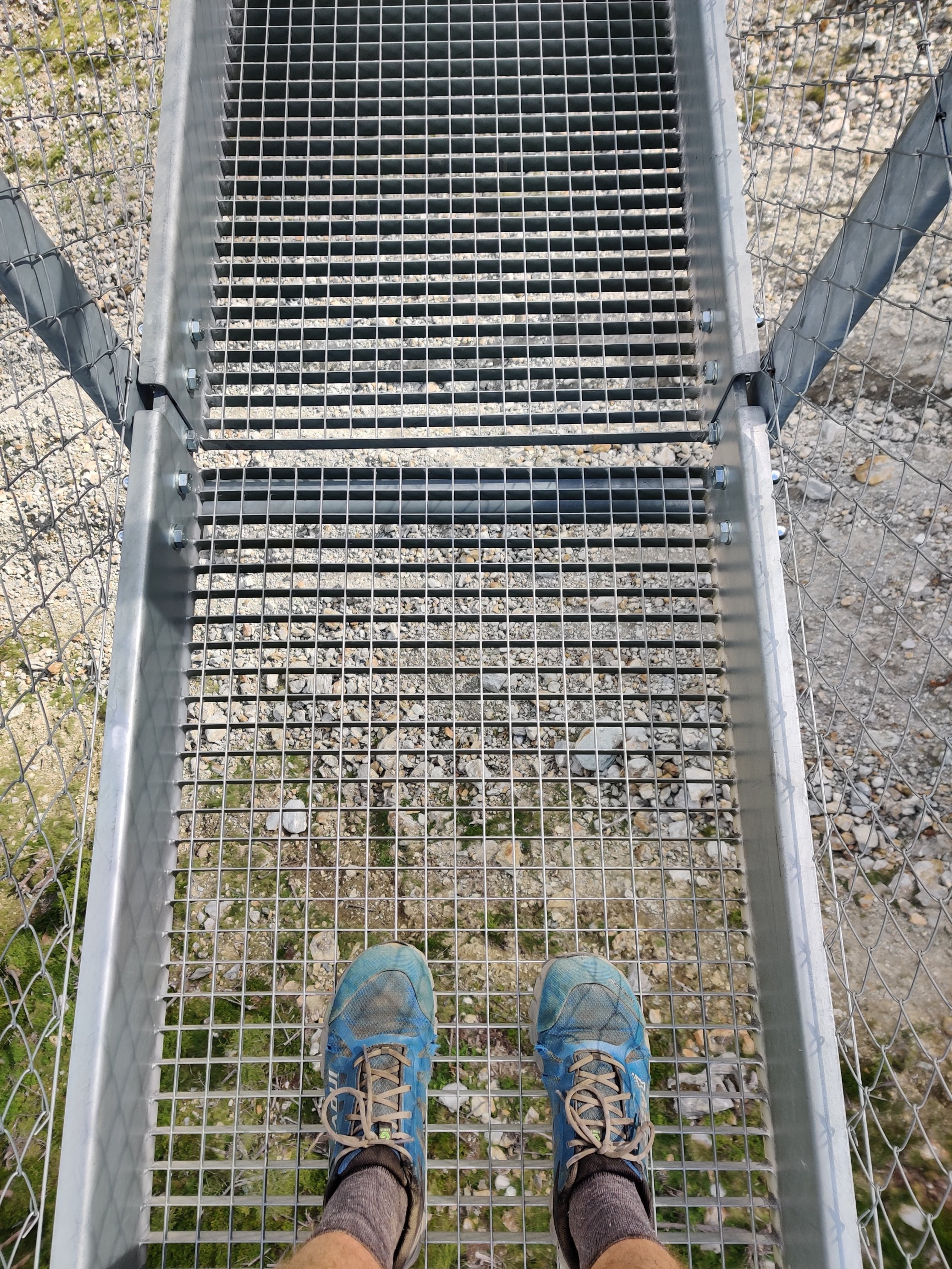
The Charles Kuonen Suspension Bridge is the longest hanging bridge for pedestrians in the Alps and 3rd longest in the world! It replaced the defunct Europabridge, which had been damaged by a rock slide, with the twisted wreck visible today from the new bridge. It is 500 m (1,640 ft) long, 85 m (280 ft) above the valley at its highest point, and only 65 cm (~2 ft) wide, requiring pedestrians going in opposite directions to squeeze past each other. Access is free, and it requires a certain level of bravery due to the walkway having see-through grating.
4. Europaweg via TÄshalp (Suspension Bridge to Sunegga)
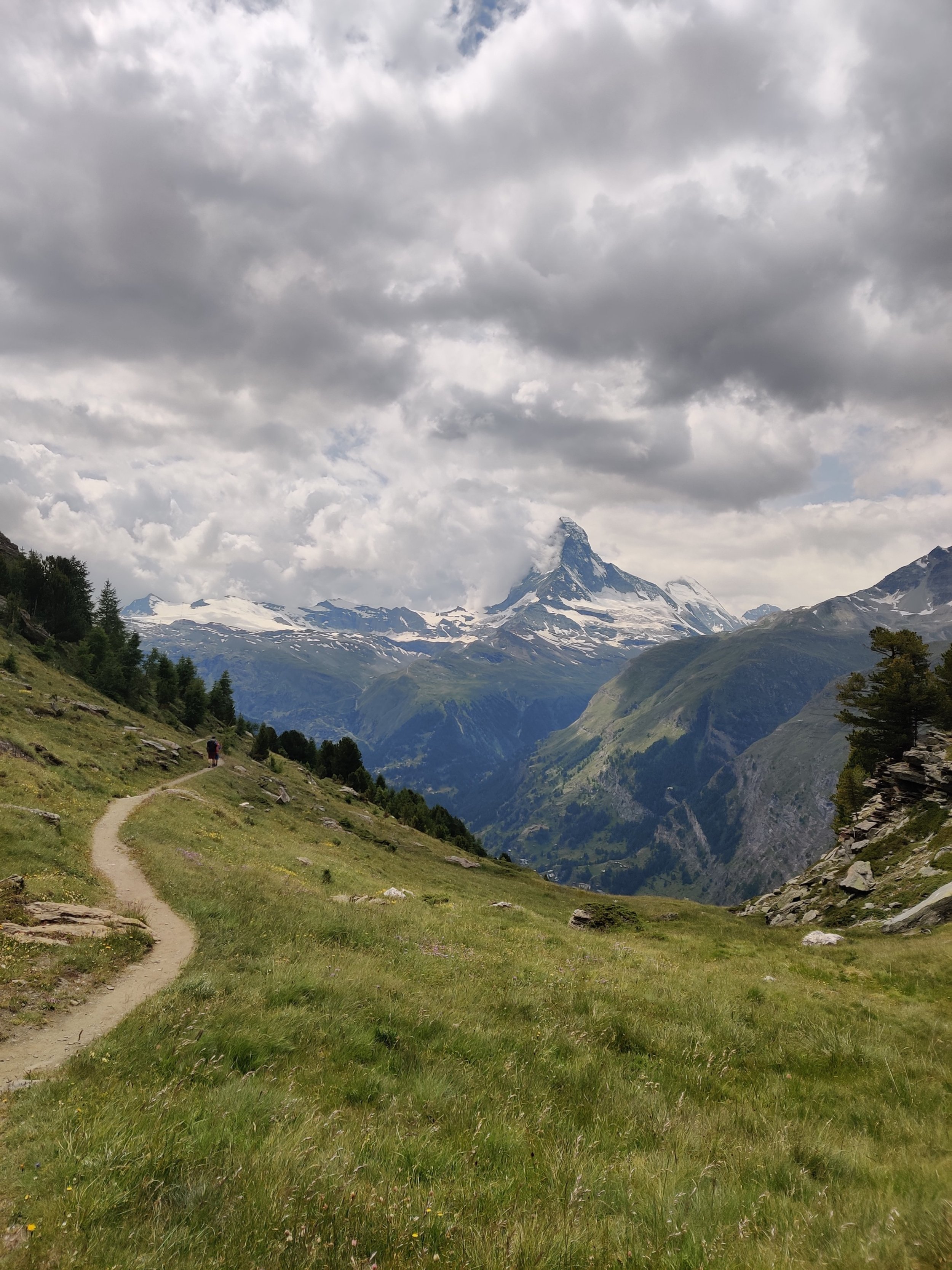
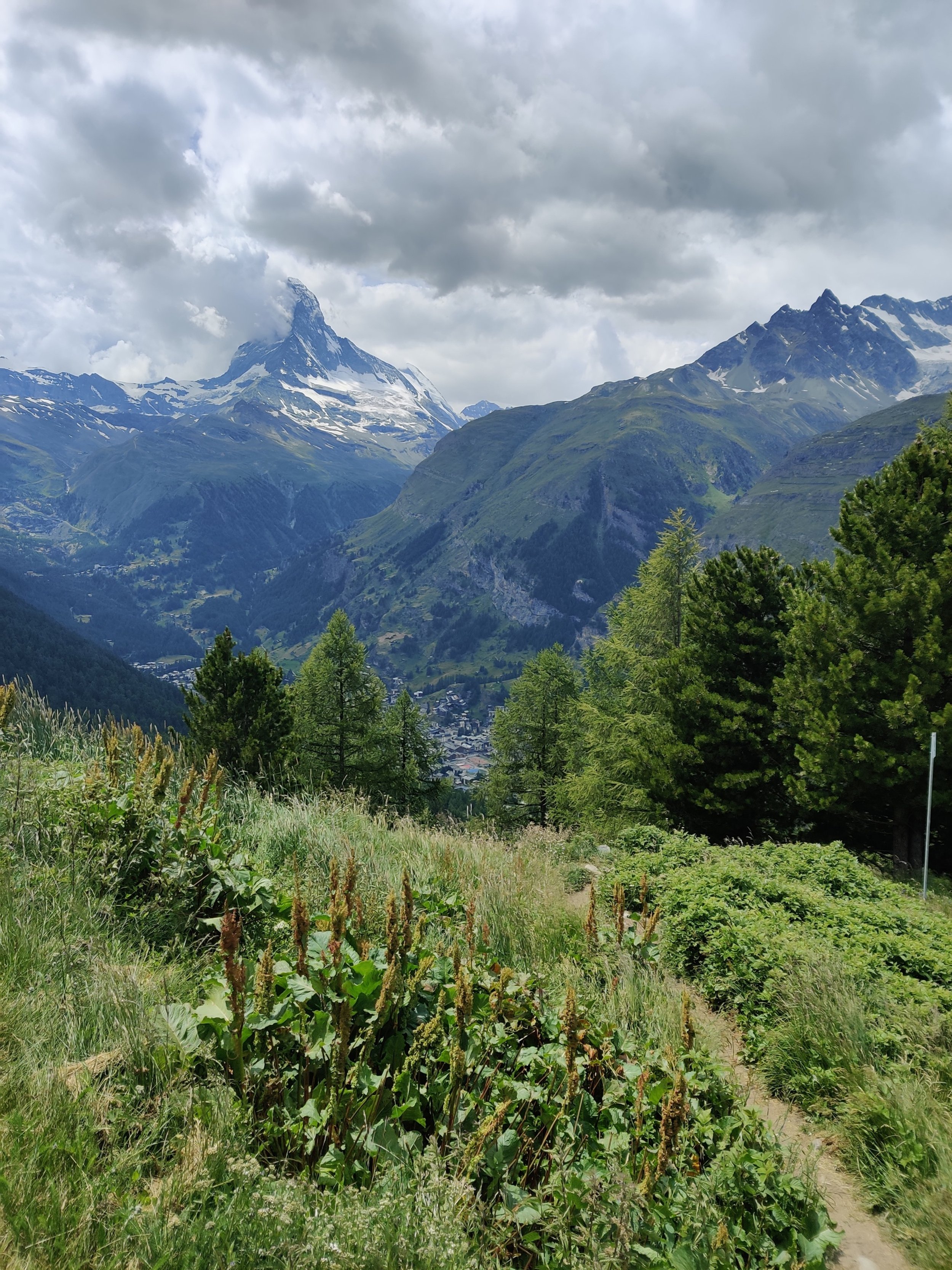
The Europaweg trail between the suspension bridge and Rothorn-Sunegga ski area above Zermatt has been unchanged in recent years and has all the breathtaking features high mountain hikers love: balcony trail with steep drop-offs to the valley below, tunnels, bridges, big views across and along the valley to snow-capped peaks, and cable assisted narrow trail. They even have avalanche barriers on some higher-risk sections to protect hikers. The most thrilling section is to the north of Täschalp, which is around the furthest point the Matthorn can be seen. The trail to the south of Täschalp is generally wider and boasts big Matterhorn views, which is why most people come here. Look for the perfect photo spot in a bend just north of the ski area.
5. Sunegga ski area (Sunegga to Zermatt)
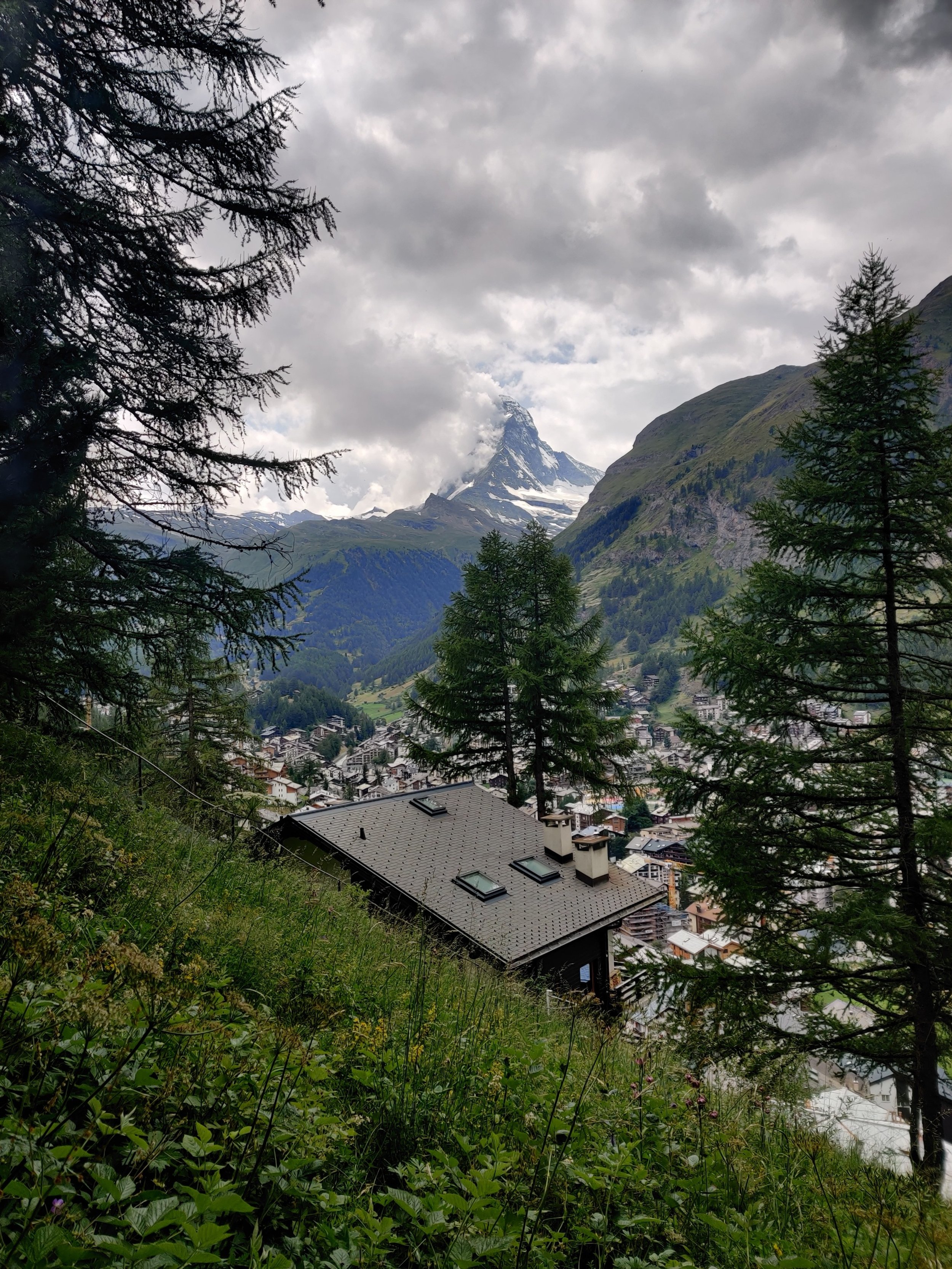
There is an option for those who prefer to take the shortest route between the Europaweg balcony trail and Zermatt, and an alternative path, which spends more time in the Rothorn-Sunegga ski area savoring the Matterhorn views. On a clear afternoon, the alternative route is appealing, particularly if you include a stop at one of the restaurants around Eggen to toast your accomplishment. Otherwise, as the Matterhorn can still be seen from Zermatt, taking the direct route through the trees does not cause hikers to miss out on continuing to enjoy this memorable mountain peak.
How has the trail changed in recent years?
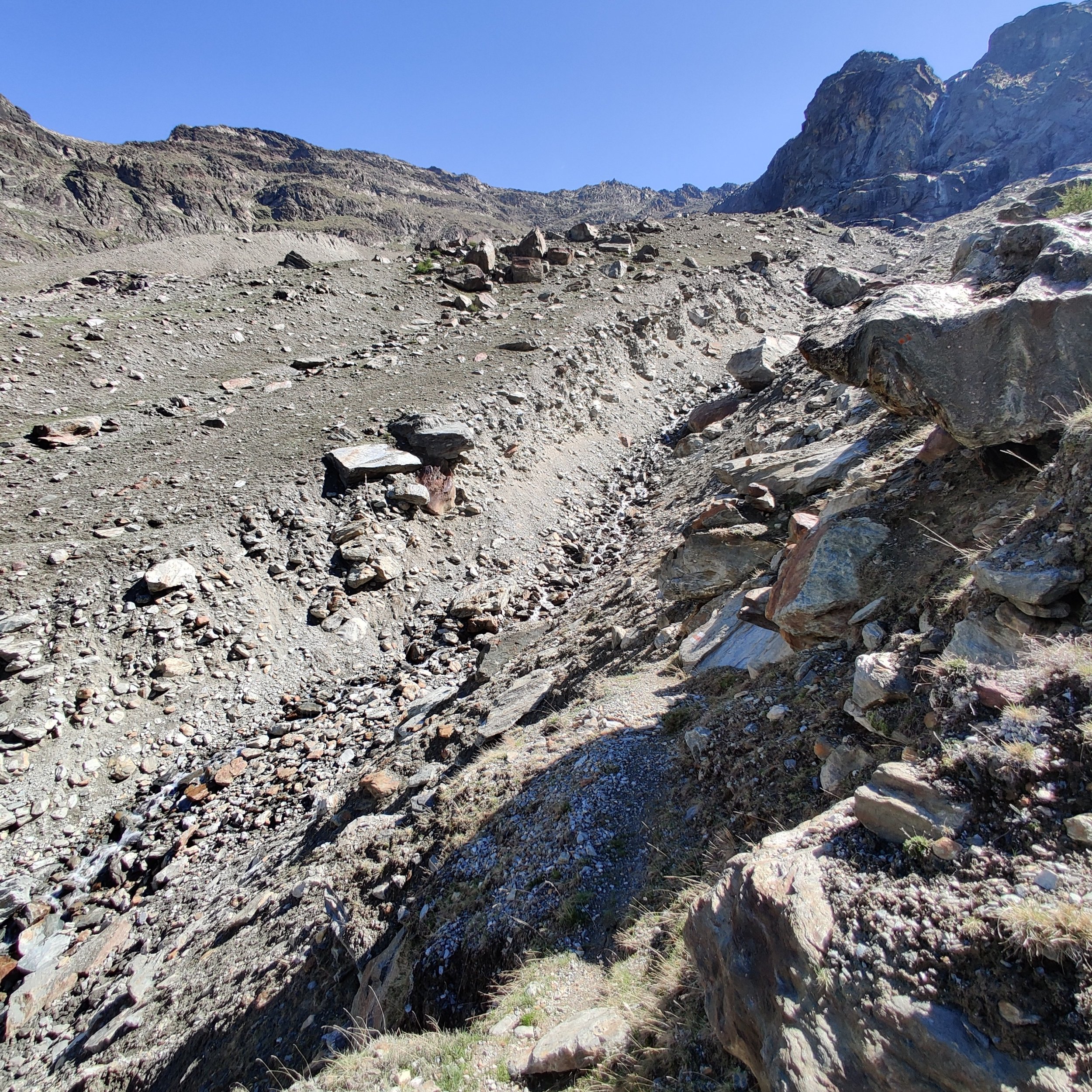
At the end of the 2018 hiking season, a rockfall badly damaged the original Europaweg trail between Grat and Galenburg. This section of trail was regularly being impacted by rockfall and after over a year of consideration, the local authorities decided to re-route the trail rather than try to repair it anymore due to the ongoing risk to hikers.
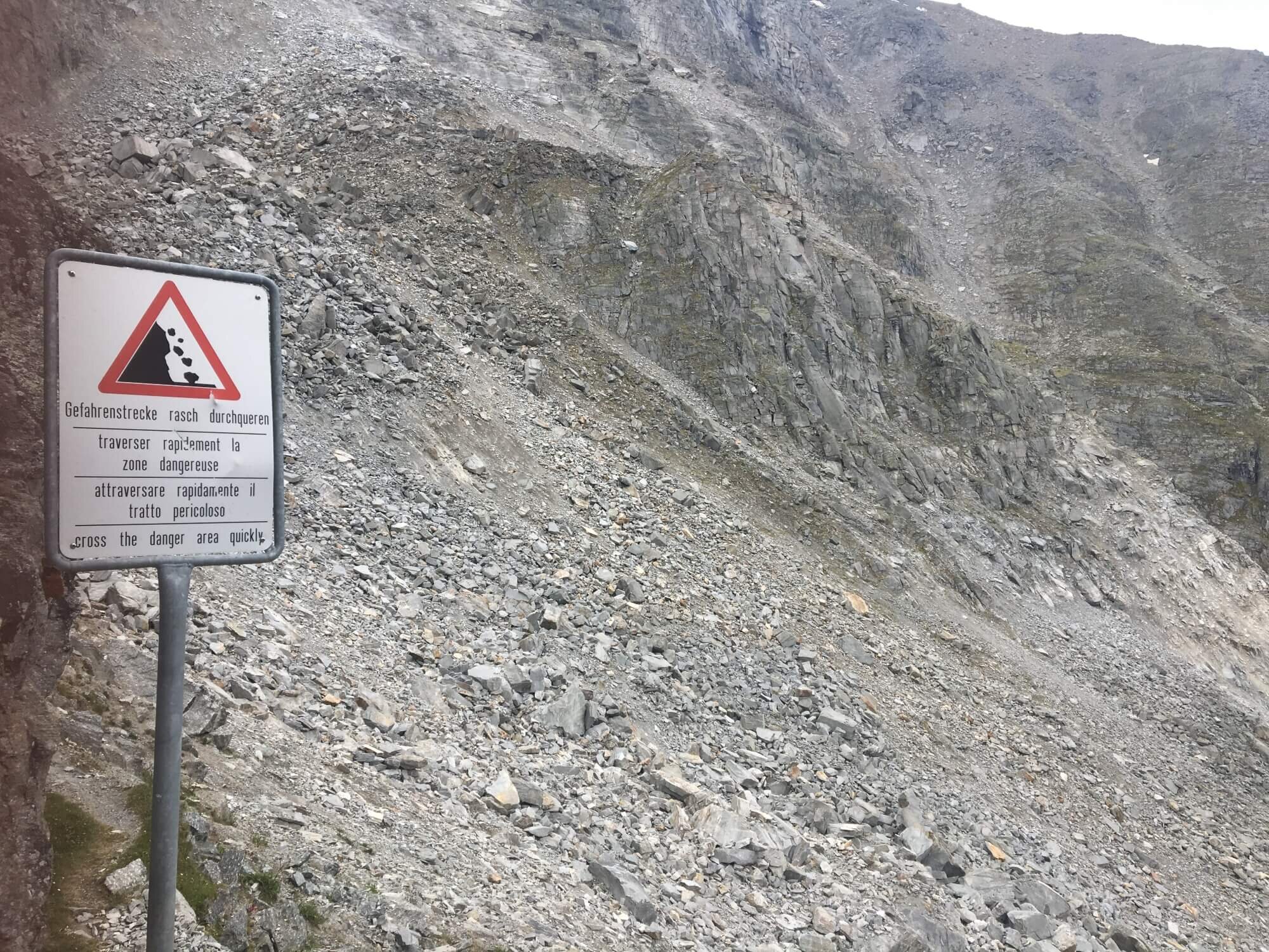
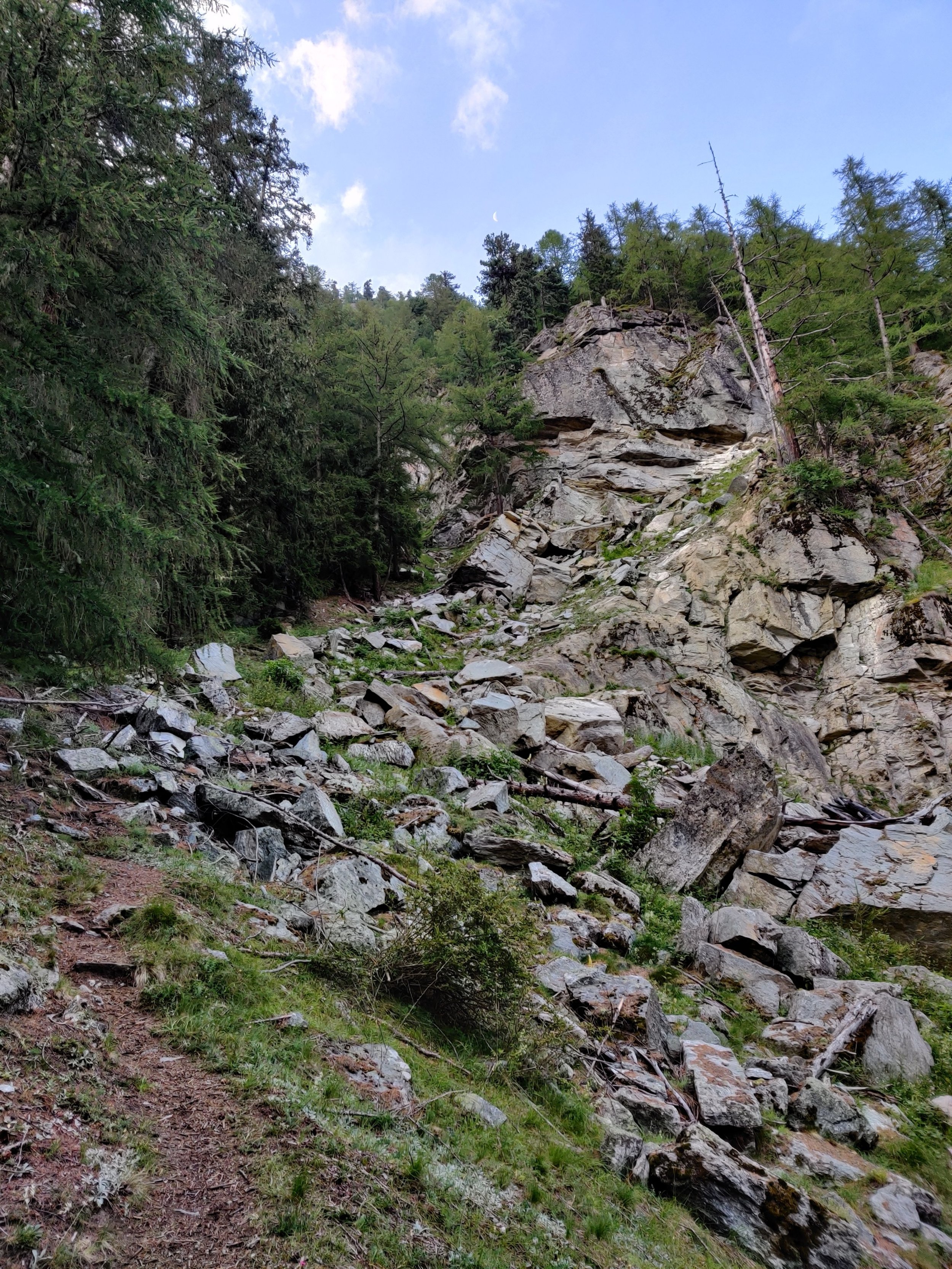
Section between Grat and Galenburg: When I completed the Europaweg trail in 2017, this is what one of the worst sections impacted by rockfall looked like. This area of the trail was further impacted in 2018, leading to the permanent closure of the section between Grat and Galenburg.
In 2019, a new trail between Gasenried and Herbriggen was worked on that would avoid the closed trail. At Herbriggen, it was then possible to follow a lightly marked trail to Galenburg and then continue along the original Euroapweg trail all the way to Zermatt.

Trail between Herbriggen and Galenberg: I completed this trail in 2020. It was lightly marked and in parts seemed more like an animal track than maintained hiking trail.
In 2021, rather than improve the trail between Herbriggen and Galenburg, work commenced on a new section of trail linking Herbriggen with the original Europaweg balcony trail near the Birchbach torrent, which included a multi-staircase structure around the Geisstriftbach torrent, and new bridge over the Birchbach torrent. This section is now complete and forms part of the official Europaweg trail.
Can you still do the original route?
The original route between Grat and the Europaweg balcony trail at Birchbach torrent has been permanently closed by the local authorities and is no longer marked on the latest Swiss national map. The temporary trail detour between Herbriggen and Galenberg is also no longer marked on the latest Swiss national map, indicating it, too, is no longer available for hikers. I’ve provided some specific comments and images for each section below.
Gasenried and Grat
The trail between Gasenried and Grat is open (at the time of writing) and can be completed as a circular loop.
Grat and Galenburg
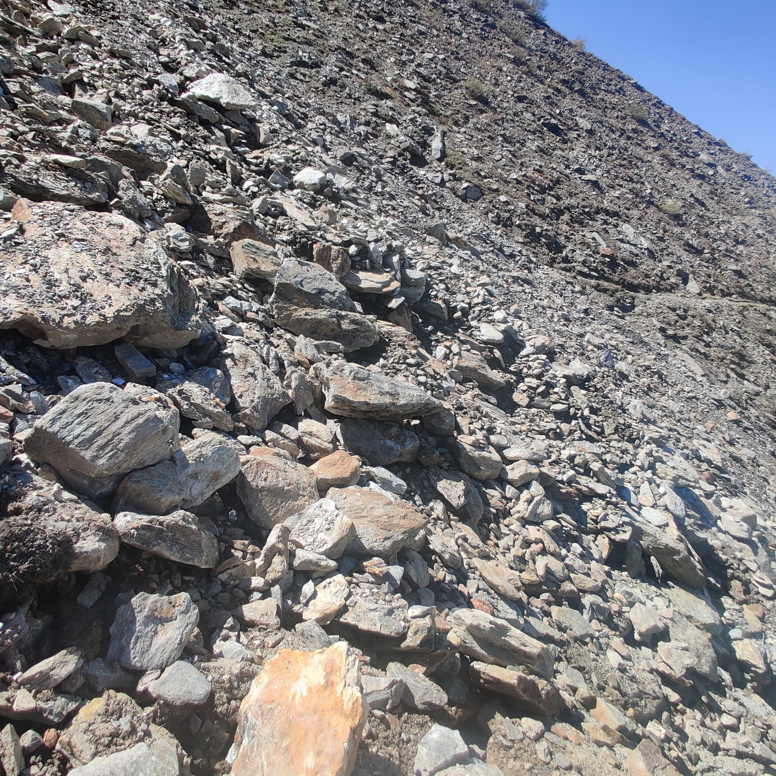
The trail between Grant and Galesburg is permanently closed. In 2023, the Switzerland topographic map authority finally removed the trail between Grat and Galenburg after showing it as ‘closed’ on their map for many years. It remains shown as a trail on the open streetmap database with the labelling ‘Old Europaweg (Not Passable)’. Those who are using older topographic maps, guidebooks, or navigation apps with old underlying maps may continue to see these trails.
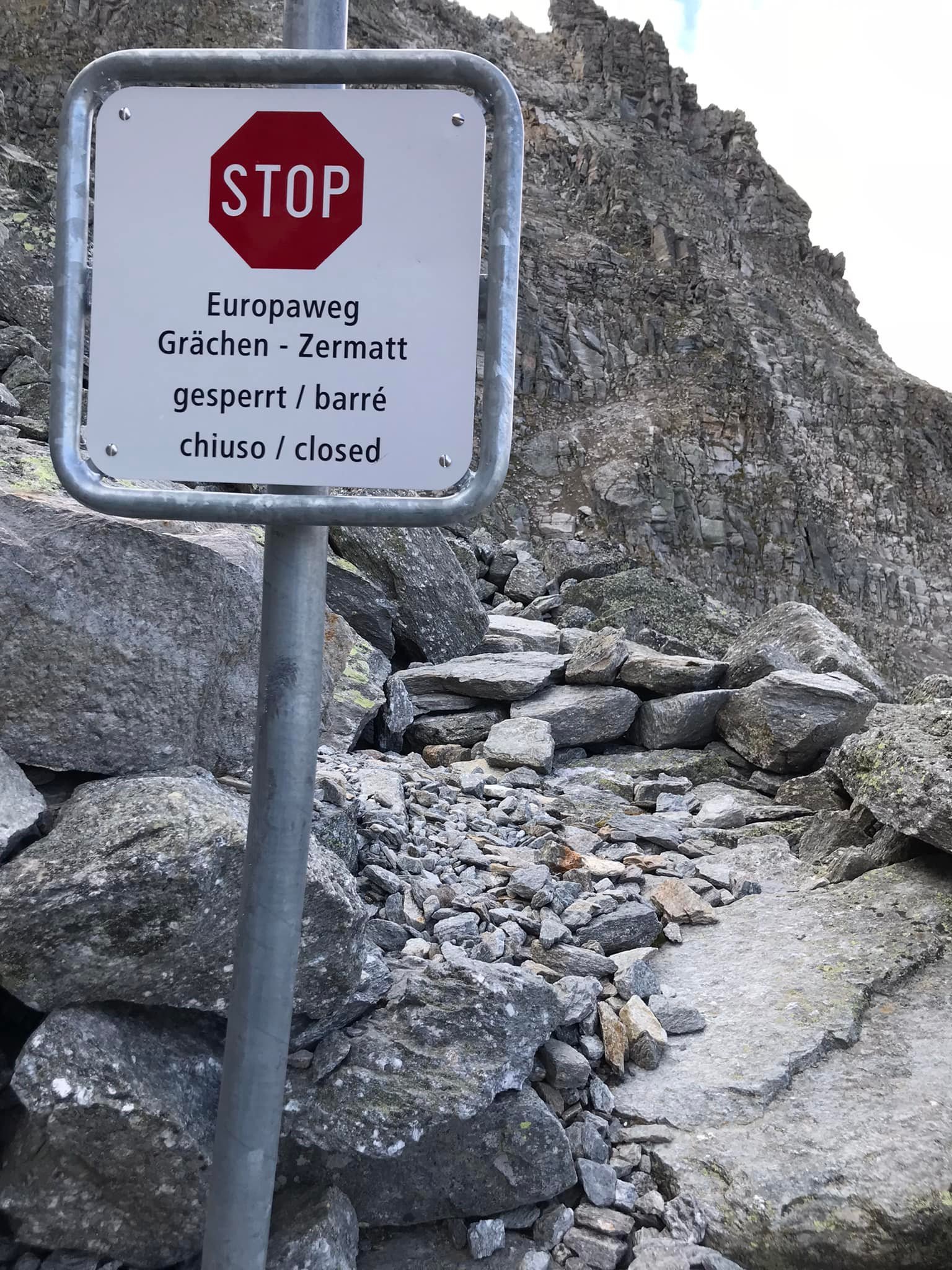
Permanently closed: Photo shared by someone who went to see if was still possible to complete the section between Grat and Galenburg in the summer of 2021, but had to turn back as there was no way through.
Despite the revised route being open for a couple of years now with clear signage and the original section being roped off with warnings, some hikers have continued to attempt the original trail between Grat and Galenburg.
Having been in touch with people who have attempted to complete it since it was closed, I can tell you that some people made it through in 2019/2020, however, in recent years, the people I have been in touch with have all turned back.
Temporary trail Detour Herbriggen and GalenburG
No continuous route is marked on the latest Switzerland topographic map between Herbriggen and Galenberg, suggesting it has not been maintained and will be left to deteriorate.
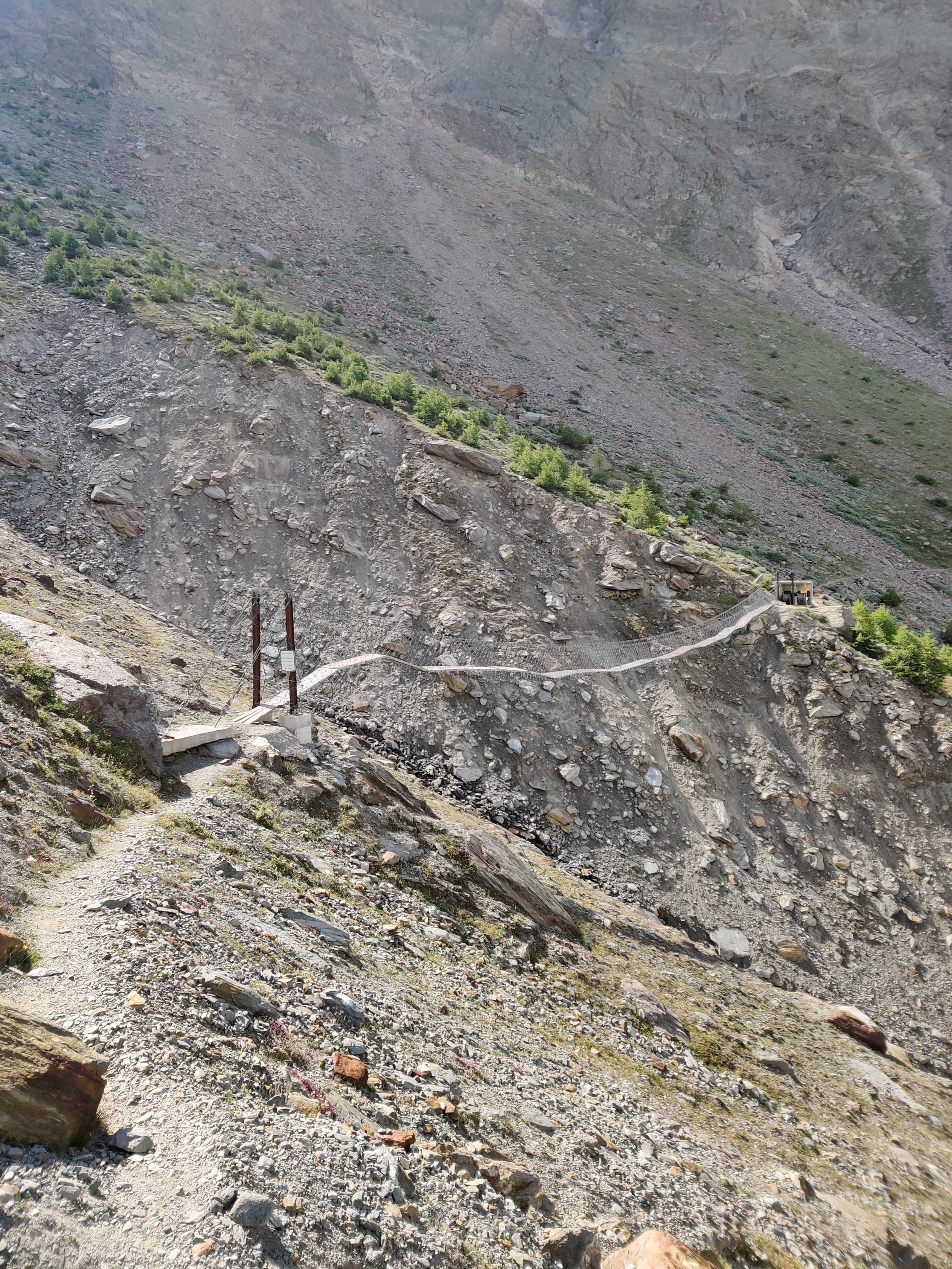
Galenburg and Europaweg balcony trail At Birchbach torrent
The trail between Galenburg and where the new Europaweg trail rejoins the balcony at the Birchbach torrent is also not continuously marked on the latest Switzerland topographic map, meaning it, too, is no longer being maintained. Where this section crosses over the Birchbach torrent, there used to be a small but critical bridge installed each summer, however, when I was there in 2023, it had not been put up. Without the bridge in place, hikers could not safely cross the Birchbach torrent via the original path, or reach the new trail further down to use the new bridge and rejoin with Europaweg trail.

planning resources
The local tourism authority has a webpage dedicated to the Europaweg trail.
If you’re planning to complete the Europaweg trail as part of the Walker’s Haute Route and Tour of Monte Rosa, check out our planning app. Our app is purpose-built for multi-day hiking trips - it can be used to plan any journey that forms part of the legendary trails we support (so you can use it to plan your 2-day Europaweg hike too ;)

Everything you need to plan, book, prepare and navigate your adventure. This package includes;

Everything you need to plan, book, prepare and navigate your adventure. This package includes;

Author: Brendan Jones, Founder, The Hiking Club
A pizza-making, craft beer-loving, peanut butter connoisseur that has been exploring the great outdoors since completing the Duke of Edinburgh Award in high school. I started The Hiking Club to democratise hiking and the benefits that come from spending time in nature.