Alta Via 1 (Dolomites): Expert Access


Alta Via 1 (Dolomites): Expert Access
Access a trail expert to prepare an itinerary that meets your needs.
This package includes;
Personalised itinerary designed by trail expert
EXPERT CONSULTATION
You receive a 45 min consultation with one of our trail experts to discuss your itinerary requirements and answer any questions you have about the trail. Topics could include:
routes options
accommodation options
trail conditions
when to hike
PERSONALIZED ITINERARY
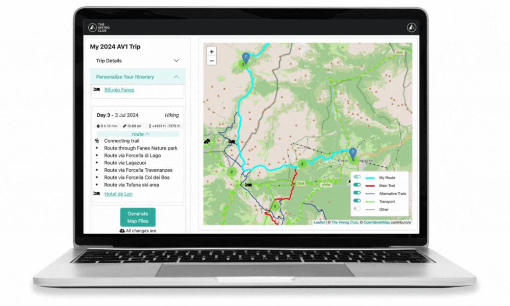
Based on your phone consult, our trail expert will create you a personalised itinerary within our new planning app. Access to our new planning app allows you to:
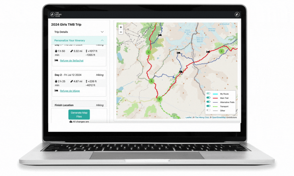
Visualise your daily itinerary: Your trip is broken day by day, with estimated time, distance, elevation change and information on your chosen route.
Select your accommodation: 80+ mountain huts, hotel and campgrounds are displayed on the map. Find accommodation for your nights before, during and after your trip.
Add transportation to your plan: Easily select transport options (gondola, bus) to see the impact to your daily hiking stats. All transport details including 2024 schedules and costs are included in your final GPS map.
Change your route: Explore different route options, including main and variant, using our extensive image library and route descriptions. Your estimated time, distance, and elevation change are automatically re-calculated and displayed with every decision.
See which properties are taking 2024 online bookings: Don’t miss out on your preferred accommodation by seeing their booking status directly on the map.
PLANNING PORTAL
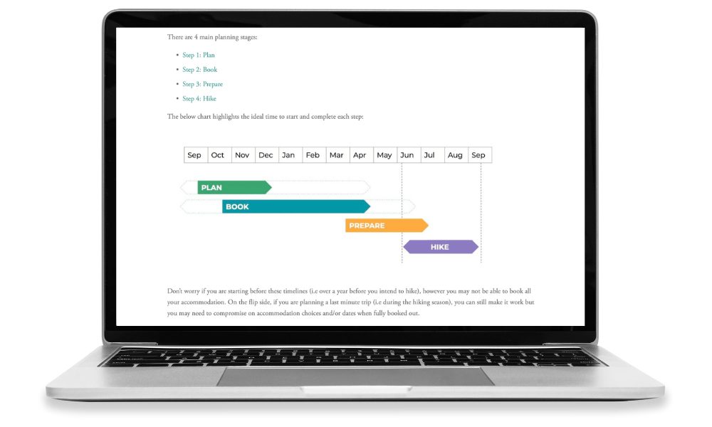
Researching details about the trail and organising your accommodation for the Alta Via 1 (Dolomites) can be the most time consuming (and sometimes stressful) part of the planning process, especially when confronted with outdated and conflicting information! We’ve created a ‘Planning Portal’; all the information a self-guided hiker needs to plan their trip in one spot, including;
Planning: The best time to hike, descriptions of terrain types, start/end locations, possible rest day locations, information on hiking speed estimates
Booking: Where to fly into, how to get to the start/end points, alpine club membership details
Preparing: Packing list, best weather source, emergency contact information, travel insurance recommendations, how to receive trail updates
This information is reviewed and updated every year to ensure hikers confidently make bookings and prepare for the trail.
GPS MAP
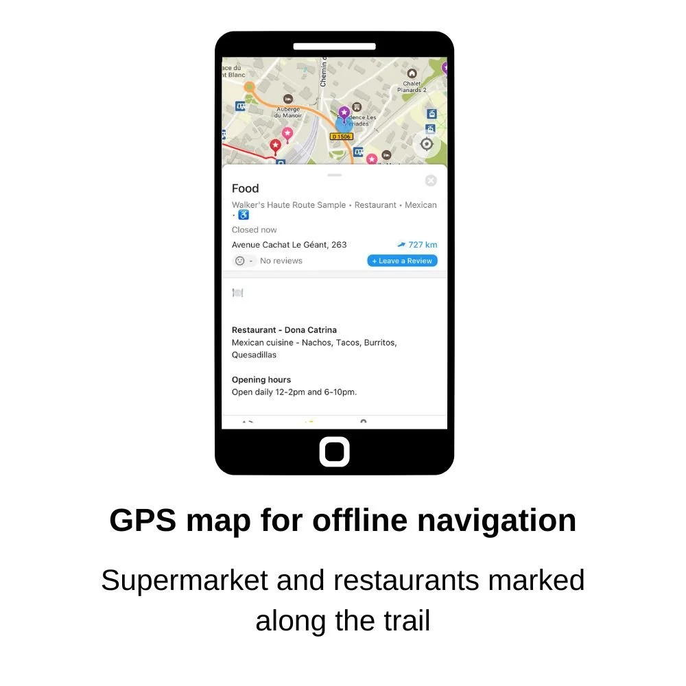
Your personalised GPS trail map allows you to navigate your hike in the same way you would in urban areas. Your map is created based on your specific plan/route and can be used on any Android or Apple smartphone. Key features on your GPS map:
Your current location is visible on the map
Your personalized daily hiking statistics are displayed for each section and day of your itinerary
Coloured markers to highlight points of interest, such as water refill, toilet, food/supermarkets and laundry locations
Current season transport schedules to reroute your plan if you need to skip ahead on the trail
Bad weather routes if you need to change to an easier hiking route (where possible)